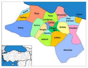
Akkuş
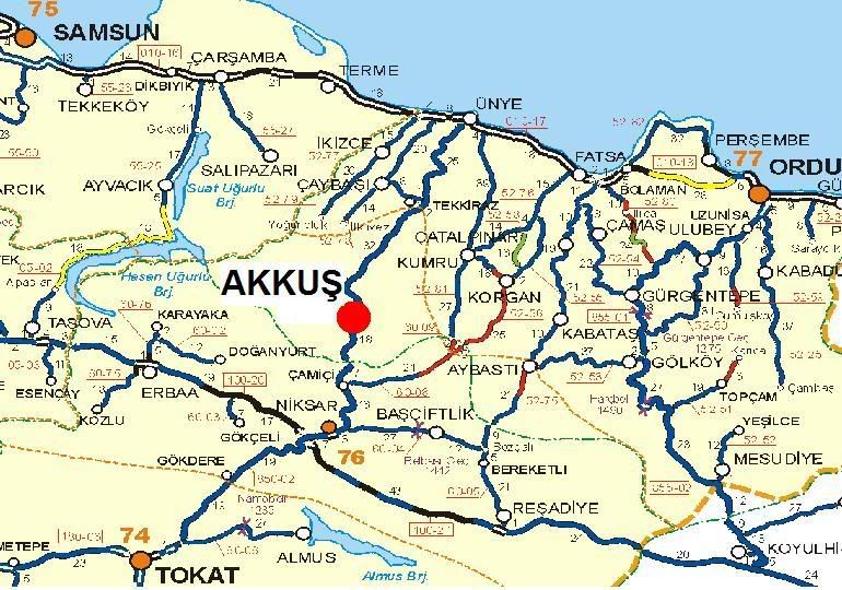
Akkuş is a town and a district of Ordu Province in the Black Sea region of Turkey. According to the 2000 census, population of the district is 49,799 of which 8,768 live in the town of Akkuş.[3] The district covers an area of 763 km2 (295 sq mi),[4] and the town lies at an elevation of 1,313 m (4,308 ft).
Akkuş | |
|---|---|
District | |
 Location of Akkuş within Turkey. | |
 Akkuş Location of Akkuş | |
| Coordinates: 40°48′N 37°01′E | |
| Country | |
| Region | Black Sea |
| Province | Ordu |
| Government | |
| • Mayor | İsa Demirci (AKP) |
| Area | |
| • District | 763.23 km2 (294.68 sq mi) |
| Elevation | 1,313 m (4,308 ft) |
| Population (2012)[2] | |
| • Urban | 7,073 |
| • District | 31,106 |
| • District density | 41/km2 (110/sq mi) |
| Time zone | UTC+2 (EET) |
| • Summer (DST) | UTC+3 (EEST) |
| Postal code | 52xxx |
| Area code(s) | 0452 |
| Licence plate | 52 |
| Climate | Csb |
| Website | www.akkus.bel.tr |
Geography
Akkuş is in the foothills of Mount Argan in the Canik range inland from the Black Sea coast. Two rivers, the Tifi and the Karakuş are formed from streams running down from these mountains. The climate is typical of high pasture country, the district is under snow for four to five months of the year, and fog and rain for the remainder. The summer sun occasionally shines and when it does the lush green countryside is beautiful. The area could attract visitors on trekking or winter sports vacations but lacks the infrastructure for this at the moment. The local economy depends on farming, forestry and grazing livestock plus some handicrafts including carpet weaving.
History
Formerly known as Karakuş, the area was once part of the Kingdom of Pontus. The first Turkish rulers were the Danishmend and Hacıemiroğlu Anatolian beyliks and then from the 15th century the Ottoman Empire.
Villages
The villages of Akkuş district include Alanköy, Ambargürgen, Ceyhanlı, Çaldere, Çamlıca, Çavdar, Çökek, Çukurköy, Dağyolu, Damyeri, Düğencili, Esentepe, Gedikli, Gökçebayır, Gürgenliyatak, Haliluşağı, Karaçal, Kargı, Kemikgeriş, Ketendere, Koçcuvaz, Kurtboğaz, Kuşçulu, Külekçili, Meyvalı, Muratlı, Ormancık, Ortabölme, Şahin, Tuzakköy, Yeniköy, Yeşilgüneycik, Yeşilköy, Yolbaşı, and Yukarıdüğencili Köyü.
Image gallery
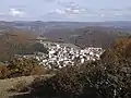
general view of the town of Akkus 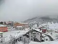
Akkus challenging winter 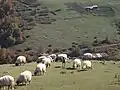
Argan is a square plateau
Notes
- "Area of regions (including lakes), km²". Regional Statistics Database. Turkish Statistical Institute. 2002. Retrieved 2013-03-05.
- "Population of province/district centers and towns/villages by districts - 2012". Address Based Population Registration System (ABPRS) Database. Turkish Statistical Institute. Retrieved 2013-02-27.
- Turkish Statistical Institute. "Census 2000, Key statistics for urban areas of Turkey" (in Turkish). Archived from the original (XLS) on 2007-07-22. Retrieved 2009-05-19.
- Statoids. "Statistical information on districts of Turkey". Archived from the original on 19 May 2009. Retrieved 2009-05-19.
References
- Falling Rain Genomics, Inc. "Geographical information on Akkuş, Turkey". Retrieved 2009-05-18.
External links
| Wikimedia Commons has media related to Akkuş. |
