Black Diamond, Alberta
Black Diamond is a town in the Calgary Region of Alberta, Canada within Foothills County. It is located at the intersection of Highway 22 (Cowboy Trail) and Highway 7. Its first post office opened in 1907.[5] Black Diamond was so named because of coal deposits near the original town site.[6]
Black Diamond | |
|---|---|
Town | |
| Town of Black Diamond | |
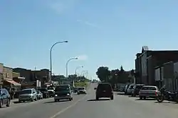
 Downtown Black Diamond on Alberta Highway 22 | |
 Black Diamond Location of Black Diamond  Black Diamond Black Diamond (Canada) | |
| Coordinates: 50°41′17″N 114°14′00″W | |
| Country | Canada |
| Province | Alberta |
| Region | Calgary Metropolitan Region |
| Census division | 6 |
| Municipal district | Foothills County |
| Incorporated[1] | |
| • Village | May 8, 1929 |
| • Town | January 1, 1956 |
| Government | |
| • Mayor | Ruth Goodwin |
| • Governing body | Black Diamond Town Council |
| Area (2016)[3] | |
| • Land | 3.84 km2 (1.48 sq mi) |
| Elevation | 1,159 m (3,802 ft) |
| Population (2016)[3] | |
| • Total | 2,700 |
| • Density | 702.7/km2 (1,820/sq mi) |
| Time zone | UTC−07:00 (MST) |
| • Summer (DST) | UTC−06:00 (MDT) |
| Postal code span | T0L |
| Area code(s) | +1-403 |
| Highways | Highway 22 Highway 7 |
| Waterways | Sheep River |
| Website | town |
It is a sister town to Turner Valley. It has a hospital, shops, hotels and residences, elementary school (K-6th grade), high school (7th-12th grade), hockey rink and a Boys and Girls Club. Little oil or gas remains.
Black Diamond is located in the foothills of the Canadian Rockies in the midst of some of Canada's best ranch country.
A 3 km (1.9 mi) trail next to the roadway between Black Diamond and Turner Valley is named the Friendship Trail.
Demographics
In the 2016 Census of Population conducted by Statistics Canada, the Town of Black Diamond recorded a population of 2,700 living in 1,098 of its 1,108 total private dwellings, a 13.8% change from its 2011 population of 2,373. With a land area of 3.84 km2 (1.48 sq mi), it had a population density of 703.1/km2 (1,821.1/sq mi) in 2016.[3]
In the 2011 Census, the Town of Black Diamond had a population of 2,373 living in 945 of its 1,001 total dwellings, a 24.9% change from its 2006 population of 1,900. With a land area of 3.21 km2 (1.24 sq mi), it had a population density of 739.3/km2 (1,914.7/sq mi) in 2011.[7]
The population of the Town of Black Diamond according to its 2009 municipal census is 2,308.[8]
Images
 Looking south in Black Diamond
 Sign looking east on Alberta Highway 22
 Post office
 Looking east at Black Diamond
 Oilfields General Hospital
See also
References
- "Location and History Profile: Town of Black Diamond" (PDF). Alberta Municipal Affairs. October 7, 2016. p. 57. Retrieved October 13, 2016.
- "Municipal Officials Search". Alberta Municipal Affairs. September 22, 2017. Retrieved September 25, 2017.
- "Population and dwelling counts, for Canada, provinces and territories, and census subdivisions (municipalities), 2016 and 2011 censuses – 100% data (Alberta)". Statistics Canada. February 8, 2017. Retrieved February 8, 2017.
- "Alberta Private Sewage Systems 2009 Standard of Practice Handbook: Appendix A.3 Alberta Design Data (A.3.A. Alberta Climate Design Data by Town)" (PDF) (PDF). Safety Codes Council. January 2012. pp. 212–215 (PDF pages 226–229). Retrieved October 8, 2013.
- Hamilton, William (1978). The Macmillan Book of Canadian Place Names. Toronto: Macmillan. p. 21. ISBN 0-7715-9754-1.
- Place-names of Alberta. Ottawa: Geographic Board of Canada. 1928. p. 20.
- "Population and dwelling counts, for Canada, provinces and territories, and census subdivisions (municipalities), 2011 and 2006 censuses (Alberta)". Statistics Canada. 2012-02-08. Retrieved 2012-02-08.
- Alberta Municipal Affairs (2009-09-15). "Alberta 2009 Official Population List" (PDF). Retrieved 2010-09-14.
External links
| Wikimedia Commons has media related to Black Diamond, Alberta. |
- Official website

 Black Diamond and Turner Valley travel guide from Wikivoyage