Rainbow Lake, Alberta
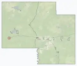
Rainbow Lake is a town in northwest Alberta, Canada. It is located west of High Level at the end of Highway 58, in Mackenzie County.
Rainbow Lake | |
|---|---|
Town | |
| Town of Rainbow Lake | |
.jpg.webp) Sunset at Rainbow Lake | |
 Location in Mackenzie County | |
 Rainbow Lake Location of Rainbow Lake in Alberta | |
| Coordinates: 58°30′0″N 119°22′59″W | |
| Country | Canada |
| Province | Alberta |
| Region | Northern Alberta |
| Planning region | Lower Peace |
| Specialized municipality | Mackenzie |
| Incorporated[1] | |
| • New town | September 1, 1966 |
| Government | |
| • Mayor | Michelle Farris |
| • Governing body | Rainbow Lake Town Council |
| • MP | Chris Warkentin (Peace River-Cons) |
| • MLA | Dan Williams (Peace River-Conservative) |
| Area (2016)[3] | |
| • Land | 10.76 km2 (4.15 sq mi) |
| Elevation | 534 m (1,752 ft) |
| Population (2016)[3] | |
| • Total | 795 |
| • Density | 73.9/km2 (191/sq mi) |
| Time zone | UTC−7 (MST) |
| • Summer (DST) | UTC−6 (MDT) |
| Postal code span | T0H |
| Area code(s) | +1-780 |
| Highways | 58 |
| Website | rainbowlake.ca |
The town carries the name of the nearby lake, formed on the Hay River, that was so called due to its curved shape.
Demographics
| Year | Pop. | ±% |
|---|---|---|
| 1971 | 355 | — |
| 1976 | 434 | +22.3% |
| 1981 | 504 | +16.1% |
| 1986 | 675 | +33.9% |
| 1991 | 817 | +21.0% |
| 1996 | 1,138 | +39.3% |
| 2001 | 976 | −14.2% |
| 2006 | 965 | −1.1% |
| 2011 | 870 | −9.8% |
| 2016 | 795 | −8.6% |
| Source: Statistics Canada [5][6][7][8][9][3] | ||
In the 2016 Census of Population conducted by Statistics Canada, the Town of Rainbow Lake recorded a population of 795 living in 303 of its 475 total private dwellings, a change of -8.6% from its 2011 population of 870. With a land area of 10.76 km2 (4.15 sq mi), it had a population density of 73.9/km2 (191.4/sq mi) in 2016.[3]
The population of the Town of Rainbow Lake according to its 2015 municipal census is 938,[10] a change of -13.3% from its 2007 municipal census population of 1,082.[11]
In the 2011 Census, the Town of Rainbow Lake had a population of 870 living in 305 of its 424 total dwellings, a change of -9.8% from its 2006 population of 965. With a land area of 11.04 km2 (4.26 sq mi), it had a population density of 78.8/km2 (204.1/sq mi) in 2011.[12]
Infrastructure
The community is served by the Rainbow Lake Airport (IATA: YOP, ICAO: CYOP), and is connected via Alberta Highway 58.
Education
The town is home to the Rainbow Lake School operated by the Fort Vermilion School Division, which offers curriculum for kindergarten through grade 12.[13]
References
- "Location and History Profile: Town of Rainbow Lake" (PDF). Alberta Municipal Affairs. October 7, 2016. p. 506. Retrieved October 16, 2016.
- "Municipal Officials Search". Alberta Municipal Affairs. September 22, 2017. Retrieved September 25, 2017.
- "Population and dwelling counts, for Canada, provinces and territories, and census subdivisions (municipalities), 2016 and 2011 censuses – 100% data (Alberta)". Statistics Canada. February 8, 2017. Retrieved February 8, 2017.
- "Alberta Private Sewage Systems 2009 Standard of Practice Handbook: Appendix A.3 Alberta Design Data (A.3.A. Alberta Climate Design Data by Town)" (PDF) (PDF). Safety Codes Council. January 2012. pp. 212–215 (PDF pages 226–229). Retrieved October 9, 2013.
- "Table 3: Population for census divisions and subdivisions, 1971 and 1976". 1976 Census of Canada. Census Divisions and Subdivisions, Western Provinces and the Territories. Population: Geographic Distributions. Ottawa: Statistics Canada. 1977.
- "Table 2: Census Subdivisions in Alphabetical Order, Showing Population Rank, Canada, 1981". 1981 Census of Canada. Census subdivisions in decreasing population order. Ottawa: Statistics Canada. 1982. ISBN 0-660-51563-6.
- "Table 2: Population and Dwelling Counts, for Census Divisions and Census Subdivisions, 1986 and 1991 – 100% Data". 91 Census. Population and Dwelling Counts – Census Divisions and Census Subdivisions. Ottawa: Statistics Canada. 1992. pp. 100–108. ISBN 0-660-57115-3.
- "Population and Dwelling Counts, for Canada, Provinces and Territories, and Census Divisions, 2001 and 1996 Censuses – 100% Data (Alberta)". Statistics Canada. Retrieved 2019-05-25.
- "Population and dwelling counts, for Canada, provinces and territories, and census subdivisions (municipalities), 2006 and 2001 censuses – 100% data (Alberta)". Statistics Canada. January 6, 2010. Retrieved 2019-05-25.
- "Outcomes: 2015 Municipal Census" (PDF). REDI Region. August 25, 2015. Retrieved September 11, 2015.
- "Alberta 2009 Official Population List" (PDF). Alberta Municipal Affairs. September 15, 2009. Retrieved September 11, 2015.
- "Population and dwelling counts, for Canada, provinces and territories, and census subdivisions (municipalities), 2011 and 2006 censuses (Alberta)". Statistics Canada. 2012-02-08. Retrieved 2012-02-08.
- "Rainbow Lake School". Fort Vermilion School Division. Retrieved 2012-07-30.
- Statcan page for Rainbow Lake
- Discover the Peace Country. Rainbow Lake
- Rainbow Lake Provincial Recreation Area