Bombay, New South Wales
Bombay is a locality in the Queanbeyan–Palerang Regional Council, New South Wales, Australia. It is located about 14 km southwest of Braidwood on the western bank of the Shoalhaven River.[2][3] At the 2016 census, it had a population of 117.[1] It has two areas of somewhat denser settlement described as "Bombay" (near Bombay creek) and "Little Bombay" (further north and near North Bombay creek). It had a school in 1871 (when it was called "Little Bombay Half-Time School") and from 1873 to 1928, normally described as "Bombay Half-Time School" but sometimes as "Bombay Provisional School".[4]
| Bombay New South Wales | |||||||||||||||
|---|---|---|---|---|---|---|---|---|---|---|---|---|---|---|---|
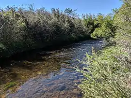 Shoalhaven River below Bombay Bridge | |||||||||||||||
Bombay Location in New South Wales | |||||||||||||||
| Coordinates | 35°25′57″S 149°39′02″E | ||||||||||||||
| Population | 117 (2016 census)[1] | ||||||||||||||
| Postcode(s) | 2622 | ||||||||||||||
| Location | 14 km (9 mi) SW of Braidwood | ||||||||||||||
| LGA(s) | Queanbeyan-Palerang Regional Council | ||||||||||||||
| Region | Southern Tablelands | ||||||||||||||
| County | Murray | ||||||||||||||
| Parish | Jinglemoney | ||||||||||||||
| State electorate(s) | Monaro | ||||||||||||||
| Federal Division(s) | Eden-Monaro | ||||||||||||||
| |||||||||||||||
References
- Australian Bureau of Statistics (27 June 2017). "Bombay". 2016 Census QuickStats. Retrieved 19 January 2018.

- "Bombay". Geographical Names Register (GNR) of NSW. Geographical Names Board of New South Wales. Retrieved 19 January 2018.
- "Bombay". OpenStreetMap. Retrieved 19 January 2018.
- "Bombay School in the School history database search". New South Wales Department of Education. Retrieved 19 January 2018.
This article is issued from Wikipedia. The text is licensed under Creative Commons - Attribution - Sharealike. Additional terms may apply for the media files.