Mount Fairy
Mount Fairy is a locality in the Queanbeyan–Palerang Regional Council, New South Wales, Australia. It is located to the east of the Bungendore–Tarago road.[2][3] At the 2016 census, it had a population of 205.[1]
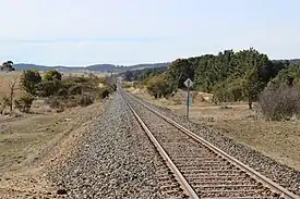
Bombala railway line, looking north to former Mount Fairy railway station
| Mount Fairy New South Wales | |||||||||||||||
|---|---|---|---|---|---|---|---|---|---|---|---|---|---|---|---|
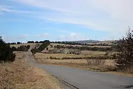 Mount Fairy, looking towards Capital Wind Farm | |||||||||||||||
Mount Fairy Location in New South Wales | |||||||||||||||
| Coordinates | 35°09′57″S 149°35′02″E | ||||||||||||||
| Population | 205 (2016 census)[1] | ||||||||||||||
| Postcode(s) | 2580 | ||||||||||||||
| Location | 59 km (37 mi) ENE of Canberra | ||||||||||||||
| LGA(s) | Queanbeyan-Palerang Regional Council | ||||||||||||||
| Region | Southern Tablelands | ||||||||||||||
| County | Murray | ||||||||||||||
| Parish | Merigan, Fairy Meadow | ||||||||||||||
| State electorate(s) | Monaro | ||||||||||||||
| Federal Division(s) | Eden-Monaro | ||||||||||||||
| |||||||||||||||
Mount Fairy had a railway station on the Bombala railway line from 1886 to 1975. Its original name was Fairy Meadow, the name of the parish lying south of Merigan (which includes most of Mount Fairy) in the Mulloon area, but it was renamed to its current name in 1903.[4]
Mount Fairy had a state school from 1910 to 1931 and from 1946 to 1951, which generally operated as a "provisional" school, but it was a "half-time" school from 1929 to 1931.[5]
References
| Wikimedia Commons has media related to Mount Fairy, New South Wales. |
- Australian Bureau of Statistics (27 June 2017). "Mount Fairy". 2016 Census QuickStats. Retrieved 21 July 2017.

- "Mount Fairy". Geographical Names Board of New South Wales. New South Wales Government. Retrieved 21 July 2017.
- "Mount Fairy". OpenStreetMap. Retrieved 17 April 2018.
- "Mount Fairy station". NSWrail.net. Retrieved 21 July 2017.
- "Mount Fairy school in the School history database search". New South Wales Department of Education. Retrieved 21 July 2017.
This article is issued from Wikipedia. The text is licensed under Creative Commons - Attribution - Sharealike. Additional terms may apply for the media files.