Bendoura
Bendoura is a locality in the Queanbeyan–Palerang Regional Council, New South Wales, Australia. It is located about 20 km southwest of Braidwood on the road to Cooma and on the eastern bank of the Shoalhaven River.[2][3] At the 2016 census, it had a population of 70.[1]
| Bendoura New South Wales | |||||||||||||||
|---|---|---|---|---|---|---|---|---|---|---|---|---|---|---|---|
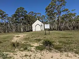 St Paul's Anglican church | |||||||||||||||
Bendoura Location in New South Wales | |||||||||||||||
| Coordinates | 35°31′57″S 149°40′02″E | ||||||||||||||
| Population | 70 (2016 census)[1] | ||||||||||||||
| Postcode(s) | 2622 | ||||||||||||||
| Location | |||||||||||||||
| LGA(s) | Queanbeyan-Palerang Regional Council | ||||||||||||||
| Region | Southern Tablelands | ||||||||||||||
| County | St Vincent | ||||||||||||||
| Parish | Bendoura | ||||||||||||||
| State electorate(s) | Monaro | ||||||||||||||
| Federal Division(s) | Eden-Monaro | ||||||||||||||
| |||||||||||||||
References
- Australian Bureau of Statistics (27 June 2017). "Bendoura". 2016 Census QuickStats. Retrieved 18 January 2018.

- "Bendoura". Geographical Names Register (GNR) of NSW. Geographical Names Board of New South Wales. Retrieved 18 January 2018.
- "Bendoura". OpenStreetMap. Retrieved 18 January 2018.
This article is issued from Wikipedia. The text is licensed under Creative Commons - Attribution - Sharealike. Additional terms may apply for the media files.