Durran Durra
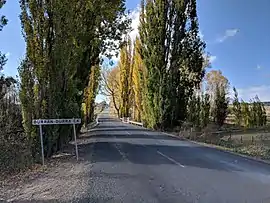
Durran Durra is a locality in the Queanbeyan–Palerang Regional Council, New South Wales, Australia. It is located on the road from Braidwood to Nowra about 15 km north of Braidwood and 100 km east of Canberra.[2][3] At the 2016 census, it had a population of 107.[1] It consists mainly of grazing country.
| Durran Durra New South Wales | |||||||||||||||
|---|---|---|---|---|---|---|---|---|---|---|---|---|---|---|---|
 Durran Durra creek | |||||||||||||||
Durran Durra Location in New South Wales | |||||||||||||||
| Coordinates | 35°18′57″S 149°53′02″E | ||||||||||||||
| Population | 107 (2016 census)[1] | ||||||||||||||
| Postcode(s) | 2622 | ||||||||||||||
| Location | |||||||||||||||
| LGA(s) | Queanbeyan-Palerang Regional Council | ||||||||||||||
| Region | Southern Tablelands | ||||||||||||||
| County | St Vincent | ||||||||||||||
| Parish | Durran Durra | ||||||||||||||
| State electorate(s) | Monaro | ||||||||||||||
| Federal Division(s) | Eden-Monaro | ||||||||||||||
| |||||||||||||||
Durran Durra had a "half-time" school from 1872 to 1898, from 1904 to 1905 and from 1915 to 1921.[4]
References
- Australian Bureau of Statistics (27 June 2017). "Durran Durra". 2016 Census QuickStats. Retrieved 26 April 2018.

- "Durran Durra". Geographical Names Register (GNR) of NSW. Geographical Names Board of New South Wales. Retrieved 26 April 2018.
- "Durran Durra". OpenStreetMap. Retrieved 26 April 2018.
- "Durran Durra in the School history database search". New South Wales Department of Education. Retrieved 26 April 2018.
This article is issued from Wikipedia. The text is licensed under Creative Commons - Attribution - Sharealike. Additional terms may apply for the media files.