Crestwood, New South Wales
Crestwood is a suburb of Queanbeyan, New South Wales, Australia.[2] Crestwood is located west of the central business district (CBD) to the west of Ross Road and the north of Canberra Avenue and also borders the Australian Capital Territory. At the 2016 census, it had a population of 4,603.[1]
| Crestwood New South Wales | |||||||||||||||
|---|---|---|---|---|---|---|---|---|---|---|---|---|---|---|---|
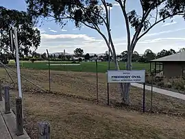 Freebody Oval | |||||||||||||||
Crestwood Location in New South Wales | |||||||||||||||
| Coordinates | 35.34832°S 149.21609°E | ||||||||||||||
| Population | 4,603 (2016 census)[1] | ||||||||||||||
| Postcode(s) | 2620 | ||||||||||||||
| LGA(s) | Queanbeyan-Palerang Regional Council | ||||||||||||||
| County | Murray | ||||||||||||||
| Parish | Queanbeyan | ||||||||||||||
| State electorate(s) | Monaro | ||||||||||||||
| Federal Division(s) | Eden-Monaro | ||||||||||||||
| |||||||||||||||
References
- Australian Bureau of Statistics (27 June 2017). "Crestwood (state suburb)". 2016 Census QuickStats. Retrieved 29 June 2017.

- "Crestwood". Geographical Names Register (GNR) of NSW. Geographical Names Board of New South Wales. Retrieved 30 July 2017.
This article is issued from Wikipedia. The text is licensed under Creative Commons - Attribution - Sharealike. Additional terms may apply for the media files.