Larbert, New South Wales
Larbert is a locality in the Queanbeyan-Palerang Region of the Southern Tablelands region of New South Wales.[2][3] It lies mostly north of the Kings Highway between Bungendore and Braidwood where it crosses the Shoalhaven River. At the 2016 census, it had a population of 39.[1]
| Larbert New South Wales | |||||||||||||||
|---|---|---|---|---|---|---|---|---|---|---|---|---|---|---|---|
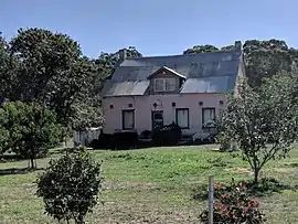 House in Larbert | |||||||||||||||
Larbert Location in New South Wales | |||||||||||||||
| Coordinates | 35°17′44″S 149°46′8″E | ||||||||||||||
| Population | 39 (2016 census)[1] | ||||||||||||||
| Postcode(s) | 2622 | ||||||||||||||
| Location | |||||||||||||||
| LGA(s) | Queanbeyan–Palerang | ||||||||||||||
| Region | Southern Tablelands | ||||||||||||||
| County | |||||||||||||||
| Parish |
| ||||||||||||||
| State electorate(s) | Monaro | ||||||||||||||
| Federal Division(s) | Eden-Monaro | ||||||||||||||
| |||||||||||||||
History
Aboriginal and early settler history
The area now known as Larbert lies on the traditional lands of the Walbanga people.[4] After settler colonisation, it was part of the County of Murray—west of the river, in what would become the Parish of Larbert—and east of the river was of the County of St. Vincent. It lay within the Nineteen Counties, in which settlement was permitted by the colonial government. The area was included in the surveying of the colonial lands, carried out under Thomas Mitchell's supervision.
The early name for the area, Kurraducbidgee,[5] was said to be a combination of two—presumably local—Aboriginal words, which settlers rendered as "kurraduc"—said to be either a native companion or a kind of long-beaked crane common on the Shoalhaven's river flats—and "bidgee"—said to mean a river with flats.[6][7] The original use of this name by colonists probably reflects the view of Thomas Mitchell that 'native names' should be used.[8]
Colonial settlers took up land in this area from the 1820s. The Ryrie family's property and homestead, 'Arnprior', was the nucleus of colonial settlement in the area.
By 1832, the crossing of the Shoalhaven River at Kurraducbidgee was part of the southward continuation of the Great South Road, which in those times ran from Goulburn via Bungonia.[9]
Village of Larbert
There was once a small village named Larbert, north of the Kings Highway, along modern-day Mayfield Road and alongside the left bank of the Shoalhaven River. It is likely, but uncertain, that Larbert is named after Larbert, Scotland.[10]
In 1843, Larbert was proclaimed as one of the planned townships to lie along route of the road from Braidwood to Jervis Bay, at a locality then named as Kurraducbidgee,[5] which is said to be its local Aboriginal name. This portion of the road was originally part of an existing road—leading to Bungonia and ultimately to Sydney—and it was upgraded to connect to the new 'Wool Road'.[11] The new township site was adjacent to William Ryrie's 2,650 acre landholding Arnprior, at the location where the road crossed the river.[12]
It seems that Ryrie had plans to irrigate his land from the Shoalhaven and farm it using convict labour. The township of Larbert was a part of those plans.[10] Allotments were sold in the township in 1843[13] and 1852.[14] New South Wales entered an economic depression in the early 1840s, the Wool Road was a failure, and Ryrie turned his attention to the Port Phillip District,[15] reducing Larbert's prospects of growth. Ryrie even attempted to dispose of Arnprior, in 1844,[16] without success.
However, any plans for the township were curtailed by the demonstration—during the Shoalhaven River flood of July 1853—that most of its site was flood prone—as some had foreseen[17]—bringing scorn and ridicule upon the government and its surveyor.[18][19][20] Fortunately, no houses had been built there at the time.[17] The site lay on a natural floodplain, just upstream from where the topography constricts the width of river valley. Flood waters could rise very quickly at Larbert—without any prior warning—following rain in the upper part of the Shoalhaven catchment.[21]
Nonetheless, the river crossing was on the mail route from Braidwood to Sydney in 1854,[22] it was also used by the gold escort in 1852,[23] and it was on what seems to have been a stage coach route in 1858.[24] A small settlement did develop at Larbert. From around 1858, there was a public house known as the 'Cottage of Content' and, from 1866, it also served as a post office.[25][26] It was affected by serious floods in 1860,[27] 1867,[28] and 1870,[29] and the building would be lost altogether in yet another flood in 1925.[26]
Mail was still being carried over the crossing in April 1867 but an observer noted that, "really the mail road from Arnprior to Boro by the Stony Range is in such a rascally condition that it is almost impassable, and it is a marvel how the mail-drivers manage to get along in the dark."[30] With the delays due to floods and the terrible condition of the road, it was only a matter of time before this route would cease to be the main route to Sydney.
A shorter road from Braidwood to Goulburn (modern-day Goulburn Road) was made, via another crossing of the Shoalhaven at Warri, and opened to traffic in 1862 [31][32][33] However, parts of the new road became boggy after rain, and the mail service, alternately, used the new road and older Larbert route.[34] In 1867—with the coming of the railway to Marulan imminent—there was agitation for the road from Braidwood to Marulan—via Larbert and Bungonia—to be upgraded to include a bridge at Larbert, but that road would bypass the important town of Goulburn.[35][36] In 1868, estimates were made for a bridge to be situated either at the Warri or Larbert river crossing.[37] However, by September 1868, a local landholder erected fences across the old road and the mail could no longer be carried via Larbert.[38] The bridge at Warri was opened in September 1874.[39][40] Larbert was fated to become an isolated backwater.
Larbert had a public school from 1867 to 1868[41] and from 1874 to 1891. Larbert East school operated from 1874 to 1892. Both schools operated as "half-time" schools and as each other's partners from 1874, except in 1892 when Larbert East school was partnered with Uradux school.[42][43][44] Land was reserved for a Union Church in 1878.[45]
A village site was reserved on the same land as the earlier settlement, in 1881. The village had an unusual street plan with large open spaces, between the different parts of the village, corresponding to low-lying areas and reflecting the hard-won experience of earlier floods. One of the village's street names, Borough Street (originally Boro Street), still appears on modern-day maps.[46][12][47][48]
Although Larbert was primarily an agricultural area, gold had been found in the area by October 1851[49] and the Shoalhaven's riverbed contained alluvial gold. A gold dredge operated near Larbert from 1901 to 1904.[50][51]
By 1917, the village seems to have been reduced to just one street of town allotments.[52] By 1948, the village's small Union Church, while then still standing, had not been used for eight years.[10] It was revived for a time, but finally sold in the 1970s.[53]
Present day
All that is left of the church now are its foundations, front steps, and the adjoining cemetery.[54][55] Larbert Road still runs from the King's Highway outside Braidwood toward the old river crossing but these days is only a local road.[56] The area of the locality, near the right bank of the river, is now the site of an extensive quarrying operation.[57][58]
Heritage listings
Larbert has a number of heritage-listed sites, including:
References
- Australian Bureau of Statistics (27 June 2017). "Larbert (State Suburb)". 2016 Census QuickStats. Retrieved 3 September 2017.

- "Larbert". Geographical Names Register (GNR) of NSW. Geographical Names Board of New South Wales. Retrieved 29 December 2017.
- "Larbert". OpenStreetMap. Retrieved 29 December 2017.
- "Tindale Tribes - Walbanga". archives.samuseum.sa.gov.au. Retrieved 6 January 2021.
- "TOWNSHIPS ON ROAD TO JERVIS BAY". New South Wales Government Gazette (Sydney, NSW : 1832 - 1900). 13 January 1843. p. 72. Retrieved 16 January 2021.
- "NATIVE NAMES". Register (Adelaide, SA : 1901 - 1929). 20 March 1905. p. 4. Retrieved 25 January 2021.
- "TO THE EDITOR OF THE HERALD". Sydney Morning Herald (NSW : 1842 - 1954). 22 June 1900. p. 7. Retrieved 25 January 2021.
- "The Development of a System of Place Names in New South Wales. (1 October 1937)". trove.nla.gov.au. pp. 376–392. Retrieved 25 January 2021.
- "OLD BRAIDWOOD". Braidwood Dispatch and Mining Journal (NSW : 1888 - 1954). 3 September 1943. p. 2. Retrieved 25 January 2021.
- "PAST HISTORY OF THE CHURCH". Braidwood Review and District Advocate (NSW : 1915 - 1954). 14 December 1948. p. 1. Retrieved 16 January 2021.
- ngh environmental (25 July 2017). "Appendix F - Statement of Heritage Impact CHARLEYONG BRIDGE REPLACEMENT" (PDF). pp. 8, 9.
- "Plan of the village of Larbert and suburban lands [cartographic material] : Parish of Larbert, County of Murray, Land District of Braidwood, N.S.W., 1888". Trove. Retrieved 16 January 2021.
- "PROCLAMATION". New South Wales Government Gazette (Sydney, NSW : 1832 - 1900). 15 August 1843. p. 1045. Retrieved 16 January 2021.
- "THE SOUTHERN GOLD FIELDS". Goulburn Herald and County of Argyle Advertiser (NSW : 1848 - 1859). 18 September 1852. p. 4. Retrieved 16 January 2021.
- "PORT PHILLIP". Colonist (Sydney, NSW : 1835 - 1840). 15 February 1840. p. 2. Retrieved 20 January 2021.
- "Advertising". Sydney Morning Herald (NSW : 1842 - 1954). 30 November 1844. p. 1. Retrieved 21 January 2021.
- "A GUNDAGAI IN EMBRYO". People's Advocate and New South Wales Vindicator (Sydney, NSW : 1848-1856). 26 February 1853. p. 9. Retrieved 17 January 2021.
- "THE DOOMED TOWNSHIP OF "LARBERT."". People's Advocate and New South Wales Vindicator (Sydney, NSW : 1848-1856). 30 July 1853. p. 4. Retrieved 16 January 2021.
- "TO THE GOVERNMENT TOWNSHIP OF LARBERT, UNDER WATER". People's Advocate and New South Wales Vindicator (Sydney, NSW : 1848-1856). 6 August 1853. p. 6. Retrieved 16 January 2021.
- "IRRESPONSIBILITY OF GOVERNMENT". People's Advocate and New South Wales Vindicator (Sydney, NSW : 1848-1856). 3 September 1853. p. 9. Retrieved 17 January 2021.
- "RIFLE SHOOTING AT MANLY BEACH. - Flood on the Goldfields". Sydney Morning Herald (NSW : 1842 - 1954). 22 April 1861. p. 5. Retrieved 30 January 2021.
- "BRAIDWOOD". Sydney Morning Herald (NSW : 1842 - 1954). 22 April 1854. p. 3. Retrieved 30 January 2021.
- "THE SOUTHERN DIGGINGS". Goulburn Herald and County of Argyle Advertiser (NSW : 1848 - 1859). 4 September 1852. p. 4. Retrieved 30 January 2021.
- "BRAIDWOOD". Goulburn Herald and County of Argyle Advertiser (NSW : 1848 - 1859). 2 June 1858. p. 2. Retrieved 30 January 2021.
- "The Country". Illawarra Mercury (Wollongong, NSW : 1856 - 1950). 24 June 1858. p. 2. Retrieved 19 January 2021.
- Maddrell, Roslyn. Braidwood District, Post Office and People. Braidwood, N.S.W.
- "SHOALHAVEN RIVER". Empire (Sydney, NSW : 1850 - 1875). 20 February 1860. p. 3. Retrieved 19 January 2021.
- "GREAT FLOOD IN THE BRAIDWOOD DISTRICT". Sydney Morning Herald (NSW : 1842 - 1954). 1 April 1867. p. 5. Retrieved 19 January 2021.
- "BRAIDWOOD AND QUEANBEYAN". Australian Town and Country Journal (Sydney, NSW : 1870 - 1907). 2 April 1870. p. 22. Retrieved 19 January 2021.
- "FLOODS IN THE SOUTHERN DISTRICT". Queanbeyan Age and General Advertiser (NSW : 1864 - 1867). 5 April 1867. p. 3. Retrieved 30 January 2021.
- "LOCAL AND PROVINCIAL". Goulburn Herald (NSW : 1860 - 1864). 21 August 1861. p. 2. Retrieved 30 January 2021.
- "COUNTRY NEWS". Sydney Mail (NSW : 1860 - 1871). 8 June 1861. p. 3. Retrieved 30 January 2021.
- "THE NEW ROAD TO BORO". Goulburn Herald (NSW : 1860 - 1864). 4 June 1862. p. 2. Retrieved 30 January 2021.
- "TUESDAY—MAY 14". Goulburn Herald and Chronicle (NSW : 1864 - 1881). 15 May 1867. p. 2. Retrieved 30 January 2021.
- "TELEGRAPHIC INTELLIGENCE". Empire (Sydney, NSW : 1850 - 1875). 10 July 1867. p. 4. Retrieved 30 January 2021.
- "THE BRAIDWOOD ROAD". Goulburn Herald and Chronicle (NSW : 1864 - 1881). 27 July 1867. p. 5. Retrieved 30 January 2021.
- "COUNTRY WORKS". Sydney Morning Herald (NSW : 1842 - 1954). 22 April 1868. p. 9. Retrieved 30 January 2021.
- "THE LARBERT ROUTE TO GOULBURN". Sydney Morning Herald (NSW : 1842 - 1954). 25 September 1868. p. 4. Retrieved 30 January 2021.
- "THE WARRI BRIDGE". Goulburn Herald and Chronicle (NSW : 1864 - 1881). 9 May 1874. p. 2. Retrieved 30 January 2021.
- "OPENING OF THE WARRI BRIDGE". Freeman's Journal (Sydney, NSW : 1850 - 1932). 3 October 1874. p. 6. Retrieved 30 January 2021.
- "Larbert (1) Half-Time School in the School history database search". New South Wales Department of Education. Retrieved 29 December 2017.
- "Larbert (2) Half-Time School in the School history database search". New South Wales Department of Education. Retrieved 29 December 2017.
- "Larbert East Half-Time School in the School history database search". New South Wales Department of Education. Retrieved 29 December 2017.
- "Glossary of school types". education.nsw.gov.au. 3 December 2019. Retrieved 16 January 2021.
- "RESERVE FROM SALE FOR A UNION CHURCH". New South Wales Government Gazette (Sydney, NSW : 1832 - 1900). 30 March 1878. p. 1346. Retrieved 17 January 2021.
- "SITE FOR THE VILLAGE OF LARBERT". New South Wales Government Gazette (Sydney, NSW : 1832 - 1900). 25 April 1881. p. 2349. Retrieved 16 January 2021.
- "Parish of Larbert, County of Murray [cartographic material] : Land District of Braidwood, Eastern Division N.S.W. (1924)". Trove. Retrieved 16 January 2021.
- "Borough Street, Larbert, 35°17'39.9"S 149°46'08.5"E". Google Maps. Retrieved 16 January 2021.
- "COPY OF A LETTER FROM THE REV. W. B. CLARKE". Empire (Sydney, NSW : 1850 - 1875). 14 February 1852. p. 4. Retrieved 21 January 2021.
- "BRAIDWOOD MINING NEWS". Goulburn Evening Penny Post (NSW : 1881 - 1940). 30 March 1901. p. 6. Retrieved 19 January 2021.
- "The Larbert Dredge". Nowra Colonist (NSW : 1899 - 1904). 6 July 1904. p. 3. Retrieved 19 January 2021.
- "County of Murray - Proposed railway routes between Yass and Canberra". Trove. Retrieved 16 January 2021.
- Maddrell, Roslyn. Braidwood District, Post Office and People. Braidwood, N.S.W. pp. 160, 206.
- "Arnprior | NSW Environment, Energy and Science". www.environment.nsw.gov.au. Retrieved 21 January 2021.
- "Australian Cemeteries Index - Cemetery 1690 - Larbert". austcemindex.com. Retrieved 21 January 2021.
- "Larbert Rd". Google Maps. Retrieved 30 January 2021.
- "Locations". www.schmidtquarries.com.au. Retrieved 16 January 2021.
- "Larbert - Satellite view". Google maps. Retrieved 16 January 2021.
- "Arnprior". New South Wales State Heritage Register. Office of Environment and Heritage. H01357. Retrieved 18 May 2018.
External links
Media at Wikimedia Commons under Category: Larbert, New South Wales