Butuan–Cagayan de Oro–Iligan Road
The Butuan–Cagayan de Oro–Iligan Road, or Butuan–Cagayan de Oro–Iligan–Tukuran Road, is a 416-kilometer (258 mi), two-to-six lane major thoroughfare, connecting the provinces of Agusan del Norte,[1] Misamis Oriental,[2][3] Lanao del Norte,[4][5] and Zamboanga del Sur.[6]
| ||||
|---|---|---|---|---|
| Butuan–Cagayan de Oro–Iligan–Tukuran Road | ||||
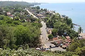 Portion of the Highway at Iligan | ||||
| Route information | ||||
| Maintained by Department of Public Works and Highways | ||||
| Length | 416 km (258 mi) | |||
| Component highways | ||||
| Major junctions | ||||
| East end | ||||
| ||||
| West end | ||||
| Location | ||||
| Provinces | Agusan del Norte, Misamis Oriental, Lanao del Norte, Zamboanga del Sur | |||
| Major cities | Butuan, Gingoog, Cagayan de Oro, El Salvador, Iligan | |||
| Towns | Buenavista, Nasipit, Carmen, Magsaysay, Medina, Talisayan, Balingoan, Kinoguitan, Sugbongcogon, Binuangan, Salay, Lagonglong, Balingasag, Jasaan, Tagoloan, Opol, Alubijid, Laguindingan, Gutagum, Libertad, Initao, Naawan, Manticao, Lugait, Linamon, Kauswagan, Bacolod, Maigo, Kolambugan, Tubod, Baroy, Lala, Kapatagan, Aurora, Tukuran | |||
| Highway system | ||||
| ||||
.svg.png.webp)
The entire highway is designated as the National Route 9 (N9) of the Philippine highway network.
Route description

Butuan to Cagayan de Oro
The highway starts at the junction with the Maharlika Highway in Ampayon, Butuan. It then passes the Agusan River and traverses the poblacion area of Butuan. Past Butuan, it soon enters the municipalities of Buenavista, Nasipit, and Carmen before reaching the province of Misamis Oriental.
Intersections
Intersections are numbered by kilometre post, with the Rizal Park in Manila city proper designated as kilometre 0.
| Region | Province | City/Municipality | km | mi | Destinations | Notes | ||
|---|---|---|---|---|---|---|---|---|
| Caraga | Butuan | Eastern terminus. | ||||||
| Agusan del Norte | Nasipit | |||||||
| Northern Mindanao | Misamis Oriental | Gingoog | Serves as a diversion road. | |||||
| Villanueva | Serves as a diversion road. | |||||||
| Cagayan de Oro | ||||||||
| Iligan | ||||||||
| Lanao del Norte | Tubod | |||||||
| Zamboanga Peninsula | Zamboanga del Sur | Aurora | ||||||
| Tukuran | Western terminus. | |||||||
| 1.000 mi = 1.609 km; 1.000 km = 0.621 mi | ||||||||
References
- "Agusan del Norte". www.dpwh.gov.ph. Retrieved 2018-09-02.
- "Misamis Oriental 1st". www.dpwh.gov.ph. Retrieved 2018-09-02.
- "Misamis Oriental 2nd". www.dpwh.gov.ph. Retrieved 2018-09-02.
- "Lanao del Norte 1st". www.dpwh.gov.ph. Retrieved 2018-09-02.
- "Lanao del Norte 2nd". www.dpwh.gov.ph. Retrieved 2018-09-02.
- "Zamboanga del Sur 1st". www.dpwh.gov.ph. Retrieved 2018-09-02.
External links
| National primary roads |
| |||||||
|---|---|---|---|---|---|---|---|---|
| National secondary roads |
| |||||||
See also: Philippine expressway network | ||||||||