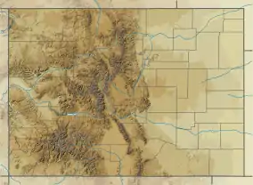
Carbon Peak
Carbon Peak, elevation 12,088 ft (3,684 m), is a summit in the West Elk Mountains of Colorado. The peak is southwest of Crested Butte in the Gunnison National Forest. Carbon peak is a laccolith formed during the mid-Tertiary period, and is part of the “laccolith triangle” as described by the Colorado Geological Survey. [4]
| Carbon Peak | |
|---|---|
 Carbon Peak Colorado | |
| Highest point | |
| Elevation | 12,088 ft (3,684 m) NAVD 88[1] |
| Prominence | 2,159 ft (658 m) [2] |
| Listing | Colorado prominent summits |
| Coordinates | 38°47′39″N 107°02′35″W [3] |
| Geography | |
| Location | Gunnison County, Colorado, U.S. |
| Parent range | West Elk Mountains |
| Topo map | USGS Mount Axtell |
| Climbing | |
| Easiest route | hike |
References
- "CARBON". NGS data sheet. U.S. National Geodetic Survey. Retrieved 2013-06-20.
- "Carbon Peak, Colorado". Peakbagger.com. Retrieved 2013-06-20.
- "Carbon Peak". Geographic Names Information System. United States Geological Survey. Retrieved 2013-06-20.
- Branda, Alex; Swanbom, Lief; Burton, Bradford R. (September 25, 2016). "Structural geology and emplacement history of the Carbon Peak laccolith, Gunnison County, Colorado". GSA Annual Meeting. Denver, Colorado: Geological Society of America. doi:10.1130/abs/2016AM-283853.
See also
- Mountain peaks of Colorado
- Mountain ranges of Colorado
This article is issued from Wikipedia. The text is licensed under Creative Commons - Attribution - Sharealike. Additional terms may apply for the media files.
