Trinchera Peak
Trinchera Peak is a mountain in Costilla County and Huerfano County in the U.S. state of Colorado. It is located in the Culebra Range.[2]
| Trinchera Peak | |
|---|---|
 Trinchera Peak taken from along U.S. Route 160, just northeast of Fort Garland. | |
| Highest point | |
| Elevation | 13,510 ft (4,120 m) [1] |
| Coordinates | 37°17′22″N 105°09′54″W [1] |
| Geography | |
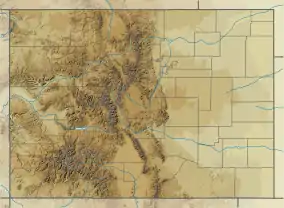 Trinchera Peak Location of Trinchera Peak within Colorado | |
| Location | Costilla County and Huerfano County, Colorado, U.S. |
| Parent range | Culebra Range[2] |
| Topo map | USGS Trinchera Peak |
References
- "Trinchera Peak". Geographic Names Information System. United States Geological Survey. Retrieved 2019-03-07.
- Mayfield, Marty (2016-02-23). "Trinchera Peak, 13'er in the rough". KRTN Radio. Retrieved 2019-03-09.
This article is issued from Wikipedia. The text is licensed under Creative Commons - Attribution - Sharealike. Additional terms may apply for the media files.