Greenhorn Mountain
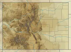
Greenhorn Mountain is the highest summit of the Wet Mountains range in the Rocky Mountains of North America. The prominent 12,352-foot (3,765 m) peak is located in the Greenhorn Mountain Wilderness of San Isabel National Forest, 5.2 miles (8.4 km) southwest by west (bearing 238°) of the Town of Rye, Colorado, United States, on the boundary between Huerfano and Pueblo counties. The summit of Greenhorn Mountain is the highest point in Pueblo County, Colorado.[1][2][3] The peak's summit rises above timberline, which is about 11,500 feet (3,500 m) in south-central Colorado.
| Greenhorn Mountain | |
|---|---|
 Greenhorn Mountain seen from Walsenburg, Colorado | |
| Highest point | |
| Elevation | 12,352 ft (3,765 m) [1][2] |
| Prominence | 3,777 ft (1,151 m) [3] |
| Isolation | 25.24 mi (40.62 km) [3] |
| Listing | Colorado county high points 35th |
| Coordinates | 37°52′53″N 105°00′48″W [1] |
| Geography | |
 Greenhorn Mountain | |
| Location | Huerfano County and the high point of Pueblo County, Colorado, U.S.[3] |
| Parent range | Highest summit of the Wet Mountains[3] |
| Topo map | USGS 7.5' topographic map San Isabel, Colorado[4] |
| Climbing | |
| Easiest route | Hike |
Geography
The massive Greenhorn Mountain can be seen from Colorado Springs, Pueblo, Trinidad, and also from along Interstate 25 rising over 7,000 feet (2,100 m) above the great plains to the east. The mountain's habitats are protected within the secluded Greenhorn Mountain Wilderness Area, which is only accessed by a few trails and a 4-wheel drive road on its north.
Name origin
The original name for the mountain peak was Cuerno Verde.[5] The name comes from Cuerno Verde (Green Horn) given by the colonial Spanish of the Provincias Internas to two, father and son, Jupe Comanche band mahimiana paraibo or war chiefs. The younger Cuerno Verde was known to the Comanches as "Man Who Holds Danger." On September 3, 1779, younger Cuerno Verde, his son, medicine man, four principal chiefs, and ten of his warriors, were killed near Greenhorn Mountain by the men of the expedition of Spanish troops and native American allies (Apache, Ute,and Pueblo) under Juan Bautista de Anza.[6]
On April 4, 1906, the United States Board on Geographic Names decided to use the English translation, Greenhorn, for the name it carries today.
See also
References
- "GREENHORN MTN". NGS data sheet. U.S. National Geodetic Survey. Retrieved October 20, 2014.
- The elevation of Greenhorn Mountain includes an adjustment of +1.401 m (+4.60 ft) from NGVD 29 to NAVD 88.
- "Greenhorn Mountain, Colorado". Peakbagger.com. Retrieved October 20, 2014.
- "Greenhorn Mountain". Geographic Names Information System. United States Geological Survey. Retrieved November 15, 2014.
- "The Rocky Mountain News (Daily) January 31, 1868 — Colorado Historic Newspapers Collection". www.coloradohistoricnewspapers.org. Retrieved 2020-12-26.
- Elizabeth A.H. John, Storms Brewed in Other Men's Worlds, Texas A&M University Press, College Station 1975, pages 584-589 ISBN 9780806128696 (2nd ed. University of Oklahoma Press, 1996).
Sources
- Pekka Hämäläinen, The Comanche Empire,Yale University Press, New Haven & London 2008, pages 103-104 ISBN 978-0300151176
