Silver Mountain (Colorado)
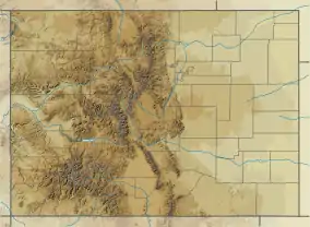
Silver Mountain, elevation 10,525 ft (3,208 m), is a mountain in Huerfano County, Colorado. It is part of the southern Sangre de Cristo Range of the Southern Rocky Mountains of North America. Silver Mountain is located northeast of Mount Mestas and north of the Spanish Peaks.
| Silver Mountain | |
|---|---|
| Dike Mountain | |
.JPG.webp) The mountain on a summer morning. Note the dikes at the base. | |
| Highest point | |
| Elevation | 3,208 m (10,525 ft) [1] |
| Prominence | 1,242 ft (379 m) [2] |
| Isolation | 2.87 mi (4.62 km) [2] |
| Coordinates | 37°36′55″N 105°06′12″W |
| Geography | |
 Silver Mountain | |
| Parent range | Sangre de Cristos |
| Topo map | USGS La Veta |
Earlier name
The mountain used to be called Dike Mountain for the numerous magmatic dikes that radiate out from its base. The name was changed in the 1870s after miners discovered gold and silver deposits there.[3]
References
- "Silver Mountain". Geographic Names Information System. United States Geological Survey. Retrieved 2017-08-14.
- Peakbagger. Silver Mountain. Retrieved: 2017-08-14
- "Silver Mountain". Colorado Geological Survey. Retrieved 2017-08-14.
Silver Mountain was once known as Dike Mountain, but that changed in some circles in the late 1870s when gold and silver were discovered on different parts of the mountain. There are still a couple of mining claims outstanding, but hardly any ore has been taken from the mountain in the last fifty years. Silver Mountain is located in Huerfano County, Colorado. The northeastern half of the mountain is owned by the Bureau of Land Management (BLM), while the southwestern half is a consolidation of 'school land.'
This article is issued from Wikipedia. The text is licensed under Creative Commons - Attribution - Sharealike. Additional terms may apply for the media files.