Fletcher Mountain
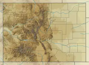
Fletcher Mountain is a high mountain summit in the Tenmile Range of the Rocky Mountains of North America. The 13,958-foot (4,254 m) thirteener is located in Arapaho National Forest, 8.1 miles (13.0 km) southwest by south (bearing 215°) of the Town of Breckenridge in Summit County, Colorado, United States.[1][2][3]
| Fletcher Mountain | |
|---|---|
 Fletcher Mountain | |
| Highest point | |
| Elevation | 13,958 ft (4,254 m) [1][2] |
| Prominence | 611 ft (186 m) [2] |
| Parent peak | Quandary Peak[2] |
| Isolation | 1.27 mi (2.04 km) [2] |
| Coordinates | 39°24′12″N 106°07′44″W [3] |
| Geography | |
| Location | Summit County, Colorado, U.S.[3] |
| Parent range | Mosquito Range, Tenmile Range[2] |
| Topo map | USGS 7.5' topographic map Copper Mountain, Colorado[3] |
Mountain
See also
References
- The elevation of Fletcher Mountain includes an adjustment of +2.037 m (+6.68 ft) from NGVD 29 to NAVD 88.
- "Fletcher Mountain, Colorado". Peakbagger.com. Retrieved November 5, 2014.
- "Fletcher Mountain". Geographic Names Information System. United States Geological Survey. Retrieved November 5, 2014.
External links

This article is issued from Wikipedia. The text is licensed under Creative Commons - Attribution - Sharealike. Additional terms may apply for the media files.