Constanța County
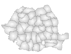
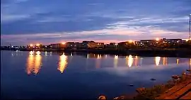
Constanța (Romanian pronunciation: [konˈstantsa] (![]() listen)) is a county (județ) of Romania on the border with Bulgaria, in the Dobruja region. Its capital city is also named Constanța.
listen)) is a county (județ) of Romania on the border with Bulgaria, in the Dobruja region. Its capital city is also named Constanța.
Constanța County
Județul Constanța | |
|---|---|
 Coat of arms | |
 | |
| Coordinates: 44.27°N 28.31°E | |
| Country | |
| Development region1 | Sud-Est |
| Historic region | Dobruja |
| Capital city (Reședință de județ) | Constanța |
| Government | |
| • Type | County Council |
| • President of the County Council | Marius-Horia Țuțuianu[1] (Social Democratic Party) |
| Area | |
| • Total | 7,071 km2 (2,730 sq mi) |
| Area rank | 8th in Romania |
| Population (2011 census[2]) | |
| • Total | 684,082 |
| • Rank | 5th in Romania |
| • Density | 96/km2 (250/sq mi) |
| Time zone | UTC+2 (EET) |
| • Summer (DST) | UTC+3 (EEST) |
| Postal Code | 90wxyz3 |
| Area code(s) | +40 x414 |
| ISO 3166 code | RO-CT |
| Car Plates | CT5 |
| GDP | US$10.930 billion (2018) |
| GDP per capita | US$15,978 (2018) |
| Economy rank | 3rd |
| Website | County Board County Prefecture |
| 1The development regions of Romania have no administrative role. They were formed just to attract funds from the European Union 2 as of 2007, the Prefect is not a politician, but a public official. He or she is not allowed to be a member of a political party and is forbidden from political activity in the first six months after the resignation (or exclusion) from the ranks of public officials 3w, x, y, and z are digits that indicate the city, the street, part of the street, or even the building of the address 4x is a digit indicating the operator: 2 for the former national operator, Romtelecom, and 3 for the other ground telephone networks 5used on both the plates of the vehicles that operate only in the county limits (like utility vehicles, ATVs, etc.), and the ones used outside the county | |
Demographics
In 2011, it had a population of 684,082 and the population density was 96/km2. The degree of urbanization is much higher (about 75%) than the Romanian average. In recent years the population trend is:
| Year | County population[2][3] |
|---|---|
| 1948 | 311,062 |
| 1956 | |
| 1966 | |
| 1977 | |
| 1992 | |
| 2002 | |
| 2011 |
The majority of the population are Romanians. There are important communities of Turks and Tatars, remnants of the time of Ottoman rule. Currently the region is the centre of the Muslim minority in Romania. A great number of Aromanians have migrated to Dobruja in the last century, and they consider themselves a cultural minority rather than an ethnic minority. There are also Romani.
| Ethnicity | 1880[4] | 2002[5] | 2011[2] |
|---|---|---|---|
| All | 64,902 | 715,151 | 630,679 |
| Romanian | 14,884 (23%) | 652,777 (91%) | 567,779 (90%) |
| Turkish | 14,947 (23%) | 24,246 (3.4%) | 21,014 (3.3%) |
| Tatar | 22,854 (35%) | 23,230 (3.2%) | 19,720 (3.1%) |
| Bulgarian | 7,919 (12%) | 74 (0.01%) | N/A |
| Greek | 2,607 (4%) | 590 (0.08%) | N/A |
| Roma/Gypsy | <100 (<0.1%) | 6,023 (0.84%) | 8,401 (1.33%) |
Geography
- Călărași County and Ialomița County are to the west.
- Tulcea County and Brăila County are to the north.
- Bulgaria (Dobrich Province and Silistra Province) are to the south.
Economy
The predominant industries in the county are:
- Tourism
- Chemicals and petrochemicals
- Food and beverages
- Textiles
- Shipbuilding
- Construction materials
- Mechanical components
- Paper
Agriculture is an important part in the county's economy, with Constanța being the county with the largest irrigation systems in the country (more than 4,300 km2 before 1989, now greatly reduced), cereals being the most important products. Also, the county is famous for its wines from the Murfatlar region.
At Cernavodă there is a nuclear power plant with two reactors, each of the CANDU type of Canadian design. The plant covers over 15% of the country's power demand.
The Port of Constanța is the largest port in Romania, the most important of the Black Sea and the 4th in Europe. It is linked with the Danube by the Danube-Black Sea Canal – the widest and deepest navigable channel in Europe, although it is not used to its full potential.
Tourism
The Romanian Riviera along the coast of the Black Sea is the preferred destination for the summer holidays in Romania. The resorts are, from North to South:
- Năvodari
- Mamaia
- Eforie (North and South)
- Costinești
- Olimp
- Neptun
- Jupiter
- Cap Aurora
- Venus
- Saturn
- Mangalia
- 2 Mai
- Vama Veche
Also worth visiting are:
Politics
As of 27 September 2020, the elected President of the County Council is Mihai Lupu from PNL.[6] In addition, the current Constanța County Council is made up of 36 counselors, with the following party composition:
| Party | Seats | Current County Council | |||||||||||||||
|---|---|---|---|---|---|---|---|---|---|---|---|---|---|---|---|---|---|
| National Liberal Party (PNL) | 15 | ||||||||||||||||
| Social Democratic Party (PSD) | 10 | ||||||||||||||||
| USR-PLUS | 5 | ||||||||||||||||
| PRO Romania (PRO) | 3 | ||||||||||||||||
| People's Movement Party (PMP) | 3 | ||||||||||||||||
Administrative divisions

Constanța County has 3 municipalities, 9 towns and 58 communes:
- Communes
- 23 August
- Adamclisi
- Agigea
- Albești
- Aliman
- Amzacea
- Băneasa (town between 2004 and 2019)
- Bărăganu
- Castelu
- Cerchezu
- Chirnogeni
- Ciobanu
- Ciocârlia
- Cobadin
- Cogealac
- Comana
- Corbu
- Costinești
- Crucea
- Cumpăna
- Cuza Vodă
- Deleni
- Dobromir
- Dumbrăveni
- Fântânele
- Gârliciu
- Ghindărești
- Grădina
- Horia
- Independența
- Ion Corvin
- Istria
- Limanu
- Lipnița
- Lumina
- Mereni
- Mihai Viteazu
- Mihail Kogălniceanu
- Mircea Vodă
- Nicolae Bălcescu
- Oltina
- Ostrov
- Pantelimon
- Pecineaga
- Peștera
- Poarta Albă
- Rasova
- Saligny
- Saraiu
- Săcele
- Seimeni
- Siliștea
- Târguşor
- Topalu
- Topraisar
- Tortoman
- Tuzla
- Valu lui Traian
- Vulturu
Historical county
Județul Constanța | |
|---|---|
County (Județ) | |
 The Constanța County Prefect's building (1906–1949), currently used as headquarters of the Constanța military district[9] | |
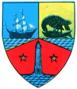 Coat of arms | |
 | |
| Country | |
| Historic region | Dobruja |
| Capital city (Reședință de județ) | Constanța |
| Established | 1879 |
| Ceased to exist | Administrative reform of 1950 |
| Area | |
| • Total | 6,916 km2 (2,670 sq mi) |
| Population (1930) | |
| • Total | 253,093 |
| • Density | 37/km2 (95/sq mi) |
| Time zone | UTC+2 (EET) |
| • Summer (DST) | UTC+3 (EEST) |
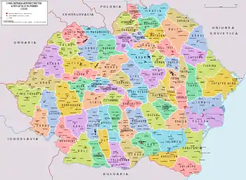
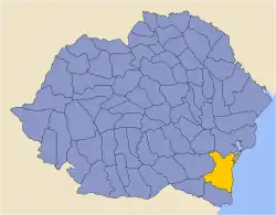
Following the 1926 administrative reform, the borders of the historical county are identical to the ones of the current Constanța County, with the exception of the Ostrov and Lipnița communes, which were then administered by the Durostor County, the Baia commune, now part of Tulcea County, and the villages of Tereskondu, Pârâul Caprei, Fundeni, Pădureni, Saldu Alde and Enigea-Haidar, now in Bulgaria.
Geography
The county neighboured the Black Sea to the east, the counties of Tulcea and Brăila to the north, Ialomița to the west, Durostor to the south-west and Caliacra to the south.
Administration
The county originally consisted of four districts (plăși):[10]
- Plasa Dunărea
- Plasa Mangalia
- Plasa Ovidiu
- Plasa Traian
Subsequently, the territory of the county was reorganized into seven districts:
- Plasa Cernavodă, headquartered in Cernavodă
- Plasa Dunărea, headquartered in Hârșova
- Plasa Ferdinand, headquartered in Constanța
- Plasa Mangalia, headquartered in Mangalia
- Plasa Negru-Vodă, headquartered in Negru Vodă
- Plasa Traian, headquartered in Ion Corvin
- Plasa Medgidia, headquartered in Medgidia
On the territory of Constanta County there were seven urban localities: Constanţa (with city status) and the urban communes of Carmen-Sylva, Techirghiol, Mangalia, Medgidia, Cernavodă and Hârșova.
After 1938
After the 1938 Administrative and Constitutional Reform, this county merged with the counties of Ialomița, Durostor and Caliacra to form Ținutul Mării. It was re-established in 1940 after the fall of Carol II's regime. Ten years later, it was abolished by the Communist regime.
Population
According to the census data of 1930, the county's population was 253,093 inhabitants, of which 66.2% were Romanians, 8.9% Bulgarians, 6.8% Turks, 6.0% Tatars, 3.8% Germans, 1.8% Greeks, 1.5% Russians, 1.3% Armenians, as well as other minorities.[11] In religion, the population consisted of 78.9% Eastern Orthodox, 13.1% Islam, 2.5% Lutheran, 1.8% Roman Catholics, as well as other minorities.[12]
Urban population
In 1930, the urban population of the county was 81,631 inhabitants, 68.7% Romanians, 7.3% Turks, 5.2% Greeks, 3.9% Armenians, 2.5% Germans, 2.2% Jews, 2.0% Tatars, 2.0% Bulgarians, 1.7% Russians, 1.7% Hungarians, as well as other minorities. Among the urban population, mother tongues were reported to be Romanian (72.0%), Turkish (9.7%), Greek (4.5%), Armenian (3.6%), German (2.4%), as well as other minorities. From the religious point of view, the urban population was composed mostly of Eastern Orthodox (78.4%), followed by Muslim (9.6%), Armenian Apostolic (3.3%), Roman Catholic (2.7%), Jewish (2.3%), Lutheran (1.6%), as well as other minorities.
References
| Wikimedia Commons has media related to Constanța County. |
| Wikimedia Commons has media related to Interwar Constanța County. |
- "Administraţia locală a Constanţei, din nou la start. Primul mandat, după 16 ani, fără Mazăre şi Constantinescu" (in Romanian). Adevărul. 22 June 2016. Retrieved 23 June 2016.
- "Population at 20 October 2011" (in Romanian). INSSE. 5 July 2013. Retrieved 9 July 2013.
- National Institute of Statistics, "Populația la recensămintele din anii 1948, 1956, 1966, 1977, 1992 și 2002"
- Robert Stănciugel and Liliana Monica Bălașa, Dobrogea în Secolele VII-XIX. Evoluție istorică, Bucharest, 2005; pg. 202
- 2002 official census results Archived 16 August 2009 at the Wayback Machine
- "S-au împărțit mandatele: cum va arăta noul consiliu județean Constanța". Cuget Liber (in Romanian).
- "Population at 20 October 2011" (in Romanian). INSSE. 5 July 2013. Retrieved 5 July 2013.
- "Istoric Cercul Militar Constanța ["History of the Constanța military circle"]" (in Romanian). Logistical Naval Base. Retrieved 8 November 2019.
- "Istoric Cercul Militar Constanța ["History of the Constanța military circle"]" (in Romanian). Logistical Naval Base. Retrieved 8 November 2019.
- Portretul României Interbelice - Județul Constanța
- Recensământul general al populației României din 29 decemvrie 1930, Vol. II, pag. 142-143
- Recensământul general al populației României din 29 decemvrie 1930, Vol. II, pag. 592-595
External links
- (in Romanian) memoria.ro, Interwar Constanța County
