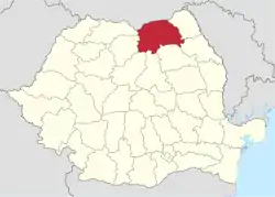
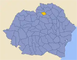
Suceava County
Suceava County (Romanian pronunciation: [suˈtʃe̯ava]) is a county (județ) of Romania. Most of its territory lies in the southern portion of the historical region of Bukovina, while the remainder forms part of Western Moldavia proper. The county seat is the historical city of Suceava, formerly the capital of the Principality of Moldavia during the late Middle Ages.
Suceava County
Județul Suceava | |
|---|---|
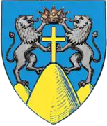 Coat of arms | |
 | |
| Coordinates: 47.58°N 25.76°E | |
| Country | Romania |
| Development region | Nord-Est |
| Historical region | Southern Bukovina |
| Capital | Suceava |
| Area | |
| • Total | 8,553 km2 (3,302 sq mi) |
| Area rank | 2nd |
| Population (2011) | |
| • Total | 634,810 |
| • Estimate (2018)[1] | 757,679 |
| • Rank | 8th |
| • Density | 74/km2 (190/sq mi) |
| Telephone code | (+40) 230 or (+40) 330[2] |
| ISO 3166 code | RO-SV |
| GDP (nominal) | US$ 3.188 billion (2015) |
| GDP per capita | US$ 5,022 (2015) |
| Website | County Council Prefecture |
Demographics
In 2011, Suceava County had a population of 634,810, with a population density of 74/km2. The proportion of each ethnic group is displayed as follows:[3]
- Romanians - 96.14%
- Romani - 1.92%
- Ukrainians (including Hutsuls and Rusyns) - 0.92%
- Lipovans - 0.27%
- Germans (Bukovina Germans, Zipser Germans, and Regat Germans) - 0.11%
- West Slavs (i.e. Poles, Slovaks, and Czechs) as well as other ethnic groups - 0.5%
| Year | County population[4][5] |
|---|---|
| 1948 | |
| 1956 | |
| 1966 | |
| 1977 | |
| 1992 | |
| 2002 | |
| 2011 | |
| 2016 (estimate) |
Geography
The county lies within the southern part of the historical region of Bukovina, but also incorporates territories from Western Moldavia proper.
In terms of total area, it covers a surface of 8,553 square kilometres (3,302 sq mi), making it thus the second in Romania in this particular regard, just after Timiș County in Banat.
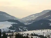
The western side of the county consists of mountains from the Eastern Carpathians group: the Rodna Mountains, the Rarău Mountains, the Giumalău Mountains, and the Ridges of Bukovina, the latter with lower heights.
The county's elevation decreases towards the east, with the lowest height in the Siret River valley. The rivers crossing the county are the Siret River with its tributaries: the Moldova, Suceava, and Bistrița rivers.
Neighbours
The county of Suceava is bordered by the following other territorial units:
- Ukraine to the north - Chernivtsi Oblast.
- Mureș County, Harghita County, and Neamț County to the south.
- Botoșani County and Iași County to the east.
- Maramureș County and Bistrița-Năsăud County to the west.
Historical county
Județul Suceava | |
|---|---|
County (Județ) | |
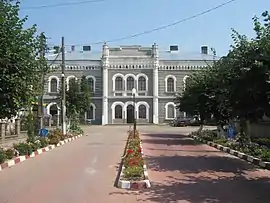
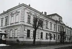 The Suceava County Prefecture building from the interwar period (now the History Museum in Suceava) | |
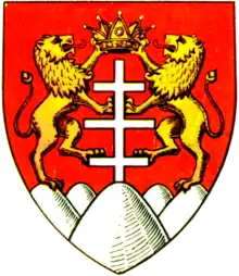 Coat of arms | |
 | |
| Country | |
| Historic region | Bukovina |
| Capital city (Reședință de județ) | Suceava |
| Established | 1925 |
| Area | |
| • Total | 1,309 km2 (505 sq mi) |
| Population (1930) | |
| • Total | 121,327 |
| • Density | 93/km2 (240/sq mi) |
| Time zone | UTC+2 (EET) |
| • Summer (DST) | UTC+3 (EEST) |
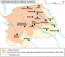
In the Kingdom of Romania, between the early 20th century up to the end of the 1940s, the county had a smaller size and population. The contemporary Suceava county is the result of the merger of other smaller former Romanian counties from the historical province of Bukovina that were functional mostly throughout the interwar period (e.g. Rădăuți County or Câmpulung County).
The present-day Suceava County also incorporates part of Baia County. As per the administrative reform of 1938 under King Carol II, the whole counties which divided Bukovina in the Kingdom of Romania were united into a bigger land called Ținutul Suceava.
As for the historical interwar Suceava County, this administrative unit was located in the northern part of Greater Romania and in the southern part of the historical region of Bukovina respectively. Its territory is situated entirely within the borders of the current Suceava County, constituting thus the central-eastern part of the contemporary namesake county. During the interwar period, it was the smallest county of Greater Romania by area, covering 1,309 square kilometres (505 sq mi).
It is bordered on the east by the counties of Dorohoi and Botoșani, to the north by Rădăuți County, to the west by Câmpulung County, and to the south by Baia County.
Administrative organization
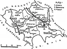
As of 1930, the county was administratively subdivided into three districts (plăṣi):[6]
- Plasa Arbore, headquartered at Arbore
- Plasa Dragomirna, headquartered at Dragomirna
- Plasa Ilișești, headquartered at Ilișești
In 1938, the county was administratively reorganized into the following districts:
Population
According to the 1930 census data, the county population was 121,327, ethnically divided among Romanians (79.5%), Germans (primarily Bukovina Germans but also Zipsers) (8.2%), Jews (5.5%), Poles (2.7%), Ukrainians (1.7%), as well as other minor ethnic minorities.[7]
By language the county was divided among Romanian (76.5%), German (9.4%), Ukrainian (5.5%), Yiddish (4.3%), Polish (2.5%), as well as other languages. From the religious point of view, the population consisted of Eastern Orthodox (80.1%), Roman Catholic (8.4%), Jewish (5.5%), Evangelical Lutheran (3.3%), Greek Catholic (1.4%), as well as other minor religions.[8]
Urban population
The county's urban population consisted of 19,850 inhabitants (17,028 in Suceava and 2,822 in Solca), ethnically divided among Romanians (61.5%), Jews (18.7%), Germans (13.9%), Poles (2.6%), as well as other minor ethnic minorities.[7]
As a mother tongue in the urban population, Romanian (60.4%) predominated, followed by German (18.7%), Yiddish (13.8%), Ukrainian (3.2%), Polish (2.2%), as well as other minor spoken languages. From the religious point of view, the urban population consisted of 60.6% Eastern Orthodox, 18.8% Jewish, 15.3% Roman Catholic, 2.0% Greek Catholic, 1.7% Evangelical Lutheran, 0.7% Baptist, as well as other confessional minorities.[8]
Economy
The predominant industries/economic sectors in the county are as follows:
- Lumber - producing the greatest land mass of forests in Romania
- Food and Cooking
- Mechanical components
- Construction materials
- Mining
- Textile and leather
Suceava occupies the first place among the Romanian cities with the most commercial spaces per inhabitant.[9] Notable supermarket chains correlated with the aforementioned economic areas: Metro, Carrefour, Auchan, Selgros, Kaufland, and Lidl (some of the biggest supermarket chains in Romania).
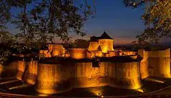
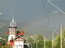
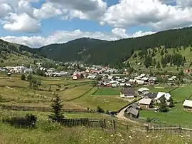
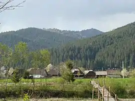
Tourism
In 2018, Suceava County was designated 'European destination of excellence' by the European Commission.[10] Furthermore, back in 2017, Suceava ranked 3rd in Romania regarding total tourist accommodation capacity.[11]
.jpg.webp)
.jpg.webp)
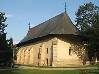
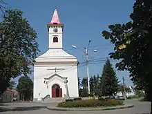
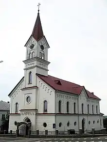
The main touristic attractions of the county are:
- The city of Suceava with its medieval fortifications;
- The Painted churches of northern Moldavia and their monasteries:
- The Voroneț Monastery;
- The Putna Monastery;
- The Moldovița Monastery;
- The Sucevita Monastery;
- The Bogdana Monastery from Rădăuți;
- The Humor Monastery;
- The Arbore Monastery;
- The Probota Monastery;
- The Dragomirna Monastery;
- The medieval salt mine of Cacica;
- The Vatra Dornei resort;
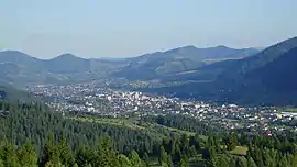
- The cities and towns of Rădăuți, Fălticeni, Câmpulung Moldovenesc, Gura Humorului, and Siret.
Politics
The Suceava County Council, elected at the 2020 local government elections, is made up of 36 counselors, with the following party composition:[12]
| Party | Seats | Current County Council | |||||||||||||||||||||
|---|---|---|---|---|---|---|---|---|---|---|---|---|---|---|---|---|---|---|---|---|---|---|---|
| National Liberal Party (PNL) | 18 | ||||||||||||||||||||||
| Social Democratic Party (PSD) | 13 | ||||||||||||||||||||||
| People's Movement Party (PMP) | 5 | ||||||||||||||||||||||
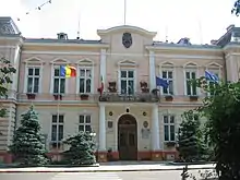
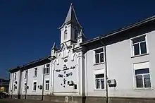
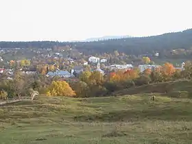
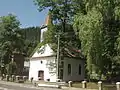
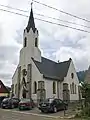
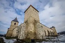
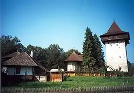
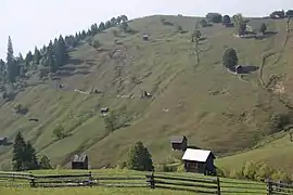
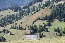
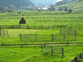
Administrative divisions
_from_Fortess.jpg.webp)
.jpg.webp)
.JPG.webp)
.JPG.webp)
Suceava County has 5 municipalities, 11 towns, and 98 communes.
- Municipalities
- Câmpulung Moldovenesc
- Fălticeni
- Rădăuți
- Suceava - capital city; population within city limits: 124,161 (as of 2018)[1]
- Vatra Dornei
- Communes
- Adâncata
- Arbore
- Baia
- Bălăceana
- Bălcăuți
- Berchișești
- Bilca
- Bogdănești
- Boroaia
- Bosanci
- Botoșana
- Breaza
- Brodina
- Bunești
- Burla
- Cacica
- Calafindești
- Capu Câmpului
- Cârlibaba
- Ciocănești
- Ciprian Porumbescu
- Comănești
- Cornu Luncii
- Coșna
- Crucea
- Dărmănești
- Dolhești
- Dorna-Arini
- Dorna Candrenilor
- Dornești
- Drăgoiești
- Drăgușeni
- Dumbrăveni
- Fântâna Mare
- Fântânele
- Forăști
- Frătăuții Noi
- Frătăuții Vechi
- Frumosu
- Fundu Moldovei
- Gălănești
- Grămești
- Grănicești
- Hănțești
- Hârtop
- Horodnic de Jos
- Horodnic de Sus
- Horodniceni
- Iacobeni
- Iaslovăț
- Ilișești
- Ipotești
- Izvoarele Sucevei
- Mălini
- Mănăstirea Humorului
- Marginea
- Mitocu Dragomirnei
- Moara
- Moldova-Sulița
- Moldovița
- Mușenița
- Ostra
- Păltinoasa
- Panaci
- Pârteștii de Jos
- Pătrăuți
- Poiana Stampei
- Poieni-Solca
- Pojorâta
- Preutești
- Putna
- Rădășeni
- Râșca
- Sadova
- Șaru Dornei
- Satu Mare
- Șcheia
- Șerbăuți
- Siminicea
- Slatina
- Straja
- Stroiești
- Stulpicani
- Sucevița
- Todirești
- Udești
- Ulma
- Vadu Moldovei
- Valea Moldovei
- Vama
- Vatra Moldoviței
- Verești
- Vicovu de Jos
- Voitinel
- Volovăț
- Vulturești
- Zamostea
- Zvoriștea
- Villages
2010 floods
During June 2010, Gheorghe Flutur, the president of Suceava County, told the Mediafax news agency that his region was one of the worst hit in the country. In the morning of June 29, relief work was coordinated to deal with flooding that killed 21 people, and caused hundreds to be evacuated from their homes.[13]
Gallery
 Tihuța Pass – connecting Bukovina to neighbouring westward Transylvania
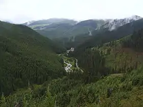 Prislop Pass
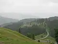 Ciumârna (Palma) Pass
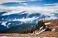 Pietrosul Bistriței peak, Bistrița Mountains (1791 m)
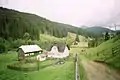 Traditional Romanian inn by a countryside road
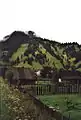 Hills covered in fog in the countryside
.jpg.webp) Part of the forested Carpathian Mountains near Ciocănești
Part of the forested Carpathian Mountains near Ciocănești.jpg.webp) Crucea Commune
Crucea Commune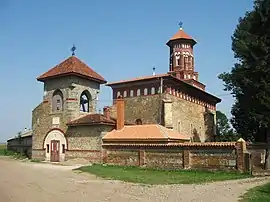 Romanian white church in Baia
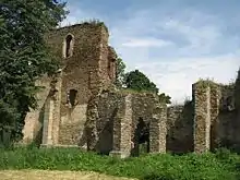 14th century Roman Catholic church ruins built by the Transylvanian Saxons in Baia (German: Moldenmarkt)
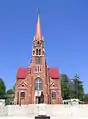
 Solonețu Nou (Polish: Nowy Sołoniec) village
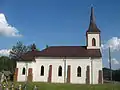 Poiana Micului (Polish: Pojana Mikuli)
.JPG.webp)
.JPG.webp)
 Roman Catholic church in Putna
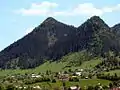 Mountainous landscape near Câmpulung Moldovenesc
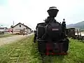 Mocăniță narrow-gauge railway steam train
.jpg.webp)

 Meadows in Panaci
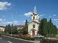
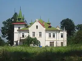 Sturdza manor in Salcea
Natives and residents
- Matei Vișniec - Romanian-French playwright
- Nichita Danilov - Lipovan poet
- Iulian Vesper - Romanian poet and writer
- Nicolae Labiș - Romanian poet
- Grigore Vasiliu Birlic - Romanian actor
- Ion G. Sbiera - Romanian folklorist
- Ion Costist - Romanian 16th century Roman Catholic monk
- Liviu Giosan - Romanian-American marine geologist
- Elisabeta Lipă - Romanian Olympic rower
- Constantin Schumacher - Romanian-German footballer
- Józef Weber - German Roman Catholic archbishop
- Elisabeth Axmann - German writer
- Otto Babiasch - German Olympic boxer
- Lothar Würzel - German linguist, journalist, and politician
- George Ostafi - German abstract painter
- Hugo Weczerka - German historian and academician
- Anton Keschmann - German politician in the Imperial Austrian Parliament
- Olha Kobylianska - Ukrainian-German writer
- Ludwig Adolf Staufe-Simiginowicz - Ukrainian-German writer and educator
- George Löwendal - Russian-Danish painter[14]
References
| Wikimedia Commons has media related to Suceava County. |
- "HARTĂ INTERACTIVĂ - Câți mai suntem în România? Populația în fiecare județ și în fiecare municipiu din țară" (in Romanian). INSSE. 6 May 2019. Retrieved 6 May 2019.
- The number used depends on the numbering system employed by the phone companies on the market.
- National Institute of Statistics, "Populația după etnie" Archived 2009-08-16 at the Wayback Machine
- National Institute of Statistics, "Populația la recensămintele din anii 1948, 1956, 1966, 1977, 1992 și 2002"
- "Populaţia României pe localitati la 1 ianuarie 2016" (in Romanian). INSSE. 6 June 2016. Archived from the original on 2017-10-27. Retrieved 27 October 2017.
- Portretul României Interbelice - Județul Suceava
- Recensământul general al populației României din 29 decemvrie 1930, Vol. II, pag. 434-437
- Recensământul general al populației României din 29 decemvrie 1930, Vol. II, pag. 738-739
- Sandrinio Neagu (4 May 2018). "Suceava pe primul loc la nivel național în privința spațiilor comerciale". Monitorul de Suceava (in Romanian). Retrieved 23 October 2020.
- Dan Coman. "Flutur a primit, la Bruxelles, premiul "Suceava, destinație europeană de excelență" (in Romanian)". Radio România Internațional. Retrieved 22 March 2020.
- "Județul Suceava pe locul trei ca număr de structuri de primire turistică după Brașov și Constanța (in Romanian)". News Bucovina. Retrieved 22 March 2020.
- "Mandate de CJ pe județe și competitori" (in Romanian). Biroul Electoral Central. 10 June 2016. Retrieved 16 June 2016.
- "Archived copy". Archived from the original on 2010-07-03. Retrieved 2010-07-11.CS1 maint: archived copy as title (link)
- "Fundația Löwendal" (in Romanian).