Dahra Range
The Dahra Range (Arabic: جبال الظهرة) is a mountain range located in northern Algeria. 'Dahra' is an Arabic word meaning 'back'; in toponymy this term indicates a long plateau of lesser altitude.[2]
| Dahra Range | |
|---|---|
| جبال الظهرة | |
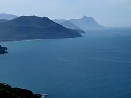 View of the coastal Dahra Range in Cap Ténès | |
| Highest point | |
| Peak | Mount Zaccar |
| Elevation | 1,550 m (5,090 ft) |
| Coordinates | 36°35′0″N 1°40′0″E [1] |
| Geography | |
| Parent range | Tell Atlas |
Geography
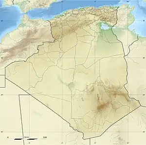
The Dahra is a low mountain chain part of the greater Tell Atlas which stretches from Algiers in the east along the Mediterranean coast until reaching the mouth of the Chelif near Mostaganem at its western end. Its tallest summit is 1,550 m high Mount Zaccar, north of Miliana, a town built on its slopes. The inhabitants of the area of the range are Berber people.[3]
The range is partly covered in Mediterranean forest, with scattered patches of cultivation.[4]
The inhabitants of the Dahra Range are from Berber origin, descending from the Banou Ifren and the Maghraouas[5]
References
- Google Earth
- E.B., « Dahra », in Encyclopédie berbère, 14
- Le Correspondant, p. 580
- Daniel Babo, Algérie, Éditions le Sureau, coll. « Des hommes et des lieux » (ISBN 978-2-911328-25-1), p. 45
- "Le Correspondant". 6 January 1864 – via Google Books.
External links
- Massif des Dahra - Couleurs d'Algérie
- Pleistocene Mazouna Stage in Western Algeria Containing Artifacts
| Tell Atlas |
|
|---|---|
| Saharan Atlas |
|
| Saharan massifs | |
| Peaks |
|