Ksour Range
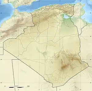
The Ksour Range or Kçour Range (Arabic: جبال القصور, French: Monts des Ksour or Djebel Ksour) is a mountain range in Algeria. Stretching across the provinces of Béchar and El Bayadh, it is the westernmost range of the Saharan Atlas, with the Amour Range further east.[2]
| Ksour Range | |
|---|---|
| جبال القصور | |
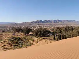 View of the Ksour Range from near Ain Sefra | |
| Highest point | |
| Peak | Mount Issa |
| Elevation | 2,236 m (7,336 ft) |
| Coordinates | 32°52′0″N 0°29′0″E [1] |
| Geography | |
 Ksour Range | |
| Countries | Algeria and Morocco |
| Parent range | Saharan Atlas |
Geography
The range extends between Figuig Province in the Oriental Region of Morocco near the Moroccan/Algerian border and El Bayadh municipality in Algeria.[3] The range pattern continues westwards as the High Atlas. The highest summit of the range is 2,236 m high Mount Issa or Djebel Aïssa (جبل عيسى).
Rock art
Neolithic art, in the form of engraved stones representing horses, elephants and other animals, is found in different caves and walls throughout the range (such as at Thyout).[4]
Protected areas
The Djebel Aissa National Park is a protected area within the limits of the mountain range since 2003.[5]
Features
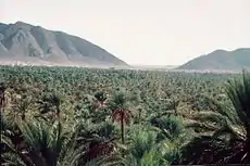 Western foothills of the Ksour Range near Figuig |
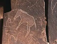 Neolithic rock engravings near Ain Sefra. |
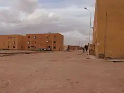 Street in El Abiodh Sidi Cheikh, a town located below the southern slopes of the range. |
References
- Google Earth
- Un gisement d'ostracodes non-marins dans l'Éocène inférieur du Djebel Amour, Atlas saharien central, Algérie
- Montagnes des Ksour - Géographie militaire
- Lhote (Henri), Les gravures rupestres du Sud-oranais, Arts et Métiers graphiques, Paris, 1970
- "Parc national de Djebel Aïssa". Archived from the original on 2018-04-18. Retrieved 2013-05-20.
External links
 Media related to Ksour Range at Wikimedia Commons
- Parc du Djebel Aïssa (Nâama)
- A. Bernard, Les régions naturelles de l'Algérie
- Les montagnes d'atlas
- Persée - Notes de géographie physique algérienne
| Tell Atlas |
|
|---|---|
| Saharan Atlas |
|
| Saharan massifs | |
| Peaks |
|