Dalkhola
Dalkhola is a city and a municipality of Uttar Dinajpur district in the state of West Bengal, India.[2]
Dalkhola | |
|---|---|
City | |
  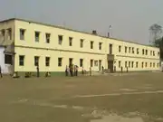 Top to bottom: Dalkhola College, Dalkhola market, Dalkhola High School | |
 Dalkhola Location in West Bengal, India  Dalkhola Dalkhola (India) | |
| Coordinates: 25.876°N 87.839°E | |
| Country | |
| State | West Bengal |
| District | Uttar Dinajpur |
| Government | |
| • Type | Municipality |
| • Body | Dalkhola Municipality |
| • Chairman | Subhash Goswami (TMC) |
| • Vice-Chairman | Ali Reza khan (TMC) |
| Area | |
| • Total | 15.95 km2 (6.16 sq mi) |
| Elevation | 23 m (75 ft) |
| Population (2011)[1] | |
| • Total | 37,127 |
| • Density | 2,300/km2 (6,000/sq mi) |
| Languages | |
| • Official | Bengali, English, Urdu |
| Time zone | UTC+5:30 (IST) |
| PIN | 733201, 733209 |
| Telephone code | +913525 25xxxx |
| Vehicle registration | WB 59 and WB 91 commercial vehicle WB 60 and WB 92 private vehicle |
| Lok Sabha constituency | Raiganj |
| Vidhan Sabha constituency | Karandighi |
| Climate | Cwa (Köppen) |
| Precipitation | 1,100 millimetres (43 in) |
| Avg. annual temperature | 32 °C (90 °F) |
| Avg. summer temperature | 41 °C (106 °F) |
| Avg. winter temperature | 13 °C (55 °F) |
| Website | www.dalkholamunicipality.org.in |
History
Dalkhola was originally in the state of Bihar in India. After 1959, Dalkhola was located in the state of West Bengal. The town expanded around the Dalkhola village Panchayats and developed into an important centre for trade and commerce due to mainstream connection with both Railway and Roadway. It is an important center for commodities like jute, corn and oil trade in Uttar Dinajpur. It is also an important center for the trade of maize, which is produced in the neighboring state of Bihar.[3]
Before the Independence of India in 1947 and later, the figure of Dalkhola was idly rural area where some Pucca and Kacha roads were connected to nearest place. The area was covered by jungle in large, only a few area was used for living. Their main source of income was agriculture and fishery from Mahananda. That time it was ruled by Raja P.C.Lal. After Independence & partition of India, innumerable refugees came to Dalkhola from Bangladesh formerly known as East Pakistan & they live in Dalkhola rural area. Before in 1956, this area belong to the state of Bihar under Purnia district. In 1956 this area was transferred to Territory of West Bengal by endeavour of Chief Minister Dr. B.C. Roy. It is an important place in this spare of communication facility as NH 12 and NH 27 pass through this locality. Small villages are administered by Panchayat Raj, & they gradually develop into work-oriented busy market & that gradually convert into Small Township. With the growth of population and economic base establishment, the people of Dalkhola experienced a green revolution. In consequence, Dalkhola Municipality was set up on 1 January 2003 for upliftment of social and economic development.
Politics
Dalkhola became a municipality in 2003. In the Dalkhola municipal area, there were 14 Wards. But now 2 more ward are divided now there are 16 wards. In last election, the Indian National Congress won 9 seats out of 14, and the Communist Party of India (Marxist) won the other 5 seats. It is one of the four municipalities in North Dinajpur district. Dalkhola has 16 now. in Recently 2013 Municipality election Congress won 10 seats, cpim 4 and Tmc 2. Now whole councillors of congress party joined Trinamool Congress nd now the status are TMC 12, CPIM 4 and CONG 0
Geography
| Cities and towns in the Uttar Dinajpur district M: municipal city/ town, CT: census town, R: rural/ urban centre, T: tourist centre Owing to space constraints in the small map, the actual locations in a larger map may vary slightly |

Dalkhola has an average elevation of 23 meters (75 feet) and is located at 25.85°N 87.85°E.[4]
In the map alongside, all places marked on the map are linked in the full screen version.
It is the second-largest area in the Uttar Dinajpur district, with a length 13 km from East to West, 18 km from North to South. Dalkhola was divided on the 14 wards. But now to more wards are added, 9 number ward divided into 9 and 16 and 11 number ward divided into 11 and 15.
The following 16 ward are:
- Muhammad Pur
- Hari Pur
- Bhusamani
- Mithapur
- Malickpur More
- Deshbandhu Para
- Dalkhola Bazar
- High School Para
- Dalkhola Basti
- Subhash Pally
- Farsara
- Bidhan Pally
- Uttar Dalkhola
- Purnia More
- Shikar Pur
- Nichit Pur
- Binoy colony
- Shree pally
- Vivekananda pally
- Hatbari
- College para
- College more
- High school more
Climate
The cooler months in Dalkhola begin in December and end in February. The temperature generally peaks at about 35 °C. The annual low temperature is usually near 10 °C. The monsoon season starts in June and runs through September.
| Climate data for Dalkhola | |||||||||||||
|---|---|---|---|---|---|---|---|---|---|---|---|---|---|
| Month | Jan | Feb | Mar | Apr | May | Jun | Jul | Aug | Sep | Oct | Nov | Dec | Year |
| Average high °C (°F) | 20.3 (68.5) |
26.5 (79.7) |
32.6 (90.7) |
37.7 (99.9) |
38.9 (102.0) |
36.7 (98.1) |
33.0 (91.4) |
32.4 (90.3) |
32.3 (90.1) |
31.5 (88.7) |
28.8 (83.8) |
24.7 (76.5) |
31.53 (88.75) |
| Average low °C (°F) | 9.2 (48.6) |
11.6 (52.9) |
16.4 (61.5) |
22.3 (72.1) |
25.2 (77.4) |
26.7 (80.1) |
26.2 (79.2) |
26.1 (79.0) |
25.7 (78.3) |
21.8 (71.2) |
14.7 (58.5) |
9.9 (49.8) |
19.65 (67.37) |
| Average precipitation mm (inches) | 19 (0.7) |
11 (0.4) |
11 (0.4) |
8 (0.3) |
33 (1.3) |
134 (5.3) |
306 (12.0) |
274 (10.8) |
227 (8.9) |
94 (3.7) |
9 (0.4) |
4 (0.2) |
1,130 (44.5) |
| Source: worldweather.org[5] | |||||||||||||
Development

Dalkhola is the largest exporter of Maize in West Bengal. In Dalkhola, a national level Power Grid was established in 1973, which expanded the availability of electricity to the Municipality. Other developments include a Flour Mill, Tantia agro chemical Pvt Ltd and maize processing company which use the crops produced by local farmers.
Official languages
As per the West Bengal Official Language (Amendment) Act, 2012, which came into force from December 2012, Urdu was given the status of official language in areas, such as subdivisions and blocks, having more than 10% Urdu speaking population.[6] In Uttar Dinajpur district, Goalpokhar I and II blocks, Islampur block and Islampur municipality were identified as fulfilling the norms set[7] In 2014, Calcutta High Court, in an order, included Dalkhola municipality in the list.[8]
Schools
The schools in Dalkhola include:
- Dalkhola High School (H.S)
- Dalkhola Girls High School (H.S)
- Uttar Dalkhola High School (H.S)
- Hindi High School (JR)
- Middle School
- Farsara F.P School
- Nazarpur F.P School
- Jawahar Navadoya Vidyalaya, Dalkhola
- Dalkhola Urdu Jr High School
- Itvata F.P. School
- Sarsar F.F. School
- Nichitpur F. P. School
- Subhash Pally F.P. School
English medium schools
- St. Mary's School (Dalkhola)
- St. Stephen's School
- St. Xavier's School (Dalkhola)
- Dalkhola Public School (D.P.S)
- Iqra Public School
- Children's Academy
- South Point Public school (Loknathpara)
- Holy Cross School
- National Public School (High School Para)
- St Ignatius School
College
- Shree Agrasen Mahavidyalaya was established in 1995. Affiliated to the University of Gour Banga it offers honours courses in Bengali, Hindi, English, history, political science, sociology and accountancy, and general courses in arts and commerce. Urdu is taught as a general subject.[9][10]
Demographics
As per the 2011 Census of India, Dalkhola had a total population of 36,930, of which 19,230 (52%) were males and 17,700 (48%) were females. Population below 6 years was 5,592. The total number of literates in Dalkhola was 21,207 (67.67% of the population over 6 years).[11]
In the 2001 India census, Dalkhola had a population of 13,891. In 2008, the population grew to approximately 19,000. Males constituted 54% of the population and females 46%. The literacy rate in Dalkhola of 69% was greater than the national average of 59.5%; male literacy was 70% and female literacy was 63%. In Dalkhola, 18% of the population was under 6 years of age.
Decadal growth for the period 1991 to 2001 was 30.41% in Dalkhola, compared to 28.72% in the Uttar Dinajpur district.[12] Decadal growth in West Bengal was 17.84%.[13]
Year of Establishment Dalkhola Municipality has been formed on 01 /01 /2003 as per Notification No. 1 /MA/0 /C-4 /1 M-14 / 2000 with the entire area of Dalkhola 1 and four mouza of Dalkhola 2 gram panchayats with a population of 29783 according to the census of 2001. Dalkhola Municipality is the 4 th Municipality of Uttar Dinajpur district constituted with 14 wards and first election was held on 22 /06 /2003 and second election was held on 29 /06 /2008. Sri Himadri Mukharjee was the first chairman and Sri Subhas Goshwami has become the Chairman in the second. Sri Tanay Day was the 3 rd Chairman. Now Sri Subhash Goswami again on the Chair.[14]
Transport

Highway 34 cuts through the middle of the town to meet NH 31.[3] NH 34 starts from Dalkhola and it ends in Dumdum, near Kolkata to help northeastern part of India to connect kolkata.
There are two airports near Dalkhola. Bagdogra Airport is 100 km away, and Purnea Airport is 40 km from Dalkhola.

The largest railway station and busiest Rack point in the district is located in Dalkhola. This railway connects to several major cities, including Siliguri, Kolkata, Guwahati, Delhi, Jaipur , Chennai and Patna. Bus transportation runs from Dalkhola to Siliguri, Raiganj, Kishanganj, Kaliaganj, Balurghat, and Malda.
AC bus services for Kolkata, Bhutan, Patna and Siliguri are also available from Dalkhola.
Festivals
Many religious festivals are observed in Dalkhola. The three largest festivals are Durga puja, Eid, and Diwali. Other festivals include Holy, Kurbani, Chhat Puja, Muharram, Saraswati Puja, Kali Puja, Dushera, Christmas, and Bishwakarama Puja. Muslims religious festival are observed in Dalkhola. The three largest festival are [Eid ultimate zuha] Eid ul fitr & Moharram.
Media
Dalkhola press club is under on North Bengal Press club.
References
- "Dalkhola City".
- "Uttar Dinajpur Rail Network Map". Maps of India. Retrieved 2 February 2008.
- Sen, Kousik. "New year gift for business hub". The Telegraph, 28 December 2002. Retrieved 5 February 2008.
- Falling Rain Genomics, Inc - Dalkhola
- "Climatological Information for Dalkhola". World Weather. Retrieved 25 February 2011.
- "Minority Affairs and Madrasah Education". Chief Minister’s Office, Government of West Bengal. Retrieved 14 January 2019.
- "Bengal gives second language status to Urdu". Zee News, 4 February 2012. Retrieved 14 January 2019.
- "Santosh Chowdhury and Ors Vs State of West Bengal and ors". Indian Kanoon. Retrieved 14 January 2019.
- "Shree Agrasen Mahavidyalaya". SAM. Retrieved 12 January 2019.
- "Shree Agrasen Mahavidyalaya". College Admission. Retrieved 12 January 2019.
- "2011 Census – Primary Census Abstract Data Tables". West Bengal – District-wise. Registrar General and Census Commissioner, India. Retrieved 6 January 2019.
- "Provisional population totals, West Bengal, Table 4, Uttar Dinajpur District". Census of India 2001. North-Eastern Frontier Railway. Archived from the original on 19 July 2011. Retrieved 2 February 2008.
- "Provisional Population Totals, West Bengal. Table 4". Census of India 2001. Census Commission of India. Archived from the original on 21 July 2011. Retrieved 5 February 2008.
- "Dalkhola city, Uttar Dinajpur District". city details. Akhtar Ahmed. Retrieved 3 March 2012.
External links
| Wikimedia Commons has media related to Dalkhola. |
Places adjacent to Dalkhola | ||||||||||
|---|---|---|---|---|---|---|---|---|---|---|
| ||||||||||
Cities, towns and locations in Uttar Dinajpur district | |||||
|---|---|---|---|---|---|
| Cities, municipal and census towns |
| ||||
| Locations other than cities and towns |
| ||||
| Neighbourhoods in Uttar Dinajpur | |||||
| Related topics | |||||
| |||||