Malbazar
Malbazar, also known as Mal, is a city and a municipality in Jalpaiguri district[5] in the state of West Bengal, India. It is the headquarters of the Malbazar subdivision. It lies about 65 km from Jalpaiguri and 55 km from Siliguri.
Malbazar
Mal | |
|---|---|
City | |
 | |
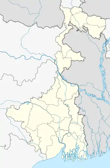
 Malbazar Location in West Bengal, India  Malbazar Malbazar (India)  Malbazar Malbazar (Asia) | |
| Coordinates: 26.85°N 88.75°E | |
| Country | |
| State | West Bengal |
| District | Jalpaiguri |
| Government | |
| • Type | Municipality |
| • Body | Malbazar Municipality |
| • Municipality Chairperson | Mr. Swapan Saha |
| Area | |
| • Total | 3.50 km2 (1.35 sq mi) |
| Population (2011) | |
| • Total | 25,218[2] |
| • Density | 9,851/km2 (25,510/sq mi) |
| Languages | |
| • Official | Bengali[3][4] |
| • Additional official | English[3] |
| Time zone | UTC+5:30 (IST) |
| PIN | 735221 |
| Sex ratio | 950/968 ♂/♀[2] |
| Lok Sabha constituency | Jalpaiguri (SC) |
| Vidhan Sabha constituency | Mal (ST) |
| Literacy rate | 88.68% |
| Website | www.malmunicipality.org |
History
Before 1947 Malbazar was a very small place, mainly known for its tea gardens mostly owned by British people. Those tea gardens had a few Bengali white collar employees and the work force consisted of tribal people.
After independence of India as well as partition of Bengal refugees from the then East Pakistan (now Bangladesh) started to settle here by cutting down forests. By that time, Narayan Chandra Bannerjee, Dr Amalendu Biswas (came from Pabna), Dr Tarak Mukherjee, Nripendra nath Choudhary who came there from Dacca established this city. Bannerjee had earned a lot of respect for his effective medical treatments and social services. He took initiatives to get the refugees settled there in an organised way. As a result, some colonies came up.
Later, due to efforts of Bannerjee, Amalendu Biswas, Nripendra nath Choudhary, Sarat ch Ghosh, Dulal Sengupta, Makhan Bose established Adarsha Bidya Bhawan (a boys' high school). Narayan Chandra Bannerjee and Bipin Bihari Bandyopadhyay established Subhasini Balika Vidyalay (a girls' high school) in the 1950s. The Government Mal Grameen Hospital was established. Biswas contributed a lot as the only dentist of Malbazar. Nath Choudhury had helped the refugees get settled. Soon, the police station was shifted to Malbazar from nearby Kranti.
During that time, Jogesh Chandra Dutta was closely associated with Narayan Chandra Bannerjee, Amalendu Biswas, Nripendra nath Choudhary and others. Jogesh Chandra Dutta was the only practicing ophthalmologist in that area. He was also closely associated with development of Mal RR Primary School.
In the 1970s Malbazar got its fire service station. Later, a street was named after Narayan Chandra Bannerjee. The street is called "Dr. Narayan Banerjee Sarani" just behind Subhasini Balika Vidyalaya and Mal Adarsha Bidya Bhaban.
Geography
| Places and tea estates in Malbabazar subdivision (including Mal, Nagrakata and Matiali CD blocks) in Jalpaiguri district CT: census town, R: rural/ urban centre, N: neighbourhood, NP: national park/ wildlife sanctuary, TE: tea estate Abbreviations used in names – TG for Tea Garden (town/village), TE for Tea Estate, JRS: junction railway station Owing to space constraints in the small map, the actual locations in a larger map may vary slightly |
Location
Mal is at 26.85°N 88.75°E.[6]
Malbazar is one of the more important towns in Dooars. It is strategically located in the eastern part of the Dooars region. The town does not have much to offer tourists except for the Mal Park, but due to its location on the national highway, one can stay at Malbazar and visit the tourist destination of Eastern Dooars – Gorumara National Park, Chapramari Wildlife Reserve, Jhalong, Bindu, Samsing, Suntalekhola are among the tourist spots in this area.
There is a government tourist lodge in Malbazar apart from a few private accommodations. An annual flower show is held, visited by people from places far and near.
Area overview
Gorumara National Park has overtaken traditionally popular Jaldapara National Park in footfall and Malbazar has emerged as one of the most important towns in the Dooars. Malbazar subdivision is presented in the map alongside.[7][8] It is a predominantly rural area with 88.62% of the population living in rural areas and 11.32% living in the urban areas.[9][10] Tea gardens in the Dooars and Terai regions produce 226 million kg or over a quarter of India's total tea crop.[11][12] Some tea gardens were identified in the 2011 census as census towns or villages.[13] Such places are marked in the map as CT (census town) or R (rural/ urban centre). Specific tea estate pages are marked TE.
Note: The map alongside presents some of the notable locations in the subdivision. All places marked in the map are linked in the larger full screen map.
Demographics
According to the 2011 Census of India, Mal had a total population of 25,218 of which 12,814 (51%) were males and 12,404 (49%) were females. There were 1,161 persons in the age range of 0 to 6 years. The total number of literate people in Mal was 20,354 (84.61% of the population over 6 years).[14]
In the 2001 census, Malbazar had a population of 23,212 out of which 12,111 were males and 11,101 were females. Decadal growth for the period 1991–2001 was 13.81% for Malbazar, against 21.52% in Jalpaiguri district. Decadal growth in West Bengal was 17.84%.[15]
Education
- Caesar School (CBSE, English)(H.S.)
- Parimal Mitra Smriti Mahavidyalaya
- Mal Adarsha Bidya Bhaban (WBCHSE, Bengali)(H.S.)
Transport
The local train station, New Mal Junction, is connected by the newly converted Broad Gauge of the New Jalpaiguri–Alipurduar–Samuktala line. The railway line leads from the forests of North Bengal to the foothills near the border with Bhutan.
Malbazar is well connected by road with cities like Siliguri and Jalpaiguri. It became popular to tourists as a gateway to many more spots like Gorumara, and Chalsa. There is a short route between Malbazar and Lava via Gorubathan.
Politics
The chairperson of Mal Municipality is Swapan Saha and vice chairperson is Dipa Sarkar.[16]
References
- "Malbazar Info". malmunicipality.org. Retrieved 26 November 2020.
- http://www.census2011.co.in/data/town/801639-mal.html
- "Fact and Figures". Wb.gov.in. Retrieved 14 August 2019.
- "52nd Report of the Commissioner for Linguistic Minorities in India" (PDF). Nclm.nic.in. Ministry of Minority Affairs. p. 85. Archived from the original (PDF) on 25 May 2017. Retrieved 14 August 2019.
- Administrative setup of Jalpaiguri district Archived 8 December 2008 at the Wayback Machine from official website of Jalpaiguri District
- "Yahoo maps of Mal". Yahoo maps. Retrieved 29 November 2008.
- "Malbazar". North Bengal Tourism. Retrieved 13 July 2020.
- "Dooars Tour". North Bengal Tourism. Retrieved 13 July 2020.
- "Jalpaiguri". District Profile. District administration. Retrieved 13 July 2020.
- "District Statistical Handbook 2014 Jalpaiguri". Tables 2.2, 2.4b. Department of Planning and Statistics, Government of West Bengal. Retrieved 13 July 2020.
- "Tea Growing Regions". Dooars and Terai. Indian Tea Association. Retrieved 13 July 2020.
- "Dooars-Terai". Tea Board India. Retrieved 13 July 2020.
- "2011 Census – Primary Census Abstract Data Tables". West Bengal – District-wise. Registrar General and Census Commissioner, India. Retrieved 13 July 2020.
- "2011 Census – Primary Census Abstract Data Tables". West Bengal – District-wise. Registrar General and Census Commissioner, India. Retrieved 2 July 2020.
- "Provisional population totals, West Bengal, Table 4, Jalpaiguri District". Census of India 2001. Census Commission of India. Archived from the original on 19 July 2011. Retrieved 23 August 2007.
- "Mal municipality". Official website of the Department of Municipal Affairs, West Bengal. Archived from the original on 12 March 2016. Retrieved 29 November 2008.