Jangipur, Murshidabad
Jangipur is a city and a municipality in Murshidabad district in the state of West Bengal, India. It is the headquarters of the Jangipur subdivision. It is situated on the banks of the Bhagirathi. The city is said to have been founded by the Mughal emperor Jahangir which it is also known as Jahangirpur. During the early years of British rule (when it was known as Jungipoor) it was an important centre of the Silk Trade and the site of East India Company's commercial residencies.[2] In 1858, W. J. Herschel, while serving as Magistrate, began the use of fingerprints for identification on contracts.
Jangipur
Jahangirpur | |
|---|---|
City | |
 | |
 Jangipur Location in West Bengal, India  Jangipur Jangipur (India) | |
| Coordinates: 24.47°N 88.07°E | |
| Country | |
| State | West Bengal |
| District | Murshidabad |
| Jangipur Municipality (JM) | 1869 |
| Government | |
| • Type | Municipality |
| • Body | Jangipur Municipality |
| • Administrative Division | Malda |
| Area | |
| • City | 8.20 km2 (3.17 sq mi) |
| Elevation | 11 m (36 ft) |
| Population (2011)[1] | |
| • City | 88,165 |
| • Density | 11,000/km2 (28,000/sq mi) |
| • Metro | 122,875 |
| Languages | |
| • Official | Bengali, English |
| Time zone | UTC+5:30 (IST) |
| ISO 3166 code | IN-WB |
| Lok Sabha constituency | Jangipur |
| Vidhan Sabha constituency | Jangipur |
| Website | jangipurmunicipality |
Geography
Jangipur is located at 24.47°N 88.07°E.[3] It has an average elevation of 11 metres (36 feet).
Jangipur Barrage
There is a 213 m long barrage across the Bhagirathi at Jangipur.[4]
Demographics
In the 2011 census, Jangipur Urban Agglomeration had a population of 122,875, out of which 62,734 were males and 60,141 were females. The 0–6 years population was 16,299. Effective literacy rate for the 7+ population was 75.71 per cent.[5]
As of 2001 India census,[6] Jangipur had a population of 74,464. Males constitute 51% of the population and females 49%. Jangipur has an average literacy rate of 62%, higher than the national average of 59.5%: male literacy is 68%, and female literacy is 56%. In Jangipur, 15% of the population is under 6 years of age.
Transportation
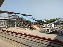
Jangipur is well connected with Kolkata and district headquarter Baharampur via NH 34. A railway station, (In Azimganj - Farakka line) Jangipur Road railway station is situated in Raghunathganj. Many express and passengers trains pass regularly over the city. Raghunathganj is a twin town of Jangipur opposite of the Bhagirathi River.
Education
Jangipur College was established in 1950 at Jangipur. Affiliated to the University of Kalyani it offers honours courses in Bengali, English, Sanskrit, history, geography, philosophy, political science, economics, physics, chemistry, mathematics, botany, zoology and accountancy. From 2016-17, it is offering post-graduate courses in Bengali, English, history and education in distance mode.[7] There is a Management Development Institute of Murshidabad which is optional from 2014.This was inaugurated by then Indian President Shri Pranab Mukherjee.This institute is one of the premier educational institution of India.
References
- "Jangipur City".
-
 One or more of the preceding sentences incorporates text from a publication now in the public domain: Chisholm, Hugh, ed. (1911). "Jangipur". Encyclopædia Britannica. 15 (11th ed.). Cambridge University Press. p. 150.
 - Falling Rain Genomics, Inc - Jangipur
- "Chapter 14: Farakka Barrage Project" (PDF). Ministry of Water Resources, Government of India. Retrieved 3 September 2017.
- "Urban Agglomerations/Cities having population 1 lakh and above" (PDF). Provisional Population Totals, Census of India 2011. Retrieved 21 October 2011.
- "Census of India 2001: Data from the 2001 Census, including cities, villages and towns (Provisional)". Census Commission of India. Archived from the original on 16 June 2004. Retrieved 1 November 2008.
- "Jangipur College". JC. Retrieved 12 September 2017.
Cities, towns and locations in Murshidabad District | |||||||||||
|---|---|---|---|---|---|---|---|---|---|---|---|
| Cities, municipal and census towns |
| ||||||||||
| Locations other than cities and towns |
| ||||||||||
| Neighbourhoods | |||||||||||
| Related topics |
| ||||||||||