Durham Parish, New Brunswick
Durham is a civil parish in Restigouche County, New Brunswick, Canada.[2]
Durham | |
|---|---|
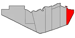 Location within Restigouche County. Heron Island erroneously shown as belonging to this parish. | |
| Coordinates: 47.86°N 66.07°W | |
| Country | |
| Province | |
| County | Restigouche |
| Erected | 1840 |
| Area | |
| • Land | 410.89 km2 (158.65 sq mi) |
| Population (2016)[1] | |
| • Total | 1,076 |
| • Density | 2.6/km2 (7/sq mi) |
| • Pop 2006-2011 | |
| • Dwellings | 592 |
| Time zone | UTC-4 (AST) |
| • Summer (DST) | UTC-3 (ADT) |
For governance purposes it is divided between the village of Belledune and the local service districts of Chaleur and Lorne.[3] The village is a member of the Chaleur Regional Service Commission (CRSC),[4] the LSDs of the Restigouche Regional Service Commission (RRSC).[4]
Origin of name
The parish was named in honour of the Earl of Durham,[5] Governor General of British North America at the time the legislation erecting the parish was passed;[6] he resigned his post before the Act became effective.
History
Durham was erected in 1840 from Beresford Parish.[6] Durham comprised Restigouche County between the eastern county line and a line due south from the mouth of Benjamin River.
In 1881 the county line was altered, removing part of Durham and adding it to Gloucester County.[7]
Delineation
Durham Parish is defined in the Territorial Division Act[2] as being bounded:
- East and south by the County lines; west by Colborne Parish, and north by Chaleur Bay including all the islands in front.[lower-alpha 1]
Communities
Parish population total does not include incorporated municipalities (in bold or italics).
|
|
Demographics
Population
| Canada census – Durham Parish, New Brunswick community profile | |||
|---|---|---|---|
| 2016 | 2011 | 2006 | |
| Population: | 1,076 (-10.9% from 2011) | 1,207 (-7.4% from 2006) | 1,303 (-12.6% from 2001) |
| Land area: | 410.89 km2 (158.65 sq mi) | 411.10 km2 (158.73 sq mi) | 410.28 km2 (158.41 sq mi) |
| Population density: | 2.6/km2 (6.7/sq mi) | 2.9/km2 (7.5/sq mi) | 3.2/km2 (8.3/sq mi) |
| Median age: | 55.6 (M: 55.8, F: 55.5) | 51.3 (M: 51.6, F: 51.0) | 47.1 (M: 47.4, F: 47.0) |
| Total private dwellings: | 592 | 611 | 640 |
| Median household income: | $36,403 | $.N/A | $28,192 |
| References: 2016[8] 2011[9] 2006[10] earlier[11] | |||
|
|
| |||||||||||||||||||||||||||
| [12][1] | |||||||||||||||||||||||||||||
Language
| Canada Census Mother Tongue - Durham Parish, New Brunswick[12] | ||||||||||||||||||
|---|---|---|---|---|---|---|---|---|---|---|---|---|---|---|---|---|---|---|
| Census | Total | English |
French |
English & French |
Other | |||||||||||||
| Year | Responses | Count | Trend | Pop % | Count | Trend | Pop % | Count | Trend | Pop % | Count | Trend | Pop % | |||||
2011 |
1,210 |
905 | 74.79% | 265 | 21.90% | 35 | 2.89% | 5 | 0.41% | |||||||||
2006 |
1,300 |
1,055 | 81.15% | 220 | 16.92% | 15 | 1.15% | 10 | 0.77% | |||||||||
2001 |
1,495 |
1,140 | 76.25% | 330 | 22.07% | 25 | 1.67% | 0 | 0.00% | |||||||||
1996 |
1,605 |
1,145 | n/a | 71.34% | 425 | n/a | 26.48% | 35 | n/a | 2.18% | 0 | n/a | 0.00% | |||||
Access Routes
Highways and numbered routes that run through the parish, including external routes that start or finish at the parish limits:[13]
See also
Notes
- Heron Island is explicitly part of Colborne Parish.
References
- "Census Profile, 2016 Census: Durham, Parish [Census subdivision], New Brunswick". Statistics Canada. Retrieved August 26, 2019.
- "Chapter T-3 Territorial Division Act". Government of New Brunswick. Retrieved 13 November 2020.
- "New Brunswick Regulation 84-168 under the Municipalities Act (O.C. 84-582)". Government of New Brunswick. Retrieved 22 July 2020.
- "Communities in each of the 12 Regional Service Commissions (RSC) / Les communautés dans chacune des 12 Commissions de services régionaux (CSR)" (PDF), Government of New Brunswick, July 2017, retrieved 2 February 2021
- Ganong, William F. (1896). A Monograph of the Place-Nomenclature of the Province of New Brunswick. Royal Society of Canada. p. 231.
- "2 Vic. c. 19 An Act to divide the County of Restigouche into five Towns or Parishes and to define the boundaries thereof.". Acts of the General Assembly of Her Majesty's Province of New Brunswick, Passed in the Year 1839. Fredericton: Government of New Brunswick. 1839. pp. 63–64.
- "44 Vic. c. 24 An Act to amend Chapter 2 of The Consolidated Statutes, of 'The Division of the Province into Counties, Towns, and Parishes,' so far as the same relates to the Boundary between Restigouche and Gloucester.". Acts of the General Assembly of Her Majesty's Province of New Brunswick. Passed in the Month of March 1881. Fredericton: Government of New Brunswick. 1881. p. 57.
- "2016 Community Profiles". 2016 Canadian Census. Statistics Canada. February 21, 2017. Retrieved 2019-08-26.
- "2011 Community Profiles". 2011 Canadian Census. Statistics Canada. July 5, 2013. Retrieved 2014-03-19.
- "2006 Community Profiles". 2006 Canadian Census. Statistics Canada. March 30, 2011. Retrieved 2014-03-19.
- "2001 Community Profiles". 2001 Canadian Census. Statistics Canada. February 17, 2012.
- Statistics Canada: 1996, 2001, 2006, 2011 census
- Atlantic Canada Back Road Atlas ISBN 978-1-55368-618-7 Pages 6-7, 15
Places adjacent to Durham Parish, New Brunswick | |
|---|---|
| Subdivisions | |
|---|---|
| Cities | |
| Counties | |
| |