East Amwell Township, New Jersey
East Amwell Township is a township in Hunterdon County, New Jersey, United States. As of the 2010 United States Census, the township's population was 4,013,[8][9][10] reflecting a decline of 442 (-9.9%) from the 4,455 counted in the 2000 Census, which had in turn increased by 123 (+2.8%) from the 4,332 counted in the 1990 Census.[19]
East Amwell Township, New Jersey | |
|---|---|
| Township of East Amwell | |
 Old Presbyterian church in Reaville Historic District | |
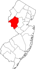
 Map of East Amwell Township in Hunterdon County. Inset: Location of Hunterdon County in the State of New Jersey. | |
 Census Bureau map of East Amwell Township, New Jersey | |
 East Amwell Township Location in Hunterdon County 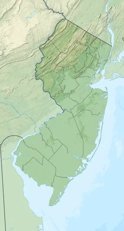 East Amwell Township Location in New Jersey  East Amwell Township Location in the United States | |
| Coordinates: 40.434992°N 74.82303°W[1][2] | |
| Country | |
| State | |
| County | |
| Incorporated | April 6, 1846 |
| Named for | Amwell Township / Amwell, Hertfordshire |
| Government | |
| • Type | Township (New Jersey) |
| • Body | Township Committee |
| • Mayor | Richard "Rick" Wolfe (R, term ends December 31, 2020)[4][5] |
| • Municipal clerk | Krista Parsons (acting)[6] |
| Area | |
| • Total | 28.56 sq mi (73.96 km2) |
| • Land | 28.46 sq mi (73.70 km2) |
| • Water | 0.10 sq mi (0.27 km2) 0.36% |
| Area rank | 94th of 565 in state 8th of 26 in county[1] |
| Elevation | 203 ft (62 m) |
| Population | |
| • Total | 4,013 |
| • Estimate (2019)[11] | 3,858 |
| • Rank | 413th of 566 in state 11th of 26 in county[12] |
| • Density | 141.0/sq mi (54.4/km2) |
| • Density rank | 529th of 566 in state 23rd of 26 in county[12] |
| Time zone | UTC−05:00 (Eastern (EST)) |
| • Summer (DST) | UTC−04:00 (Eastern (EDT)) |
| ZIP Code | |
| Area code(s) | 609 and 908[15] |
| FIPS code | 3401918820[1][16][17] |
| GNIS feature ID | 0882180[1][18] |
| Website | www |
East Amwell Township is located in the southeastern corner of Hunterdon County where it borders both Somerset and Mercer counties. It includes the unincorporated community of Ringoes, the oldest known settlement in Hunterdon County, as well as the communities of Larison's Corner, Weert's Corner and part of Reaville.[20]
History
Amwell Township was established by a royal patent from Queen Anne in 1708. Its territory comprised 200 square miles (520 km2) and included present day Delaware Township, Raritan Township, Readington Township, East Amwell Township and West Amwell Township and portions of Clinton, Lebanon and Tewksbury Townships. Both East Amwell Township and West Amwell Township were formed on April 6, 1846, when Amwell Township was split in two. Territory was gain in 1854 from Delaware Township, Raritan Township and West Amwell Township, and again from those same three townships in 1897.[21] The township was named for Amwell Township, which in turn was named for Amwell, Hertfordshire in England.[22]
During the American Revolutionary War, a small but important skirmish occurred in East Amwell when local militia under Capt. John Schenck ambushed a party of British dragoons near Larison's Corner. The "Ambush of Geary" on December 14, 1776, helped rein in British scouting parties in Hunterdon County in the crucial weeks before George Washington's crossing of the Delaware River and victory at the Battle of Trenton on December 26.[23]
East Amwell was the location of the Lindbergh kidnapping, in which Charles Augustus Lindbergh III, was abducted from the estate owned by Charles Lindbergh and Anne Morrow Lindbergh, and was later found dead nearby.[24]
Geography
According to the United States Census Bureau, the township had a total area of 28.56 square miles (73.96 km2), including 28.46 square miles (73.70 km2) of land and 0.10 square miles (0.27 km2) of water (0.36%).[1][2]
The northern areas of East Amwell are in the Amwell Valley, while the southern sections are in The Sourlands region. The township borders Delaware Township, Raritan Township and West Amwell Township in Hunterdon County; Hopewell Township in Mercer County; and Hillsborough Township and Montgomery Township in Somerset County.[25][26][27]
Unincorporated communities, localities and place names located partially or completely within the township include Amwell, Boss Road, Bowne, Buttonwood Corners, Cloverhill, Furmans Corner, Larisons Corners, Linvale, New Market, Reaville, Rileyville, Ringoes, Rocktown, Snydertown, Union, Unionville, Venliews Corners and Wertsville.[28]
Demographics
| Historical population | |||
|---|---|---|---|
| Census | Pop. | %± | |
| 1850 | 1,330 | — | |
| 1860 | 1,865 | 40.2% | |
| 1870 | 1,802 | −3.4% | |
| 1880 | 1,696 | −5.9% | |
| 1890 | 1,375 | −18.9% | |
| 1900 | 1,327 | −3.5% | |
| 1910 | 1,203 | −9.3% | |
| 1920 | 1,102 | −8.4% | |
| 1930 | 1,210 | 9.8% | |
| 1940 | 1,218 | 0.7% | |
| 1950 | 1,525 | 25.2% | |
| 1960 | 1,981 | 29.9% | |
| 1970 | 2,568 | 29.6% | |
| 1980 | 3,468 | 35.0% | |
| 1990 | 4,332 | 24.9% | |
| 2000 | 4,455 | 2.8% | |
| 2010 | 4,013 | −9.9% | |
| 2019 (est.) | 3,858 | [11][29] | −3.9% |
| Population sources: 1850-1920[30] 1850-1870[31] 1850[32] 1870[33] 1880-1890[34] 1890-1910[35] 1910-1930[36] 1930-1990[37] 2000[38][39] 2010[8][9][10] | |||
Census 2010
The 2010 United States Census counted 4,013 people, 1,518 households, and 1,155 families in the township. The population density was 141.0 per square mile (54.4/km2). There were 1,580 housing units at an average density of 55.5 per square mile (21.4/km2). The racial makeup was 95.81% (3,845) White, 1.25% (50) Black or African American, 0.05% (2) Native American, 1.42% (57) Asian, 0.00% (0) Pacific Islander, 0.67% (27) from other races, and 0.80% (32) from two or more races. Hispanic or Latino of any race were 2.82% (113) of the population.[8]
Of the 1,518 households, 28.7% had children under the age of 18; 67.2% were married couples living together; 6.1% had a female householder with no husband present and 23.9% were non-families. Of all households, 17.9% were made up of individuals and 6.2% had someone living alone who was 65 years of age or older. The average household size was 2.63 and the average family size was 3.01.[8]
22.0% of the population were under the age of 18, 6.5% from 18 to 24, 18.2% from 25 to 44, 39.1% from 45 to 64, and 14.2% who were 65 years of age or older. The median age was 46.8 years. For every 100 females, the population had 106.9 males. For every 100 females ages 18 and older there were 101.0 males.[8]
The Census Bureau's 2006-2010 American Community Survey showed that (in 2010 inflation-adjusted dollars) median household income was $105,846 (with a margin of error of +/- $12,725) and the median family income was $124,659 (+/- $16,916). Males had a median income of $87,727 (+/- $15,438) versus $53,491 (+/- $7,390) for females. The per capita income for the borough was $46,986 (+/- $4,981). About 0.8% of families and 2.1% of the population were below the poverty line, including none of those under age 18 and none of those age 65 or over.[40]
Census 2000
As of the 2000 United States Census[16] there were 4,455 people, 1,581 households, and 1,305 families residing in the township. The population density was 155.3 people per square mile (60.0/km2). There were 1,624 housing units at an average density of 56.6 per square mile (21.9/km2). The racial makeup of the township was 96.97% White, 0.72% African American, 0.13% Native American, 0.92% Asian, 0.02% Pacific Islander, 0.47% from other races, and 0.76% from two or more races. Hispanic or Latino of any race were 1.53% of the population.[38][39]
There were 1,581 households, out of which 36.6% had children under the age of 18 living with them, 73.8% were married couples living together, 5.6% had a female householder with no husband present, and 17.4% were non-families. 13.3% of all households were made up of individuals, and 5.6% had someone living alone who was 65 years of age or older. The average household size was 2.80 and the average family size was 3.07.[38][39]
In the township the population was spread out, with 25.3% under the age of 18, 5.3% from 18 to 24, 27.6% from 25 to 44, 31.5% from 45 to 64, and 10.2% who were 65 years of age or older. The median age was 41 years. For every 100 females, there were 103.4 males. For every 100 females age 18 and over, there were 96.5 males.[38][39]
The median income for a household in the township was $85,664, and the median income for a family was $90,000. Males had a median income of $60,945 versus $39,306 for females. The per capita income for the township was $37,187. About 1.8% of families and 1.7% of the population were below the poverty line, including 2.2% of those under age 18 and none of those age 65 or over.[38][39]
Government
Local government
East Amwell Township Township is governed under the Township form of New Jersey municipal government, one of 141 municipalities (of the 565) statewide that use this form, the second-most commonly used form of government in the state.[41] The Township Committee is comprised of five members, who are elected directly by the voters at-large in partisan elections to serve three-year terms of office on a staggered basis, with either one or two seats coming up for election each year as part of the November general election in a three-year cycle.[3][42] At an annual reorganization meeting, the Township Committee selects one of its members to serve as Mayor and another as Deputy Mayor.[43]
As of 2020, members of the East Amwell Township Committee are Mayor Richard "Rick" Wolfe (R, term on committee ends December 31, 2022; term as mayor ends 2020), Deputy Mayor Chris Sobieski (R, term on committee ends 2021; term as deputy mayor ends 2020), Mark Castellano (R, 2022), Tim Mathews (R, 2020) and Peter J. Miller (R, 2020).[4][44][45][46][47][48][49]
Federal, state and county representation
East Amwell Township is located in the 7th Congressional District[50] and is part of New Jersey's 15th state legislative district.[9][51][52] Prior to the 2011 reapportionment following the 2010 Census, East Amwell Township had been in the 23rd state legislative district.[53] Prior to the 2010 Census, East Amwell Township had been part of the 12th Congressional District, a change made by the New Jersey Redistricting Commission that took effect in January 2013, based on the results of the November 2012 general elections.[53]
For the 116th United States Congress. New Jersey's Seventh Congressional District is represented by Tom Malinowski (D, Ringoes).[54] New Jersey is represented in the United States Senate by Democrats Cory Booker (Newark, term ends 2021)[55] and Bob Menendez (Paramus, term ends 2025).[56][57]
For the 2020–2021 session (Senate, General Assembly), the 15th Legislative District of the New Jersey Legislature is represented in the State Senate by Shirley Turner (D, Lawrence Township, Mercer County) and in the General Assembly by Verlina Reynolds-Jackson (D, Trenton) and Anthony Verrelli (D, Hopewell Township, Mercer County, New Jersey).[58][59]
Hunterdon County is governed by a five-member Board of Chosen Freeholders, who serve three-year terms of office at-large on a staggered basis, with either one or two seats up for election each year on a partisan basis as part of the November general election. At an annual reorganization meeting held each January, the freeholders select one member to serve as the board's Director and another to serve as Deputy Director.[60] As of 2015, Hunterdon County's Freeholders are Freeholder Director John King (R; Raritan Township, 2015),[61] Freeholder Deputy Director Suzanne Lagay (R; Holland Township, 2016),[62] J. Matthew Holt (R; Clinton Town, 2015),[63] John E. Lanza (R; Flemington, 2016)[64] and Robert G. Walton (R; Hampton, 2017).[65][66] Constitutional officers elected on a countywide basis are County Clerk Mary H. Melfi (R; Flemington, 2017),[67] Sheriff Fredrick W. Brown (R; Alexandria Township, 2016)[68] and Surrogate Susan J. Hoffman (R; Kingwood Township, 2018).[69][70][71]
Politics
As of March 23, 2011, there were a total of 3,059 registered voters in East Amwell Township, of which 875 (28.6%) were registered as Democrats, 956 (31.3%) were registered as Republicans and 1,224 (40.0%) were registered as Unaffiliated. There were 4 voters registered to other parties.[72]
In the 2012 presidential election, Republican Mitt Romney received 57.3% of the vote (1,346 cast), ahead of Democrat Barack Obama with 40.9% (961 votes), and other candidates with 1.7% (41 votes), among the 2,364 ballots cast by the township's 3,135 registered voters (16 ballots were spoiled), for a turnout of 75.4%.[73][74] In the 2008 presidential election, Republican John McCain received 54.8% of the vote (1,405 cast), ahead of Democrat Barack Obama with 42.4% (1,088 votes) and other candidates with 1.7% (44 votes), among the 2,564 ballots cast by the township's 3,180 registered voters, for a turnout of 80.6%.[75] In the 2004 presidential election, Republican George W. Bush received 57.3% of the vote (1,452 ballots cast), outpolling Democrat John Kerry with 41.8% (1,059 votes) and other candidates with 1.0% (30 votes), among the 2,534 ballots cast by the township's 3,043 registered voters, for a turnout percentage of 83.3.[76]
In the 2013 gubernatorial election, Republican Chris Christie received 71.6% of the vote (1,223 cast), ahead of Democrat Barbara Buono with 26.2% (448 votes), and other candidates with 2.2% (37 votes), among the 1,770 ballots cast by the township's 3,088 registered voters (62 ballots were spoiled), for a turnout of 57.3%.[77][78] In the 2009 gubernatorial election, Republican Chris Christie received 61.2% of the vote (1,196 ballots cast), ahead of Democrat Jon Corzine with 29.2% (571 votes), Independent Chris Daggett with 7.4% (145 votes) and other candidates with 1.0% (20 votes), among the 1,953 ballots cast by the township's 3,094 registered voters, yielding a 63.1% turnout.[79]
Education
The East Amwell Township School District serves public school students in pre-kindergarten through eighth grade at East Amwell Township School.[80] As of the 2018–19 school year, the district, comprised of one school, had an enrollment of 355 students and 37.8 classroom teachers (on an FTE basis), for a student–teacher ratio of 9.4:1.[81]
Public school students in ninth through twelfth grades attend Hunterdon Central High School, part of the Hunterdon Central Regional High School District in central Hunterdon County, which serves students from Delaware Township, East Amwell Township, Flemington Borough, Raritan Township and Readington Township.[82][83] As of the 2018–19 school year, the high school had an enrollment of 2,844 students and 238.8 classroom teachers (on an FTE basis), for a student–teacher ratio of 11.9:1.[84] Seats on the high school district's nine-member board of education are allocated based in the population of the five constituent municipalities who participate in the school district, with one seat allocated to East Amwell Township.[85]
Eighth grade students from all of Hunterdon County are eligible to apply to attend the high school programs offered by the Hunterdon County Vocational School District, a county-wide vocational school district that offers career and technical education at its campuses in Raritan Township and at programs sited at local high schools, with no tuition charged to students for attendance.[86]
Transportation
_in_East_Amwell_Township%252C_Hunterdon_County%252C_New_Jersey.jpg.webp)
As of May 2010, the township had a total of 68.03 miles (109.48 km) of roadways, of which 42.84 miles (68.94 km) were maintained by the municipality, 17.15 miles (27.60 km) by Hunterdon County and 8.04 miles (12.94 km) by the New Jersey Department of Transportation.[87]
Route 31 passes through mostly along the western border with West Amwell.[88] Route 179[89] and US Route 202[90] pass through near Ringoes, with Route 31 becoming concurrent with US 202 where they intersect.
Major county roads that go through the township are CR 514 (along the border with Raritan)[91] and CR 579.[92] The closest limited access road is Interstate 295 in neighboring Hopewell Township.
The Hopewell Project
East Amwell is home to an experimental renewable energy project called The Hopewell Project, which uses solar power to generate hydrogen that is used to provide 100% of a home's heating, cooling and electrical needs. The Hopewell Solar-Hydrogen Residence was dedicated on October 20, 2006.[93]
Wineries
Notable people
People who were born in, residents of, or otherwise closely associated with East Amwell Township include:
- James Buchanan (1839–1900) represented New Jersey's 2nd congressional district from 1885 to 1893.[94]
- Matt Ioannidis (born 1994), defensive end for the Washington Football Team of the National Football League.[95]
- Charles Lindbergh (1902–1974) and Anne Morrow Lindbergh (1906–2001), aviators. The Lindbergh kidnapping occurred at the family home in East Amwell, though press reports were filed from the nearby town of Hopewell.[24]
- Andrew Maguire (born 1939), represented New Jersey's 7th congressional district from 1975 to 1981.[96]
- David Stout Manners (1808–1884), Mayor of Jersey City, New Jersey from 1852 to 1857.[97]
- Horace Griggs Prall (1881–1951), acting Governor of New Jersey in 1935.[98]
- Jason Read (born 1977), rower who rowed in the bow seat in the 2004 Summer Olympics gold medal-winning U.S. Men's Rowing Team Eight.[99]
References
- 2019 Census Gazetteer Files: New Jersey Places, United States Census Bureau. Accessed July 1, 2020.
- US Gazetteer files: 2010, 2000, and 1990, United States Census Bureau. Accessed September 4, 2014.
- 2012 New Jersey Legislative District Data Book, Rutgers University Edward J. Bloustein School of Planning and Public Policy, March 2013, p. 103.
- Mayor and Township Committees, East Amwell Township. Accessed September 20, 2019.
- 2020 New Jersey Mayors Directory, New Jersey Department of Community Affairs. Accessed February 1, 2020. As of date accessed, Chris Sobieski is listed incorrectly as mayor.
- Township Clerk, Township of East Amwell. Accessed April 30, 2020.
- U.S. Geological Survey Geographic Names Information System: Township of East Amwell, Geographic Names Information System. Accessed March 5, 2013.
- DP-1 - Profile of General Population and Housing Characteristics: 2010 for East Amwell township, Hunterdon County, New Jersey Archived 2020-02-12 at Archive.today, United States Census Bureau. Accessed November 14, 2012.
- Municipalities Sorted by 2011-2020 Legislative District, New Jersey Department of State. Accessed February 1, 2020.
- Profile of General Demographic Characteristics: 2010 for East Amwell township, New Jersey Department of Labor and Workforce Development. Accessed November 14, 2012.
- Annual Estimates of the Resident Population for Minor Civil Divisions in New Jersey: April 1, 2010 to July 1, 2019, United States Census Bureau. Accessed May 21, 2020.
- GCT-PH1 Population, Housing Units, Area, and Density: 2010 - State -- County Subdivision from the 2010 Census Summary File 1 for New Jersey Archived 2020-02-12 at Archive.today, United States Census Bureau. Accessed November 14, 2012.
- Look Up a ZIP Code for Ringoes, NJ, United States Postal Service. Accessed November 14, 2012.
- Look Up a ZIP Code for Stockton, NJ, United States Postal Service. Accessed November 14, 2012.
- Area Code Lookup - NPA NXX for Ringoes, NJ, Area-Codes.com. Accessed September 3, 2013.
- U.S. Census website , United States Census Bureau. Accessed September 4, 2014.
- Geographic codes for New Jersey, Missouri Census Data Center. Accessed September 1, 2019.
- US Board on Geographic Names, United States Geological Survey. Accessed September 4, 2014.
- Table 7. Population for the Counties and Municipalities in New Jersey: 1990, 2000 and 2010, New Jersey Department of Labor and Workforce Development, February 2011. Accessed November 14, 2012.
- Demographics Archived 2012-07-16 at the Wayback Machine, Township of East Amwell. Accessed November 14, 2012. "East Amwell is at the base of the Sourland Mountains. Its 28.68 square miles encompasses the communities of Ringoes, Weert's Corner, Larison's Corner and a portion of Reaville."
- Snyder, John P. The Story of New Jersey's Civil Boundaries: 1606-1968, Bureau of Geology and Topography; Trenton, New Jersey; 1969. p. 154. Accessed October 25, 2012.
- Hutchinson, Viola L. The Origin of New Jersey Place Names, New Jersey Public Library Commission, May 1945. Accessed August 29, 2015.
- "The Amwell Skirmish", Nature's Grapevine of Washington Crossing State Park, Winter 2006. Accessed November 14, 2012. "On December 14th, a patrol of eight dragoons under the command of Cornet Francis Geary was dispatched from the main force at Pennington and proceeded up the road to Flemington. On the return leg of their raid they were attacked from the woods along present day Route 31, just north of Ringoes by Capt. John Schenk and a squad of citizen soldiers from the Amwell Militia."
- Gill, Barbara. "Lindbergh kidnapping rocked the world 50 years ago", The Hunterdon County Democrat, 1981. Accessed May 22, 2015. "So while the world's attention was focused on Hopewell, from which the first press dispatches emanated about the kidnapping, the Democrat made sure its readers knew that the new home of Col. Charles A. Lindbergh and Anne Morrow Lindbergh was in East Amwell Township, Hunterdon County."
- Areas touching East Amwell Township, MapIt. Accessed September 20, 2019.
- Map of County Municipalities, Hunterdon County, New Jersey. Accessed November 15, 2019.
- New Jersey Municipal Boundaries, New Jersey Department of Transportation. Accessed November 15, 2019.
- Locality Search, State of New Jersey. Accessed March 15, 2015.
- Census Estimates for New Jersey April 1, 2010 to July 1, 2019, United States Census Bureau. Accessed May 21, 2020.
- Compendium of censuses 1726-1905: together with the tabulated returns of 1905, New Jersey Department of State, 1906. Accessed September 4, 2013.
- Raum, John O. The History of New Jersey: From Its Earliest Settlement to the Present Time, Volume 1, p. 267, J. E. Potter and company, 1877. Accessed September 4, 2013. "East Amwell was formed from Amwell in 1856; in 1860 it contained a population of 1,865; and in 1870, 1,802. The Sourland Mountains are partly in this township and partly in Hillsborough township, Somerset county." Note that the establishment date is listed as 1856 (not 1846) and that no population is provided for 1850.
- Debow, James Dunwoody Brownson. The Seventh Census of the United States: 1850, p. 139. R. Armstrong, 1853. Accessed September 4, 2013. No population is provided.
- Staff. A compendium of the ninth census, 1870, p. 258. United States Census Bureau, 1872. Accessed September 4, 2013.
- Porter, Robert Percival. Preliminary Results as Contained in the Eleventh Census Bulletins: Volume III - 51 to 75, p. 98. United States Census Bureau, 1890. Accessed November 14, 2012.
- Thirteenth Census of the United States, 1910: Population by Counties and Minor Civil Divisions, 1910, 1900, 1890, United States Census Bureau, p. 337. Accessed November 14, 2012.
- Fifteenth Census of the United States : 1930 - Population Volume I, United States Census Bureau, p. 716. Accessed November 14, 2012.
- New Jersey Resident Population by Municipality: 1930 - 1990, Workforce New Jersey Public Information Network. Accessed June 28, 2015.
- Census 2000 Profiles of Demographic / Social / Economic / Housing Characteristics for East Amwell township, Hunterdon County, New Jersey, United States Census Bureau. Accessed November 14, 2012.
- DP-1: Profile of General Demographic Characteristics: 2000 - Census 2000 Summary File 1 (SF 1) 100-Percent Data for East Amwell township, Hunterdon County, New Jersey Archived 2020-02-12 at Archive.today, United States Census Bureau. Accessed November 14, 2012.
- DP03: Selected Economic Characteristics from the 2006-2010 American Community Survey 5-Year Estimates for East Amwell township, Hunterdon County, New Jersey Archived 2020-02-12 at Archive.today, United States Census Bureau. Accessed November 14, 2012.
- Inventory of Municipal Forms of Government in New Jersey, Rutgers University Center for Government Studies, July 1, 2011. Accessed November 18, 2019.
- "Forms of Municipal Government in New Jersey", p. 7. Rutgers University Center for Government Studies. Accessed June 3, 2015.
- Duties, East Amwell Township. Accessed April 30, 2020. "The Township Committee form of government is formed under the State of New Jersey Statute NJSA:40A:63-1 et. seq. In this form of municipal government voters select five Committee members, elected at-large for staggered, three year terms. Elections are partisan with the governing body holding a reorganization meeting the first week in January. Mayor: Elected by Township Committee for 1 year term."
- 2020 Municipal Data Sheet, East Amwell Township. Accessed April 30, 2020.
- 2020 County and Municipal Directory, Hunterdon County, New Jersey. Accessed April 30, 2020.
- Township of East Amwell, Hunterdon County, New Jersey. Accessed April 30, 2020.
- Hudson County General Election 2018 Statement of Vote November 5, 2019, Hudson County, New Jersey Clerk, updated November 13, 2019. Accessed January 1, 2020.
- Hudson County General Election 2018 Statement of Vote November 6, 2018, Hudson County, New Jersey Clerk, updated November 29, 2018. Accessed January 1, 2019.
- Hudson County General Election 2017 Statement of Vote November 7, 2017, Hudson County, New Jersey Clerk, updated November 17, 2017. Accessed January 1, 2018.
- Plan Components Report, New Jersey Redistricting Commission, December 23, 2011. Accessed February 1, 2020.
- 2019 New Jersey Citizen's Guide to Government, New Jersey League of Women Voters. Accessed October 30, 2019.
- Districts by Number for 2011-2020, New Jersey Legislature. Accessed January 6, 2013.
- 2011 New Jersey Citizen's Guide to Government Archived 2013-06-04 at the Wayback Machine, p. 56, New Jersey League of Women Voters. Accessed May 22, 2015.
- Directory of Representatives: New Jersey, United States House of Representatives. Accessed June 1, 2020.
- About Cory Booker, United States Senate. Accessed January 26, 2015. "He now owns a home and lives in Newark's Central Ward community."
- Biography of Bob Menendez, United States Senate, January 26, 2015. "He currently lives in Paramus and has two children, Alicia and Robert."
- Senators of the 116th Congress from New Jersey. United States Senate. Accessed April 17, 2019. "Booker, Cory A. - (D - NJ) Class II; Menendez, Robert - (D - NJ) Class I"
- Legislative Roster 2020-2021 Session, New Jersey Legislature. Accessed August 27, 2020.
- District 15 Legislators, New Jersey Legislature. Accessed August 27, 2020.
- About the Board, Hunterdon County, New Jersey. Accessed January 8, 2015.
- John King, Hunterdon County, New Jersey. Accessed January 8, 2015.
- Suzanne Lagay, Hunterdon County, New Jersey. Accessed January 8, 2015.
- J. Matthew Holt, Hunterdon County, New Jersey. Accessed January 8, 2015.
- John E. Lanza, Hunterdon County, New Jersey. Accessed January 8, 2015.
- Robert G. Walton, Hunterdon County, New Jersey. Accessed January 8, 2015.
- Hunterdon County Board of Chosen Freeholders, Hunterdon County, New Jersey. Accessed January 8, 2015.
- Hunterdon County Clerk Mary H. Melfi, Hunterdon County, New Jersey. Accessed January 8, 2015.
- Frederick W. Brown; Hunterdon County Sheriff, Hunterdon County, New Jersey. Accessed January 8, 2015.
- Surrogate Susan J. Hoffman, Hunterdon County, New Jersey. Accessed January 8, 2015.
- 2014 Elected Officials, Hunterdon County, New Jersey. Accessed January 8, 2015.
- 2014 County and Municipal Guide ... Hunterdon County Now, Hunterdon County, New Jersey. Accessed January 8, 2015.
- Voter Registration Summary - Hunterdon, New Jersey Department of State Division of Elections, March 23, 2011. Accessed November 14, 2012.
- "Presidential General Election Results - November 6, 2012 - Hunterdon County" (PDF). New Jersey Department of Elections. March 15, 2013. Retrieved December 24, 2014.
- "Number of Registered Voters and Ballots Cast - November 6, 2012 - General Election Results - Hunterdon County" (PDF). New Jersey Department of Elections. March 15, 2013. Retrieved December 24, 2014.
- 2008 Presidential General Election Results: Hunterdon County, New Jersey Department of State Division of Elections, December 23, 2008. Accessed November 14, 2012.
- 2004 Presidential Election: Hunterdon County, New Jersey Department of State Division of Elections, December 13, 2004. Accessed November 14, 2012.
- "Governor - Hunterdon County" (PDF). New Jersey Department of Elections. January 29, 2014. Retrieved December 24, 2014.
- "Number of Registered Voters and Ballots Cast - November 5, 2013 - General Election Results - Hunterdon County" (PDF). New Jersey Department of Elections. January 29, 2014. Retrieved December 24, 2014.
- 2009 Governor: Hunterdon County Archived 2012-10-17 at the Wayback Machine, New Jersey Department of State Division of Elections, December 31, 2009. Accessed November 14, 2012.
- 2019-2020 Public School Directory, Hunterdon County Department of Education. Accessed November 17, 2019.
- District information for East Amwell Township School District, National Center for Education Statistics. Accessed April 1, 2020.
- Hunterdon Central Regional Board of Education District Policy 0110 - Identification, Hunterdon Central Regional High School. Accessed April 17, 2020. "Purpose: The Board of Education exists for the purpose of providing a thorough and efficient system of free public education in grades nine through twelve in the Hunterdon Central Regional High School District. Composition: The Hunterdon Central Regional High School District is comprised of all the area within the municipal boundaries of Delaware Township, East Amwell, Flemington Boro, Raritan Township, and Readington Township."
- Hunterdon Central Regional High School District 2016 Report Card Narrative, New Jersey Department of Education. Accessed April 17, 2020. "Located in beautiful, historic Hunterdon County in central New Jersey, Hunterdon Central Regional High School serves the five municipalities of Delaware Township, East Amwell Township, Flemington Borough, Raritan Township and Readington Township. The District is comprised of 152.5 square miles and has a population of approximately 51,468 residents."
- School data for Hunterdon Central Regional High School District, National Center for Education Statistics. Accessed April 1, 2020.
- Board of Education, Hunterdon Central Regional High School. Accessed April 17, 2020. "The Hunterdon Central Regional Board of Education is comprised of nine members, elected by constituents in the five municipalities whose students attend Hunterdon Central Regional High School: one each from Delaware Township, East Amwell Township and the Borough of Flemington; three each from Raritan Township and Readington Township."
- Heyboer, Kelly. "How to get your kid a seat in one of N.J.'s hardest-to-get-into high schools", NJ Advance Media for NJ.com, May 2017. Accessed November 18, 2019. "Hunterdon County's vo-tech district has three academies for high-achieving students, all operating in partnerships with local high schools.... The academies are open to all students in the county. Students in the 8th grade are required to submit an application, schedule an interview and take a placement exam."
- Hunterdon County Mileage by Municipality and Jurisdiction, New Jersey Department of Transportation, May 2010. Accessed July 18, 2014.
- Route 31 Straight Line Diagram, New Jersey Department of Transportation, updated May 2017. Accessed November 17, 2019.
- Route 179 Straight Line Diagram, New Jersey Department of Transportation, updated April 2016. Accessed November 17, 2019.
- U.S. Route 202 Straight Line Diagram, New Jersey Department of Transportation, updated May 2017. Accessed November 17, 2019.
- County Route 514 Straight Line Diagram, New Jersey Department of Transportation, updated October 2012. Accessed November 17, 2019.
- County Route 579 Straight Line Diagram, New Jersey Department of Transportation, updated October 2012. Accessed November 17, 2019.
- Hurdle, Jon. "Solar power eliminates utility bills in U.S. home", Reuters, January 19, 2007. Accessed September 23, 2012.
- James Buchanan, Biographical Directory of the United States Congress. Accessed August 27, 2007.
- Lovett, Jackie. "Top 10: Local Players at the NFL Combine", New York Jets, February 26, 2016. Accessed May 3, 2016. "Matt Ioannidis, DT; Hometown: Ringoes, NJ; High School: Hunterdon Central Regional"
- Gene Andrew Maguire, Biographical Directory of the United States Congress. Accessed June 10, 2007.
- Brown, William Mawbey; and Lee, Francis Bazley. Biographical, Genealogical and Descriptive History of the State of New Jersey, p. 284. New Jersey Historical Publishing Company, 1900. Accessed November 14, 2012.
- Myers, William S. Prominent Families of New Jersey, p. 1078. Genealogical Publishing Company, 1945. ISBN 0806350369. Accessed November 14, 2012.
- Kiriluk-Hill, Renée. "N.J. Olympic gold medalist Jason Read says Team U.S.A. thrives on community support", NJ.com, February 4, 2014. Accessed November 10, 2016. "'The dreams of representing your country as an athlete' are fully recognized by those who gather behind their countries' flags and join the parade of nations, Olympic gold medalist Jason Read of East Amwell Township said today, leading to emotions that are written all over their faces."
External links
| Wikimedia Commons has media related to East Amwell Township, New Jersey. |
- East Amwell Township website
- Hunterdon County web page for East Amwell Township
- East Amwell Township School
- East Amwell Township School's 2015–16 School Report Card from the New Jersey Department of Education
- School Data for the East Amwell Township School, National Center for Education Statistics
- Hunterdon Central Regional High School District
- Hunterdon Land Trust Alliance
Places adjacent to East Amwell Township, New Jersey | |
|---|---|