Ekalaka Hills
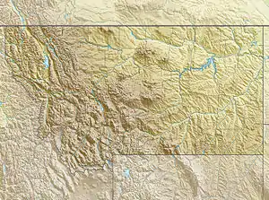
The Ekalaka Hills, elevation 3,720 feet (1,130 m),[1] form a small mountain range that lies east and south of Ekalaka, Montana, in Carter County.
| Ekalaka Hills | |
|---|---|
 Ekalaka Hills | |
| Highest point | |
| Elevation | 3,720 ft (1,130 m) |
| Coordinates | 45°49′30″N 104°27′35″W |
| Geography | |
| Country | United States |
| State | Montana |
This range is closely affiliated with three other small ranges in the area: the Long Pines,[2] which are located southeast of Ekalaka, the East Short Pine Hills,[3] which are located southwest of Buffalo, South Dakota, and the West Short Pine Hills,[4] which are located south of Camp Crook, South Dakota.
Ekalaka Hills is the current designation of the former Ekalaka National Forest, which was eventually consolidated into the Custer Gallatin National Forest. The Ekalaka Hills land unit is part of Custer Gallatin’s Sioux Ranger District,[5] as are the aforementioned Long Pines, East Short Pine Hills, and West Short Pine Hills land units.[6]
See also
References
- "Ekalaka Hills". Geographic Names Information System. United States Geological Survey.
- "Long Pines". Geographic Names Information System. United States Geological Survey.
- "East Short Pine Hills". Geographic Names Information System. United States Geological Survey.
- "West Short Pine Hills". Geographic Names Information System. United States Geological Survey.
- "Sioux Ranger District". Custer Gallatin National Forest. Retrieved 16 December 2020.
- "Forest Visitor Maps". Custer Gallatin National Forest. Retrieved 16 December 2020.