Custer County, Montana
Custer County is a county located in the U.S. state of Montana. As of the 2010 United States Census, the population was 11,699.[1] Its county seat is Miles City.[2] The county was established on June 2, 1865 as one of the nine original counties of the Territory of Montana named Big Horn County,[3] and was renamed on February 16, 1877 in honor of Lieutenant Colonel George Armstrong Custer.[4]
Custer County | |
|---|---|
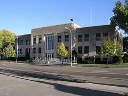
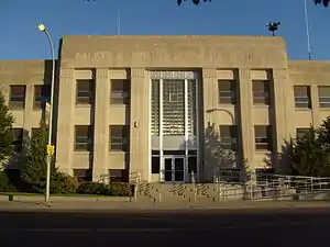 Custer County Courthouse in Miles City | |
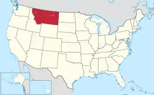
 Location within the U.S. state of Montana | |
 Montana's location within the U.S. | |
| Coordinates: 46°16′N 105°35′W | |
| Country | |
| State | |
| Founded | June 2, 1865 |
| Named for | George Armstrong Custer |
| Seat | Miles City |
| Largest city | Miles City |
| Area | |
| • Total | 3,793 sq mi (9,820 km2) |
| • Land | 3,783 sq mi (9,800 km2) |
| • Water | 9.9 sq mi (26 km2) 0.3% |
| Population (2010) | |
| • Total | 11,699 |
| • Estimate (2019) | 11,402 |
| • Density | 3.1/sq mi (1.2/km2) |
| Time zone | UTC−7 (Mountain) |
| • Summer (DST) | UTC−6 (MDT) |
| Congressional district | At-large |
| Website | http://ccsomt.com/ |
| |
Geography
According to the U.S. Census Bureau, the county has a total area of 3,793 square miles (9,820 km2), of which 3,783 square miles (9,800 km2) is land and 9.9 square miles (26 km2) (0.3%) is water.[5]
Major highways
Adjacent counties
- Prairie County - north
- Fallon County - east
- Carter County - southeast
- Powder River County - south
- Rosebud County - west
- Garfield County - northwest
Politics
| Year | Republican | Democratic | Third parties |
|---|---|---|---|
| 2020 | 71.8% 4,205 | 25.8% 1,514 | 2.4% 141 |
| 2016 | 70.5% 3,657 | 22.7% 1,176 | 6.8% 352 |
| 2012 | 62.9% 3,373 | 34.2% 1,833 | 3.0% 159 |
| 2008 | 55.9% 3,047 | 41.6% 2,267 | 2.5% 138 |
| 2004 | 65.3% 3,297 | 32.3% 1,630 | 2.4% 121 |
| 2000 | 64.3% 3,156 | 30.6% 1,501 | 5.1% 248 |
| 1996 | 46.3% 2,467 | 39.7% 2,115 | 14.0% 747 |
| 1992 | 37.5% 2,105 | 35.1% 1,968 | 27.4% 1,538 |
| 1988 | 55.1% 3,007 | 42.9% 2,343 | 2.1% 112 |
| 1984 | 65.5% 3,879 | 33.5% 1,982 | 1.0% 58 |
| 1980 | 60.8% 3,533 | 31.3% 1,822 | 7.9% 461 |
| 1976 | 55.3% 3,120 | 42.9% 2,425 | 1.8% 102 |
| 1972 | 63.3% 3,486 | 34.1% 1,875 | 2.6% 145 |
| 1968 | 58.1% 2,831 | 36.1% 1,760 | 5.9% 285 |
| 1964 | 45.1% 2,302 | 54.7% 2,790 | 0.2% 9 |
| 1960 | 55.0% 2,943 | 44.7% 2,393 | 0.3% 15 |
| 1956 | 58.3% 3,240 | 41.7% 2,317 | 0.0% 0 |
| 1952 | 62.5% 3,461 | 37.0% 2,050 | 0.4% 24 |
| 1948 | 43.3% 1,845 | 55.3% 2,359 | 1.4% 59 |
| 1944 | 47.0% 1,830 | 52.3% 2,038 | 0.7% 29 |
| 1940 | 41.7% 2,017 | 57.6% 2,782 | 0.7% 35 |
| 1936 | 29.3% 1,381 | 67.8% 3,196 | 2.9% 136 |
| 1932 | 37.0% 1,675 | 60.3% 2,729 | 2.7% 124 |
| 1928 | 64.1% 2,503 | 35.5% 1,386 | 0.4% 17 |
| 1924 | 43.8% 1,654 | 10.9% 412 | 45.3% 1,712 |
| 1920 | 64.5% 2,347 | 31.0% 1,127 | 4.5% 163 |
| 1916 | 37.1% 1,615 | 59.7% 2,602 | 3.3% 142 |
| 1912 | 21.7% 695 | 33.3% 1,068 | 45.0% 1,440 |
| 1908 | 60.7% 967 | 33.3% 531 | 6.0% 96 |
| 1904 | 72.2% 824 | 25.0% 285 | 2.8% 32 |
Demographics
| Historical population | |||
|---|---|---|---|
| Census | Pop. | %± | |
| 1870 | 38 | — | |
| 1880 | 2,510 | 6,505.3% | |
| 1890 | 5,308 | 111.5% | |
| 1900 | 7,891 | 48.7% | |
| 1910 | 14,123 | 79.0% | |
| 1920 | 12,194 | −13.7% | |
| 1930 | 11,242 | −7.8% | |
| 1940 | 10,422 | −7.3% | |
| 1950 | 12,661 | 21.5% | |
| 1960 | 13,227 | 4.5% | |
| 1970 | 12,174 | −8.0% | |
| 1980 | 13,109 | 7.7% | |
| 1990 | 11,697 | −10.8% | |
| 2000 | 11,696 | 0.0% | |
| 2010 | 11,699 | 0.0% | |
| 2019 (est.) | 11,402 | [7] | −2.5% |
| US Decennial Census[8] 1790-1960[9] 1900-1990[10] 1990-2000[11] 2010-2019[1] | |||
2000 census
At the 2000 United States Census, there were 11,696 people, 4,768 households and 3,089 families living in the county. The population density was 3 per square mile (1/km2). There were 5,360 housing units at an average density of 1 per square mile (1/km2). The racial makeup of the county was 97.02% White, 0.09% Black or African American, 1.27% Native American, 0.26% Asian, 0.05% Pacific Islander, 0.34% from other races, and 0.97% from two or more races. 1.51% of the population were Hispanic or Latino of any race. 34.3% were of German, 12.0% Norwegian, 8.4% English, 8.3% Irish and 5.4% American ancestry. 96.8% spoke English, 1.5% Spanish and 1.2% German as their first language.
There were 4,768 households, of which 30.40% had children under the age of 18 living with them, 51.10% were married couples living together, 10.00% had a female householder with no husband present, and 35.20% were non-families. 29.90% of all households were made up of individuals, and 12.30% had someone living alone who was 65 years of age or older. The average household size was 2.36 and the average family size was 2.94.
25.10% of the population were under the age of 18, 8.40% from 18 to 24, 25.60% from 25 to 44, 23.80% from 45 to 64, and 17.10% who were 65 years of age or older. The median age was 39 years. For every 100 females there were 95.80 males. For every 100 females age 18 and over, there were 91.20 males.
The median household income was $30,000 and the median family income was $38,779. Males had a median income of $27,857 compared with $18,343 for females. The per capita income for the county was $15,876. About 10.10% of families and 15.10% of the population were below the poverty line, including 18.10% of those under age 18 and 9.10% of those age 65 or over.
2010 census
As of the 2010 United States Census, there were 11,699 people, 5,031 households, and 3,014 families living in the county.[12] The population density was 3.1 inhabitants per square mile (1.2/km2). There were 5,560 housing units at an average density of 1.5 per square mile (0.58/km2).[13] The racial makeup of the county was 95.5% white, 1.7% American Indian, 0.3% black or African American, 0.3% Asian, 0.1% Pacific islander, 0.5% from other races, and 1.6% from two or more races. Those of Hispanic or Latino origin made up 2.2% of the population.[12] In terms of ancestry, 33.6% were German, 18.3% were Irish, 14.3% were American, 14.1% were Norwegian, and 10.6% were English.[14]
Of the 5,031 households, 27.3% had children under the age of 18 living with them, 46.6% were married couples living together, 9.0% had a female householder with no husband present, 40.1% were non-families, and 34.3% of all households were made up of individuals. The average household size was 2.24 and the average family size was 2.88. The median age was 42.1 years.<refdp1/>
The median income for a household in the county was $38,913 and the median income for a family was $49,011. Males had a median income of $37,535 versus $26,576 for females. The per capita income for the county was $21,676. About 12.4% of families and 15.7% of the population were below the poverty line, including 19.8% of those under age 18 and 14.6% of those age 65 or over.[15]
Economy
Agriculture (dryland farming) and cattle raising provide the bulk of Custer County economy.[16] Miles City serves as the center of commerce in an area extending for 100 miles in every direction.[17] As of 2009 the county's largest employers were Holy Rosary Healthcare, Sanjel USA, Stockman Bank, and Walmart.[17]
See also
- List of lakes in Custer County, Montana
- List of mountains in Custer County, Montana
- National Register of Historic Places listings in Custer County, Montana
References
- "State & County QuickFacts". US Census Bureau. Archived from the original on July 9, 2011. Retrieved September 14, 2013.
- "Find a County". National Association of Counties. Archived from the original on May 31, 2011. Retrieved June 7, 2011.
- Big Horn County, Montana Territory was not the same county as present day Big Horn County, Montana.
- "A Brief Custer County History". Custer County Montana. Archived from the original on October 28, 2014. Retrieved December 1, 2014.
- "2010 Census Gazetteer Files". US Census Bureau. August 22, 2012. Archived from the original on December 5, 2014. Retrieved November 27, 2014.
- Leip, David. "Atlas of US Presidential Elections". uselectionatlas.org. Retrieved April 2, 2018.
- "Population and Housing Unit Estimates". Retrieved October 23, 2020.
- "U.S. Decennial Census". US Census Bureau. Retrieved November 27, 2014.
- "Historical Census Browser". University of Virginia Library. Retrieved November 27, 2014.
- "Population of Counties by Decennial Census: 1900 to 1990". US Census Bureau. Retrieved November 27, 2014.
- "Census 2000 PHC-T-4. Ranking Tables for Counties: 1990 and 2000" (PDF). US Census Bureau. Retrieved November 27, 2014.
- "Profile of General Population and Housing Characteristics: 2010 Demographic Profile Data". US Census Bureau]]. Archived from the original on February 13, 2020. Retrieved January 9, 2016.
- "Population, Housing Units, Area, and Density: 2010 - County". US Census Bureau. Archived from the original on February 13, 2020. Retrieved January 9, 2016.
- "Selected Social Characteristics in the US – 2006-2010 American Community Survey 5-Year Estimates". US Census Bureau]]. Archived from the original on February 13, 2020. Retrieved January 9, 2016.
- "Selected Economic Characteristics – 2006-2010 American Community Survey 5-Year Estimates". US Census Bureau. Archived from the original on February 13, 2020. Retrieved January 9, 2016.
- Merrill, Andrea; Judy Jacobson (1997). Montana almanac. Helena MT: Falcon Publishing. ISBN 1-56044-493-2.
- Montana Dept. of Labor and Industry (September 2010). "Demographic & Economic Information for Custer County" (PDF). Archived from the original (PDF) on September 6, 2011. Retrieved July 23, 2011.
- Bonfield, Custer County MT Google Maps (accessed January 1, 2019)
- Garland, Custer County MT Google Maps (accessed January 1, 2019)
- Knowlton, Custer County MT Google Maps (accessed January 1, 2019)
- Mizpah, Custer County MT Google Maps (accessed January 1, 2019)
- Tusler, Custer County MT Google Maps (accessed January 1, 2019)
Places adjacent to Custer County, Montana | ||||||||||
|---|---|---|---|---|---|---|---|---|---|---|
| ||||||||||
Municipalities and communities of Custer County, Montana, United States | ||
|---|---|---|
| City | Custer County map | |
| Town | ||
| Unincorporated communities | ||
| ||
| Authority control |
|---|