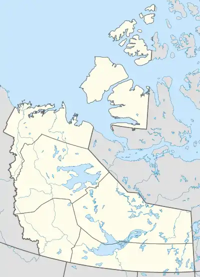
Hay River, Northwest Territories
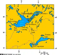
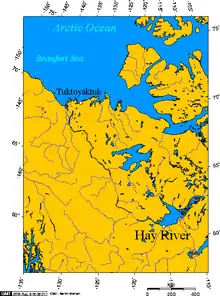
Hay River (South Slavey: Xátł’odehchee [xátɬ’odɛhtʃʰe]),[5] known as "the Hub of the North,"[8] is a town in the Northwest Territories, Canada, located on the south shore of Great Slave Lake, at the mouth of the Hay River. The town is separated into two sections, a new town and an old town with the Hay River/Merlyn Carter Airport between them. The town is in the South Slave Region, and along with Fort Smith is one of the two regional centres.[9]
Hay River
Xátł'odehchee | |
|---|---|
Town | |
 The High Rise dominates the skyline | |
| Motto(s): Hub of the North | |
 Hay River  Hay River | |
| Coordinates: 60°49′59″N 115°46′40″W | |
| Country | Canada |
| Territory | Northwest Territories |
| Region | South Slave Region |
| Constituency | Hay River North Hay River South |
| Census division | Region 5 |
| Incorporated (town) | 27 June 1963 |
| Government | |
| • Mayor | Kandis Jameson[1] |
| • Senior Administrative Officer | Judy Goucher |
| • MLA | Wally Schumann (South) |
| • MLA | R. J. Simpson (North) |
| Area | |
| • Land | 133.15 km2 (51.41 sq mi) |
| • Population centre[3] | 3.59 km2 (1.39 sq mi) |
| Elevation | 165 m (541 ft) |
| Population (2017)[2] | |
| • Total | 3,528 |
| • Density | 26.5/km2 (69/sq mi) |
| • Population centre | 2,806 |
| • Population centre density | 781.4/km2 (2,024/sq mi) |
| Time zone | UTC−07:00 (MST) |
| • Summer (DST) | UTC−06:00 (MDT) |
| Canadian Postal code | X0E 0R0 - 0R9/1G1 - 1G5 |
| Area code(s) | 867 |
| Telephone exchange | 874/5 |
| - Living cost | 132.5A |
| - Food price index | 121.3B |
| Climate | Dfc |
| Website | www.hayriver.com |
| Sources: Department of Municipal and Community Affairs,[4] Prince of Wales Northern Heritage Centre,[5] Canada Flight Supplement[6] ^A 2013 figure based on Edmonton = 100[7] ^B 2015 figure based on Yellowknife = 100[7] | |
History
The area has been in use by First Nations, known as the Long Spear people, as far back as 7000 BC.[10]
According to the Legislative Assembly of the Northwest Territories the first buildings were those of the Hudson's Bay Company in 1868 followed by a Roman Catholic Mission in 1869 and an Anglican Mission in 1894.[10]
However, according to the history of the area provided by the town, the first permanent settlement in the area of Hay River was established in what is now the Katl'odeeche First Nation or Hay River Reserve. This was sometime between 1892-93. This first settlement was established by Chief Chiatlo and a group of people by the building of log cabins and bringing dairy cows. This was followed in 1893 by the Anglican Mission, at the request of Chief Chiatlo in 1893 with the Roman Catholic Mission and the Hudson's Bay Company arriving later.[8]
A school, health centre and the Royal Canadian Mounted Police followed, and as part of the Canol Road project the United States Army Corps of Engineers built a runway on Vale Island in the Hay River delta. In 1948 the Government of Canada built a gravel road, now the Mackenzie Highway, from Grimshaw, Alberta to Hay River, making it the first community in the NWT to be linked with southern Canada.[8] The settlement's role as terminus of all-season trucking, and the establishment of a commercial fishing industry, started an economic boom. In 1949, the community organized its first community government, forming an Administrative District under the direction of the Government of Canada, run by a trustee board with two elected members, two appointed members, and a chairman.[11]
In 1959, the Northern Transportation Company Limited located their main base in Hay River and over the years developed the facilities. Today the base is the major staging point for the annual sealift along the Mackenzie River, via Inuvik and Tuktoyaktuk and the communities of the Arctic Ocean, as far east as Taloyoak, Nunavut and west to Utqiagvik, Alaska.[8][12]
In 1964, Vale Island, the historical location of the town, was severely flooded. As a response, the town was moved to the new location upstream.[13]
By 1964, as part of the Pine Point Mine development, the Mackenzie Northern Railway was constructed.[14] The railway, through Canadian National Railway in Edmonton, makes Hay River the northernmost point in Canada, and all of North America, which is connected to the continental railway system.[8][12] The Alaska Railroad is located farther north but is orphaned from the network.
In 1978, Hay River, along with the now-abandoned Pine Point, hosted the fifth Arctic Winter Games.
Services
The community has a full hospital, the H.H. Williams Memorial Hospital, a woman's shelter/transition house, a dental clinic and an ambulance service.[15][16] The RCMP detachment has eight members and the South Mackenzie Correctional Centre is located here.[15][17] There are two grocery stores in Hay River, including the Northern Store, branches of both the Canadian Imperial Bank of Commerce and the Royal Bank of Canada and a Home Hardware.[15][16] There is also a museum detailing the history of Hay River and the Hudson's Bay Company in Old Town.
Airlines servicing Hay River include the locally based Buffalo Airways, who provide scheduled flights to Yellowknife as well as charter services and a courier service throughout the north.[18][19] First Air provides scheduled services to Yellowknife with connections elsewhere.[20] Northwestern Air also offers scheduled service to Edmonton and Fort Smith. Other companies offering charter services in Hay River include Landa Air, Carter Air Services (fixed-wing aircraft), Denendeh Helicopters and Remote Helicopters.[21]
Religious services include a Catholic church, an Anglican/Grace United church, a Baptist church, a Pentecostal church, and a Community Fellowship within New Town. There is also a Jehovah's Witness Kingdom Hall along the highway coming into town. On the Katl'odeeche First Nations Reserve there are a small Catholic church, and a larger Pentecostal church. There is also an Anglican church that was destroyed in the 2008 Hay River ice breakup. The religious diversity in Hay River exceeds the outward appearance given by these services.
Education

The town hosts four schools, three of which are administered by South Slave Divisional Education Council (SSDEC). The SSDEC is responsible for Harry Camsell K-3 School, Princess Alexandra Middle School, and Diamond Jenness Secondary School, while École Boréale Francophone school is administered separately by the Commission scolaire francophone des Territoires du Nord-Ouest.[22] Harry Camsell is a primary school and serves students from kindergarten to Grade 3.[23] Princess Alexandra, named for and opened by Princess Alexandra in 1967,[24] is a middle school and serves the Grade 4 to the Grade 7.[25] École Boréale is a francophone school that was opened in 2005 and works with students from PK4 to grade 12. Diamond Jenness, named for scientist and anthropologist Diamond Jenness and opened in 1973,[26] is the high school and serves Grade 8 to Grade 12.[27] The town also supports a Community Learning Centre and a Career Centre.[15]
Media

Radio
| Frequency | Call sign | Branding | Format | Owner | Notes |
|---|---|---|---|---|---|
| FM 93.7 | CBDJ-FM | CBC Radio One | Talk radio, public radio | Canadian Broadcasting Corporation | Rebroadcaster of CFYK-FM (Yellowknife) |
| FM 100.1 | CJCD-FM-1 | 100.1 The Moose | Adult contemporary | Vista Broadcast Group | Rebroadcaster of CJCD-FM (Yellowknife) |
| FM 101.9 | CHRR-FM | CKLB Radio: The Voice of Denendeh | Community radio | Native Communications Society of the Northwest Territories | First Nations community radio; rebroadcaster of CKLB-FM (Yellowknife) |
| FM 107.3 | CKHR-FM | Hay River Community Radio | Community radio | Hay River Community Service Society |
CKHR-FM 107.3 is a community radio station in Hay River, and the only station in Hay River to maintain local studios; it is owned and operated by the Hay River Community Service Society. Other radio stations in Hay River are repeaters of stations based in Yellowknife.[21]
Television
The Hay River Community Service Society also controls television broadcasting and it is paid for through property taxes, at a rate of $36 per household per year.[28] Channels 2-5, 7, and 8-13 rebroadcast Canadian and US channels in analog format from towers atop the Mackenzie Place highrise. Transmitter powers range from 9W to 2.545 kW. Channels include CIHC-TV channel 5, a community channel; CH4435 channel 8, rebroadcasting Radio-Canada through CBFT Montreal; and CH4160 channel 12, repeating the Aboriginal Peoples Television Network; among other channels. The local CBC-owned CBC North television repeater, CBEBT-1 channel 7, closed on 31 July 2012;[29] however, the Hay River Community Service Society announced that it acquired the transmitter, which they intended to use for CBC Television service.[28]
Print
The Hub is a weekly newspaper published by Northern News Services. The editor is Sarah Ladik.[30] Besides Hay River, the paper is available in Yellowknife, Enterprise, Fort Smith, Inuvik, Fort Providence, Fort Resolution and Grande Prairie.[31]
Communications
Internet services are provided by SSI Micro and NorthwesTel,[32] land based telephone by Northwestel and cell phones by NMI Mobility.[16][21]
Climate
Hay River has a subarctic climate (Köppen Dfc) with summer lasting for about three months. Although winter temperatures are usually below freezing, every month of the year has seen temperatures above 10 °C (50 °F). Rainfall, which can occur throughout the year, averages 217.4 mm (8.56 in) and snowfall 138.9 cm (54.69 in). From December to January on average there are 71.8 days when the wind chill is below −30, which indicates that frostbite may occur within 10 – 30 minutes.[33][34]
The highest temperature ever recorded in Hay River was 36.7 °C (98 °F) on 9 August 1981.[34] The coldest temperature ever recorded was −52.2 °C (−62 °F) on 23 January 1906.[35]
| Climate data for Hay River Airport, 1981–2010 normals, extremes 1893–present[lower-alpha 1] | |||||||||||||
|---|---|---|---|---|---|---|---|---|---|---|---|---|---|
| Month | Jan | Feb | Mar | Apr | May | Jun | Jul | Aug | Sep | Oct | Nov | Dec | Year |
| Record high °C (°F) | 10.7 (51.3) |
13.9 (57.0) |
15.6 (60.1) |
26.0 (78.8) |
33.3 (91.9) |
34.0 (93.2) |
35.6 (96.1) |
36.7 (98.1) |
31.7 (89.1) |
25.6 (78.1) |
15.0 (59.0) |
14.4 (57.9) |
36.7 (98.1) |
| Average high °C (°F) | −17.3 (0.9) |
−14.2 (6.4) |
−7.8 (18.0) |
2.9 (37.2) |
10.7 (51.3) |
18.0 (64.4) |
21.2 (70.2) |
19.6 (67.3) |
13.2 (55.8) |
4.1 (39.4) |
−7.7 (18.1) |
−14.4 (6.1) |
2.4 (36.3) |
| Daily mean °C (°F) | −21.8 (−7.2) |
−19.6 (−3.3) |
−13.8 (7.2) |
−2.7 (27.1) |
5.4 (41.7) |
12.5 (54.5) |
16.1 (61.0) |
14.6 (58.3) |
8.7 (47.7) |
0.5 (32.9) |
−11.6 (11.1) |
−18.8 (−1.8) |
−2.5 (27.5) |
| Average low °C (°F) | −26.2 (−15.2) |
−24.9 (−12.8) |
−19.8 (−3.6) |
−8.1 (17.4) |
0.0 (32.0) |
7.0 (44.6) |
10.9 (51.6) |
9.5 (49.1) |
4.1 (39.4) |
−3.2 (26.2) |
−15.4 (4.3) |
−23.1 (−9.6) |
−7.4 (18.7) |
| Record low °C (°F) | −52.2 (−62.0) |
−50.6 (−59.1) |
−47.2 (−53.0) |
−40.0 (−40.0) |
−24.4 (−11.9) |
−6.1 (21.0) |
−1.7 (28.9) |
−6.7 (19.9) |
−15.6 (3.9) |
−26.1 (−15.0) |
−40.8 (−41.4) |
−51.1 (−60.0) |
−52.2 (−62.0) |
| Average precipitation mm (inches) | 16.4 (0.65) |
14.3 (0.56) |
14.4 (0.57) |
12.6 (0.50) |
23.3 (0.92) |
31.9 (1.26) |
43.0 (1.69) |
58.7 (2.31) |
44.6 (1.76) |
35.7 (1.41) |
24.8 (0.98) |
16.8 (0.66) |
336.4 (13.24) |
| Average rainfall mm (inches) | 0.1 (0.00) |
0.2 (0.01) |
0.2 (0.01) |
4.3 (0.17) |
18.0 (0.71) |
31.9 (1.26) |
43.0 (1.69) |
58.7 (2.31) |
43.0 (1.69) |
16.8 (0.66) |
0.9 (0.04) |
0.3 (0.01) |
217.4 (8.56) |
| Average snowfall cm (inches) | 19.2 (7.6) |
16.9 (6.7) |
16.4 (6.5) |
8.7 (3.4) |
5.2 (2.0) |
0.1 (0.0) |
0.0 (0.0) |
0.0 (0.0) |
1.5 (0.6) |
19.9 (7.8) |
30.4 (12.0) |
20.7 (8.1) |
138.9 (54.7) |
| Average precipitation days (≥ 0.2 mm) | 11.3 | 9.7 | 8.5 | 5.0 | 8.0 | 8.8 | 9.9 | 11.3 | 12.2 | 12.6 | 14.2 | 11.4 | 122.8 |
| Average rainy days (≥ 0.2 mm) | 0.1 | 0.2 | 0.2 | 2.0 | 6.7 | 8.8 | 9.9 | 11.3 | 11.9 | 6.2 | 1.0 | 0.6 | 58.9 |
| Average snowy days (≥ 0.2 cm) | 12.0 | 10.1 | 8.7 | 3.7 | 1.8 | 0.1 | 0.0 | 0.0 | 0.8 | 8.1 | 14.5 | 12.4 | 72.2 |
| Average relative humidity (%) | 69.2 | 66.3 | 61.3 | 60.2 | 55.0 | 54.4 | 57.6 | 59.9 | 62.5 | 70.6 | 78.0 | 73.7 | 64.0 |
| Source: Environment Canada[34][36][37][38][35][39][40][41][42][43][44][45][46][47][48][49] | |||||||||||||
Demographics
| Year | Pop. | ±% |
|---|---|---|
| 1951 | 792 | — |
| 1956 | 942 | +18.9% |
| 1961 | — | |
| 1966 | 2,002 | — |
| 1971 | 2,406 | +20.2% |
| 1976 | 3,268 | +35.8% |
| 1981 | 2,863 | −12.4% |
| 1986 | 2,964 | +3.5% |
| 1991 | 3,206 | +8.2% |
| 1996 | 3,611 | +12.6% |
| 2001 | 3,510 | −2.8% |
| 2006 | 3,648 | +3.9% |
| 2011 | 3,606 | −1.2% |
| 2016 | 3,528 | −2.2% |
| Source: Statistics Canada [50][51][52][53][54][55][56] | ||
In the 2016 Census Hay River had a population of 3,528, a decrease of 2.2% from the 2011 Census. The Indigenous population in Hay River is 1,630, up from 1,600 at the 2006 Census, and is made up of First Nations, Métis people and Inuit.[2] The main languages in the town are South Slavey, Chipewyan, Michif and English.[10] In 2017 the Government of the Northwest Territories reported that the population was 3,734 with an average yearly growth rate of -0.2% from 2006.[7]

|
| ||||||||||||||||||||||||||||||||||||||||||||||||||||||||||||||||||||||||
| Sources: NWT Bureau of Statistics (2001 - 2017)[57] | |||||||||||||||||||||||||||||||||||||||||||||||||||||||||||||||||||||||||
Notable people
- Paul Delorey, professional curler and former MLA and speaker in the Northwest Territories Legislature.
- Brendan Green, Canadian team biathlete, participated in the 2010 Winter Olympics in the Men's 4x7.5 km Relay.
- Jane Groenewegen, former member of the Legislative Assembly of the Northwest Territories from Hay River South
- Joe McBryan (Buffalo Joe), president and owner of Buffalo Airways featured on Ice Pilots NWT
- Mikey McBryan, Buffalo Airways General Manager and featured on Ice Pilots NWT
- Rob McVicar, professional ice hockey goaltender
- John Pollard, member of the Legislative Assembly of the Northwest Territories from 1987 until 1995
- Geoff Sanderson, former National Hockey League player
- Donald Morton Stewart, former mayor and speaker of the Northwest Territories Legislature
- Jelena Mrdjenovich, WBA and WBC World female featherweight boxing champion
See also
References
- Mayors Welcome
- Hay River, T Northwest Territories (Census subdivision)
- Hay River Northwest Territories (Population centre)
- "NWT Communities - Hay River". Government of the Northwest Territories: Department of Municipal and Community Affairs. Retrieved 14 January 2014.
- "Northwest Territories Official Community Names and Pronunciation Guide". Prince of Wales Northern Heritage Centre. Yellowknife: Education, Culture and Employment, Government of the Northwest Territories. Archived from the original on 13 January 2016. Retrieved 13 January 2016.
- Canada Flight Supplement. Effective 0901Z 16 July 2020 to 0901Z 10 September 2020.
- Hay River - Statistical Profile
- Hay River history Archived 13 May 2008 at the Wayback Machine
- MACA Regions Archived 24 August 2012 at the Wayback Machine
- "Hay River profile". Legislative Assembly of the Northwest Territories. Archived from the original on 7 February 2012.
- "Hay River Still Growing Town" The News of the North, May 27, 1949
- NTCL services Archived 11 March 2008 at the Wayback Machine
- "Hay River". The Canadian Encyclopedia.
- "Says Hay River's population will treble in two years". Edmonton Journal. 21 February 1962. Retrieved 26 December 2020.
- Infrastructure profile
- Northwestel
- Department of Justice
- Buffalo Airways passenger services
- Buffalo Airways courier service
- First Air
- Hay River profile
- South Slave Divisional Education Council Archived 6 December 2006 at the Wayback Machine
- "Harry Camsell School". Archived from the original on 9 March 2012. Retrieved 1 October 2012.
- Princess Alexandra School - About our school Archived 3 February 2008 at the Wayback Machine
- "Princess Alexandra School". Archived from the original on 1 May 2012. Retrieved 1 October 2012.
- Diamond Jenness School - About our school
- "Diamond Jenness School". Archived from the original on 3 February 2008. Retrieved 13 March 2008.
- CACTUS press release: "Oct. 9th Deadline for Communities to Salvage CBC TV Equipment", 1 October 2012.
- Broadcasting Decision CRTC 2012-384, 17 July 2012.
- The Hub Newspaper
- The Hub Archived 29 March 2008 at the Wayback Machine
- https://nwtel.ca/shop/internet/plans-rates/hay-river
- Wind Chill Hazards and Risk of Frostbite Archived 17 December 2005 at the Wayback Machine
- "Hay River A". Canadian Climate Normals 1981–2010. Environment Canada. Climate ID: 2202400. Retrieved 30 June 2016.
- "Daily Data Report for January 1906". Canadian Climate Data. Environment Canada. Climate ID: 2202398. Retrieved 30 June 2016.
- "Daily Data Report for December 1896". Canadian Climate Data. Environment Canada. Climate ID: 2202398. Retrieved 30 June 2016.
- "Daily Data Report for September 1901". Canadian Climate Data. Environment Canada. Climate ID: 2202398. Retrieved 30 June 2016.
- "Daily Data Report for September 1903". Canadian Climate Data. Environment Canada. Climate ID: 2202398. Retrieved 30 June 2016.
- "Daily Data Report for February 1906". Canadian Climate Data. Environment Canada. Climate ID: 2202398. Retrieved 30 June 2016.
- "Daily Data Report for July 1906". Canadian Climate Data. Environment Canada. Climate ID: 2202398. Retrieved 30 June 2016.
- "Daily Data Report for May 1907". Canadian Climate Data. Environment Canada. Climate ID: 2202398. Retrieved 30 June 2016.
- "Daily Data Report for April 1908". Canadian Climate Data. Environment Canada. Climate ID: 2202398. Retrieved 30 June 2016.
- "Daily Data Report for October 1908". Canadian Climate Data. Environment Canada. Climate ID: 2202398. Retrieved 30 June 2016.
- "Daily Data Report for December 1917". Canadian Climate Data. Environment Canada. Climate ID: 2202398. Retrieved 30 June 2016.
- "Daily Data Report for June 1920". Canadian Climate Data. Environment Canada. Climate ID: 2202398. Retrieved 30 June 2016.
- "Daily Data Report for October 1923". Canadian Climate Data. Environment Canada. Climate ID: 2202398. Retrieved 30 June 2016.
- "Daily Data Report for July 1928". Canadian Climate Data. Environment Canada. Climate ID: 2202398. Retrieved 30 June 2016.
- "Daily Data Report for August 1928". Canadian Climate Data. Environment Canada. Climate ID: 2202398. Retrieved 30 June 2016.
- "Daily Data Report for March 1929". Canadian Climate Data. Environment Canada. Climate ID: 2202398. Retrieved 30 June 2016.
- "Table 6: Population by sex, for census subdivisions, 1956 and 1951". Census of Canada, 1956. Volume I: Population. Ottawa: Dominion Bureau of Statistics. 1958.
- "Table 9: Population by census subdivisions, 1966 by sex, and 1961". 1966 Census of Canada. Western Provinces. Population: Divisions and Subdivisions. Ottawa: Dominion Bureau of Statistics. 1967.
- "Table 3: Population for census divisions and subdivisions, 1971 and 1976". 1976 Census of Canada. Census Divisions and Subdivisions, Western Provinces and the Territories. Population: Geographic Distributions. Ottawa: Statistics Canada. 1977.
- "Table 2: Census Subdivisions in Alphabetical Order, Showing Population Rank, Canada, 1981". 1981 Census of Canada. Census subdivisions in decreasing population order. Ottawa: Statistics Canada. 1982. ISBN 0-660-51563-6.
- "Table 2: Population and Dwelling Counts, for Census Divisions and Census Subdivisions, 1986 and 1991 – 100% Data". 91 Census. Population and Dwelling Counts – Census Divisions and Census Subdivisions. Ottawa: Statistics Canada. 1992. pp. 100–108. ISBN 0-660-57115-3.
- "Population and Dwelling Counts, for Canada, Provinces and Territories, and Census Divisions, 2001 and 1996 Censuses – 100% Data (Northwest Territories)". Statistics Canada. Retrieved 28 May 2019.
- "Population and dwelling counts, for Canada, provinces and territories, and census subdivisions (municipalities), 2006 and 2001 censuses – 100% data (Northwest Territories)". Statistics Canada. 6 January 2010. Retrieved 28 May 2019.
- Population Estimates By Community from the GNWT
- Climate data was recorded at Hay River from September 1893 to June 1943 and at Hay River Airport from April 1943 to present.
Further reading
- DiLabio, R. N. W. Kimberlitic Indicator Minerals in the Geological Survey of Canada's Archived Till Samples Results of Analysis of Samples from Victoria Island and the Hay River Area, Northwest Territories. [Canada]: Geological Survey of Canada, 1997.
External links
| Wikimedia Commons has media related to Hay River, Northwest Territories. |
 Hay River travel guide from Wikivoyage
- The Town of Hay River
| |||||||||||||||
| Authority control |
|---|