Honey Point Township, Macoupin County, Illinois
Honey Point Township (T9N R6W) is located in Macoupin County, Illinois, United States. As of the 2010 census, its population was 155 and it contained 87 housing units.[2]
Honey Point Township | |
|---|---|
Township | |
 | |
.svg.png.webp) Location of Illinois in the United States | |
| Coordinates: 39°13′N 89°45′W | |
| Country | United States |
| State | Illinois |
| County | Macoupin |
| Settled | November 1, 1870 |
| Area | |
| • Total | 37.03 sq mi (95.9 km2) |
| • Land | 37.02 sq mi (95.9 km2) |
| • Water | 0.01 sq mi (0.03 km2) |
| Elevation | 663 ft (202 m) |
| Population (2010) | |
| • Estimate (2016)[1] | 149 |
| • Density | 4.2/sq mi (1.6/km2) |
| Time zone | UTC-6 (CST) |
| • Summer (DST) | UTC-5 (CDT) |
| FIPS code | 17-117-35996 |
Geography
According to the 2010 census, the township has a total area of 37.03 square miles (95.9 km2), of which 37.02 square miles (95.9 km2) (or 99.97%) is land and 0.01 square miles (0.026 km2) (or 0.03%) is water.[2]
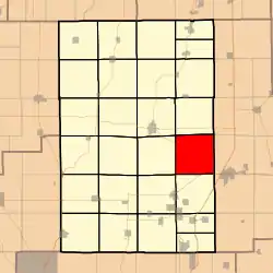
Adjacent townships
- Shaws Point Township (north)
- Zanesville Township, Montgomery County (northeast)
- North Litchfield Township, Montgomery County (east)
- South Litchfield Township, Montgomery County (southeast)
- Cahokia Township (south)
- Gillespie Township (southwest)
- Brushy Mound Township (west)
- Carlinville Township (northwest)
References
- "Population and Housing Unit Estimates". Retrieved June 9, 2017.
- "Population, Housing Units, Area, and Density: 2010 - County -- County Subdivision and Place -- 2010 Census Summary File 1". United States Census. Archived from the original on 2020-02-12. Retrieved 2013-05-28.
- "Census of Population and Housing". Census.gov. Retrieved June 4, 2016.
External links
Municipalities and communities of Macoupin County, Illinois, United States | ||
|---|---|---|
| Cities | Map of Illinois highlighting Macoupin County | |
| Town | ||
| Villages | ||
| Townships | ||
| Unincorporated communities | ||
| Footnotes | ‡This city also has portions in adjacent county or counties | |
| ||

This article is issued from Wikipedia. The text is licensed under Creative Commons - Attribution - Sharealike. Additional terms may apply for the media files.