Will County, Illinois
Will County is a county in the northeastern part of the state of Illinois. According to the 2010 census, it had a population of 677,560, an increase of 34.9% from 502,266 in 2000,[2] making it Illinois's fourth-most populous county. The county seat is Joliet.[3]
Will County | |
|---|---|
.jpg.webp) 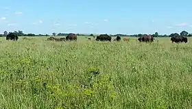 Flanders House in Plainfield (1840), Midewin National Tallgrass Prairie. | |
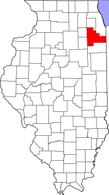 Location within the U.S. state of Illinois | |
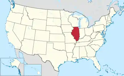 Illinois's location within the U.S. | |
| Coordinates: 41°26′N 87°59′W | |
| Country | |
| State | |
| Founded | January 12, 1836 |
| Named for | Dr. Conrad Will |
| Seat | Joliet |
| Largest city | Joliet |
| Area | |
| • Total | 849 sq mi (2,200 km2) |
| • Land | 837 sq mi (2,170 km2) |
| • Water | 12 sq mi (30 km2) 1.5% |
| Population (2010) | |
| • Total | 677,560 |
| • Estimate (2019)[1] | 690,743 |
| • Density | 810/sq mi (310/km2) |
| Time zone | UTC−6 (Central) |
| • Summer (DST) | UTC−5 (CDT) |
| Congressional districts | 1st, 2nd, 3rd, 11th, 14th, 16th |
| Website | www |
Will County is one of the five collar counties of the Chicago-Naperville-Elgin, IL-IN-WI Metropolitan Statistical Area. The portion of Will County around Joliet uses the 815 and 779 area codes, 630 and 331 are for far northern Will County, and 708 is for eastern Will County.
History
Will County was formed in 1836 out of Cook and Iroquois. It was named after Dr. Conrad Will, a businessman involved in salt production in southern Illinois, and also a politician.[4] Will was a member of the first Illinois Constitutional Convention and a member of the Illinois Legislature until his death in 1835. On January 12, 1836, Will County was formed from Cook County and Iroquois County. Besides its present area, it included the part of Kankakee County, Illinois north of the Kankakee River. Will County lost that area when Kankakee County was organized in 1852. Since then its boundaries have been unchanged.
36 locations in Will County are listed on the National Register of Historic Places.
— 1854 U.S. Gazetteer
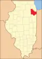 Will County from its 1836 creation to 1852
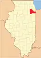 Will County in 1853, reduced to its current borders by the creation of Kankakee County
Geography
According to the U.S. Census Bureau, the county has an area of 849 square miles (2,200 km2), of which 837 square miles (2,170 km2) is land and 12 square miles (31 km2) (1.5%) is water.[5]
The Kankakee River, Du Page River and the Des Plaines River run through the county and join on its western border. The Illinois and Michigan Canal and the Chicago Sanitary and Ship Canal run through Will County.
A number of areas are preserved as parks (over 20,000 acres (81 km2) total) under the Forest Preserve District of Will County. The 17,000 acres (69 km2) Midewin National Tallgrass Prairie is a U.S. Forest Service park in the county on the grounds of the former Joliet Arsenal. Other parks include Channahon State Park and the Des Plaines Fish and Wildlife Area.
Climate and weather
| Joliet, Illinois | ||||||||||||||||||||||||||||||||||||||||||||||||||||||||||||
|---|---|---|---|---|---|---|---|---|---|---|---|---|---|---|---|---|---|---|---|---|---|---|---|---|---|---|---|---|---|---|---|---|---|---|---|---|---|---|---|---|---|---|---|---|---|---|---|---|---|---|---|---|---|---|---|---|---|---|---|---|
| Climate chart (explanation) | ||||||||||||||||||||||||||||||||||||||||||||||||||||||||||||
| ||||||||||||||||||||||||||||||||||||||||||||||||||||||||||||
| ||||||||||||||||||||||||||||||||||||||||||||||||||||||||||||
In recent years, average temperatures in the county seat of Joliet have ranged from a low of 13 °F (−11 °C) in January to a high of 85 °F (29 °C) in July, although a record low of −26 °F (−32 °C) was recorded in January 1985 and a record high of 104 °F (40 °C) was recorded in June 1988. Average monthly precipitation ranged from 1.58 inches (40 mm) in January to 4.34 inches (110 mm) in July.[6]
Adjacent counties
- Kane County (northwest)
- DuPage County (north)
- Cook County (northeast)
- Lake County, Indiana (east)
- Kankakee County (south)
- Grundy County (southwest)
- Kendall County (west)
Demographics
| Historical population | |||
|---|---|---|---|
| Census | Pop. | %± | |
| 1840 | 10,167 | — | |
| 1850 | 16,703 | 64.3% | |
| 1860 | 29,321 | 75.5% | |
| 1870 | 43,013 | 46.7% | |
| 1880 | 53,422 | 24.2% | |
| 1890 | 62,007 | 16.1% | |
| 1900 | 74,764 | 20.6% | |
| 1910 | 84,371 | 12.8% | |
| 1920 | 92,911 | 10.1% | |
| 1930 | 110,732 | 19.2% | |
| 1940 | 114,210 | 3.1% | |
| 1950 | 134,336 | 17.6% | |
| 1960 | 191,617 | 42.6% | |
| 1970 | 249,498 | 30.2% | |
| 1980 | 324,460 | 30.0% | |
| 1990 | 357,313 | 10.1% | |
| 2000 | 502,266 | 40.6% | |
| 2010 | 677,560 | 34.9% | |
| 2019 (est.) | 690,743 | [1] | 1.9% |
| U.S. Decennial Census[7] 1790–1960[8] 1900–1990[9] 1990–2000[10] 2010–2019[2] | |||
As of the 2010 Census, there were 677,560 people, 225,256 households, and 174,062 families residing in the county.[11] The population density was 809.6 inhabitants per square mile (312.6/km2). There were 237,501 housing units at an average density of 283.8 per square mile (109.6/km2).[5] The racial makeup of the county was 76.0% white, 11.2% black or African American, 4.6% Asian, 0.3% American Indian, 5.8% from other races, and 2.3% from two or more races. Those of Hispanic or Latino origin made up 15.6% of the population.[11] In terms of ancestry, 21.6% were German, 18.6% were Irish, 13.3% were Polish, 11.1% were Italian, 5.9% were English, and 2.1% were American.[12]
Of the 225,256 households, 44.0% had children under the age of 18 living with them, 61.9% were married couples living together, 10.9% had a female householder with no husband present, 22.7% were non-families, and 18.5% of all households were made up of individuals. The average household size was 2.97 and the average family size was 3.41. The median age was 35.4 years.[11]
The median income for a household in the county was $75,906 and the median income for a family was $85,488. Males had a median income of $60,867 versus $40,643 for females. The per capita income for the county was $29,811. About 5.0% of families and 6.6% of the population were below the poverty line, including 9.0% of those under age 18 and 5.6% of those age 65 or over.[13]
Government
Will County is governed via a 26-member county board who are elected from one of 13 districts. Each district elects 2 members. The County Executive, County Clerk, Coroner, Auditor, Treasurer, Recorder of Deeds, State's Attorney and Sheriff are all elected in a countywide vote.
Politics
Will County, once a Republican stronghold, has become a swing county in recent years. It voted for the national winner in every presidential election from 1980 to 2012, but Donald Trump's unpopularity in suburban counties of the largest metropolitan areas nationwide helped Chicago-born Hillary Clinton win it along with the rest of the "collar counties" aside from McHenry in 2016.
| Year | Republican | Democratic | Third parties |
|---|---|---|---|
| 2020 | 44.9% 155,116 | 53.2% 183,915 | 1.7% 6,074 |
| 2016 | 43.6% 132,720 | 49.9% 151,927 | 6.4% 19,579 |
| 2012 | 46.4% 128,969 | 51.9% 144,229 | 1.8% 4,967 |
| 2008 | 42.7% 122,597 | 55.9% 160,406 | 1.5% 4,178 |
| 2004 | 52.4% 130,728 | 46.9% 117,172 | 0.7% 1,709 |
| 2000 | 50.0% 95,828 | 47.4% 90,902 | 2.6% 4,940 |
| 1996 | 42.2% 62,506 | 46.8% 69,354 | 11.1% 16,444 |
| 1992 | 38.4% 58,337 | 39.2% 59,633 | 22.5% 34,153 |
| 1988 | 59.1% 73,129 | 40.3% 49,816 | 0.6% 786 |
| 1984 | 63.3% 78,684 | 36.3% 45,193 | 0.4% 520 |
| 1980 | 57.4% 69,310 | 34.8% 41,975 | 7.8% 9,373 |
| 1976 | 53.9% 61,784 | 44.5% 51,103 | 1.6% 1,840 |
| 1972 | 65.7% 65,155 | 33.9% 33,633 | 0.4% 430 |
| 1968 | 49.3% 43,630 | 35.7% 31,576 | 15.0% 13,254 |
| 1964 | 43.8% 38,619 | 56.3% 49,663 | 0.0% 0 |
| 1960 | 50.9% 42,575 | 49.0% 41,056 | 0.1% 81 |
| 1956 | 64.3% 45,628 | 35.5% 25,188 | 0.1% 100 |
| 1952 | 56.3% 38,533 | 43.5% 29,749 | 0.2% 110 |
| 1948 | 51.4% 28,601 | 47.5% 26,430 | 1.1% 597 |
| 1944 | 52.3% 30,058 | 47.1% 27,085 | 0.5% 310 |
| 1940 | 52.1% 32,291 | 47.5% 29,442 | 0.3% 213 |
| 1936 | 45.3% 25,028 | 50.9% 28,135 | 3.9% 2,151 |
| 1932 | 48.2% 25,173 | 49.4% 25,798 | 2.5% 1,295 |
| 1928 | 55.0% 26,081 | 44.0% 20,877 | 0.9% 447 |
| 1924 | 64.2% 22,780 | 13.3% 4,707 | 22.6% 8,018 |
| 1920 | 76.4% 21,746 | 19.0% 5,410 | 4.6% 1,318 |
| 1916 | 62.6% 19,881 | 35.8% 11,378 | 1.6% 506 |
| 1912 | 19.9% 3,331 | 28.1% 4,717 | 52.0% 8,719 |
| 1908 | 61.3% 10,358 | 33.7% 5,693 | 5.0% 850 |
| 1904 | 66.4% 10,001 | 21.2% 3,191 | 12.4% 1,873 |
| 1900 | 59.2% 10,056 | 39.2% 6,655 | 1.6% 269 |
| 1896 | 56.9% 9,249 | 42.3% 6,873 | 0.7% 120 |
| 1892 | 49.5% 6,720 | 47.4% 6,434 | 3.1% 420 |
Education
- Governors State University is a 6,000-student public university located in University Park, Illinois.
- Lewis University is a 5,200-student four-year private university located in Romeoville, Illinois.
- University of St. Francis is a 3,300-student four-year private university located in Joliet, Illinois.
- The county is in Community College District 525 and is served by Joliet Junior College in Joliet.[15] Joliet Junior College was the first two-year higher education institution in the United States.
Transportation
Will County is served by 4 US Interstate Highways, 4 US Highways, and 12 Illinois Highways.
Major highways
 Interstate 55
 Interstate 57
 Interstate 80
 Interstate 355
 U.S. Route 6
 U.S. Highway 30
 U.S. Highway 45
 U.S. Highway 52
 Illinois Route 1
 Illinois Route 7
 Illinois Route 43
 Illinois Route 50
 Illinois Route 53
 Illinois Route 59
 Illinois Route 102
 Illinois Route 113
 Illinois Route 126
 Illinois Route 129
 Illinois Route 171
 Illinois Route 394
Rail
Four different Metra commuter rail lines (Metra Electric Main Line, Southwest Service, Rock Island District and Heritage Corridor) connect the parts of the county with the Chicago Loop.
Energy Infrastructure
Pipelines
The county is a major hub in the United States natural gas pipeline grid where pipelines from Canada and the Gulf of Mexico meet and then fan out to serve the Midwest. The following major energy companies own pipeline that run through Will County:
- Alliance Pipeline
- Enbridge
- Integrys Energy Group
- Kinder Morgan Interstate Gas Transmission
- TransCanada
- ANR Pipeline - Fully owned & operated
- Northern Border Pipeline - Partially owned & fully operated
- Vector Pipeline
Joliet Refinery
ExxonMobil owns and operated the Joliet Refinery which is located along the Des Plaines River just east of I-55. According to ExxonMobil, the refinery employs about 600 people and was constructed in 1972.[16]
Municipalities
The municipalities with their population within Will County and their total population as of the 2010 Census, are:[17]
Cities
- Aurora – 11,471 (total 197,899; mostly in DuPage, Kane and Kendall counties)
- Braidwood – 6,191
- Crest Hill – 20,837
- Joliet – 137,684 (total 147,433; partly in Kendall County)
- Lockport – 24,839
- Naperville – 47,320 (total 141,853; mostly in DuPage County)
- Wilmington – 5,724
Villages
- Beecher – 4,359
- Bolingbrook – 71,795 (total 73,366; partly in DuPage County)
- Braceville – 1 (total 793; mostly in Grundy County)
- Channahon – 9,345 (total 12,560; partly in Grundy County)
- Coal City – 2 (total 5,587; mostly in Grundy County)
- Crete – 8,259
- Diamond – 19 (total 2,527; mostly in Grundy County)
- Elwood – 2,279
- Frankfort – 17,782 (total 17,789; partly in Cook County)
- Godley – 552 (total 601; partly in Grundy County)
- Homer Glen – 24,220
- Lemont – 3 (total 16,000; mostly in Cook and DuPage counties)
- Manhattan – 7,051
- Matteson – 0 (total 19,009; mostly in Cook County)
- Minooka – 1,803 (total 10,924; mostly in Grundy and Kendall counties)
- Mokena – 18,740
- Monee – 5,148
- New Lenox – 24,394
- Orland Park – 184 (total 56,767; mostly in Cook County)
- Park Forest – 3,303 (total 21,975; mostly in Cook County)
- Peotone – 4,142
- Plainfield – 37,502 (total 39,581; partly in Kendall County)
- Rockdale – 1,976
- Romeoville – 39,680
- Sauk Village – 0 (total 10,506; mostly in Cook County)
- Shorewood – 15,615
- Steger – 5,467 (total 9,570; partly in Cook County)
- Symerton – 87
- Tinley Park – 7,467 (total 56,703; mostly in Cook County)
- University Park – 6,856 (total 7,129; partly in Cook County)
- Woodridge – 22 (total 32,971; mostly in DuPage County)
Census-designated places
- Crystal Lawns – 1,872
- Fairmont – 2,459
- Frankfort Square – 9,276
- Goodings Grove (former CDP)
- Ingalls Park – 3,314
- Lakewood Shores – 1,347
- Preston Heights – 2,575
- Willowbrook – 2,076
Townships
The 24 townships of Will County, with their populations as of the 2010 Census, are:
- Channahon – 10,322
- Crete – 23,774
- Custer – 1,430
- DuPage – 87,793
- Florence – 933
- Frankfort – 57,055
- Green Garden – 4,010
- Homer – 39,059
- Jackson – 4,100
- Joliet – 87,398
- Lockport – 60,010
- Manhattan – 9,218
- Monee – 15,669
- New Lenox – 40,270
- Peotone – 4,431
- Plainfield – 80,318
- Reed – 6,948
- Troy – 45,991
- Washington – 6,263
- Wesley – 2,241
- Wheatland – 81,472
- Will – 1,821
- Wilmington – 6,193
- Wilton – 841
References
- Specific
- "Population and Housing Unit Estimates". Retrieved March 26, 2020.
- "State & County QuickFacts". United States Census Bureau. Archived from the original on June 6, 2011. Retrieved July 9, 2014.
- "Find a County". National Association of Counties. Archived from the original on May 31, 2011. Retrieved June 7, 2011.
- "Was Dr. Conrad Will really worth his salt?" Archived October 1, 2011, at the Wayback Machine, Ledger-Sentinel, Roger Matile, June 22, 2006
- "Population, Housing Units, Area, and Density: 2010 - County". United States Census Bureau. Archived from the original on February 12, 2020. Retrieved July 12, 2015.
- "Monthly Averages for Joliet, Illinois". The Weather Channel. Archived from the original on January 27, 2012. Retrieved January 27, 2011.
- "U.S. Decennial Census". United States Census Bureau. Retrieved April 16, 2015.
- "Historical Census Browser". University of Virginia Library. Archived from the original on August 11, 2012. Retrieved July 9, 2014.
- "Population of Counties by Decennial Census: 1900 to 1990". United States Census Bureau. Archived from the original on April 24, 2014. Retrieved April 16, 2014.
- "Census 2000 PHC-T-4. Ranking Tables for Counties: 1990 and 2000" (PDF). United States Census Bureau. Archived (PDF) from the original on December 18, 2014. Retrieved July 9, 2014.
- "DP-1 Profile of General Population and Housing Characteristics: 2010 Demographic Profile Data". United States Census Bureau. Archived from the original on February 13, 2020. Retrieved July 12, 2015.
- "DP02 SELECTED SOCIAL CHARACTERISTICS IN THE UNITED STATES – 2006-2010 American Community Survey 5-Year Estimates". United States Census Bureau. Archived from the original on February 13, 2020. Retrieved July 12, 2015.
- "DP03 SELECTED ECONOMIC CHARACTERISTICS – 2006-2010 American Community Survey 5-Year Estimates". United States Census Bureau. Archived from the original on February 13, 2020. Retrieved July 12, 2015.
- Leip, David. "Dave Leip's Atlas of U.S. Presidential Elections". uselectionatlas.org. Archived from the original on March 23, 2018. Retrieved April 29, 2018.
- retrieved 2007-02-13 Archived December 8, 2006, at the Wayback Machine
- "Archived copy" (PDF). Archived (PDF) from the original on October 5, 2013. Retrieved August 30, 2013.CS1 maint: archived copy as title (link)
- "GCT-PH1 Population, Housing Units, Area, and Density: 2010 - County -- County Subdivision and Place". United States Census Bureau. Retrieved October 29, 2018.
- General
- Forstall, Richard L. (editor) (1996). Population of states and counties of the United States: 1790 to 1990: from the twenty-one decennial censuses. United States Department of Commerce, Bureau of the Census, Population Division. ISBN 0-934213-48-8.CS1 maint: extra text: authors list (link)
External links
Places adjacent to Will County, Illinois | ||||||||||
|---|---|---|---|---|---|---|---|---|---|---|
| ||||||||||
Municipalities and communities of Will County, Illinois, United States | ||
|---|---|---|
| Cities | Map of Illinois highlighting Will County | |
| Villages |
| |
| CDPs | ||
| Townships | ||
| Unincorporated communities |
| |
| Ghost town | ||
| Footnotes | ‡This populated place also has portions in an adjacent county or counties | |
| ||
| Major city |  | |
|---|---|---|
| Cities (over 30,000 in 2010) | ||
| Towns and villages (over 30,000 in 2010) |
| |
| Counties | ||
| Regions | ||
| Sub-regions | ||
| Authority control |
|---|