Iron Post
Iron Post is a historic boundary marker located in New Albin, Iowa, United States. An Act of Congress on March 3, 1849 sought to resolve the boundary issue between the State of Iowa and the newly established Minnesota Territory. This cast iron post was placed here by Captain Thomas Lee of the U.S. Army Corps of Topographical Engineers. He determined that North latitude 43 degrees, 30 minutes was indeed the border between the two entities, which the United States Congress had designated on August 4, 1846 as Iowa's northern border.[2] It also served as a correction for the townships that had been established below the line, and as a practical surveying base for the territory to the north from this point all the way to the Big Sioux River.
Iron Post | |
 | |
  | |
| Location | Northern end of Main St. New Albin, Iowa |
|---|---|
| Coordinates | 43°30′03″N 91°16′59″W |
| Area | 1 acre (0.40 ha) |
| Built | 1849 |
| Architect | A. Dowling |
| NRHP reference No. | 76000732[1] |
| Added to NRHP | September 29, 1976 |
The post is an obelisk that rises 54 inches (1.4 m).[2] It is painted an aluminium color, and bears inscriptions on its four faces: "Iowa" (south), "Minnesota" (north), "1849" (east), and "Lat 43 degrees 30 minutes" (west). It was brought here across the frozen Mississippi River from Victory, Wisconsin by John Ross on a sled pulled by a team of oxen. The post was listed on the National Register of Historic Places in 1976.[1]
References
- "National Register Information System". National Register of Historic Places. National Park Service. March 13, 2009.
- Sara K. Smerud. "Iron Post". National Park Service. Retrieved 2016-08-18. with photos
| Topics | |
|---|---|
| Lists by state |
|
| Lists by insular areas | |
| Lists by associated state | |
| Other areas | |
| Related | |
| |
| Dorchester | 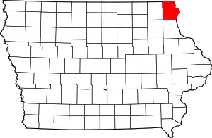 | |
|---|---|---|
| Hanover Township | ||
| Lansing | ||
| Ludlow | ||
| Marquette | ||
| New Albin | ||
| Postville | ||
| Waterville | ||
| Waukon | ||