National Register of Historic Places listings in Allamakee County, Iowa
This is a list of the National Register of Historic Places listings in Allamakee County, Iowa.
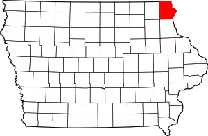
Location of Allamakee County in Iowa
This is intended to be a complete list of the properties and districts on the National Register of Historic Places in Allamakee County, Iowa, United States. Latitude and longitude coordinates are provided for many National Register properties and districts; these locations may be seen together in a map.[1]
There are 22 properties and districts listed on the National Register in the county.
- This National Park Service list is complete through NPS recent listings posted February 5, 2021.[2]
| [3] | Name on the Register[4] | Image | Date listed[5] | Location | City or town | Description |
|---|---|---|---|---|---|---|
| 1 | Allamakee County Court House | 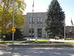 Allamakee County Court House |
August 28, 2003 (#03000827) |
110 Allamakee Street 43°16′14″N 91°28′35″W |
Waukon | |
| 2 | Allamakee County Courthouse | 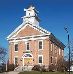 Allamakee County Courthouse |
April 11, 1977 (#77000492) |
107 Allamakee Street 43°16′15″N 91°28′31″W |
Waukon | |
| 3 | Effigy Mounds National Monument |  Effigy Mounds National Monument |
October 15, 1966 (#66000109) |
3 miles north of Marquette on Iowa Highway 76 43°05′33″N 91°11′46″W |
Marquette | Extends into Clayton County |
| 4 | Fish Farm Mound Group | 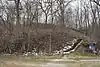 Fish Farm Mound Group |
July 25, 1988 (#88001131) |
Fish Farm Mounds State Preserve[6] 43°27′19″N 91°16′46″W |
New Albin | |
| 5 | Otto J. Hager House | 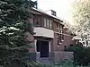 Otto J. Hager House |
June 27, 1985 (#85001383) |
402 Allamakee Street 43°16′23″N 91°28′33″W |
Waukon | |
| 6 | Iron Post | 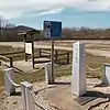 Iron Post |
September 29, 1976 (#76000732) |
Northern end of Main Street 43°30′03″N 91°16′59″W |
New Albin | Survey marker which legally defines the boundary between Minnesota and Iowa. |
| 7 | G. Kerndt and Brothers Elevator and Warehouses, No. 11, No.12 and No. 13 | 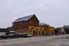 G. Kerndt and Brothers Elevator and Warehouses, No. 11, No.12 and No. 13 |
October 18, 1979 (#79000881) |
Front Street 43°21′43″N 91°12′52″W |
Lansing | |
| 8 | G. Kerndt & Brothers Office Block | 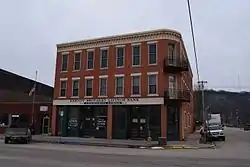 G. Kerndt & Brothers Office Block |
November 10, 1982 (#82000402) |
4th and Main Street 43°21′42″N 91°13′07″W |
Lansing | |
| 9 | Lansing Fisheries Building | 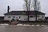 Lansing Fisheries Building |
December 23, 1991 (#91001832) |
Between County Highway X-52 and the Mississippi River in southern Lansing 43°21′38″N 91°12′49″W |
Lansing | |
| 10 | Lansing Main Street Historic District | 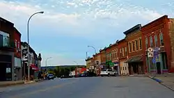 Lansing Main Street Historic District |
September 17, 2014 (#14000624) |
100–401 Main Street, 1 block north and south on Front and 2nd streets, and 190 John Street 43°21′43″N 91°12′59″W |
Lansing | |
| 11 | Lansing Stone School | 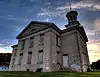 Lansing Stone School |
December 18, 1973 (#73000721) |
Southwestern corner of Center and Fifth Streets 43°21′38″N 91°13′16″W |
Lansing | |
| 12 | Fred W. Meier Round Barn | June 30, 1986 (#86001411) |
Off Iowa Highway 9 43°14′03″N 91°28′34″W |
Ludlow | ||
| 13 | Monsrud Bridge | June 25, 1998 (#98000771) |
Swebakken Road over Paint Creek 43°13′08″N 91°19′36″W |
Waterville | ||
| 14 | Old Allamakee County Courthouse | 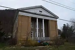 Old Allamakee County Courthouse |
February 24, 1983 (#83000338) |
Second Street 43°21′20″N 91°12′44″W |
Lansing | |
| 15 | Old East Paint Creek Lutheran Church | 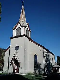 Old East Paint Creek Lutheran Church |
July 7, 1983 (#83000339) |
North of Waterville on County Road A-52 43°15′52″N 91°16′11″W |
Waterville | |
| 16 | Thomas Reburn Polygonal Barn | 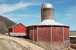 Thomas Reburn Polygonal Barn |
June 30, 1986 (#86001413) |
Off Iowa Highway 26 43°29′32″N 91°18′11″W |
New Albin | |
| 17 | Red Bridge | 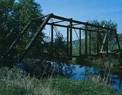 Red Bridge |
June 25, 1998 (#98000773) |
Fuel Hollow Road over the Yellow River 43°07′51″N 91°25′29″W |
Postville | |
| 18 | Slinde Mound Group |  Slinde Mound Group |
November 1, 1989 (#88001132) |
Address Restricted |
Hanover Township | |
| 19 | Turner Hall | 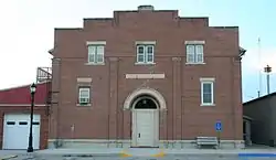 Turner Hall |
December 11, 2000 (#00000921) |
119 East Greene Street 43°05′13″N 91°34′04″W |
Postville | |
| 20 | Upper Iowa River Bridge | 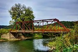 Upper Iowa River Bridge |
June 25, 1998 (#98000772) |
Mays Prairie Road over the Upper Iowa River 43°25′57″N 91°24′43″W |
Dorchester | |
| 21 | Waterloo Ridge Menigheds Kirke og Kirkegard Historic District | 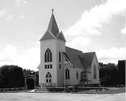 Waterloo Ridge Menigheds Kirke og Kirkegard Historic District |
July 21, 2015 (#15000435) |
169 Dorchester Drive 43°29′08″N 91°36′01″W |
Dorchester vicinity | |
| 22 | West Paint Creek Synod Evangelical Lutheran Church and Cemetery | 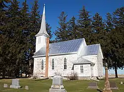 West Paint Creek Synod Evangelical Lutheran Church and Cemetery |
March 7, 2019 (#100003422) |
1351 Elon Dr. 43°15′39″N 91°21′33″W |
Waterville |
Former listings
| [3] | Name on the Register | Image | Date listed | Date removed | Location | City or town | Summary |
|---|---|---|---|---|---|---|---|
| 1 | Postville Public School | April 12, 1984 (#84001200) | September 23, 1987 | Ogden and Post Streets |
Postville |
See also
| Wikimedia Commons has media related to National Register of Historic Places in Allamakee County, Iowa. |
References
- The latitude and longitude information provided in this table was derived originally from the National Register Information System, which has been found to be fairly accurate for about 99% of listings. Some locations in this table may have been corrected to current GPS standards.
- "National Register of Historic Places: Weekly List Actions". National Park Service, United States Department of the Interior. Retrieved on February 5, 2021.
- Numbers represent an alphabetical ordering by significant words. Various colorings, defined here, differentiate National Historic Landmarks and historic districts from other NRHP buildings, structures, sites or objects.
- "National Register Information System". National Register of Historic Places. National Park Service. April 24, 2008.
- The eight-digit number below each date is the number assigned to each location in the National Register Information System database, which can be viewed by clicking the number.
- Fish Farm Mounds Wildlife Management Area, Iowa Department of Natural Resources, 2011-03. Accessed 2013-01-17.
| Topics | |
|---|---|
| Lists by state |
|
| Lists by insular areas | |
| Lists by associated state | |
| Other areas | |
| Related | |
| |

Municipalities and communities of Allamakee County, Iowa, United States | ||
|---|---|---|
| Cities | Map of Iowa highlighting Allamakee County | |
| Townships | ||
| Unincorporated communities | ||
| Footnotes | ‡This populated place also has portions in an adjacent county or counties | |
| ||
This article is issued from Wikipedia. The text is licensed under Creative Commons - Attribution - Sharealike. Additional terms may apply for the media files.