Irupana Municipality
Irupana Municipality or Villa de Lanza Municipality is the second municipal section of the Sud Yungas Province in the La Paz Department, Bolivia. Its seat is Irupana.
Irupana | |
|---|---|
Municipality | |
 Irupana | |
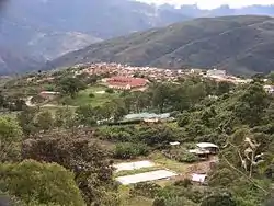
 Irupana Location within Bolivia | |
| Coordinates: 16°30′S 67°30′W | |
| Country | |
| Department | La Paz Department |
| Province | Sud Yungas Province |
| Seat | Irupana |
| Government | |
| • Mayor | Clemente Mamani Condorena (2007) |
| Elevation | 5,900 ft (1,800 m) |
| Population (2001) | |
| • Total | 11,383 |
| Time zone | UTC-4 (-4) |

Geography
The Cordillera Real traverses the municipality. The highest peaks of the municipality is Illimani at 6,438 m (21,122 ft) above sea level. Other mountains are listed below:[1][2][3]
- Allpaqani
- Churu
- Ch'iyar Qullu
- Ch'uxña Pata
- K'illimani
- K'uchu Munti
- K'usill Willk'i
- Layqa Qullu
- Llaytuwani
- Link'u Link'u
- Mururata
- Pararani
- Pupusani
- Qaqinkura
- Qutapata
- Thiya Quta
- Waychuni
- Wisk'achani
Subdivision
Irupana Municipality is divided into six cantons.
| Canton | Inhabitants (2001)[4] | Seat | Inhabitants (2001) |
|---|---|---|---|
| Irupana | 4,465 | Irupana | 1,882 |
| Lambate | 2,693 | Lambate | 347 |
| Laza | 800 | Laza | 164 |
| Taca | 1,080 | Taca | 183 |
| Chicaloma | 1,177 | Chicaloma | 634 |
| Victorio Lanza | 1,168 | Victorio Lanza | 181 |
See also
References
- Bolivian IGM map 1:50,000 Araca 6043-I
- Bolivian IGM map 1:50,000 Lambate 6044-II
- "Irupana". INE, Bolivia. Archived from the original on March 26, 2016. Retrieved March 18, 2016.
- www.ine.gob.bo Archived 2011-09-24 at the Wayback Machine
External links

This article is issued from Wikipedia. The text is licensed under Creative Commons - Attribution - Sharealike. Additional terms may apply for the media files.