Palca Municipality
Palca or Pallqa (Aymara) is the first municipal section of the Pedro Domingo Murillo Province in the La Paz Department, Bolivia. Its seat is Palca.
Palca
Pallqa | |
|---|---|
Municipality | |
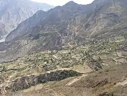 Chojahuaya, Cohoni Canton, Palca Municipality | |
 Palca Location of the Palca Municipality within Bolivia | |
| Coordinates: 16°42′0″S 67°50′0″W | |
| Country | |
| Department | La Paz Department |
| Province | Pedro Domingo Murillo Province |
| Seat | Palca |
| Government | |
| • Mayor | Cecilio Quispe Gomez (2007) |
| Area | |
| • Total | 283 sq mi (734 km2) |
| Elevation | 12,500 ft (3,800 m) |
| Population (2001) | |
| • Total | 14,185 |
| • Ethnicities | Aymara |
Geography
The Cordillera Real traverses the municipality. Some of the highest peaks of the municipality are listed below:[1]
- Achachi Qala
- Ch'iyar Qullu (Murillo)
- Ch'iyar Qullu (Palca)
- Jalancha
- Janq'u Qalani
- Jisk'a Jalancha
- Jukumarini
- Kunturiri
- Layqa Qullu
- Link'u Link'u
- Parqu Quta
- P'iq'iñ Q'ara
- Q'asiri
- Silla Pata
- Tata Ch'iyar Qullu
- Wila Quta
- Wichhu Pata
- Wichhu Pata Qullu
- Wiluma
Population
The people are predominantly indigenous citizens of Aymara descent.[2]
| Ethnic group | % |
|---|---|
| Quechua | 0.6 |
| Aymara | 91.6 |
| Guaraní, Chiquitos, Moxos | 0.1 |
| Not indigenous | 7.6 |
| Other indigenous groups | 0.1 |
Places of interest
Some of the tourist attractions of the municipality are:[3]
- Apacheta viewpoint in Palca Canton which offers a sight of the contrasting landscape and snowcapped Illimani
- Valle de los Ánimas ("Valley of the Souls") and its lake (Laguna de las Ánimas) in Palca Canton
- the town of Palca with houses of colonial times, Palca River, Chuaqueri gorge, also known as Palca gorge, and Takesi pre-Columbian trail in Palca Canton
- the communities of Quilihuaya and Pinaya in Quilihuaya Canton
- the community of Cohoni, its church dating from the 17th century and the chullpas of Ch'ullu Cahinbaya in Cohoni Canton
See also
References
- Bolivian IGM map 1:50,000 6043-I Araca, 6044-IV Chojlla, Cohoni 6043-IV, Lambate 6044-II and 6044-III Palca
- obd.descentralizacion.gov.bo/municipal/fichas/ (inactive)
- www.gobernacionlapaz.gob.bo Archived 2011-05-09 at the Wayback Machine Tourist guide by the government of the department
External links
- Palca Municipality: population data and map (PDF; 534 kB)

This article is issued from Wikipedia. The text is licensed under Creative Commons - Attribution - Sharealike. Additional terms may apply for the media files.