Jalilabad District (Azerbaijan)
Jalilabad (Azerbaijani: Cəlilabad) is a region in Azerbaijan. The capital of the region is Cəlilabad (English: Jalilabad). The region covers an area of 1,440 square kilometres (560 sq mi). There are 2 cities, Jalilabad and Göytəpə, and 117 villages in the region. The distance between Baku and Jalilabad is 221 kilometres (137 mi).
Jalilabad | |
|---|---|
.svg.png.webp) Map of Azerbaijan showing Jalilabad Region | |
| Country | |
| Capital | Cəlilabad |
| Area | |
| • Total | 1,440 km2 (560 sq mi) |
| Population (2018) | |
| • Total | 219,500 |
| Postal code | AZ1500 |
| Telephone code | (+994) 25[3] |
Geography
Territory
The region borders Bilasuvar Region in the north, Neftchala Region in the east, Masally Region in the south, Yardymli Region in the south-west, and Iran in the south.
Its territory primarily consists of plains and low mountains. The altitude of some mountains in the east is below sea level. The climate is mild with dry summers. The average temperature is 1–3 °C (34–37 °F) in winter and 25–30 °C (77–86 °F) in summer. The average amount of annual precipitation is 400–600mm. The Bolgarchay, Misharchay, Injachay, Goytapachay, and other rivers flow through the region. Soils here are alluvial-meadow, chestnut, mountainous brown, forest soils and others. Forests occupy 17,700 hectares (177 km2). Mammals such as rabbit, wild boar, badger, wolf, fox, jackal, beaver, inhabit the region along with birds such as eagle, crow, lark, duck, coot, pheasant, stork, bustard.[4]
Natural resources include oil-and-gas fields, lime, clay, sand and stone deposits. Total area of productive lands is 661,2 km2, area of useless agricultural lands is 8,16 km2.
History

The town of Hamashara, which was located in Jalilabad region, belongs to the 2nd millennium BC. The city was surrounded by a 3-meter-high (9.8 ft) fort. After the Arabs invaded the territory, the city of Hamashara was collapsed and in subsequent periods the city of Hasilly was established. As a result of the relocation of Russians to Azerbaijan in the 1930s, the city of Astarkhanbazar, where Azerbaijanis and Russians lived together, became the center of the region.
The rayon was established on August 8, 1930. Until July 2, 1967, .[5] it was called Astarkhanbazar. Its name changed on June 2, 1967 to Jalilabad in honor of Azerbaijani writer-playwright Jalil Mammadguluzadeh. On May 26, 1964, Jalilabad joined Bilasuvar administrative territorial unit. On January 6, 1965 it again became an independent region.
In 1999 more than 190 municipalities were established in the rayon. 841 people took part in the election of the municipalities.
There are 50 historical and archeological monuments such as the remains of the ancient cities Bajirevan and Mughan, Alikomektepe and Misharchay residential areas, the Kazan lodge, the Bajiravan mounds, Gurudere residential area from the 4th millennium B.C., Jinlitepe which is from the Bronze Age, and Pirakhanjar, Zoroastrian cabins in the district.[6]
Economy
The main spheres of the regional economy are cotton growing, potato growing and animal breeding. About 276 square kilometres (107 sq mi) of area is used for cattle-breeding pastures. Planted lands in the region cover 536 square kilometres (207 sq mi). Grains, potatoes, and viticulture in the economy of Jalilabad region are the main ones. In addition, vegetables, sunflower and corn are grown in the territory. The total area of fruit gardens in the region is 1.83 square kilometres (0.71 sq mi).
In 2017 the volume of gross domestic product increased by 4.8 times compared to 2003 and by 62.6% compared to 2016. 7,244,000 manat industrial output was produced in the region, which is 11.4 times more than in 2003.
In the same year, 282,376,000 manat worth of agricultural products was produced, of which 139,864,000 manat or 49.5 percent from crops and 142,512,000 512 manat or 50.5 percent from livestock.
In addition 23 thousand tons of meat, 82.4 thousand tons of milk and 41.3 million eggs were produced. 222 thousand cattle and 624572 birds are fed in private farms. Also 3635 tons of poultry meat was sold by "Jalilabad-broiler" OJSC in 2017.
There are about 250 state, 800+ private and 5 foreign enterprises operating in the region. The largest ones are center of forest preserve and restoration, “Avtodəmir” JSC, Irrigation Department, Melioservice, Regional experiment station, "Kənd-Nəqliyyat" JSC, "Kərpic zavodu" JSC, "Kristal" Ltd, "Dalğa-94", "Nuranə" medical center, “Xalçaçılıq Mərkəzi”, "Rizvan" and “Duyaz” companies.
There are 5 city and 3 rural health clinics in the region with 176 doctors and 528 midwives in 40 outpatient clinics.
Tourism
The territory of the Jalilabad region is appropriate for hunting. It is allowed to hunt aquatic birds on designated certain hunting farms. There is also a small local history museum, park, hotel and motel. "Kral" recreation zone is functioning in Jalilabad city.
Media, Education and Culture
Jalilabad region has its own TV and radio stations, and newspapers such as “Yeni gun”, "Sozun ishigi" and "Munasibet". “Yeni gun” has been published since 1932. The "Sozun ishigi" and "Munasibet" newspapers began its operation between 2003 and 2004
There are 18 infant schools, 129 general education schools, 2 vocational and secondary schools, and a higher school in the rayon. In 2010 Ilham Aliyev took part in the opening ceremony of a chess school in Jalilabad city.[7]
There are 2 music schools, 43 clubs, 64 libraries, an art gallery, and parks in the district, a centralized library with 601,893 books, regional history and ethnography museum with 2,123 exhibits, a regional state art gallery with 137 exhibits, and 50 historical and cultural monuments in the region.
Demographics
According to the State Statistics Committee, as of 2018, the population of city was 219,500, which increased by 47,500 persons (about 27 percent) from 172,000 persons in 2000.[8] 110,700 of total population are men and 108,800 are women.[9] More than 28.7 percent of the population (about 63,200 persons) consists of young people and teenagers aged 14–29.[10] 219,286 are Azerbaijani, 130 Russian, 15 Turkish, 14 Tatars, 12 Ukrainian, 21 Talyshs and 22 other nationals.
| Region | 2000 | 2001 | 2002 | 2003 | 2004 | 2005 | 2006 | 2007 | 2008 | 2009 | 2010 | 2011 | 2012 | 2013 | 2014 | 2015 | 2016 | 2017 | 2018 |
|---|---|---|---|---|---|---|---|---|---|---|---|---|---|---|---|---|---|---|---|
| Jalilabad region | 172,000 | 174,100 | 176,000 | 177,900 | 179,800 | 182,300 | 184,800 | 187,000 | 189,400 | 191,700 | 194,100 | 196,500 | 198,800 | 202,000 | 205,600 | 209,300 | 213,000 | 216,600 | 219,500 |
| urban population | 48,200 | 49,000 | 49,700 | 50,500 | 51,400 | 52,400 | 53,400 | 54,100 | 54,900 | 55,800 | 56,300 | 56,900 | 57,300 | 57,900 | 58,600 | 59,500 | 60,200 | 60,900 | 61,400 |
| rural population | 123,800 | 125,100 | 126,300 | 127,400 | 128,400 | 129,900 | 131,400 | 132,900 | 134,500 | 135,900 | 137,800 | 139,600 | 141,500 | 144,100 | 147,000 | 149,800 | 152,800 | 155,700 | 158,100 |
Prominent persons
- Mustafa Nuriyev – general-major
- Javad Gasimov - Head of the Staff of the National Defense of Azerbaijan
- Gabil Guliyev - National artists of Azerbaijan
- Nuraddin Mehdikhanli - National artists of Azerbaijan
- Teymur Mustafayev - Honoured artist of Azerbaijan
- Mansure Musayeva - Hero of the Socialist Labour
- Gulkhara Mehdiyeva - Hero of the Socialist Labour
- Musret Mammadov - Hero of the Socialist Labour
- Mharram Aliyev - Hero of the Socialist Labour
- Boukkhan Mammadov - Hero of the Socialist Labour
- Sahib Ahadov - European Champion 2019 and Silver Medalist of World Championship 2018
- Konul Guliyeva Design KGD - Graphic Designer
Gallery
- Jalilabad Rayon
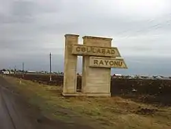 Road sign at the entrance of Jalilabad Rayon
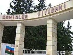 Martyrs' Lane in Jalilabad district
 "Aztelekom" Limited Liability Company in the district
References
- "Jalilabad Region". Archived from the original on 2013-04-15.
- "Jalilabad Region".
- "Şəhərlərarası telefon kodları". Aztelekom MMC. Aztelekom İB. Retrieved 19 August 2015. (in Azerbaijani)
- "Джалилабадский район". azerbaijan.az. Archived from the original on 2018-10-18.
- "Jalilabad". discoverazerbaijan.az. Archived from the original on 2013-09-04.
- "Information on the administrative-territorial unit : Jelilabad". Archived from the original on 2018-09-15. Retrieved 2018-09-25.
- "President Ilham Aliyev opens a chess school in Jalilabad".
- "Political division, population size and structure: Population by towns and regions of the Republic of Azerbaijan". The State Statistical Committee of the Republic of Azerbaijan. Retrieved 2018-12-18.
- "Political division, population size and structure: Population by sex, towns and regions, urban settlements of the Republic of Azerbaijan at the beginning of the 2018". The State Statistical Committee of the Republic of Azerbaijan. Retrieved 2018-12-18.
- "Political division, population size and structure: Population at age 14-29 by towns and regions of the Republic of Azerbaijan at the beginning of the 2018". The State Statistical Committee of the Republic of Azerbaijan. Retrieved 2018-12-18.