Qubadli District
Qubadli District (Azerbaijani: Qubadlı rayonu), is a district of Azerbaijan. The region holds rich subsoil resources and mysterious natural beauty, and is situated between Mount Zangazur and Nagorno Karabakh mountain range. It was established in 1933 as an administrative unit. Its area covers 802 square km. There are 94 residential districts, including a town and 93 villages.
Qubadli District
Qubadlı rayonu | |
|---|---|
 Map of Azerbaijan showing Qubadly Rayon | |
| Coordinates: 39°16′N 46°32′E | |
| Country | |
| Capital | Qubadlı |
| Government | |
| • Executive power | Malik Ishaqov |
| Area | |
| • Total | 802 km2 (310 sq mi) |
| Elevation | 477 m (1,565 ft) |
| Population (2009) | |
| • Total | 8 997 |
| Time zone | UTC+4 (AZT) |
| Postal code | 3900 |
| Telephone code | (+994) 26[1] |
| Website | www |
History
The district came under the control of the self-declared Republic of Artsakh in 1993 during the First Nagorno-Karabakh War. Azerbaijani forces regained control of the district including the city of Qubadli at 25th of October 2020 during the 2020 Nagorno-Karabakh war.
Demographics
According to the last Soviet census of 1989, population was 28,110.[2] According to undated Azerbaijani data, the population was 34,100.[3]
As of 1979 a total of 26,673 people:[4]
- Azerbaijanis 99,5% (26,537)
- Armenians 0,1% (26)
- Russians 0,2% (45)
As of 1989 a total of 28,110 people.[2]
References
- "Şəhərlərarası telefon kodları". Aztelekom MMC. Aztelekom İB. Retrieved 19 August 2015. (in Azerbaijani)
- "Демоскоп Weekly - Приложение. Справочник статистических показателей". www.demoscope.ru (in Russian). Retrieved 11 October 2020.
- "Ministry of Culture and Tourism of Azerbaijan Republic. Gubadli". Retrieved April 28, 2010.
- "население азербайджана". www.ethno-kavkaz.narod.ru. Retrieved 11 October 2020.
Gallery
 Laləzar körpüsü
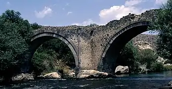 Laləzar körpüsü
%252C_Building%252C_2014.05.09_-_panoramio.jpg.webp) Qubadli, building
Qubadli, building%252C_Memorial_spring%252C_2014.05.09_-_panoramio.jpg.webp) Qubadli, Memorial spring
Qubadli, Memorial spring
