Lachin District
Lachin District (Azerbaijani: Laçın rayonu) is a district in the Republic of Azerbaijan. Its administrative center is the city of Lachin. This territory was established in 1930 and given the status of a district. It was under the effective control of the self-declared Republic of Artsakh from 1992 until late 2020.[3] Under the terms of an agreement that ended the 2020 Nagorno-Karabakh War, most of the district was returned to Azerbaijani control on 1 December 2020.[4] A smaller part of the district called the Lachin corridor is controlled by a Russian peacekeeping force.
Laçın | |
|---|---|
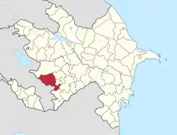 Map of Azerbaijan showing Lachin Rayon | |
| Country | |
| Capital | Lachin |
| Area | |
| • Total | 1,835 km2 (708 sq mi) |
| Population (2009)[1] | |
| • Total | 72,000[α] |
| Postal code | 4100 |
| Telephone code | (+994) 26[2] |
Demographics
In 1926, from a total of 14,770 people:
- 14,282 Azerbaijanis
- 282 Kurds
- 87 Armenians
In 1979, from a total of 47,261 people:[5]
- Azerbaijanis 94.5% (44,665)
- Kurds 5.2% (2,437)
- Armenians 0.1% (34)
In 1989 a total of 47,339 people.[6]
History
It was originally known as Abdalyar or Abdallyar (after the Turkic Abdal tribe).[7][8][9] It was granted town status in 1923 and renamed Lachin (a Turkic first name meaning falcon) in 1926.[7] Between 1923 and 1929,[10] Lachin was established as the Kurdistan Uyezd, an autonomous Soviet district.
The district has one city, one settlement (Gayghi settlement) and 125 villages. It is located in the south west of Azerbaijan and is predominantly mountainous. The district shares borders with Kalbajar district in the north, Khojali, Shusha and Khojavand districts in the east, Gubadli district in the south and Armenia in the west.
Lachin district is an administrative rayon in the Republic of Azerbaijan. Established in 1930. Situated in the Lesser Caucasus, in the south-west of Azerbaijan. Bordered by Armenia on the west. It occupies an area of 1,835 square kilometres (708 sq mi), while the population is 68,900 (as of 01.01.2006). The capital is the city of Lachin.
The area is mountainous. Lachin extends to the south-western slope of Karabakh ridge on the east, to the south-eastern slope of Mikhtokan ridge on the north, to Karabakh plateau on the south-west. The highest point is the Qızılboga mountain (3594 m). Jurassic-anthropogenic sediments are spread. The rayon has mineral resources such as mercury, polymetals, building materials, Narzan-type mineral water springs. Mild warm and cold climate with dry winter prevails over the most of the area. The average temperature is from −10–0 °C (14–32 °F) in January, to 10–22 °C (50–72 °F) in July. Annual precipitation is 600–900 millimetres (24–35 in). The rayon's river is Hakari and its tributaries. The most spread soil types are sod mountainous-meadow, brown mountainous-forest and carbonate mountainous-black. The vegetation comprises bushy and rare woods, deciduous mountain forests (oak, hornbeam, beech), sub-alpine and alpine meadows.
Lachin is an agricultural region. Cattle-breeding occupies has a major place in its economy.
There are 149 secondary schools, 2 pre-school and 5 extracurricular educational institutions, a vocational school, a children creativity center, 85 clubs, 119 libraries, 5 music schools, and 142 health facilities in the rayon.
The cave-temple (5th century), mausoleums (14th-19th century), a castle (17th century), a mosque (1718), a palace (1716), a bridge (18th century) are registered architectural monuments in the territory of Lachin.
Lachin was captured on May 18, 1992, by the Armenian armed forces during the First Nagorno-Karabakh War. As part of an agreement that ended the 2020 Nagorno-Karabakh War most of the district was returned to Azerbaijani control by 1 December 2020.[11] This excludes the Lachin corridor which is controlled by Russian peacekeeping forces in accordance with the agreement.[12]
Notes
- α Official Azerbaijani data by January 1, 2009.
References
- "The State Statistical Committee of the Republic of Azerbaijan". Retrieved September 29, 2010.
- "Şəhərlərarası telefon kodları". Aztelekom MMC. Aztelekom İB. Retrieved 19 August 2015. (in Azerbaijani)
- "The conflict over the Nagorno-Karabakh region dealt with by the OSCE Minsk Conference". Retrieved 2020-05-09.
- "Azerbaijani Forces Enter Third District Under Nagorno-Karabakh Truce". RadioFreeEurope/RadioLiberty. Retrieved 2020-11-30.
- "население азербайджана". www.ethno-kavkaz.narod.ru. Retrieved 11 October 2020.
- "Демоскоп Weekly - Приложение. Справочник статистических показателей". www.demoscope.ru (in Russian). Retrieved 11 October 2020.
- Pospelov, p. 23
- Karapetian, Samvel. Armenian Cultural Monuments in the Region of Karabagh. Yerevan: Gitutiun Publishing House, 2001, p. 169.
- Map of Armenia and Adjacent Countries by H. F. B. Lynch and F. Oswald in Armenia, Travels and Studies. London: Longmans, 1901.
- (in Russian) Russia and the problem of Kurds Archived 2012-02-12 at the Wayback Machine
- "Azerbaijani Forces Enter Third District Under Nagorno-Karabakh Truce". RadioFreeEurope/RadioLiberty. Retrieved 2020-11-30.
- {cite news|date=2020-11-10|title=Nagorno-Karabakh: Russia deploys peacekeeping troops to region|publisher=BBC News |url=https://www.bbc.co.uk/news/world-europe-54885906%7Caccess-date=2020-11-17}}
External links
- Demographic Crisis in Lachin
- An eyewitness report of conditions in 2001
- State Statistical Committee of Azerbaijan Republic. Population of Azerbaijan