Jalpaiguri division
Jalpaiguri Division is one of the 5 divisions in the Indian state of West Bengal. It is the northernmost division of West Bengal. It is surrounded by Nepal on the western side, Bhutan on the Northern side and Bangladesh on the southern side. Shri Barun Kumar Ray is the divisional commissioner of the division [1]
Jalpaiguri Division | |
|---|---|
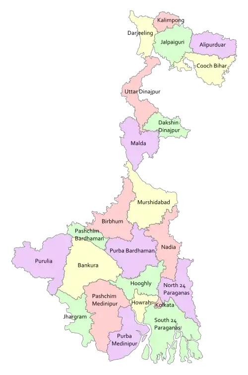
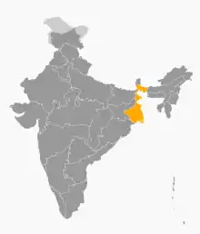
 Jalpaiguri division (in Red) | |
| Country | India |
| State | West Bengal |
| Capital | Jalpaiguri |
| Largest City | Siliguri |
| Districts | 1. Darjeeling, 2. Jalpaiguri, 3. Kalimpong, 4. Cooch Behar, 5. Alipurduar |
| Area | |
| • Total | 12,713 km2 (4,909 sq mi) |
| Population (2011 census) | |
| • Total | 8,790,397 |
| • Density | 690/km2 (1,800/sq mi) |
Districts
Districts of West Bengal
It consists of 5 districts:[2]
| Code | District | Headquarters | Established | Sub-Division | Area | Population As of 2011 | Population Density | Map |
|---|---|---|---|---|---|---|---|---|
| DA | Darjeeling | Darjeeling | 1947 | 2,092.5 km2 (807.9 sq mi) | 1,797,422 | 859/km2 (2,220/sq mi) |  | |
| JP | Jalpaiguri | Jalpaiguri | 1947 | 2,844 km2 (1,098 sq mi) | 2,172,846 | 621/km2 (1,610/sq mi) | 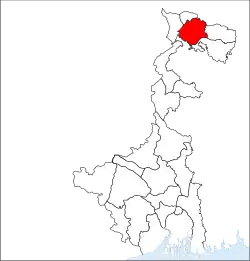 | |
| KB | Cooch Behar | Cooch Behar | 1950[3] | 3,387 km2 (1,308 sq mi) | 2,822,780 | 833/km2 (2,160/sq mi) |  | |
| AD | Alipurduar | Alipurduar | 2014[4] | 3,383 km2 (1,306 sq mi) | 1,700,000 | 400/km2 (1,000/sq mi) | 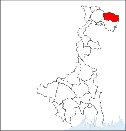 | |
| KA | Kalimpong | Kalimpong | 2017[4] | 1,044 km2 (403 sq mi) | 251,642 | 239/km2 (620/sq mi) |  | |
| Total | 5 | — | - | 13 | 12,713 km2 (4,909 sq mi) | 8,790,397 |
691/km2 (1,790/sq mi) |
 |
Demographics
Hindus forms the majority of the population while Muslims forms the largest minority group. There is a significant Christian and Buddhist population in the division. They are mainly concentrated in Kalimpong district and hill subdivisions of Darjeeling district. The Dooars regions also has a significant tribal population.[5]
References
- "Divisional Commissioners/ West Bengal". Office of the Resident Commissioner- Govt. of WB. 4 June 2019.
- "Directory of District, Sub division, Panchayat Samiti/ Block and Gram Panchayats in West Bengal, March 2008". West Bengal. National Informatics Centre, India. 19 March 2008. p. 1. Archived from the original on 25 February 2009. Retrieved 28 February 2009.
- "Brief History of Cooch Behar". Official website of Cooch Behar District. Archived from the original on 24 July 2011. Retrieved 10 September 2008.
- Jana, Naresh (31 December 2001). "Tamluk readies for giant's partition". The Telegraph (Kolkata). Retrieved 1 September 2008.
- Population by religious community: West Bengal. 2011 Census of India.
This article is issued from Wikipedia. The text is licensed under Creative Commons - Attribution - Sharealike. Additional terms may apply for the media files.