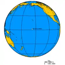
Kiritimati
Kiritimati or Christmas Island is a Pacific Ocean coral atoll in the northern Line Islands. It is part of the Republic of Kiribati. Its Gilbertese name is the rendition of the English word "Christmas" according to its phonology, in which the combination ti is pronounced s, and the name is thus pronounced /kiˈrɪsmæs/.
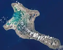 Photograph from the International Space Station | |
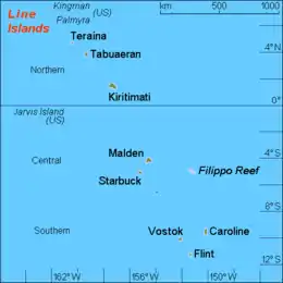 Map of the Line Islands | |
 Kiritimati 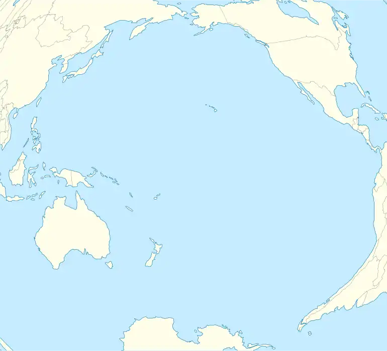 Kiritimati | |
| Geography | |
|---|---|
| Location | North Pacific Ocean |
| Coordinates | 01°52′N 157°24′W |
| Archipelago | Line Islands |
| Area | 388.39 km2 (149.96 sq mi) |
| Highest elevation | 13 m (43 ft) |
| Highest point | Joe's Hill |
| Administration | |
| Island council | Kiritimati |
| Largest settlement | Tabwakea |
| Demographics | |
| Population | 7,380 (2020 census) |
| Pop. density | 16.6/km2 (43/sq mi) |
| Languages | Gilbertese |
| Ethnic groups | I-Kiribati |
| Additional information | |
| Time zone | |
The island has the greatest land area of any coral atoll in the world, about 388 square kilometres (150 square miles);[1] its lagoon is roughly the same size. The atoll is about 150 km (93 mi) in perimeter, while the lagoon shoreline extends for over 48 km (30 mi).[2] Kiritimati comprises over 70% of the total land area of Kiribati, a country encompassing 33 Pacific atolls and islands.[3]
It lies 232 km (144 mi) north of the Equator, 2,160 km (1,340 mi) south of Honolulu, and 5,360 km (3,330 mi) from San Francisco. Kiritimati Island is in the world's farthest forward time zone, UTC+14, and is one of the first inhabited places on Earth to experience the New Year (see also Caroline Atoll, Kiribati). Despite being 2,460 km (1,530 mi) east of the 180 meridian, a 1995 realignment of the International Date Line by the Republic of Kiribati moved Kiritimati to west of the dateline.
Nuclear tests were conducted on and around Christmas Island by the United Kingdom in the late 1950s, and by the United States in 1962. During these tests the island was not evacuated. Subsequently, British, New Zealand, and Fijian servicemen as well as local islanders were exposed to the radiation from these blasts.
The entire island is a Wildlife Sanctuary;[4] access to five particularly sensitive areas is restricted.[1]
History
Christmas Island was inhabited by Polynesian traders and settlers, who would have found the island a useful replenishing station on the long voyages from the Society Islands or Marquesas Islands to Hawaii. This trade route was apparently used with some regularity by about AD 1000. From 1200 onwards Polynesian long-distance voyages became less frequent,[5] and had there been human settlement on Christmas Island, it would have been abandoned in the early-mid second millennium AD. Two possible village sites and some stone structures of these early visitors have been located.[1] Today, most inhabitants are I-Kiribati, and Gilbertese is the only language of any significance. English is generally understood, but little used outside the tourism sector.
The atoll was then discovered by Europeans with the Spanish expedition of Hernando de Grijalva in 1537, that charted it as Acea.[6][7][8][9] This discovery was referred by a contemporary, the Portuguese António Galvão, governor of Ternate, in his book Tratado dos Descubrimientos of 1563.[10] During his third voyage, Captain James Cook visited the island on Christmas Eve (24 December) 1777[11] and the island was put on a map in 1781 as “île des Tortues” (Turtles Island) by Tobias Conrad Lotter in Augsburg.[12] Whaling vessels were visiting the island from at least 1822.[13] and it was claimed by the United States under the Guano Islands Act of 1856,[14] though little actual mining of guano took place.
Bridges Point is at the central upper margin.
Permanent settlement started in 1882, mainly by workers in coconut plantations and fishermen. In 1902, the British Government granted a 99-year lease on Christmas Island to Levers Pacific Plantations. The company planted 72,863 coconut palms on the island and introduced silver-lipped pearl oysters into the lagoon. The settlement didn't stay long as extreme drought killed off 75% of the coconut palms and the island was once again abandoned between 1905 and 1912.[1]
Many of the toponyms in the island go back to Father Emmanuel Rougier, a French priest who leased the island from 1917 to 1939 and planted some 500,000 coconut trees there.[15] He lived in his Paris house (now only small ruins) located at Benson Point, across the Burgle Channel from Londres (today London) at Bridges Point where he established the port. He gave the name of Poland to a village where Stanisław (Stanislaus) Pełczyński, his Pole plantation manager was. Joe's Hill (some 12 metres high) was named by Joe English, who served also as plantation manager for Rougier between 1915 and 1919. English was left alone on the island for a year and a half (1917–19), with two teens, when cholera broke out in Papeete and transport stopped due to the First World War. English was later rescued by Lord John Jellicoe, 1st Earl Jellicoe, admiral of the British Fleet. English, still thinking the war was in effect and that the ship was German, pulled his revolver on the British admiral, causing a short standoff until some explanation defused the situation. Upon his rescue, English's adventures were later chronicled in the Boston Globe.[16]
Christmas Island was occupied by the Allies in World War II with the US taking over island garrison. The first contingent of Americans was a company from the 102nd Infantry Regiment, a National Guard unit from New Haven, Connecticut. The atoll was important to hold as Japanese occupation would allow interdiction of the main Hawaii-to-Australia supply route. For the first few months there were next to no recreational facilities on the island, and the men amused themselves by shooting sharks in the lagoon. The first airstrip was constructed at this time[1] for servicing the Air Force weather station and communications center. The airstrip also provided rest and refuelling facilities for planes travelling between Hawaii and the South Pacific. The 1947 census listed only 47 inhabitants on the island. The U.S. Guano Islands Act claim was formally ceded by the Treaty of Tarawa between the U.S. and Kiribati. The treaty was signed in 1979 and ratified in 1983.
Spain's sovereignty rights
During the dispute over the Caroline islands between Germany and Spain in 1885 which was arbitrated by Pope Leo XIII, the sovereignty of Spain over the Caroline and Palau islands as part of the Spanish East Indies was analysed by a commission of cardinals and confirmed by an agreement signed on 17 December 1885. Its Article 2 specifies the limits of Spanish sovereignty in South Micronesia, being formed by the Equator and 11°N Latitude and by 133° and by 164° Longitude. In 1899, Spain sold the Marianas, Carolines, and Palau to Germany after its defeat in 1898 in the Spanish–American War. However Emilio Pastor Santos, a researcher of the Spanish National Research Council, claimed in 1948 that there was historical basis, supported by the charts and maps of the time, to argue that Kiritimati (or Acea as in the Spanish maps) and some other islands had never been considered part of the Carolines. Thus Kiritimati was not included in the description of the territory transferred to Germany and therefore was not affected on the part of Spain to any cessation of transfer. Theoretically Spain would then have the only jurisdiction and right to the island. Pastor Santos presented his thesis to the Spanish government in 1948. In the Council of Ministers of Spain on 12 January 1949, the Minister of Foreign Affairs declared that the proposal had passed to the first stage of public attention. The Cabinet of Diplomatic Information of the Ministry of Foreign Affairs circulated the following note:
The Minister of Foreign Affairs informed the Council of Ministers of the situation in which we find ourselves in view of information and public commentary in the press and because of the requests made of the Spanish administration. The Ministry recognises that it is a certain fact and historic truth due to Article 3 of the Treaty of 1 July 1899, that Spain reserved a series of rights in Micronesia and for another thing, the specifications of the territories which Spain ceded in 1899 leaves apart certain groups of islands in the same zone.
However, no Spanish government has made any attempt in this respect, and this case remains as a historical curiosity related to Kiritimati.[17][18]
Nuclear bomb tests
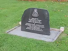
During the Cold War there was some nuclear weapons testing in the Kiritimati area. The United Kingdom conducted its first successful hydrogen bomb test at Malden Island on 15 May 1957 and used Kiritimati as the operation's main base.[19] This test did not work as planned, and the first British H-bomb was successfully detonated over the southeastern tip of Kiritimati on 8 November 1957. Subsequent tests in 1958 (Grapple Y and Z) took place above or near Kiritimati itself. The United States conducted 22 successful nuclear detonations of the island as part of Operation Dominic in 1962. Some toponyms (like Banana and Main Camp) come from the nuclear testing period, during which at times over 4,000 servicemen were present. By 1969, military interest in Kiritimati had ceased and the facilities were mostly dismantled. However, some communications, transport and logistics facilities were converted for civilian use which Kiritimati uses serve as the administrative center for the Line Islands.[1]
The United Kingdom detonated some 5 megatonnes of TNT (21 PJ) of nuclear payload near and 1.8 megatonnes of TNT (7.5 PJ) directly above Kiritimati in 1957/58, while the total yield of weapons tested by the United States in the vicinity of the island between 25 April and 11 July 1962 was 24 megatonnes of TNT (100 PJ). During the British Grapple X test, yield was stronger than expected and there was some blast damage in the settlements. Islanders were usually not evacuated during the nuclear weapons testing and data on the environmental and public health impact of these tests remains contested.
Present status
The island's population has strongly increased in recent years, from about 2,000 in 1989 to about 5,000 in the early 2000s. Kiritimati has three representatives in the Maneaba ni Maungatabu. Today there are five villages, four populated and one abandoned, on the island:
| No. | Village | Population (Census 2015) [20] |
|---|---|---|
| 1 | Tabwakea | 3,001 |
| 2 | London | 1,899 |
| 3 | Banana (Banana Wells) | 1,209 |
| 4 | Poland | 351 |
| 5 | Paris (ruins) | – |
| Christmas Island | 6,456 |
The main villages of Kiritimati are Banana, Tabwakea, and London, which are located along the main road on the northern tip of the island, and Poland, which is across the main lagoon to the South.[3] London is the main village and port facility. Banana is near Cassidy International Airport (IATA code CXI) but may be relocated closer to London to prevent contamination of its groundwater. The abandoned village of Paris is no longer listed in census reports.
The ministry of the Line and Phoenix islands is located in London. There are also two new high schools on the road between Tabwakea and Banana: one Catholic and one Protestant. The University of Hawaii has a climatological research facility on Kiritimati.[1] A Catholic church dedicated under the auspices of Saint Stanislaus and a primary school is located in Poland.
Transport and commerce
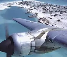
Cassidy International Airport is located just north of Banana and North East Point. It has a paved runway with a length of 6,900 feet (2,103 m) and was for some time the only airport in Kiribati to serve the Americas, via an Air Pacific (now Fiji Airways) flight to Honolulu, Hawaii. American Te Mauri Travel offers weekly charter flights from Honolulu.
Although Air Pacific hoped to commence on 25 May 2010 flying on a weekly schedule to Kiritimati Island from both Honolulu and Fiji, they cancelled reservations for those flights explaining that the runway is not suitable. Rebranded Fiji Airways has resumed services from Nadi and Honolulu to Kiritimati with one Boeing 737 service per week. A monthly air freight service is flown using a chartered Boeing 727 from Honolulu operated by Asia Pacific Airlines.[21]
The abandoned Aeon Field, constructed before the British nuclear tests, is located on the southeastern peninsula, northwest of South East Point.
In the early 1950s, Wernher von Braun proposed using this island as a launch site for manned spacecraft. There is a Japanese JAXA satellite tracking station; the abandoned Aeon Field had at one time been proposed for reuse by the Japanese for their now-canceled HOPE-X space shuttle project. Kiritimati is also located fairly close to the Sea Launch satellite launching spot at 0° N 154° W, about 370 kilometres (200 nmi) to the east in international waters.
Most of the atoll's food supplies have to be imported. Potable water can be in short supply, especially around November in La Niña years. A large and modern jetty, handling some cargo, was built by the Japanese at London. Marine fish provide a large portion of the island's nutrition, although overfishing has caused a drastic decrease in the populations of large, predatory fish over the last several years.[22]
Exports of the atoll are mainly copra (dried coconut pulp); the state-owned coconut plantation covers about 51 square kilometres (20 sq mi). In addition aquarium fish and seaweed are exported. A 1970s project to commercially breed Artemia salina brine shrimp in the salt ponds was abandoned in 1978. In recent years there have been attempts to explore the viability of live crayfish and chilled fish exports and salt production.[1]
Furthermore, there is a small amount of tourism, mainly associated with anglers interested in lagoon fishing (for bonefish in particular) or offshore fishing. Week-long ecotourism packages during which some of the normally closed areas can be visited are also available.[1] In recent years, surfers have discovered that there are good waves during the Northern Hemisphere's winter season and there are interests developing to service these recreational tourists.[23] There is some tourism-related infrastructure, such as a small hotel, rental facilities, and food services.
Geography
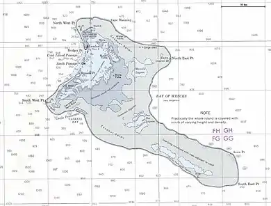
Kiritimati's roughly 320 km2 (120 sq mi) lagoon opens to the sea in the northwest; Burgle Channel (the entrance to the lagoon) is divided into the northern Cook Island Passage and the southern South Passage. The southeastern part of the lagoon is partially dried out today; essentially, progressing SE from Burgle Channel, the 160 km2 (62 sq mi) main lagoon gradually turns into a network of subsidiary lagoons, tidal flats, partially hypersaline brine ponds and salt pans, which as a whole has about the same area again as the main lagoon. Thus, the land and lagoon areas can only be given approximately, as no firm boundary exists between the main island body and the salt flats.[1] Vaskess Bay is a large bay which extends along the southwest coast of Kiritimati Island.
In addition to the main island, there are several smaller ones. Cook Island is part of the atoll proper but unconnected to the Kiritimati mainland. It is a sand/coral island of 19 ha (47 acres), divides Burgle Channel into the northern and the southern entrance, and has a large seabird colony. Islets (motus) in the lagoon include Motu Tabu (3.5 ha or 8.6 acres) with its Pisonia forest and the shrub-covered Motu Upua (also called Motu Upou or Motu Upoa, 19 ha or 47 acres) at the northern side, and Ngaontetaake (2.7 ha or 7 acres) at the eastern side.[1]
Joe's Hill (originally La colline de Joe) on the northcoast of the southeastern peninsula, southeast of Artemia Corners, is the highest point on the atoll, at about 13 m (43 ft) ASL.[1][24] On the northwestern peninsula for example, the land rises only to some 7 m (20 ft),[2] which is still considerable for an atoll.
Climate
Despite its proximity to the Intertropical Convergence Zone (ITCZ), Kiritimati is located in an equatorial dry zone and rainfall is rather low except during El Niño years; 873 mm (34.4 in) on average per year, in some years it can be as little as 177 mm (7.0 in) and much of the flats and ponds can dry up such as in late 1978. On the other hand, in some exceptionally wet years abundant downpours in March–April may result in a total annual precipitation of over 2,500 mm (98 in). Kiritimati is thus affected by regular, severe droughts. They are exacerbated by its geological structure; climatically "dry" Pacific islands are more typically located in the "desert belt" at about 30°N or S latitude. Kiritimati is a raised atoll, and although it does occasionally receive plenty of precipitation, little is retained given the porous carbonate rock, the thin soil, and the absence of dense vegetation cover on much of the island, while evaporation is constantly high.[2] Consequently, Kiritimati is one of the rather few places close to the Equator which have an effectively arid climate.[1]
The temperature is constantly between 24 °C and 30 °C (75 °F and 86 °F) with more diurnal temperature variation than seasonal variation. Easterly trade winds predominate.[1]
| Climate data for London, Kiritimati, Kiribati | |||||||||||||
|---|---|---|---|---|---|---|---|---|---|---|---|---|---|
| Month | Jan | Feb | Mar | Apr | May | Jun | Jul | Aug | Sep | Oct | Nov | Dec | Year |
| Record high °C (°F) | 32 (89) |
33 (91) |
33 (92) |
33 (92) |
34 (93) |
32 (90) |
32 (90) |
33 (91) |
33 (91) |
33 (92) |
33 (92) |
33 (91) |
34 (93) |
| Average high °C (°F) | 29 (85) |
29 (85) |
30 (86) |
30 (86) |
31 (87) |
31 (87) |
30 (86) |
31 (87) |
31 (87) |
31 (87) |
30 (86) |
30 (86) |
30 (86) |
| Daily mean °C (°F) | 27 (80) |
27 (80) |
27 (81) |
27 (81) |
27 (81) |
27 (81) |
27 (81) |
28 (82) |
27 (81) |
27 (81) |
27 (81) |
27 (80) |
27 (81) |
| Average low °C (°F) | 24 (75) |
24 (75) |
24 (76) |
24 (76) |
24 (76) |
24 (76) |
24 (76) |
25 (77) |
24 (76) |
24 (75) |
24 (76) |
24 (75) |
24 (76) |
| Record low °C (°F) | 19 (66) |
22 (71) |
22 (71) |
21 (70) |
23 (73) |
20 (68) |
22 (72) |
22 (71) |
21 (69) |
20 (68) |
19 (67) |
21 (69) |
19 (66) |
| Average precipitation mm (inches) | 25 (1.0) |
71 (2.8) |
64 (2.5) |
210 (8.1) |
89 (3.5) |
81 (3.2) |
51 (2.0) |
15 (0.6) |
2.5 (0.1) |
2.5 (0.1) |
7.6 (0.3) |
15 (0.6) |
633.6 (24.8) |
| Average precipitation days | 2.4 | 4.6 | 6.0 | 13.8 | 6.8 | 6.1 | 3.0 | 1.8 | 0.1 | 0.3 | 0.7 | 1.7 | 47.3 |
| Average relative humidity (%) | 77 | 80 | 80 | 83 | 81 | 80 | 78 | 75 | 74 | 74 | 73 | 75 | 78 |
| Source: Weatherbase [25] | |||||||||||||
Demography
At the first census done in the Gilbert and Ellice Islands colony in 1931, only 38 inhabitants were living on Christmas Island, most of them workers of the Emmanuel Rougier Company. Just after WWII, they were 52 inhabitants (1947). After the nuclear tests, they increased to 477 (1963). They were only 367, 5 years later, but 674 in 1973, starting a demographic grow without stop. In 1978, one year before the independence, they were 1,265 people, 1,737 in 1985 census, 2,537 in 1990, 3,225 in 1995, 3,431 in 2000, 5,115 in 2005, 5,586 in 2010 and 6,456 in 2015, the highest growing population of the whole Republic.
Ecology
The flora and the fauna consist of taxa adapted to drought. Terrestrial fauna is scant; there are no truly native land mammals and only one native land bird[26] – Kiribati's endemic reed-warbler, the bokikokiko (Acrocephalus aequinoctialis). The 1957 attempt to introduce the endangered Rimitara lorikeet (Vini kuhlii) has largely failed; a few birds seem to linger on, but the lack of abundant coconut palm forest, on which this tiny parrot depends, makes Kiritimati a suboptimal habitat for this species.
Flora
The natural vegetation on Kiritimati consists mostly of low shrubland and grassland. What little woodland exists is mainly open coconut palm (Cocos nucifera) plantation. There are three small woods of catchbird trees (Pisonia grandis), at Southeast Point, Northwest Point, and on Motu Tabu. The latter was planted there in recent times. About 50 introduced plant species are found on Kiritimati; as most are plentiful around settlements, former military sites and roads, it seems that these only became established in the 20th century.[1]
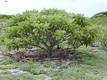
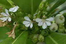
Beach naupaka (Scaevola taccada) is the most common shrub on Kiritimati; beach naupaka scrub dominates the vegetation on much of the island, either as pure stands or interspersed with tree heliotrope (Heliotropium foertherianum) and bay cedar (Suriana maritima). The latter species is dominant on the drier parts of the lagoon flats where it grows up to 2 m (6.6 ft) tall. Tree heliotrope is most commonly found a short distance from the sea- or lagoon-shore. In some places near the seashore, a low vegetation dominated by Polynesian heliotrope (Heliotropium anomalum), yellow purslane (Portulaca lutea) and common purslane (P. oleracea) is found. In the south and on the sandier parts, Sida fallax, also growing up to 2 m tall, is abundant. On the southeastern peninsula, S. fallax grows more stunted, and Polynesian heliotrope, yellow and common purslane as well as the spiderling Boerhavia repens, the parasitic vine Cassytha filiformis, and Pacific Island thintail (Lepturus repens) supplement it. The last species dominates in the coastal grasslands. The wetter parts of the lagoon shore are often covered by abundant growth of shoreline purslane (Sesuvium portulacastrum).[1]
Perhaps the most destructive of the recently introduced plants is sweetscent (Pluchea odorata), a camphorweed, which is considered an invasive weed as it overgrows and displaces herbs and grasses. The introduced creeper Tribulus cistoides, despite having also spread conspicuously, is considered to be more beneficial than harmful to the ecosystem, as it provides good nesting sites for some seabirds.[1]
Birds
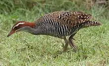
More than 35 bird species have been recorded from Kiritimati. As noted above, only the bokikokiko (Acrocephalus aequinoctialis), perhaps a few Rimitara lorikeets (Vini kuhlii) – if any remain at all – and the occasional eastern reef egret (Egretta sacra) make up the entire landbird fauna. About 1,000 adult bokikokikos are to be found at any date, but mainly in mixed grass/shrubland away from the settlements.[1]
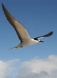
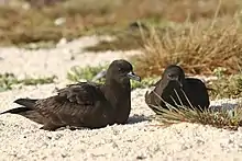
On the other hand, seabirds are plentiful on Kiritimati, and make up the bulk of the breeding bird population. There are 18 species of seabirds breeding on the island, and Kiritimati is one of the most important breeding grounds anywhere in the world for several of these:[1]
- Eastern red-tailed tropicbird (Phaethon rubricauda melanorhynchus[27]) – important breeding colony; 8,000 birds before the 1982/83 decline, fewer than 3,000 in 1984
- Micronesian black noddy (Anous minutus marcusi) – 20,000 birds before the 1982/83 decline
- Little white tern (Gygis microrhyncha[28]) – 8,000 birds before the 1982/83 decline
- Central Pacific sooty tern (Onychoprion fuscatus oahuensis[27]) – largest breeding colony in the world; around 7,000,000 birds before the 1982/83 decline
- Spectacled tern (Onychoprion lunatus) – important breeding colony; 6,000 birds before the 1982/83 decline
- Central blue-grey noddy (Procelsterna cerulea cerulea) – important breeding colony, possibly the largest worldwide of this subspecies; 4,000 birds before the 1982/83 decline
- Polynesian storm petrel (Nesofregetta fuliginosa) – important breeding colony; 1,000 birds before the 1982/83 decline
- Phoenix petrel (Pterodroma alba) – largest breeding colony in the world; 24,000 birds before the 1982/83 decline
- Christmas shearwater (Puffinus nativitatis) – largest subpopulation worldwide on Motu Upua; 12,000 birds before the 1982/83 decline
- Wedge-tailed shearwater (Puffinus pacificus[29]) – among the very largest breeding colonies in the world; about 1,000,000 birds before the 1982/83 decline
- Indopacific lesser frigatebird (Fregata ariel ariel) – important breeding colony; 9,000 birds before the 1982/83 decline
- Central Pacific great frigatebird (Fregata minor palmerstoni[27]) – important breeding colony; 12,000 birds before the 1982/83 decline, 6,500 afterwards
- Austropacific masked booby (Sula dactylatra personata) – important breeding colony; 3,000 birds before the 1982/83 decline
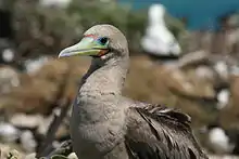
- Indopacific red-footed booby (Sula sula rubripes[27]) – 12,000 birds before the 1982/83 decline
Kiritimati's lagoon and the saltflats are a prime location for migratory birds to stop over or even stay all winter. The most commonly seen migrants are ruddy turnstone (Arenaria interpres), Pacific golden plover (Pluvialis fulva), bristle-thighed curlew (Numenius tahitiensis) and wandering tattler (Tringa incana); other seabirds, waders and even dabbling ducks can be encountered every now and then.[1] Around 7 October (± 5 days), some 20 million sooty shearwaters pass through here en route from the North Pacific feeding grounds to breeding sites around New Zealand.[30]
See also "Extinction" below.
Other fauna
The only mammals native to the region are the common Polynesian rat (Rattus exulans), and the goat. Indeed, the rat would seem to have been introduced by seafarers numerous centuries before Cook found Christmas Island in 1777 (he mentioned their existence), and the goat is extinct since 14 January 2004. Black rats (Rattus rattus) were present at some time, perhaps introduced by 19th century sailors or during the nuclear tests. They have not been able to gain a foothold between predation by cats and competitive exclusion by Polynesian rats, and no black rat population is found on Kiritimati today.[1]
Up to 2,000 feral cats can in some years be found on the island; the population became established in the 19th century. Their depredations seriously harm the birdlife. Since the late 19th century,[2] they have driven about 60% of the seabird species from the mainland completely, and during particular dry spells they will cross the mudflats and feast upon the birds on the motus. Spectacled tern chicks seem to be a favourite food of the local cat population. There are some measures being taken to ensure the cat population does not grow. That lowering the cat population by some amount would much benefit Christmas and its inhabitants is generally accepted, but the situation is too complex to simply go and eradicate them outright (which is theoretically possible; see Marion Island) – see below for details. A limited population of feral pigs exists. They were once plentiful and wreaked havoc especially on the Onychoprion and noddies. Pig hunting by locals has been encouraged, and was highly successful at limiting the pig population to a sustainable level, while providing a source of cheap protein for the islanders.[1]

There are some "supertramp" lizards which have reached the island by their own means. Commonly seen are the mourning gecko (Lepidodactylus lugubris) and the skink Cryptoblepharus boutonii; the four-clawed gecko (Gehyra mutilata) is less often encountered.[1]
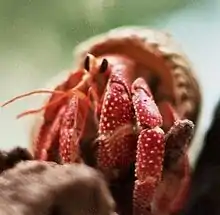
There are some crustaceans of note to be found on Kiritimati and in the waters immediately adjacent. The amphibious coconut crab (Birgus latro) is not as common as for example on Teraina. Ghost crabs (genus Ocypode), Cardisoma carnifex and Geograpsus grayi land crabs, the strawberry land hermit crab (Coenobita perlatus), and the introduced brine shrimp Artemia salina which populates the saline ponds are also notable.[1]
Ecology of the reef
Overfishing and pollution have impacted on the ocean surrounding the island. In the ocean surrounding uninhabited islands of the Northern Line Islands, Sharks comprised 74% of the top predator biomass (329 g m-2) at Kingman Reef and 57% at Palmyra Atoll (97 g m-2), whereas low shark numbers have been observed at Tabuaeran and Kiritimati.[31]
Green turtles (Chelonia mydas) regularly nest in small numbers on Kiritimati. The lagoon is famous among sea anglers worldwide for its bonefish (Albula glossodonta), and has been stocked with Oreochromis tilapia to decrease overfishing of marine species. Though the tilapias thrive in brackish water of the flats, they will not last long should they escape into the surrounding ocean.[1]
Giant Trevally (Caranx ignobilis) are found in large numbers both inside and outside of the lagoon and along the surrounding reefs. Very large specimens of Giant Trevally can be found around these surrounding reefs and they are sought after by many fishermen in addition to Bonefish.
Conservation and extinction
In December 1960, the British colonial authority gazetted Kiritimati as a bird sanctuary under the "Gilbert and Ellice Island Colony Wild Birds Protection Ordinance" of 1938. Access to Cook Island, Motu Tabu and Motu Upua was restricted. Kiritimati was declared a Wildlife Sanctuary in May 1975, in accordance with the Wildlife Conservation Ordinance of the then self-governing colony. Ngaontetaake and the sooty tern breeding grounds at North West Point also became restricted-access zones. Two years later, active conservation measures got underway.[1]
To a limited extent, permits to enter the restricted areas for purposes like research or small-scale ecotourism are given. Kiribati's Wildlife Conservation Unit participates in the Kiritimati Development Committee and the Local Land Planning Board, and there exists an integrated program of wildlife conservation and education. New Zealand is a major sponsor of conservation efforts on Kiritimati.[1]
Egg collecting for food on a massive scale was frequent in the past but is now outlawed. It is to be noted that the sooty terns for example could sustain occasional collection of effectively all of a season's eggs (over 10 million), if given sufficient time to recover and if cats are absent. Even egg collecting on a scale that significantly decreases costly food imports thus in theory could be possible, but not until the cat and rat populations have been brought under control. Poaching remains a concern; with the population rising and spreading out on Kiritimati, formerly remote bird colonies became more accessible and especially the red-tailed tropicbirds and the Sula are strongly affected by hunting and disturbance. Tropicbirds are mainly poached for their feathers which are used in local arts and handicraft; it would certainly be possible to obtain them from living birds as it was routinely done at the height of the Polynesian civilisation.[1]
It may seem that the erstwhile numbers of seabirds may only ever be approached again by the wholesale eradication of the feral cats. While this has been since shown to be feasible,[32] it is not clear whether even a severe curtailing of the cat population would be desirable. Though it previously was assumed that the small Polynesian rat is of little if any harm for seabirds, even house mice have been shown to eat seabird nestlings. Most nesting birds, in particularly Procellariiformes, are now accepted to be jeopardised by Rattus exulans. Kiritimati's cats are meanwhile very fond of young seabirds; it even seems that their behaviour has shifted accordingly, with cats being less territorial generally and congregating in numbers at active bird colonies, and generally eschewing rats when seabird chicks are in plenty.[1]
Possession of an unneutered female cat on Kiritimati is illegal, and owners need to prevent their domestic cats from running wild (such animals are usually quickly killed in traps set for this purpose). Nighttime cat hunting has made little effect on the cat population. As noted above, vigorous protecting of active nesting grounds from cats by traps, poison and supplemented by shooting while otherwise leaving them alone to hunt rats may well be the optimal solution.[1]
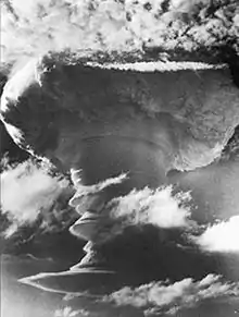
Grapple X Round C1, the first successful British hydrogen bomb test, detonates over Kiritimati's South East Point.
There is no reliable data on the environmental and public health impact of the nuclear tests conducted on the island in the late 1950s.[1] A 1975 study[33] claimed that there was negligible radiation hazard; certainly, fallout was successfully minimised. More recently however, a Massey University study of New Zealand found chromosomal translocations to be increased about threefold on average in veterans who participated in the tests;[34] most of the relevant data remains classified to date.
The 1982/83 "mega-El Niño" devastated seabird populations on Kiritimati. In some species, mortality rose to 90% and breeding success dropped to zero during that time.[1] In general, El Niño conditions will cause seabird populations to drop, taking several years to recover at the present density of predators. Global warming impact on Kiritimati is thus unpredictable. El Niño events seem to become shorter but more frequent in a warmer climate. Much of the island's infrastructure and habitation, with the notable exception of the airport area, is located to the leeward and thus somewhat protected from storms. A rising sea level does not appear to be particularly problematic; the increasing flooding of the subsidiary lagoons would provide easily observed forewarning, and might even benefit seabird populations by making the motus less accessible to predators. In fact, geological data suggests that Kiritimati has withstood prehistoric sea level changes well.[2][35] The biggest hazard caused by a changing climate would seem to be more prolonged and/or severe droughts, which could even enforce the island's abandonment as they did in 1905. However, it is not clear how weather patterns would change, and it may be that precipitation increases.
Extinction
The type specimen of the Tuamotu sandpiper (Prosobonia cancellata) was collected on Christmas Island in 1778, probably on 1 or 2 January, during Captain Cook's visit.[36] The expedition's naturalist William Anderson observed the bird, and it was painted by William Ellis (linked below). The single specimen was in Joseph Banks's collection at the end of the 18th century, but later was lost or destroyed. There is some taxonomic dispute regarding the Kiritimati population.[37][38] As all Prosobonia seem(ed) to be resident birds unwilling to undertake long-distance migrations, an appropriate treatment would be to consider the extinct population the nominate subspecies, as Prosobonia cancellata cancellata or Kiritimati sandpiper, distinct from the surviving Tuamotu Islands population more than 2,000 km (1,200 mi) to the southeast.
It may have been, but probably was not, limited to Kiritimati; while no remains have been found, little fieldwork has been conducted and judging from the Tuamotu sandpiper's habits, almost all Line Islands would have offered suitable habitat. The Kiritimati population of P. cancellata disappeared in the earlier part of the 19th century or so, almost certainly due to predation by introduced mammals. While Prosobonia generally manage to hold their own against Polynesian rats, they are highly vulnerable to the black rat and feral cats.[39] Given the uncertainties surrounding the introduction date and maximum population of the former, the cats seem to be the main culprits in the Kiritimati sandpiper's extinction.
Given that the island was apparently settled to some extent in prehistoric times, it may already have lost bird species then. The geological data indicates that Kiritimati is quite old, was never completely underwater in the Holocene at least, and thus it might have once harboured highly distinct wetland birds. The limited overall habitat diversity on Kiritimati nonetheless limits the range of such hypothetical taxa, as does biogeography due to its remote location. At least one, possibly several Gallirallus and/or Porzana rails make the most likely candidates, given their former presence in the region and that conditions on Kiritimati would seem well suited. Perhaps a Todiramphus kingfisher was also present; such a bird would probably have belonged to the sacred kingfisher (T. sanctus) group as that species today occurs as a vagrant in Micronesia, and related forms are resident in southeastern Polynesia. These birds would have fallen victim to the Polynesian rat and, in the case of the rails which would have almost certainly been flightless, hunting by natives.[35]
Education
There is a government high school, Melaengi Tabai Secondary School, which is located on Tabuaeran (though the government of Kiribati wished to re-open its campus on Kiritimati instead)[40] in addition to a Catholic senior high, St. Francis High School.[41]
See also
- List of Guano Island claims
- List of islands
- Bay of Wrecks
Notes and references
- Teeb'aki in Scott, Derek A. (1993): Republic of Kiribati Archived 30 August 2018 at the Wayback Machine. A Directory of Wetlands in Oceania, pp. 199–228. International Waterfowl and Wetlands Research Bureau, Slimbridge, U.K. and Asian Wetland Bureau, Kuala Lumpur, Malaysia.
- Streets, Thomas H. (1877). "Some Account of the Natural History of the Fanning Group of Islands". American Naturalist. 11 (2): 65–72. doi:10.1086/271824. JSTOR 2448050.
- "20. Kiritimati" (PDF). Office of Te Beretitenti - Republic of Kiribati Island Report Series. 2012. Archived (PDF) from the original on 14 July 2016. Retrieved 28 April 2015.
- Edward R. Lovell; Taratau Kirata; Tooti Tekinaiti (September 2002). "Status report for Kiribati's coral reefs" (PDF). Centre IRD de Nouméa. Archived from the original (PDF) on 18 May 2015. Retrieved 15 May 2015.
- https://journals.openedition.org/jso/pdf/1701
- A Chronological History of the Discoveries in the South Sea Or Pacific Ocean. Volume 1. Page 181-182 Author: James Burney. Editor: Printed by Luke Hansard, 1803
- Spate, Oskar Hermann Khristian (October 2008). "The Spanish Lake The Pacific since Magellan, Volume I; Chapter 4. Magellan's Successors: Loaysa to Urdaneta - Two failures: Grijalva and Villalobos". ANU Press. Archived from the original on 17 July 2014. Retrieved 28 April 2015.
- Maude, H.E. "Spanish discoveries in the Pacific" Journal of the Polynesian Society, Wellington, New Zealand, 1959, Volume 68, No. 4, p 296.
- Brand, Donald D. The Pacific Basin: A History of its Geographical Explorations The American Geographical Society, New York, 1967, p.122.
- Galvano, Antonio The Discoveries of the World, from their First Original unto the Year of our Lord 1555 Hakluyt Society, London, 1865, (Ser. I, no. 30).
- "Christmas Island History: Line Islands, Republic of Kiribati". Jane Resture. Archived from the original on 6 January 2017. Retrieved 27 January 2017.
- This is the first separately-issued map to depict Sandwich Islands (O-Why-hee) and Christmas Island: 2 panels of text, beneath the map, in both French and German, mention the discoveries and tell that Christmas Island was not inhabited. The text claims also that it is based on a map published in The Gentleman's Magazine of 1780. This previously map, from the Gentleman's Magazine, was published by Thomas Kitchin the elder, initially in July 1780. Tobias Conrad Lotter (1717-1777) was also an engraver. James Cook described it: "On the 24th, about half an hour after day-break, land was discovered bearing North East by East, half East. Upon a nearer approach, it was found to be one of those low islands so common in this ocean; that is, a narrow bank of land incloseing the sea within. A few cocoa-nut trees were seen in two or three places; but in general, the land has a very barren appearance. […] The meeting with Soundings determined me to anchor to try to get some turtle, as the island seemed to be a good place for them and to be without inhabitents." (Tome 2 of James Cook third voyage, p. 180).
- Robert Langdon (ed.) Where the whalers went; an ibdex to the Pacific ports and islands visited by American whalers (and some other ships) in the 19th century, Canberra, Pacific Manuscripts Bureau, 1984, p.149. ISBN 0-86784-471-X
- "FORMERLY DISPUTED ISLANDS". U.S. Department of the Interior, Office of Insular Affairs. Archived from the original on 30 September 2007.
- Boston Globe, (February 1920).
- Pastor y Santos, Emilio Territorios de Soberanía española en Oceanía, Instituto de Estudios Africanos, CSIC, Madrid, 1950
- Weaver, Zay Territories under Spanish Sovereignty in Oceania (partial translation of Pastor y Santos, Emilio Territorios de Soberanía española en Oceanía), Palau Museum, Koror, 1967
- "UK's Nuclear Deterrent". UK Hansard. 18 July 2016.
- Report on the Kiribati 2015 Census of Population and Housing. Vol 1: Basic Information and Tables. Part B: Personal (Population) Tables. Table 3: Population by Village, Sex and Age Group - 2015. S. 50.
- Asia Pacific Airlines – Flight Schedule Archived 11 July 2011 at the Wayback Machine. Flyapa.com. Retrieved on 2013-03-02.
- "Line Islands: A Gradient of Human Impact on Reefs". World Resources Institute. 23 September 2013. Retrieved 17 June 2020.
- MERRY CHRISTMAS ISLAND | Finding north swells in the South Pacific Archived 11 January 2010 at the Wayback Machine. Surfline.Com (8 January 2010). Retrieved on 2013-03-02.
- "Joe's Hill on OpenStreetMap". Retrieved 18 October 2020.
- "Weatherbase: Historical Weather for London, Kiribati". Weatherbase. 2011. Archived from the original on 11 June 2016. Retrieved 14 May 2016. Retrieved on 24 November 2011.
- In the strict sense, i.e. excluding the amphibious eastern reef egret
- Validity of subspecies disputed
- Usually included in Gygis alba
- Probably soon to be changed to Ardenna pacifica: Penhallurick, John; Wink, Michael (2004). "Analysis of the taxonomy and nomenclature of the Procellariformes based on complete nucleotide sequences of the mitochondrial cytochrome b gene". Emu. 104 (2): 125–147. doi:10.1071/MU01060.
- Shaffer, Scott A. (2006). "Migratory shearwaters integrate oceanic resources across the Pacific Ocean in an endless summer" (PDF). Proceedings of the National Academy of Sciences. 103 (34): 12799–802.
- Stuart A. Sandin; et al. (27 February 2008). "Baselines and Degradation of Coral Reefs in the Northern Line Islands". 3 (2) PLoS ONE. Archived from the original on 1 February 2017. Retrieved 27 January 2017.
- E.g. on remote and rugged subantarctic Marion Island with 290 km2 (110 sq mi) land area
- Wolman, David. "This place is the bomb". Salon. Archived from the original on 2 February 2017. Retrieved 30 January 2017.
- Massey University (2008): DNA damage to nuclear test vets prompts call for study of children. Version of 2008-JAN-15. Retrieved 25 March 2008.
- Steadman, David William (2006): Extinction and Biogeography of Tropical Pacific Birds. University of Chicago Press. p. 282 ISBN 0-226-77142-3
- Cook, James (1784): [Birds of Christmas Island]. In: A voyage to the Pacific Ocean, ... performed under the direction of Captains Cook, Clerke, and Gore, in His Majesty's Ships the Resolution and the Discovery, etc. 2: 188–189. London. JPEG fulltext of 2nd (1785) edition
- Townsend, Charles Haskins; Wetmore, Alexander (1919). "Reports on the scientific results of the expedition to the tropical Pacific in charge of Alexander Agassiz, on the U.S. Fish Commission steamer "Albatross", from August, 1899, to March, 1900, Commander Jefferson F. Moser, U.S.N., commanding". Bulletin of the Museum of Comparative Zoology. 63: 151–225.
- Zusi Richard L. & Jehl, Robert R. Jr.; Jehl (1970). "The systematic relationships of Aechmorhynchus, Prosobonia and Phegornis (Charadriiformes; Charadrii)" (PDF). Auk. 87 (4): 760–780. doi:10.2307/4083710. Archived (PDF) from the original on 4 March 2016. Retrieved 2 March 2013.
- BirdLife International (2007): Tuamotu Sandpiper Species Factsheet Archived 29 September 2007 at the Wayback Machine. Retrieved 24 February 2008.
- "VSA Assignment Description Assignment title English Language Trainer (of Trainers/ Teachers) Country Kiribati Archived 6 July 2018 at the Wayback Machine." Volunteer Service Abroad (Te Tūao Tāwāhi). Retrieved on 6 July 2018. p. 7.
- "TABITEUEA NORTH 2008 Socio-Economic Profile" Part 2 of 4 Archived 14 September 2018 at the Wayback Machine. Strengthening Decentralized Governance in Kiribati Project , Ministry of Internal and Social Affairs (Kiribati). p. 48 (PDF p. 13/15). Part 1 is here Archived 14 September 2018 at the Wayback Machine.
Further reading
- The Christmas Island Story, by Eric Bailey, published by Stacey International, 1977
- Paul Boulagnon (2003), Emmanuel Rougier: des Isles d'Auvergne à l'Océanie (Fidji, Tahiti, Christmas Island)
- Sheers, Owen 2008. "Bomb gone". Granta 101
External links
- Kiritimati: Official government report on the island's infrastructure, ecology and ongoing issues.
- Natural History Museum: William Ellis' plate 64 – the only Kiritimati Sandpiper specimen ever studied by scientists. Retrieved 15 October 2012.
- Photos of British nuclear tests off Christmas Island
- Various pictures of Kiritimati
- Kiribati National Tourism Office
| Gilbert Islands |  | |
|---|---|---|
| Phoenix Islands | ||
| Line Islands | ||
| West of Gilberts | ||
| Reefs | ||
| ||