Kronach (district)
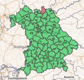
Kronach is a Landkreis (district) in Bavaria, Germany. It is bounded by (from the east and clockwise) the districts of Hof, Kulmbach, Lichtenfels and Coburg, and the state of Thuringia (districts of Sonneberg, Saalfeld-Rudolstadt and Saale-Orla).
Kronach | |
|---|---|
 Flag 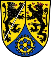 Coat of arms | |
| |
| Country | Germany |
| State | Bavaria |
| Adm. region | Upper Franconia |
| Capital | Kronach |
| Area | |
| • Total | 651 km2 (251 sq mi) |
| Population (31 December 2019)[1] | |
| • Total | 66,743 |
| • Density | 100/km2 (270/sq mi) |
| Time zone | UTC+01:00 (CET) |
| • Summer (DST) | UTC+02:00 (CEST) |
| Vehicle registration | KC |
| Website | landkreis-kronach.de |
History
Kronach was ruled by the bishopric of Bamberg from 1102 until 1803, when the clerical states of Germany were dissolved. Afterwards it fell to Bavaria, where the districts of Kronach and Teuschnitz were established on the territory of the present district. In 1931 these districts were merged in order to form the district of Kronach.
Geography
A large portion of the district is part of the Franconian Forest nature park. The Franconian Forest (German Frankenwald) is a hill chain rising to 795 metres (2,608 ft) To the southwest the country is sloping away. Several narrow rivers run southwards through the district in order to join the Main River beyond the district's borders, among them the Kronach River.
Coat of arms
Coat of arms |
The coat of arms displays:
|
Towns and municipalities

| Towns | Municipalities | |
|---|---|---|
References
- "Tabellenblatt "Daten 2", Statistischer Bericht A1200C 202041 Einwohnerzahlen der Gemeinden, Kreise und Regierungsbezirke". Bayerisches Landesamt für Statistik und Datenverarbeitung (in German). July 2020.
External links
| Wikimedia Commons has media related to Landkreis Kronach. |
- Official website (German)
Towns and municipalities in Kronach (district) | ||
|---|---|---|
Coat of Arms of Kronach district | ||
| Authority control |
|---|
