Traunstein (district)
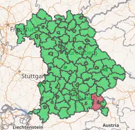
Traunstein is a Landkreis (district) in the southeastern part of Bavaria, Germany. Neighboring districts are (from the north clockwise) Mühldorf, Altötting, the Austrian states Upper Austria and Salzburg, the district Berchtesgadener Land, the Austrian states of Salzburg and Tyrol, and the district Rosenheim.
Traunstein | |
|---|---|
| |
| Country | Germany |
| State | Bavaria |
| Adm. region | Upper Bavaria |
| Capital | Traunstein |
| Area | |
| • Total | 1,533.92 km2 (592.25 sq mi) |
| Population (31 December 2019)[1] | |
| • Total | 177,319 |
| • Density | 120/km2 (300/sq mi) |
| Time zone | UTC+01:00 (CET) |
| • Summer (DST) | UTC+02:00 (CEST) |
| Vehicle registration | TS |
| Website | http://www.traunstein.com |
Geography
The district is located in the northern foothills of the Alps. The Chiemsee is located in the west of the district.
History
In 1972 the district was merged with parts of the former district Laufen, and the previously independent urban district Traunstein.
Coat of arms
 |
The coat of arms shows a blue panther to the left, the symbol of the Spanheim dynasty of the Counts of Krainburg-Ortenburg, who owned part of the area in medieval times. The eagle in the top-right derives from the diocese of Chiemsee. In the bottom right there are the Canting Arms of Baumburg Abbey (Baumburg translates to tree-castle), which ruled most of the northern part of the district. |
Towns and municipalities
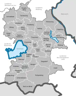
Towns and municipalities in Landkreis Traunstein
|
Towns Markt ¹ administrated inside a
|
Municipalities
|
References
- "Tabellenblatt "Daten 2", Statistischer Bericht A1200C 202041 Einwohnerzahlen der Gemeinden, Kreise und Regierungsbezirke". Bayerisches Landesamt für Statistik und Datenverarbeitung (in German). July 2020.
External links
| Wikimedia Commons has media related to Landkreis Traunstein. |
- Official website (German)
| Authority control |
|---|
This article is issued from Wikipedia. The text is licensed under Creative Commons - Attribution - Sharealike. Additional terms may apply for the media files.