List of listed buildings in Aberfoyle, Stirling
List
| Name | Location | Date Listed | Grid Ref. [note 1] | Geo-coordinates | Notes | LB Number [note 2] | Image |
|---|---|---|---|---|---|---|---|
| Achray Farm, Near Bridge Of Michael, Loch Achray | 56°13′37″N 4°22′22″W | Category B | 6592 |  | |||
| Aberfoyle, Bridge Over River Forth | 56°10′40″N 4°23′08″W | Category B | 4207 | | |||
| Brig O'Michael Over Black Water | 56°13′38″N 4°22′07″W | Category C(S) | 4156 | | |||
| Aberfoyle, Nos 1, 2, 3 And 4 Station Cottages | 56°10′39″N 4°22′44″W | Category C(S) | 50291 | | |||
| Milepost At Nn44618/02702 | 56°11′29″N 4°30′20″W | Category C(S) | 50302 | | |||
| Aberfoyle, Main Street, Nos 1-6 Inclusive Craiguchty Terrace Including Outhouses | 56°10′43″N 4°22′50″W | Category B | 4209 | | |||
| Aberfoyle, Breaval Farmhouse | 56°10′22″N 4°21′49″W | Category C(S) | 4212 | | |||
| Milton, The Corn Mill (Formerly Known As Milton Mill) | 56°10′53″N 4°24′47″W | Category C(S) | 4216 | | |||
| Dun Dhu (Also Known As Dun Dubh Or Mell Mhor) | 56°10′56″N 4°26′46″W | Category C(S) | 4219 | | |||
| Loch Katrine Tunnel Ventilation Shaft Enclosures And Sighting Pillars (Former Glasgow Corporation Water Works) | 56°10′37″N 4°30′14″W | Category C(S) | 4150 | | |||
| Loch Arklet Aqueduct Intake Including Railings, Gates And Walls (Former Glasgow Corporation Water Works) | 56°15′02″N 4°35′32″W | Category B | 50297 | | |||
| Milepost At Nn41967/06185 | 56°13′19″N 4°33′01″W | Category C(S) | 50301 | | |||
| Milepost At Nn50481/01369 | 56°10′53″N 4°24′38″W | Category C(S) | 50305 | | |||
| The Pass Including Gates, Gatepiers And Wing Walls | 56°11′02″N 4°25′38″W | Category B | 50309 | | |||
| Aberfoyle, Old Parish Church And Burial Ground Including Boundary Walls, Gatepiers And Gates | 56°10′27″N 4°23′17″W | Category B | 4206 | | |||
| Aberfoyle, St Mary's Episcopal Church | 56°10′44″N 4°22′47″W | Category C(S) | 4208 | | |||
| Aberfoyle, Lochard Road, Primary School Including Schoolhouse And Boundary Walls | 56°10′50″N 4°23′35″W | Category B | 4215 | | |||
| Duchray Valley, Valve House, Also Known As Basin House (Former Glasgow Corporation Water Works) | 56°09′50″N 4°28′56″W | Category B | 4154 | | |||
| Tom-An-Eas Aqueduct Bridge Over Duchray Water Including Ventilation Shafts (Former Glasgow Corporation Water Works) | 56°10′20″N 4°30′59″W | Category C(S) | 50293 | | |||
| Milepost At Nn40347/08862 | 56°14′43″N 4°34′41″W | Category C(S) | 50299 | | |||
| Milepost Near Nn47640/01951 | 56°11′09″N 4°27′24″W | Category C(S) | 50306 | | |||
| Glen Finglas Dam And Hydro-Electric Power Station (Former Glasgow Corporation Water Works) | 56°14′27″N 4°22′25″W | Category C(S) | 51151 | | |||
| Loch Katrine, Royal Cottage, Including Outbuildings, Jetty And Boathouse | 56°14′50″N 4°32′50″W | Category C(S) | 4149 | | |||
| Couligartan Aqueduct Bridge No 1 (Former Glasgow Corporation Water Works) | 56°09′49″N 4°30′51″W | Category A | 4151 | | |||
| Couligartan Aqueduct Bridge No 2 (Former Glasgow Corporation Water Works) | 56°10′18″N 4°29′58″W | Category A | 4152 | | |||
| Couligartan Aqueduct Bridge No 3 (Former Glasgow Corporation Water Works) | 56°09′28″N 4°27′52″W | Category A | 4153 | | |||
| River Duchray Aqueduct Pipe Bridges (Former Glasgow Corporation Water Works) Including Railings And Gates | 56°09′43″N 4°28′34″W | Category A | 4155 | | |||
| Loch Ard, Creag-Ard House (Formerly Known As Craigard), Including Walls, Gates And Dovecot | 56°10′59″N 4°25′02″W | Category C(S) | 50294 | | |||
| Loch Katrine, Royal Cottage Aqueduct Intakes Including Retaining Walls And Railings (Former Glasgow Corporation Water Works) | 56°14′52″N 4°32′54″W | Category A | 50298 | | |||
| Milepost At Nn49049/01624 | 56°11′00″N 4°26′01″W | Category C(S) | 50304 | | |||
| Milton Of Aberfoyle, Jean Mcalpine's Inn | 56°10′55″N 4°24′47″W | Category B | 43026 | | |||
| Loch Ard, Cuilvona Including Boundary Walls, Gatepiers And Railings | 56°11′04″N 4°25′19″W | Category C(S) | 50295 | | |||
| Milton, Corrienessan Coach House Including Boundary Walls, Hand Gate And Cobbled Yard | 56°10′54″N 4°24′57″W | Category C(S) | 50307 | | |||
| Stronachlachar, Loch Arklet To Loch Katrine Aqueduct Outlet, Weirs And Water Channel With Railings And Gates (Former Glasgow Corporation Water Works) | 56°15′09″N 4°34′41″W | Category B | 50308 | | |||
| Clashmore Tunnel Ventilation Shaft Enclosures And Sighting Pillar (Former Glasgow Corporation Water Works) | 56°08′36″N 4°26′24″W | Category C(S) | 51149 | | |||
| Dow Of Chon, Loch Chon Aqueduct No 3 (Former Glasgow Corporation Water Works) | 56°12′25″N 4°32′47″W | Category C(S) | 51284 | | |||
| Lochard Road, Corrienessan Including Gatepiers And Wingwalls | 56°10′56″N 4°25′01″W | Category B | 4147 | | |||
| Aberfoyle, Creag Mhor | 56°10′55″N 4°23′58″W | Category C(S) | 50288 | | |||
| Blairuskin Sighting Pillar (Former Glasgow Corporation Water Works) | 56°11′29″N 4°31′28″W | Category C(S) | 51148 | | |||
| Aberfoyle, Queen Elizabeth Forest Visitor Centre, David Marshall Lodge And Cottage | 56°10′57″N 4°23′09″W | Category B | 4210 | | |||
| Loch Ard, Dundarroch | 56°11′00″N 4°25′13″W | Category C(S) | 4217 | | |||
| Aberfoyle, Main Street, A2Z And The Clachan Hotel | 56°10′43″N 4°23′01″W | Category B | 50129 | | |||
| Aberfoyle, Main Street And Trossachs Road, The Bank House, Hbos, Trossachs Gate, Basil's, Liz Macgregor's, Photograph Scotland And The Post Office | 56°10′44″N 4°23′03″W | Category C(S) | 50290 | | |||
| Milepost At Nn46135/02255 | 56°11′17″N 4°28′51″W | Category C(S) | 50303 | | |||
| Couligartan Aqueduct Overflow Or Outlet Incorporating Bridge (Former Glasgow Corporation Water Works) | 56°10′00″N 4°29′33″W | Category B | 51150 | | |||
| Gartmore Station, Cobleland Bridge Over River Forth | 56°09′31″N 4°21′57″W | Category B | 4211 | | |||
| Aberfoyle New Parish Church (Church Of Scotland) Including Bell, War Memorial, Boundary Walls And Gatepiers | 56°10′52″N 4°23′42″W | Category B | 4214 | | |||
| Teapot Bridge Over Allt Tairbh | 56°11′41″N 4°30′58″W | Category C(S) | 4148 | | |||
| Aberfoyle, Kirkton Cottage Including Boundary Walls | 56°10′27″N 4°23′20″W | Category C(S) | 50289 | | |||
| Loch Ard, Ledard Farm, Old Barn | 56°11′27″N 4°28′58″W | Category C(S) | 50296 | | |||
| Milepost At Nn41334/07640 | 56°14′05″N 4°33′41″W | Category C(S) | 50300 | | |||
| Loch Katrine, Achray Dam Including Sluices, Weir, Fish Ladder And Railings (Former Glasgow Corporation Water Works) | 56°13′45″N 4°26′16″W | Category C(S) | 51285 | 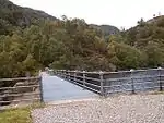 |
Key
The scheme for classifying buildings in Scotland is:
- Category A: "buildings of national or international importance, either architectural or historic; or fine, little-altered examples of some particular period, style or building type."[1]
- Category B: "buildings of regional or more than local importance; or major examples of some particular period, style or building type, which may have been altered."[1]
- Category C: "buildings of local importance; lesser examples of any period, style, or building type, as originally constructed or moderately altered; and simple traditional buildings which group well with other listed buildings."[1]
In March 2016 there were 47,288 listed buildings in Scotland. Of these, 8% were Category A, and 50% were Category B, with the remaining 42% being Category C.[2]
Notes
- Sometimes known as OSGB36, the grid reference (where provided) is based on the British national grid reference system used by the Ordnance Survey.
• "Guide to National Grid". Ordnance Survey. Retrieved 2007-12-12.
• "Get-a-map". Ordnance Survey. Retrieved 2007-12-17. - Historic Environment Scotland assign a unique alphanumeric identifier to each designated site in Scotland, for listed buildings this always begins with "LB", for example "LB12345".
References
- All entries, addresses and coordinates are based on data from Historic Scotland. This data falls under the Open Government Licence
- "What is Listing?". Historic Environment Scotland. Retrieved 29 May 2018.
- Scotland's Historic Environment Audit 2016 (PDF). Historic Environment Scotland and the Built Environment Forum Scotland. pp. 15–16. Retrieved 29 May 2018.
This article is issued from Wikipedia. The text is licensed under Creative Commons - Attribution - Sharealike. Additional terms may apply for the media files.