List of listed buildings in Stirling, Stirling
List
| Name | Location | Date Listed | Grid Ref. [note 1] | Geo-coordinates | Notes | LB Number [note 2] | Image |
|---|---|---|---|---|---|---|---|
| 52 And 54 Baker Street | 56°07′11″N 3°56′24″W | Category C(S) | 45368 |  | |||
| 60 Baker Street | 56°07′11″N 3°56′25″W | Category C(S) | 45370 | | |||
| Snowdon Place 9 Department Of The Environment | 56°06′40″N 3°56′27″W | Category C(S) | 41474 | | |||
| Torbrex 4 Torbrex Village | 56°06′20″N 3°56′54″W | Category C(S) | 41486 | | |||
| 9 Upper Bridge Street, Bellfield House Including Boundary Walls And Garden Steps | 56°07′25″N 3°56′35″W | Category B | 41489 | | |||
| Upper Bridge Street 30 (E Side) | 56°07′25″N 3°56′29″W | Category C(S) | 41494 | | |||
| Victoria Place 22, 23 | 56°06′56″N 3°56′46″W | Category C(S) | 41511 | | |||
| Victoria Place 37, 38 | 56°06′50″N 3°56′42″W | Category C(S) | 41515 | | |||
| Victoria Square 5, 7 | 56°07′00″N 3°56′44″W | Category C(S) | 41517 | | |||
| Victoria Square 17, 19 | 56°07′03″N 3°56′49″W | Category C(S) | 41521 | | |||
| Park Place Rockdale Lodge | 56°06′41″N 3°57′14″W | Category B | 41387 | | |||
| Park Place 8 Ashfield House | 56°06′43″N 3°57′07″W | Category C(S) | 41393 | | |||
| Park Terrace, 25, 26 And 2 Drummond Place | 56°06′46″N 3°56′43″W | Category B | 41403 | | |||
| Park Terrace, 29, 30, 31 | 56°06′46″N 3°56′46″W | Category B | 41405 | | |||
| Pitt Terrace, 12, 13 | 56°06′51″N 3°56′16″W | Category B | 41415 | | |||
| Port Street 83-91 | 56°06′57″N 3°56′13″W | Category C(S) | 41422 | | |||
| Princes Street 14, 16 | 56°07′15″N 3°56′21″W | Category C(S) | 41433 | | |||
| Queen Street 19 (S. Side) | 56°07′21″N 3°56′24″W | Category B | 41437 | | |||
| Queen Street 2, 4 (N. Side) And 1, 3, 5 Cowane Street Royal Hotel | 56°07′21″N 3°56′21″W | Category B | 41441 | | |||
| Queen Street 6, 8 (N. Side) | 56°07′21″N 3°56′21″W | Category B | 41442 | | |||
| Queen Street 38, 40 (N. Side) | 56°07′23″N 3°56′26″W | Category B | 41450 | | |||
| Queens Road 2 | 56°07′05″N 3°56′53″W | Category C(S) | 41453 | | |||
| 35 And 37 St John Street | 56°07′14″N 3°56′37″W | Category C(S) | 41463 | | |||
| St Ninians Road Annfield (At Rear Of Stirling Albion F C Ground) | 56°06′41″N 3°56′09″W | Category B | 41470 | | |||
| Snowdon Place 3, 5 | 56°06′42″N 3°56′22″W | Category B | 41472 | | |||
| Forth Place 9, 11 | 56°07′18″N 3°56′08″W | Category B | 41288 | | |||
| Forth Place 13, 15 | 56°07′19″N 3°56′07″W | Category B | 41289 | | |||
| Friars Street 33 | 56°07′10″N 3°56′17″W | Category B | 41294 | | |||
| Gladstone Place 13, 15 | 56°06′44″N 3°56′27″W | Category C(S) | 41299 | | |||
| Glebe Avenue 18, 19 | 56°06′58″N 3°56′27″W | Category C(S) | 41306 | | |||
| Glebe Crescent 7 Syha Offices | 56°06′55″N 3°56′27″W | Category C(S) | 41310 | | |||
| Glebe Crescent 2 And 1 Windsor Place | 56°06′57″N 3°56′30″W | Category C(S) | 41311 | | |||
| Glebe Crescent 4, 6 | 56°06′57″N 3°56′30″W | Category C(S) | 41312 | | |||
| Glebe Crescent 12, 14 | 56°06′55″N 3°56′30″W | Category C(S) | 41314 | | |||
| Hillfoots Road 12-18 | 56°08′24″N 3°55′21″W | Category B | 41316 | | |||
| Irvine Place 2 | 56°07′18″N 3°56′23″W | Category B | 41319 | | |||
| King Street 13, 15 | 56°07′04″N 3°56′14″W | Category B | 41326 | | |||
| King Street 17, 19 | 56°07′04″N 3°56′15″W | Category B | 41327 | | |||
| King Street 43, 45 | 56°07′04″N 3°56′17″W | Category B | 41332 | | |||
| King Street 53, 55, 57, 59 | 56°07′05″N 3°56′18″W | Category C(S) | 41334 | | |||
| King Street 40 | 56°07′06″N 3°56′17″W | Category B | 41341 | | |||
| Lower Bridge Street 43-47 | 56°07′35″N 3°56′30″W | Category C(S) | 41347 | | |||
| Melville Terrace 6 | 56°06′50″N 3°56′20″W | Category B | 41353 | | |||
| Melville Terrace 8, 9 | 56°06′48″N 3°56′21″W | Category B | 41355 | | |||
| Murray Place 1 And 2 King Street British Linen Bank | 56°07′04″N 3°56′13″W | Category B | 41363 | | |||
| Murray Place 9, 11 | 56°07′05″N 3°56′12″W | Category B | 41365 | | |||
| Murray Place, 77, 79 | 56°07′10″N 3°56′15″W | Category B | 41366 | | |||
| North Street, 1 Maple Cottage Cambuskenneth | 56°07′30″N 3°55′20″W | Category C(S) | 41369 | | |||
| North Street, 3 Ferry Orchard House Cambuskenneth | 56°07′31″N 3°55′19″W | Category C(S) | 41370 | | |||
| Park Avenue 3, 4 | 56°06′54″N 3°56′23″W | Category C(S) | 41377 | | |||
| Park Place 11, 13 | 56°06′41″N 3°57′06″W | Category B | 41384 | | |||
| Stirling Arcade 1-43, 2-50 And 32, 34 King Street Including The Former Douglas Hotel Fronting Murray Place, Former Alhambra Theatre | 56°07′06″N 3°56′16″W | Category B | 41204 | | |||
| 4 And 6 Baker Street | 56°07′08″N 3°56′19″W | Category C(S) | 41214 | | |||
| 24 And 26 Baker Street | 56°07′09″N 3°56′21″W | Category C(S) | 41219 | | |||
| Barnton Street 1, 3, 7 And 35 Friars Street | 56°07′11″N 3°56′17″W | Category B | 41229 | | |||
| 26 Berkeley Street (Also Fronts Weaver Row And Williamfield Avenue), Williamfield | 56°06′13″N 3°56′31″W | Category C(S) | 41236 | | |||
| Clarendon Place 9, 11 | 56°07′00″N 3°56′38″W | Category B | 41260 | | |||
| Clifford Road 12, 13 | 56°06′33″N 3°56′20″W | Category C(S) | 41271 | | |||
| Clifford Road Gatepiers | 56°06′33″N 3°56′22″W | Category C(S) | 41272 | | |||
| Cowane Street 13-23 | 56°07′22″N 3°56′21″W | Category C(S) | 41273 | | |||
| Town Wall Port Street Bastion | 56°07′01″N 3°56′09″W | Category C(S) | 41114 | | |||
| Monument to Robert Burns, Dumbarton Road | 56°07′04″N 3°56′26″W | Category B | 41121 | 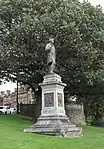 | |||
| Cowane Centre (Central Single Storey Section Only) Formerly Territorial Primary School, Cowane St | 56°07′29″N 3°56′27″W | Category C(S) | 41132 | | |||
| Stirling Castle Great Hall (1503) | 56°07′27″N 3°56′52″W | Category A | 41139 | .jpg.webp) | |||
| Stirling Castle Kings Park Wall | 56°06′57″N 3°57′22″W | Category B | 41147 | | |||
| Westerlands (Formerly Wester Livilands) Clifford Road | 56°06′32″N 3°56′04″W | Category B | 41150 | | |||
| Kerse Road, Former Kerse Corn Mill | 56°06′48″N 3°55′37″W | Category B | 41153 | | |||
| Abercromby Place 7, 9 | 56°07′00″N 3°56′31″W | Category C(S) | 41156 | | |||
| Abercromby Place 13 | 56°07′00″N 3°56′34″W | Category C(S) | 41158 | | |||
| Allan Park 17 (E. Side) | 56°06′58″N 3°56′21″W | Category B | 41194 | | |||
| Allan Park 2, 4, 6 (W. Side) | 56°07′01″N 3°56′21″W | Category B | 41197 | | |||
| Allan Park 16 (W. Side) | 56°06′59″N 3°56′24″W | Category B | 41200 | | |||
| 21, 23, 25, Baker Street | 56°07′08″N 3°56′22″W | Category C(S) | 49656 | | |||
| 74 Baker Street | 56°07′12″N 3°56′28″W | Category B | 45373 | | |||
| 1 Bow Street | 56°07′13″N 3°56′31″W | Category C(S) | 45376 | | |||
| 3 Bow Street | 56°07′13″N 3°56′31″W | Category C(S) | 45378 | | |||
| 6 And 8 Bow Street | 56°07′13″N 3°56′30″W | Category B | 45382 | | |||
| Snowdon Place 2, 4 | 56°06′43″N 3°56′22″W | Category C(S) | 41476 | | |||
| Southfield Crescent 1 And 16, 18 Gladstone Place | 56°06′46″N 3°56′30″W | Category C(S) | 41480 | | |||
| Victoria Place 3, 5 | 56°07′05″N 3°56′45″W | Category C(S) | 41504 | | |||
| Victoria Place 17, 18 | 56°06′58″N 3°56′49″W | Category B | 41508 | | |||
| Victoria Place 19, 20 | 56°06′57″N 3°56′48″W | Category B | 41509 | | |||
| Victoria Place 24, 25 | 56°06′55″N 3°56′45″W | Category C(S) | 41512 | | |||
| Victoria Square 9 | 56°07′00″N 3°56′46″W | Category C(S) | 41518 | | |||
| Victoria Square 11 And 11 Victoria Place | 56°07′00″N 3°56′48″W | Category C(S) | 41519 | | |||
| Victoria Square 13, 15 | 56°07′02″N 3°56′50″W | Category C(S) | 41520 | | |||
| 1-10 (Inclusive Nos) Viewfield Place With Boundary Walls | 56°07′19″N 3°56′18″W | Category B | 41526 | | |||
| Park Place 31-35 The Shieling | 56°06′42″N 3°57′17″W | Category C(S) | 41388 | | |||
| Park Place 6 | 56°06′42″N 3°57′06″W | Category C(S) | 41392 | | |||
| Park Terrace, 22, 23, 24 | 56°06′47″N 3°56′40″W | Category B | 41402 | | |||
| Park Terrace 27, 28 | 56°06′46″N 3°56′44″W | Category B | 41404 | | |||
| Park Terrace 33 | 56°06′45″N 3°56′49″W | Category B | 41407 | | |||
| Port Street 69-73 | 56°06′58″N 3°56′12″W | Category C(S) | 41420 | | |||
| Port Street 75-81 | 56°06′58″N 3°56′13″W | Category C(S) | 41421 | | |||
| Port Street 16, 18, 20 | 56°07′02″N 3°56′13″W | Category B | 41424 | | |||
| Princes Street 15, 17 | 56°07′15″N 3°56′22″W | Category C(S) | 41431 | | |||
| Queen Street 7, 9 (S. Side) | 56°07′20″N 3°56′22″W | Category B | 41434 | | |||
| Queen Street 11, 13 (S. Side) | 56°07′20″N 3°56′23″W | Category B | 41435 | | |||
| Queen Street 23-29 (S. Side) (Odd Nos) | 56°07′22″N 3°56′26″W | Category B | 41439 | | |||
| Queen Street 20, 22 (N. Side) | 56°07′22″N 3°56′23″W | Category B | 41445 | | |||
| Queen Street 42, 44 (N. Side) | 56°07′24″N 3°56′27″W | Category B | 41451 | | |||
| Queens Road 5, 6 | 56°07′01″N 3°56′52″W | Category C(S) | 41456 | | |||
| Forth Place 5, 7 | 56°07′18″N 3°56′08″W | Category B | 41287 | | |||
| Gladstone Place 17 And 12 Snowdon Place Including Boundary Wall And Railings | 56°06′43″N 3°56′28″W | Category C(S) | 41300 | | |||
| Glebe Avenue 16, 17 | 56°06′59″N 3°56′27″W | Category C(S) | 41305 | | |||
| King Street 1 And 4, 6, 8 Port Street | 56°07′03″N 3°56′13″W | Category B | 41324 | | |||
| King Street 37, 39, 41 | 56°07′04″N 3°56′17″W | Category C(S) | 41331 | | |||
| Lower Bridge Street 1-9 | 56°07′32″N 3°56′30″W | Category C(S) | 41346 | | |||
| Melville Terrace 3 Child Guidance Centre, Stirling District Council | 56°06′53″N 3°56′18″W | Category B | 41350 | | |||
| Melville Terrace 5 | 56°06′51″N 3°56′20″W | Category B | 41352 | | |||
| Melville Terrace 10 | 56°06′47″N 3°56′21″W | Category B | 41356 | | |||
| Melville Terrace 11, 12 | 56°06′46″N 3°56′21″W | Category B | 41357 | | |||
| Melville Terrace 13, 14 | 56°06′44″N 3°56′21″W | Category B | 41358 | | |||
| Melville Terrace 15, 16 | 56°06′43″N 3°56′21″W | Category B | 41359 | | |||
| Melville Terrace 19 | 56°06′41″N 3°56′21″W | Category B | 41361 | | |||
| Murray Place 16-24 | 56°07′05″N 3°56′10″W | Category B | 41367 | | |||
| North Street, 31 Thistle Cottage Cambuskenneth | 56°07′31″N 3°55′09″W | Category C(S) | 41372 | | |||
| Allan Park 24 (South End) | 56°06′56″N 3°56′24″W | Category B | 41203 | | |||
| 27 And 29 Baker Street | 56°07′09″N 3°56′22″W | Category C(S) | 41208 | | |||
| 28 And 30 Baker Street | 56°07′09″N 3°56′21″W | Category C(S) | 41220 | | |||
| Balmoral Place 1 And 8 Victoria Place | 56°07′04″N 3°56′49″W | Category C(S) | 41222 | | |||
| 5 Bank Street And 52 Spittal Street | 56°07′09″N 3°56′25″W | Category C(S) | 41227 | | |||
| Barn Road 30 | 56°07′25″N 3°56′37″W | Category C(S) | 41228 | | |||
| 2-24 (Even Nos) Barnton Street And Maxwell Place | 56°07′13″N 3°56′16″W | Category C(S) | 41233 | | |||
| 16 (Part) And 18 Bow Street, Erskine Of Gogar's House (Commonly Known As Darnley's House) | 56°07′14″N 3°56′30″W | Category A | 41239 | | |||
| Drummond Place 4, 6 | 56°06′45″N 3°56′41″W | Category C(S) | 41276 | | |||
| Drummond Place 8, 10 | 56°06′45″N 3°56′39″W | Category C(S) | 41277 | | |||
| 32, 34 Albert Place | 56°07′07″N 3°56′43″W | Category C(S) | 41281 | | |||
| Esplanade And Upper Castlehill, Landmark Visitor Centre (Former Castle Hotel) | 56°07′22″N 3°56′41″W | Category B | 41284 | | |||
| St. Ninians Old Parish Kirk Kirkyard | 56°06′10″N 3°56′15″W | Category A | 41096 | | |||
| South Church 67 Murray Place | 56°07′09″N 3°56′14″W | Category B | 41098 | | |||
| Albert Hall 24 Dumbarton Road | 56°07′05″N 3°56′31″W | Category B | 41099 | | |||
| Cowane's Hospital Sundial | 56°07′13″N 3°56′41″W | Category B | 41102 | | |||
| Post Office 84 Murray Place | 56°07′11″N 3°56′14″W | Category B | 41106 | | |||
| Black Boy Fountain, Allan Park | 56°06′55″N 3°56′17″W | Category B | 41123 | 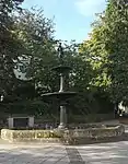 | |||
| St. Ninian's Well Wellgreen | 56°06′53″N 3°56′11″W | Category B | 41124 | | |||
| Beheading Stone Gowanhill | 56°07′40″N 3°56′34″W | Category C(S) | 41125 | | |||
| Stirling Railway Station, Station Road, With North And Middle Signal Boxes And Associated Semaphore Signals | 56°07′11″N 3°56′08″W | Category A | 41131 |  | |||
| St Thomas' Well Farmhouse | 56°06′53″N 3°57′55″W | Category B | 41151 | | |||
| Springkerse Springkerse House | 56°06′51″N 3°55′29″W | Category C(S) | 41152 | | |||
| Abercromby Place 15 | 56°07′00″N 3°56′35″W | Category C(S) | 41159 | | |||
| Abercromby Place 10 | 56°07′01″N 3°56′32″W | Category C(S) | 41164 | | |||
| Airthrey Road 22, 24 | 56°08′21″N 3°55′28″W | Category C(S) | 41167 | | |||
| Albert Place 8 | 56°07′04″N 3°56′34″W | Category B | 41175 | | |||
| Albert Place 9 | 56°07′04″N 3°56′35″W | Category B | 41176 | | |||
| Albert Place 15 | 56°07′06″N 3°56′42″W | Category B | 41182 | | |||
| Albert Place 18 And 1 Victoria Place | 56°07′06″N 3°56′45″W | Category B | 41184 | | |||
| Allan Park 1-9 (E. Side) (Odd Nos.) | 56°07′01″N 3°56′19″W | Category B | 41191 | | |||
| Allan Park 21 Allan Park House | 56°06′57″N 3°56′19″W | Category B | 41196 | | |||
| Allan Park 8, 10 (W. Side) | 56°07′00″N 3°56′22″W | Category B | 41198 | | |||
| Methodist Church 19-1/2 Queen Street | 56°07′21″N 3°56′24″W | Category B | 41091 | | |||
| St Mary's Parish Hall, Irvine Place And 17 Irvine Place (Formerly Trinity Rc Chapel) | 56°07′19″N 3°56′27″W | Category C(S) | 41094 | | |||
| St Ninians Road, Earlsgate House Including Boundary Walls To S, W And N | 56°06′35″N 3°56′19″W | Category B | 49533 | | |||
| 60, 62, 64, 66, 68 Murray Place | 56°07′10″N 3°56′13″W | Category C(S) | 50203 | | |||
| 1, 3 And 5 Kirk Wynd And 31A And 31B Main Street, St Ninians | 56°06′09″N 3°56′18″W | Category C(S) | 41344 | | |||
| 76 Baker Street | 56°07′12″N 3°56′29″W | Category C(S) | 45374 | | |||
| 32 Spittal Street | 56°07′08″N 3°56′22″W | Category C(S) | 45389 | | |||
| 33 Spittal Street, Forth Valley Health Board And District Library (Formerly Old Infirmary) | 56°07′09″N 3°56′26″W | Category B | 43574 | | |||
| Polmaise Road, Springwood House Including Gatepiers | 56°06′34″N 3°57′03″W | Category B | 43025 | | |||
| 3 Southfield Crescent And 21,23 Drummond Place | 56°06′45″N 3°56′35″W | Category C(S) | 41482 | | |||
| Upper Bridge Street 28 (E Side) | 56°07′25″N 3°56′29″W | Category C(S) | 41493 | | |||
| Upper Bridge Street 32 (E Side) | 56°07′26″N 3°56′29″W | Category C(S) | 41495 | | |||
| Victoria Square 8, 10 | 56°07′04″N 3°56′44″W | Category C(S) | 41524 | | |||
| Park Place 37 | 56°06′43″N 3°57′17″W | Category C(S) | 41390 | | |||
| Park Terrace, 8, 9 | 56°06′51″N 3°56′33″W | Category B | 41397 | | |||
| Park Terrace, 10, 11 | 56°06′50″N 3°56′35″W | Category B | 41398 | | |||
| Park Terrace, 35 | 56°06′43″N 3°56′51″W | Category B | 41409 | | |||
| Park Terrace, 36 Aberlour Trust | 56°06′41″N 3°56′54″W | Category B | 41410 | | |||
| Pitt Terrace, 5, 6, 7 | 56°06′53″N 3°56′14″W | Category C(S) | 41412 | | |||
| Pitt Terrace, 10, 11 | 56°06′51″N 3°56′15″W | Category B | 41414 | | |||
| Princes Street 10, 12 | 56°07′15″N 3°56′20″W | Category C(S) | 41432 | | |||
| Queen Street 15, 17 (S. Side) | 56°07′21″N 3°56′23″W | Category B | 41436 | | |||
| Queen Street 26, 28 (N. Side) | 56°07′22″N 3°56′24″W | Category B | 41447 | | |||
| Queen Street 30, 32 (N. Side) | 56°07′23″N 3°56′25″W | Category B | 41448 | | |||
| 19 St Ninians Road, Langgarth Lodge | 56°06′43″N 3°56′18″W | Category B | 41469 | | |||
| Snowdon Place 7 | 56°06′42″N 3°56′24″W | Category B | 41473 | | |||
| Forth Place 25, 27 | 56°07′20″N 3°56′05″W | Category B | 41292 | | |||
| Gladstone Place 1, 3 | 56°06′50″N 3°56′27″W | Category C(S) | 41295 | | |||
| Gladstone Place 11 | 56°06′45″N 3°56′28″W | Category C(S) | 41298 | | |||
| Irvine Place 10 | 56°07′20″N 3°56′26″W | Category B | 41322 | | |||
| King Street 3, 5, 7 | 56°07′03″N 3°56′14″W | Category B | 41325 | | |||
| King Street 26, 28 | 56°07′06″N 3°56′16″W | Category B | 41339 | | |||
| King Street 36, 38 | 56°07′06″N 3°56′17″W | Category B | 41340 | | |||
| North Street, 27 Tigh Beag Cambuskenneth | 56°07′31″N 3°55′10″W | Category C(S) | 41371 | | |||
| North Street 22-30 Cambuskenneth | 56°07′30″N 3°55′12″W | Category C(S) | 41373 | | |||
| North Street 38 Cambuskenneth | 56°07′30″N 3°55′20″W | Category C(S) | 41374 | | |||
| Park Place 1, Glenelm | 56°06′40″N 3°57′01″W | Category B | 41383 | | |||
| 18 Baker Street | 56°07′09″N 3°56′20″W | Category C(S) | 41218 | | |||
| Balmoral Place 5 Park View | 56°07′05″N 3°56′51″W | Category C(S) | 41224 | | |||
| 11-39 (Odd Nos) Barnton Street | 56°07′13″N 3°56′18″W | Category C(S) | 41232 | | |||
| 41 Broad Street, Church Wynd And 38 And 40 St John Street | 56°07′15″N 3°56′36″W | Category C(S) | 41244 | | |||
| 12 And 14 Broad Street, Provost Stevensons' Lodging | 56°07′16″N 3°56′33″W | Category B | 41245 | | |||
| 24 Broad Street | 56°07′16″N 3°56′36″W | Category B | 41250 | | |||
| 26 Broad Street With Gatepiers | 56°07′16″N 3°56′36″W | Category B | 41252 | | |||
| Castle Wynd The Portcullis Hotel Formerly Old Grammar School | 56°07′19″N 3°56′40″W | Category B | 41256 | | |||
| Clarendon Place 12 | 56°06′56″N 3°56′41″W | Category C(S) | 41265 | | |||
| Clifford Road 1, 2 | 56°06′31″N 3°56′22″W | Category C(S) | 41266 | | |||
| Clifford Road Lime Grove Hotel | 56°06′31″N 3°56′16″W | Category C(S) | 41269 | | |||
| Drummond Place 3, 5 | 56°06′46″N 3°56′38″W | Category C(S) | 41275 | | |||
| Drummond Place 12, 14 | 56°06′44″N 3°56′38″W | Category C(S) | 41278 | | |||
| 36, 38 Albert Place | 56°07′08″N 3°56′44″W | Category C(S) | 41282 | | |||
| St Ninians Old Parish Kirk Kirk Wynd | 56°06′09″N 3°56′16″W | Category A | 41095 | 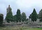 | |||
| Esplanade, Princess Louise`S Xc1 Battalion South African War Memorial | 56°07′23″N 3°56′47″W | Category C(S) | 41117 | 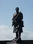 | |||
| Stirling Castle Palace (1539-42) | 56°07′25″N 3°56′53″W | Category A | 41138 | 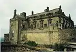 | |||
| Abercromby Place 14, 16 | 56°07′02″N 3°56′35″W | Category B | 41166 | | |||
| Albert Place 3 | 56°07′03″N 3°56′28″W | Category B | 41170 | | |||
| Albert Place 5 | 56°07′03″N 3°56′30″W | Category C(S) | 41172 | | |||
| Albert Place 10 And 1 Clarendon Place | 56°07′04″N 3°56′36″W | Category B | 41177 | | |||
| Albert Place 11 And 2 Clarendon Place | 56°07′05″N 3°56′38″W | Category B | 41178 | | |||
| Albert Place 13 | 56°07′05″N 3°56′40″W | Category B | 41180 | | |||
| Albert Place 24, 25 | 56°07′07″N 3°56′50″W | Category B | 41188 | | |||
| Albert Place 26 | 56°07′08″N 3°56′51″W | Category B | 41189 | | |||
| Allan Park 11, 11A (E. Side) | 56°07′00″N 3°56′20″W | Category B | 41192 | | |||
| 29 St John Street, Erskine Marykirk | 56°07′11″N 3°56′37″W | Category B | 41087 | 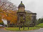 | |||
| St Columba's Church Of Scotland (The Peter Memorial) And Halls Kings Park Road | 56°06′53″N 3°56′21″W | Category B | 41092 | | |||
| St Mary's Rc Church 15 Upper Bridge Street | 56°07′25″N 3°56′33″W | Category B | 41093 | 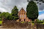 | |||
| 58,60,62,64,66,68,70 Port Street | 56°06′58″N 3°56′15″W | Category C(S) | 49599 | | |||
| Kings Park, Drinking Fountain | 56°06′50″N 3°56′45″W | Category B | 50208 | 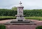 | |||
| 78 Baker Street | 56°07′12″N 3°56′30″W | Category C(S) | 45375 | | |||
| Torbrex 14 Torbrex Village | 56°06′19″N 3°56′57″W | Category C(S) | 41487 | | |||
| Upper Bridge Street 11 (W Side) Manse | 56°07′23″N 3°56′32″W | Category B | 41490 | | |||
| Upper Bridge Street 42 (E Side) | 56°07′27″N 3°56′29″W | Category C(S) | 41497 | | |||
| Upper Castlehill Mar Lodge, (Fronts Upper Castlehill) At Junction Of Castle Wynd. Classified As Being On Mar Place Though It Has No Frontage To It | 56°07′20″N 3°56′37″W | Category B | 41502 | | |||
| Victoria Square 1, 3 | 56°06′59″N 3°56′42″W | Category B | 41516 | | |||
| Victoria Square 2 And 6 Clarendon Place | 56°07′03″N 3°56′40″W | Category C(S) | 41522 | | |||
| Victoria Square 4, 6 | 56°07′03″N 3°56′42″W | Category C(S) | 41523 | | |||
| Park Place 39, 41 | 56°06′43″N 3°57′19″W | Category C(S) | 41391 | | |||
| Park Terrace 3 | 56°06′51″N 3°56′27″W | Category B | 41395 | | |||
| Park Terrace, 12, 13 | 56°06′50″N 3°56′37″W | Category B | 41399 | | |||
| Park Terrace, 14-17 | 56°06′49″N 3°56′38″W | Category B | 41400 | | |||
| Park Terrace, 34 The Whins | 56°06′44″N 3°56′50″W | Category B | 41408 | | |||
| Pitt Terrace, 8, 9 | 56°06′52″N 3°56′15″W | Category B | 41413 | | |||
| Princes Street 9, 11 | 56°07′14″N 3°56′21″W | Category C(S) | 41429 | | |||
| Randolph Road 23, 25 | 56°06′22″N 3°56′18″W | Category B | 41458 | | |||
| Royal Gardens 2, 3, 4, 5 | 56°07′10″N 3°56′49″W | Category C(S) | 41459 | | |||
| Royal Gardens 6, 7, 8, 9 | 56°07′11″N 3°56′48″W | Category C(S) | 41460 | | |||
| 33 St John Street | 56°07′14″N 3°56′37″W | Category B | 41462 | | |||
| 36 St John Street Boy's Club | 56°07′14″N 3°56′36″W | Category C(S) | 41465 |  | |||
| Gladstone Place 2 | 56°06′51″N 3°56′30″W | Category B | 41301 | | |||
| Glebe Avenue 20, 21 | 56°06′58″N 3°56′28″W | Category C(S) | 41307 | | |||
| Glebe Crescent 8, 10 | 56°06′55″N 3°56′30″W | Category C(S) | 41313 | | |||
| King Street 21, 23, 25 Royal Bank Of Scotland | 56°07′04″N 3°56′15″W | Category B | 41328 | | |||
| King Street 47, 49, 51 | 56°07′05″N 3°56′18″W | Category B | 41333 | | |||
| King Street 61 And 1 Corn Exchange Road Clydesdale Bank Buildings | 56°07′06″N 3°56′19″W | Category B | 41335 |  | |||
| King Street 4 Clydesdale Bank Ltd | 56°07′04″N 3°56′13″W | Category C(S) | 41336 | | |||
| King Street, 6-10 Golden Lion Hotel | 56°07′05″N 3°56′14″W | Category C(S) | 41337 | | |||
| Kirk Wynd, Formerly The Old Manse, St Ninians | 56°06′12″N 3°56′16″W | Category B | 41345 | | |||
| Melville Terrace 1, 2 (Exclude Late Addition To No 1) | 56°06′54″N 3°56′18″W | Category B | 41349 | | |||
| Melville Terrace 7 | 56°06′49″N 3°56′21″W | Category B | 41354 | | |||
| Melville Terrace 17, 18 | 56°06′42″N 3°56′21″W | Category B | 41360 | | |||
| North Street 40 Abbey Inn | 56°07′30″N 3°55′09″W | Category C(S) | 41375 | | |||
| Park Place 19, 21 | 56°06′42″N 3°57′10″W | Category B | 41386 | | |||
| 31, 33 And 35 Baker Street | 56°07′09″N 3°56′23″W | Category C(S) | 41209 | | |||
| 37, 39A, 39B, 41A And 41 Baker Street | 56°07′09″N 3°56′23″W | Category C(S) | 41210 | | |||
| 14 Baker Street | 56°07′09″N 3°56′20″W | Category C(S) | 41217 | | |||
| Balmoral Place 2, 4 | 56°07′03″N 3°56′50″W | Category C(S) | 41225 | | |||
| Barnton Street, Fountain | 56°07′16″N 3°56′18″W | Category C(S) | 41230 | | |||
| 36-42 (Even Nos) Barnton Street | 56°07′14″N 3°56′17″W | Category C(S) | 41234 | | |||
| 20 Bow Street | 56°07′14″N 3°56′30″W | Category C(S) | 41241 | | |||
| Clarendon Place 5 And 18 Abercromby Place | 56°07′02″N 3°56′37″W | Category B | 41258 | | |||
| Clarendon Place 13, 15 | 56°06′59″N 3°56′39″W | Category B | 41261 | | |||
| Clarendon Place 17 | 56°06′58″N 3°56′39″W | Category B | 41262 | | |||
| Clarendon Place 4 | 56°07′04″N 3°56′39″W | Category C(S) | 41263 | | |||
| Clarendon Place 10 | 56°06′57″N 3°56′42″W | Category C(S) | 41264 | | |||
| Dalgleish Court (Off Baker Street) Youth House, Stirling And District Bn Bb | 56°07′11″N 3°56′20″W | Category B | 41274 | | |||
| Forth Crescent 29 30 | 56°07′26″N 3°55′48″W | Category C(S) | 41285 | | |||
| St Ninians Parish Church Hall, Kirk Wynd | 56°06′10″N 3°56′18″W | Category C(S) | 41097 | | |||
| Back Walk, Town Wall, South Boundary Of Erskine Marykirk And St John Street Housing Development To Academy Street | 56°07′09″N 3°56′36″W | Category A | 41111 | | |||
| Broad Street, Mercat Cross | 56°07′15″N 3°56′33″W | Category B | 41115 | | |||
| Stirling Castle Kitchen Range And Grand Battery | 56°07′26″N 3°56′50″W | Category A | 41142 | | |||
| Stirling Castle The King's Old Building | 56°07′26″N 3°56′55″W | Category A | 41143 | | |||
| Beechwood Newhouse Road | 56°06′24″N 3°56′31″W | Category B | 41148 | | |||
| Abercromby Place 2, 4 | 56°07′01″N 3°56′29″W | Category C(S) | 41161 | | |||
| Abercromby Place 6 | 56°07′01″N 3°56′30″W | Category C(S) | 41162 | | |||
| Albert Place 2 | 56°07′03″N 3°56′27″W | Category B | 41169 | | |||
| Albert Place 19 And 2 Victoria Place | 56°07′07″N 3°56′47″W | Category B | 41185 | | |||
| Church Of The Holy Rood St John Street | 56°07′15″N 3°56′40″W | Category A | 41083 |  | |||
| St John Street, Ebenezer Erskine Monument | 56°07′12″N 3°56′36″W | Category B | 41088 | | |||
| Pitt Terrace, Viewforth (Stirling Council Offices), Including Entrance Gateways And Boundary Wall To West | 56°06′48″N 3°56′13″W | Category B | 48323 | | |||
| Irvine Place, Viewfield Church Including Boundary Wall | 56°07′17″N 3°56′21″W | Category C(S) | 50207 | | |||
| Drinking Fountain, Queen's Park Road | 56°06′58″N 3°56′51″W | Category C(S) | 50903 | | |||
| 4 Bow Street | 56°07′13″N 3°56′30″W | Category C(S) | 45381 | | |||
| 1 And 3 Broad Street | 56°07′14″N 3°56′32″W | Category C(S) | 45386 | | |||
| 10 Broad Street | 56°07′15″N 3°56′33″W | Category C(S) | 45388 | | |||
| Spittal Street, Allan's School With Boundary Walls | 56°07′07″N 3°56′25″W | Category B | 45390 | | |||
| Snowdon Place 14 | 56°06′43″N 3°56′36″W | Category B | 41477 | | |||
| 54 Spittal Street, Spittal's Hospital | 56°07′11″N 3°56′29″W | Category B | 41483 | | |||
| Upper Bridge Street 52, 54 (E Side) | 56°07′28″N 3°56′28″W | Category C(S) | 41501 | | |||
| Victoria Place 10, 12 | 56°07′01″N 3°56′50″W | Category C(S) | 41506 | | |||
| Victoria Place 13, 15 | 56°07′02″N 3°56′50″W | Category C(S) | 41507 | | |||
| Park Place 35, The Shieling, Gazebo | 56°06′42″N 3°57′19″W | Category C(S) | 41389 | | |||
| Port Street 65, 67 | 56°06′58″N 3°56′13″W | Category C(S) | 41419 | | |||
| Port Street 80 | 56°06′57″N 3°56′15″W | Category B | 41427 | | |||
| Queen Street 31, 33 (S. Side) | 56°07′23″N 3°56′28″W | Category B | 41440 | | |||
| 39 And 41 St John Street, Bruce Of Auchenbowie's House | 56°07′14″N 3°56′37″W | Category A | 41464 | | |||
| St Mary's Wynd John Cowane's House | 56°07′20″N 3°56′34″W | Category A | 41466 | | |||
| Forth Place 21, 23 | 56°07′20″N 3°56′05″W | Category B | 41291 | | |||
| Gladstone Place 4 | 56°06′49″N 3°56′30″W | Category C(S) | 41302 | | |||
| Glebe Crescent 1 | 56°06′57″N 3°56′28″W | Category C(S) | 41308 | | |||
| King Street 22, 24 Bank Of Scotland Buildings | 56°07′05″N 3°56′16″W | Category B | 41338 | | |||
| Melville Terrace 20 | 56°06′40″N 3°56′21″W | Category B | 41362 | | |||
| Murray Place, 80, 82 National Commercial Bank Buildings | 56°07′11″N 3°56′14″W | Category B | 41368 | | |||
| Park Avenue 5 And 9 Glebe Crescent | 56°06′54″N 3°56′26″W | Category C(S) | 41378 | | |||
| Park Avenue 6 | 56°06′54″N 3°56′31″W | Category C(S) | 41379 | | |||
| Park Avenue 9, 26 And 28 Clarendon Place | 56°06′51″N 3°56′37″W | Category C(S) | 41381 | | |||
| 49 And 51 Baker Street | 56°07′09″N 3°56′24″W | Category B | 41213 | | |||
| 8 Baker Street | 56°07′08″N 3°56′19″W | Category C(S) | 41215 | | |||
| 9 And 9 And A Half Barnton Street | 56°07′11″N 3°56′17″W | Category C(S) | 41231 | | |||
| Birkhill Road 4 | 56°06′45″N 3°57′29″W | Category C(S) | 41238 | | |||
| 16 Bow Street (Part, Within Close), Moir Of Leckie's House | 56°07′14″N 3°56′28″W | Category A | 41240 | | |||
| Brentham Park House Brentham Crescent | 56°06′35″N 3°56′08″W | Category B | 41242 | | |||
| 39 And 39A Broad Street | 56°07′15″N 3°56′36″W | Category B | 41243 | | |||
| 58 Broad Street, Mar Place House | 56°07′16″N 3°56′37″W | Category B | 41253 | | |||
| Castle Wynd Argyll Lodging (Including Garden Wall.) Now Youth Hostel | 56°07′18″N 3°56′37″W | Category A | 41255 |  | |||
| Clarendon Place 3 | 56°07′03″N 3°56′36″W | Category C(S) | 41257 | | |||
| Clifford Road 5, 6 | 56°06′30″N 3°56′19″W | Category C(S) | 41268 | | |||
| 28 Albert Place And 1 Clarendon Road | 56°07′06″N 3°56′37″W | Category C(S) | 41279 | | |||
| Sheriff Court Buildings Viewfield Place | 56°07′17″N 3°56′17″W | Category B | 41108 | | |||
| Back Walk, Town Wall And Bastion, Boundary Of Municipal Buildings, 27-33 (Odd Nos) Spittal Street And Old High School | 56°07′06″N 3°56′26″W | Category A | 41112 | | |||
| Public Library To 16 Dumbarton Road Being S Boundary Of 16 Dumbarton Road, 2, 4 Back Walk, 51 King Street 15 And 19 Corn Exchange Road | 56°07′04″N 3°56′20″W | Category A | 41113 | | |||
| George Christie Memorial Clock Allan Park | 56°06′56″N 3°56′16″W | Category C(S) | 41116 | 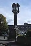 | |||
| Wallace Monument Abbey Craig | 56°08′20″N 3°55′04″W | Category A | 41118 |  | |||
| Stirling, Old Bridge | 56°07′43″N 3°56′12″W | Category A | 41129 | 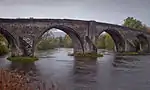 | |||
| Stirling Castle The Mint (14Th Century) | 56°07′27″N 3°56′51″W | Category A | 41141 | | |||
| Stirling Castle, Married Quarters On King`S Stables Lane And Barn Road | 56°07′22″N 3°56′39″W | Category C(S) | 41146 | | |||
| Abercromby Place 17, 19 | 56°07′01″N 3°56′36″W | Category C(S) | 41160 | | |||
| Abercromby Place 8 | 56°07′01″N 3°56′31″W | Category C(S) | 41163 | | |||
| Albert Place 6 | 56°07′04″N 3°56′32″W | Category C(S) | 41173 | | |||
| Albert Place 16, 17 | 56°07′06″N 3°56′43″W | Category B | 41183 | | |||
| Albert Place 21 | 56°07′07″N 3°56′48″W | Category C(S) | 41186 | | |||
| Allan Park 13, 15 (E. Side) | 56°06′59″N 3°56′20″W | Category B | 41193 | | |||
| Dumbarton Road, Allan Park South Church Including Gates And Railings | 56°07′03″N 3°56′22″W | Category B | 47613 | | |||
| 52, 54, 56 Port Street | 56°06′59″N 3°56′14″W | Category B | 49577 | | |||
| 2 Baker Street And 1 Friars Street, Hog's Head Public House | 56°07′08″N 3°56′19″W | Category C(S) | 45363 | | |||
| 56 And 58 Baker Street | 56°07′11″N 3°56′25″W | Category C(S) | 45369 | | |||
| 62 Baker Street | 56°07′11″N 3°56′26″W | Category C(S) | 45371 | | |||
| 70 And 72 Baker Street | 56°07′11″N 3°56′27″W | Category B | 45372 | | |||
| South Street 18 Cambuskenneth | 56°07′27″N 3°55′12″W | Category C(S) | 41478 | | |||
| 56 Spittal Street, Glengarry Lodge Or Darrow Lodging | 56°07′11″N 3°56′30″W | Category A | 41484 | | |||
| Torbrex Torbrex Inn Torbrex Village | 56°06′17″N 3°57′01″W | Category C(S) | 41488 | | |||
| Upper Bridge Street 48 (E Side) | 56°07′27″N 3°56′29″W | Category C(S) | 41499 | | |||
| Upper Bridge Street 50 (E Side) | 56°07′28″N 3°56′29″W | Category C(S) | 41500 | | |||
| Victoria Place 4, 6 | 56°07′05″N 3°56′47″W | Category C(S) | 41505 | | |||
| Victoria Square Garfield Hotel | 56°07′04″N 3°56′46″W | Category C(S) | 41525 | | |||
| Park Terrace, 32 | 56°06′45″N 3°56′47″W | Category B | 41406 | | |||
| Endrick Lodge, Lodge And Gates | 56°06′33″N 3°57′09″W | Category B | 41417 | | |||
| Port Street 38, 40 And 2, 4 Dumbarton Road | 56°07′01″N 3°56′13″W | Category B | 41425 | | |||
| Princes Street 13 | 56°07′15″N 3°56′22″W | Category C(S) | 41430 | | |||
| Queen Street 10, 12 (N. Side) | 56°07′21″N 3°56′22″W | Category B | 41443 | | |||
| Queen Street 14, 16, 18 (N. Side) | 56°07′22″N 3°56′23″W | Category B | 41444 | | |||
| Queen Street 36 (N. Side) | 56°07′23″N 3°56′26″W | Category B | 41449 | | |||
| Queens Road 4 | 56°07′02″N 3°56′53″W | Category C(S) | 41455 | | |||
| Queens Road 7 & 16 Victoria Place | 56°07′00″N 3°56′51″W | Category C(S) | 41457 |  | |||
| St Ninians Road 13, 15 Langgarth | 56°06′43″N 3°56′12″W | Category B | 41468 | | |||
| Gladstone Place 5, 7 | 56°06′49″N 3°56′27″W | Category C(S) | 41296 | | |||
| Gladstone Place 6, 8 | 56°06′49″N 3°56′31″W | Category C(S) | 41303 | | |||
| Glebe Crescent 16 | 56°06′53″N 3°56′29″W | Category C(S) | 41315 | | |||
| Hillfoots Road, Abbey Craig Park House, Walls And Gates | 56°08′22″N 3°55′18″W | Category B | 41317 | | |||
| Irvine Place 13, 15 | 56°07′19″N 3°56′27″W | Category B | 41318 | | |||
| Irvine Place 4 | 56°07′19″N 3°56′24″W | Category B | 41320 | | |||
| King Street 42-48 (Even Nos) | 56°07′07″N 3°56′16″W | Category B | 41342 | | |||
| Mar Place Mar's Wark | 56°07′16″N 3°56′39″W | Category A | 41348 |  | |||
| Murray Place 3, 5, 7 | 56°07′04″N 3°56′13″W | Category B | 41364 | | |||
| Park Place 17 | 56°06′42″N 3°57′08″W | Category B | 41385 | | |||
| Allan Park 22 (West Side) | 56°06′57″N 3°56′25″W | Category B | 41202 | | |||
| 10 And 12 Baker Street | 56°07′08″N 3°56′20″W | Category C(S) | 41216 | | |||
| Birkhill Road 2 Cliffside | 56°06′45″N 3°57′27″W | Category B | 41237 | | |||
| 16 Broad Street, East Section Of James Norrie's Lodging | 56°07′15″N 3°56′34″W | Category A | 41246 | | |||
| 18 Broad Street (Part), East Section Of Graham Of Panholes Lodging | 56°07′16″N 3°56′34″W | Category B | 41247 | | |||
| 18 Broad Street (Part), W Section Of James Norrie's Lodging | 56°07′15″N 3°56′34″W | Category B | 41248 | | |||
| Castle Wynd Valley Lodge | 56°07′18″N 3°56′40″W | Category B | 41254 | | |||
| Public Library, Corn Exchange Road | 56°07′05″N 3°56′21″W | Category B | 41107 |  | |||
| 40 Albert Place Smith Art Gallery And Museum Including Lamp Standards | 56°07′09″N 3°56′46″W | Category B | 41109 |  | |||
| War Memorial Corn Exchange Road | 56°07′04″N 3°56′24″W | Category B | 41119 |  | |||
| Campbell Bannerman Sir Henry, Monument To, Corn Exchange Road | 56°07′05″N 3°56′24″W | Category B | 41122 | 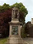 | |||
| Stirling New Bridge | 56°07′40″N 3°56′11″W | Category B | 41130 | | |||
| Stirling Castle (Comprising): Outer Defences The Counter Guard(1708-14) | 56°07′24″N 3°56′49″W | Category A | 41136 | 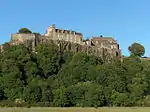 | |||
| Stirling Castle Chapel Royal (1594) | 56°07′27″N 3°56′54″W | Category A | 41140 | 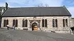 | |||
| Abercromby Place 1 | 56°06′59″N 3°56′29″W | Category C(S) | 41154 | | |||
| Abercromby Place 11 | 56°07′00″N 3°56′33″W | Category C(S) | 41157 | | |||
| Albert Place 7 | 56°07′04″N 3°56′32″W | Category B | 41174 | | |||
| Albert Place 22, 23 | 56°07′07″N 3°56′49″W | Category B | 41187 | | |||
| Albert Place 27 | 56°07′08″N 3°56′52″W | Category B | 41190 | | |||
| Allan Park 12, 14 (W. Side) | 56°07′00″N 3°56′23″W | Category B | 41199 | | |||
| Baptist Church 52 Murray Place | 56°07′08″N 3°56′10″W | Category C(S) | 41085 | | |||
| Holy Trinity Episcopal Church 26 Dumbarton Road | 56°07′06″N 3°56′34″W | Category A | 41089 | | |||
| Stirling, Drip Road, Kildean Day Hospital Including Boundary Wall And Gatepiers | 56°07′54″N 3°57′19″W | Category C(S) | 48879 | | |||
| 10 And 12 Bow Street | 56°07′14″N 3°56′30″W | Category C(S) | 45383 | | |||
| 21 Broad Street | 56°07′14″N 3°56′33″W | Category C(S) | 45387 | | |||
| Torbrex 2 Torbrex Village | 56°06′20″N 3°56′53″W | Category C(S) | 41485 | | |||
| Upper Bridge Street 15 (W Side) St Mary's Rc Presbytery | 56°07′26″N 3°56′34″W | Category B | 41491 | | |||
| Upper Bridge Street 44, 46 (E Side) | 56°07′27″N 3°56′29″W | Category C(S) | 41498 | | |||
| Upper Craigs 78 Craigs House (Masonic Hall) | 56°06′55″N 3°56′02″W | Category B | 41503 | | |||
| Victoria Place 21 | 56°06′57″N 3°56′47″W | Category B | 41510 | | |||
| Victoria Place 34, 35, 36 | 56°06′51″N 3°56′42″W | Category C(S) | 41514 | | |||
| 14 Windsor Place, The Inclosure | 56°06′57″N 3°56′36″W | Category C(S) | 41529 | | |||
| Park Terrace 1, 2 | 56°06′52″N 3°56′24″W | Category B | 41394 | | |||
| Park Terrace, 6, 7 | 56°06′51″N 3°56′32″W | Category B | 41396 | | |||
| Port Street 42 And 1, 3, 5 Dumbarton Road | 56°06′59″N 3°56′14″W | Category C(S) | 41426 | | |||
| Queen Street 21 (S. Side) | 56°07′22″N 3°56′25″W | Category B | 41438 | | |||
| Royal Gardens 10, 11 | 56°07′12″N 3°56′47″W | Category C(S) | 41461 | | |||
| 91, St. Marys Wynd ,Settle Inn | 56°07′21″N 3°56′32″W | Category C(S) | 41467 | | |||
| St Ninians Road Randolphfield (Formerly Stirling District Police Department) | 56°06′36″N 3°56′32″W | Category C(S) | 41471 | | |||
| Forth Place 17, 19 | 56°07′19″N 3°56′06″W | Category B | 41290 | | |||
| Gladstone Place 9 Forth Valley Health Board | 56°06′47″N 3°56′27″W | Category C(S) | 41297 | | |||
| Gladstone Place 10, 12 | 56°06′47″N 3°56′31″W | Category C(S) | 41304 | | |||
| Irvine Place 6, 8 | 56°07′19″N 3°56′25″W | Category B | 41321 | | |||
| Irvine Place 12 | 56°07′20″N 3°56′27″W | Category C(S) | 41323 | | |||
| King Street 27, 29 | 56°07′04″N 3°56′16″W | Category C(S) | 41329 | | |||
| King Street 50, 52 And Friars Street, Bank Of Scotland Buildings | 56°07′07″N 3°56′18″W | Category B | 41343 | | |||
| Melville Terrace 4 Terraces Hotel | 56°06′52″N 3°56′19″W | Category B | 41351 | | |||
| Park Avenue 10 And 11 | 56°06′51″N 3°56′39″W | Category C(S) | 41382 | | |||
| 9 And 11 Baker Street And Sma' Vennel | 56°07′08″N 3°56′21″W | Category C(S) | 41205 | | |||
| 3 Bank Street | 56°07′09″N 3°56′25″W | Category C(S) | 41226 | | |||
| 52-56 (Even Nos) Barnton Street | 56°07′15″N 3°56′18″W | Category C(S) | 41235 | | |||
| 20 And 22 Broad Street | 56°07′16″N 3°56′35″W | Category B | 41249 | | |||
| Clarendon Place 7 And 21 Abercromby Place | 56°07′01″N 3°56′37″W | Category C(S) | 41259 | | |||
| Clifford Road 10, 11 | 56°06′32″N 3°56′18″W | Category C(S) | 41270 | | |||
| 42 Albert Place And 1 Royal Gardens | 56°07′09″N 3°56′50″W | Category B | 41283 | | |||
| Cowane's Hospital (Now Guildhall) Including Adjoining Terrace To Bowling Green 47, 49 St John Street And Lampstands | 56°07′14″N 3°56′42″W | Category A | 41101 | 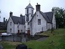 | |||
| Drillhall Princes Street (Front Building Only) | 56°07′17″N 3°56′26″W | Category B | 41103 | | |||
| 8 And 10 Corn Exchange Road, Municipal Buildings | 56°07′06″N 3°56′22″W | Category B | 41105 | .jpg.webp) | |||
| 35, 37 Broad Street, Jail Wynd And 32 St John Street, Tolbooth | 56°07′14″N 3°56′34″W | Category A | 41110 |  | |||
| The Old Town Cemeteries | 56°07′17″N 3°56′42″W | Category A | 41126 |  | |||
| Abercromby Place 3,5 | 56°06′59″N 3°56′30″W | Category C(S) | 41155 | | |||
| Albert Place 1 | 56°07′03″N 3°56′26″W | Category B | 41168 | | |||
| Albert Place 4 | 56°07′03″N 3°56′29″W | Category B | 41171 | | |||
| Allan Park 19 (E. Side) | 56°06′57″N 3°56′22″W | Category B | 41195 | | |||
| Church Of The Holy-Rood Churchyard | 56°07′17″N 3°56′42″W | Category A | 41084 |  | |||
| Cambuskenneth Abbey | 56°07′24″N 3°55′05″W | Category A | 41086 |  | |||
| 2 Bow Street, Hermon Evangelical Church | 56°07′12″N 3°56′30″W | Category C(S) | 45379 | | |||
| Snowdon Place 15 Racc/Reme Officers Mess | 56°06′42″N 3°56′33″W | Category B | 41475 | | |||
| South Street 20 Cambuskenneth | 56°07′27″N 3°55′12″W | Category C(S) | 41479 | | |||
| Southfield Crescent 2 | 56°06′46″N 3°56′33″W | Category B | 41481 | | |||
| Upper Bridge Street 26 (E Side) | 56°07′24″N 3°56′29″W | Category C(S) | 41492 | | |||
| Upper Bridge Street 36-40 (E Side) | 56°07′26″N 3°56′29″W | Category C(S) | 41496 | | |||
| Victoria Place 26, 27 | 56°06′55″N 3°56′45″W | Category C(S) | 41513 | | |||
| Park Terrace 18-21 | 56°06′49″N 3°56′39″W | Category B | 41401 | | |||
| Pitt Terrace, 3 | 56°06′54″N 3°56′14″W | Category B | 41411 | | |||
| Polmaise Road Endrick Lodge | 56°06′30″N 3°57′13″W | Category B | 41416 | | |||
| Port Street 25, 27 | 56°07′02″N 3°56′12″W | Category C(S) | 41418 | | |||
| Port Street 10, 12, 14 | 56°07′02″N 3°56′14″W | Category B | 41423 | | |||
| Princes Street 5 | 56°07′14″N 3°56′20″W | Category C(S) | 41428 | | |||
| Queen Street 24 (N. Side) | 56°07′22″N 3°56′24″W | Category B | 41446 | | |||
| Queens Road 1 | 56°07′06″N 3°56′53″W | Category C(S) | 41452 | | |||
| Queens Road 3 | 56°07′04″N 3°56′53″W | Category C(S) | 41454 | | |||
| Forth Place 1, 3 | 56°07′18″N 3°56′08″W | Category B | 41286 | | |||
| Friars Street 29, 31 | 56°07′10″N 3°56′17″W | Category C(S) | 41293 | | |||
| Glebe Crescent 3, 5 | 56°06′55″N 3°56′28″W | Category C(S) | 41309 | | |||
| King Street 33, 35 | 56°07′04″N 3°56′16″W | Category C(S) | 41330 | | |||
| Park Avenue 2 | 56°06′54″N 3°56′22″W | Category C(S) | 41376 | | |||
| Park Avenue 7, 7A And 8 | 56°06′53″N 3°56′35″W | Category C(S) | 41380 | | |||
| 13 And 15 Baker Street | 56°07′08″N 3°56′21″W | Category C(S) | 41206 | | |||
| 4 Polmaise Road, Batterflats | 56°06′37″N 3°57′12″W | Category B | 41207 | | |||
| 84 Baker Street, Sauchie House With Gatepiers And Boundary Walls | 56°07′13″N 3°56′26″W | Category B | 41221 | | |||
| Balmoral Place 3 | 56°07′05″N 3°56′50″W | Category C(S) | 41223 | | |||
| Clifford Road 3, 4 | 56°06′31″N 3°56′21″W | Category C(S) | 41267 | | |||
| 30 Albert Place | 56°07′07″N 3°56′39″W | Category C(S) | 41280 | | |||
| 2 Spittal Street And 65, 67 King Street, Athenaeum | 56°07′07″N 3°56′19″W | Category A | 41100 | .jpg.webp) | |||
| 31 St John Street, Stirling Old Town Jail (Former Military Prison) With Boundary Walls, Gatepiers And Gates | 56°07′12″N 3°56′39″W | Category A | 41104 |  | |||
| Bruce Statue Esplanade | 56°07′24″N 3°56′46″W | Category C(S) | 41120 | | |||
| Academy Road, Stirling Highland Hotel, Old High School | 56°07′08″N 3°56′32″W | Category A | 41133 | | |||
| 31 Spittal Street Snowdon School With Boundary Walls And Gate Piers | 56°07′08″N 3°56′25″W | Category C(S) | 41135 | | |||
| Stirling Castle Forework (1500-1510) | 56°07′25″N 3°56′50″W | Category A | 41137 |  | |||
| Stirling Castle Sundial | 56°07′28″N 3°56′56″W | Category A | 41144 | | |||
| Stirling Castle Regimental Headquarters | 56°07′26″N 3°56′49″W | Category A | 41145 | | |||
| Abercromby Place 12 | 56°07′02″N 3°56′34″W | Category C(S) | 41165 | | |||
| Albert Place 12 | 56°07′05″N 3°56′39″W | Category B | 41179 | | |||
| Albert Place 14 | 56°07′06″N 3°56′41″W | Category B | 41181 | | |||
| Allan Park 20 (W. Side) Allan Park Hotel | 56°06′58″N 3°56′25″W | Category B | 41201 | | |||
| 53 Baker Street And 1 Bank Street | 56°07′10″N 3°56′24″W | Category B | 41090 | |
Key
The scheme for classifying buildings in Scotland is:
- Category A: "buildings of national or international importance, either architectural or historic; or fine, little-altered examples of some particular period, style or building type."[1]
- Category B: "buildings of regional or more than local importance; or major examples of some particular period, style or building type, which may have been altered."[1]
- Category C: "buildings of local importance; lesser examples of any period, style, or building type, as originally constructed or moderately altered; and simple traditional buildings which group well with other listed buildings."[1]
In March 2016 there were 47,288 listed buildings in Scotland. Of these, 8% were Category A, and 50% were Category B, with the remaining 42% being Category C.[2]
Notes
- Sometimes known as OSGB36, the grid reference (where provided) is based on the British national grid reference system used by the Ordnance Survey.
• "Guide to National Grid". Ordnance Survey. Retrieved 2007-12-12.
• "Get-a-map". Ordnance Survey. Retrieved 2007-12-17. - Historic Environment Scotland assign a unique alphanumeric identifier to each designated site in Scotland, for listed buildings this always begins with "LB", for example "LB12345".
References
- All entries, addresses and coordinates are based on data from Historic Scotland. This data falls under the Open Government Licence
- "What is Listing?". Historic Environment Scotland. Retrieved 29 May 2018.
- Scotland's Historic Environment Audit 2016 (PDF). Historic Environment Scotland and the Built Environment Forum Scotland. pp. 15–16. Retrieved 29 May 2018.
This article is issued from Wikipedia. The text is licensed under Creative Commons - Attribution - Sharealike. Additional terms may apply for the media files.