List of state highways in Louisiana
| Louisiana State Highways | |
|---|---|
.svg.png.webp) 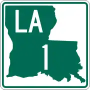 .svg.png.webp) State highway markers for different years: 1955 (left), 1990 (center), 2008–present (right) | |
| System information | |
| Length | 16,698.41 mi[1] (26,873.49 km) |
| Formed | 1955 renumbering[2] |
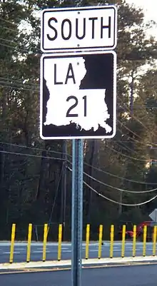
| Notes | Since 2008, La DOTD has been replacing the green-and-white state highway markers with a black-and-white version using the same design.[3] The new shields have a black background, white silhouette, black letters and numbers, and no frame outline (see photo below for comparison). |
| Highway names | |
| State | Louisiana Highway X (LA X) |
| Special routes: | Louisiana Highway X Alternate (LA X Alt.); Louisiana Highway X Business (LA X Bus.); Louisiana Highway X Bypass (LA X Byp.); Louisiana Highway X Spur (LA X Spur); Louisiana Highway X Truck (LA X Truck) |
| System links | |
| |
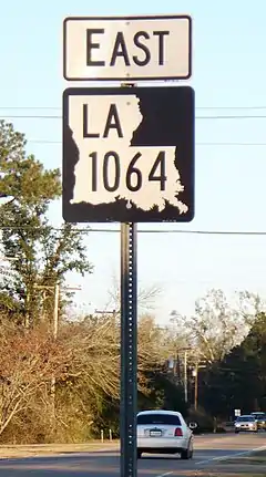
2008-style state highway marker on eastbound LA 1064 in Natalbany.
List
LA 1 to LA 99
| Number | Length (mi) | Length (km) | Southern or western terminus | Northern or eastern terminus | Formed | Removed | Notes |
|---|---|---|---|---|---|---|---|
| 431.877 | 695.039 | Bayou Rigaud in Grand Isle | SH 77 northwest of Rodessa | 1955 | current | ||
| 189.490 | 304.955 | SH 49 west of Trees | US 65 north of Lake Providence | 1955 | current | ||
| 35.705 | 57.462 | I-20, US 71, and LA 72 in Bossier City | Arkansas state line north of Plain Dealing | 1955 | current | ||
| 164.537 | 264.797 | US 71 north of Loggy Bayou | LA 605 in Newellton | 1955 | current | ||
| 28.361 | 45.643 | US 84 in Logansport | LA 175 at Kingston | 1955 | current | ||
| 54.518 | 87.738 | Texas state line southwest of Many | US 71 and US 84 in Clarence | 1955 | current | ||
| 72.9 | 117.3 | US 71 in Coushatta | Arkansas state line at Springhill | 1955 | 1994 | Became US 371 | |
| 156.273 | 251.497 | Texas state line west of Burr Ferry | US 425/LA 15 in Sicily Island | 1955 | current | ||
| 100.005 | 160.942 | US 71/US 84 in Campti | US 63/US 167 in Junction City | 1955 | current | ||
| 255.505 | 411.195 | US 171 south of Leesville | Mississippi state line east of Bogalusa | 1955 | current | ||
| 34.368 | 55.310 | Texas state line west of Starks | US 171 and US 190 in Ragley | 1955 | current | ||
| 63.993 | 102.987 | LA 14 west of Kaplan | US 167 in Turkey Creek | 1955 | current | ||
| 100.197 | 161.251 | US 90 and US 171 in Lake Charles | LA 182 in New Iberia | 1955 | current | ||
| 194.102 | 312.377 | LA 1 and LA 970 northwest of Lettsworth | US 63/US 167 in Lillie | 1955 | current | ||
| 110.234 | 177.404 | LA 22 south of French Settlement | LA 21 in Sun | 1955 | current | ||
| 66.717 | 107.371 | US 425/LA 15, LA 4, and LA 130 in Winnsboro | Arkansas state line at Kilbourne | 1955 | current | ||
| 80.118 | 128.937 | LA 1 and LA 3089 in Donaldsonville | US 90 Bus. and LA 23 in Gretna | 1955 | current | ||
| 33.897 | 54.552 | US 61 in Baton Rouge | Mississippi state line north of Norwood | 1955 | current | ||
| 36.656 | 58.992 | LA 182 in Gibson | LA 18 in Vacherie | 1955 | current | ||
| 52.023 | 83.723 | LA 22 and LA 1077 in Madisonville | Mississippi state line north of Angie | 1955 | current | ||
| 71.239 | 114.648 | LA 75 and LA 942 in Darrow | US 190 in Mandeville | 1955 | current | ||
| 73.638 | 118.509 | Jump Basin Road in Venice | LA 428 in Gretna | 1955 | current | ||
| 35.667 | 57.400 | LA 20 in Schriever | LA 3235 in Larose | 1955 | current | ||
| 38.720 | 62.314 | US 190 in Covington | Mississippi state line north of Warnerton | 1955 | current | ||
| 75.911 | 122.167 | US 171/US 190 southeast of DeRidder | LA 14 in Lake Arthur | 1955 | current | ||
| 132.424 | 213.116 | LA 14 at Holmwood | US 171 and US 190 in DeRidder | 1955 | current | ||
| 87.347 | 140.571 | US 171 and LA 8 in Leesville | US 84 west of Jonesville | 1955 | current | ||
| 54.141 | 87.131 | LA 13 north of Eunice | LA 114 west of Moreauville | 1955 | current | ||
| 27.842 | 44.807 | I-10 in Baton Rouge | US 61 and LA 431 east of Gonzales | 1955 | current | ||
| 54.577 | 87.833 | LA 182 in New Iberia | LA 182 in Opelousas | 1955 | current | ||
| 0.5 | 0.8 | LA 30 | Louisiana State Capitol building in Baton Rouge | 1955 | c. 1957 | ||
| 43.901 | 70.652 | US 80 in Ruston | Arkansas state line north of Marion | 1955 | current | ||
| 86.010 | 138.420 | US 71 and LA 1239-2 in Montgomery | US 80/LA 15 in West Monroe | 1955 | current | ||
| 52.197 | 84.003 | LA 82 north of Forked Island | US 190 in Lawtell | 1955 | current | ||
| 18.939 | 30.479 | LA 21 east of Covington | LA 41 northwest of Pearl River | 1955 | current | ||
| 42.687 | 68.698 | US 61/US 190 in Baton Rouge | LA 10 in Greensburg | 1955 | current | ||
| 48.573 | 78.171 | LA 10 in Coleman Town | LA 430 south of Hackley | 1955 | current | ||
| 54.327 | 87.431 | Pointe à la Hache | I-10 in New Orleans | 1955 | current | ||
| 53.282 | 85.749 | LA 43 southeast of Montpelier | LA 41 in Bush | 1955 | current | ||
| 23.074 | 37.134 | US 11 and LA 3081 in Pearl River | LA 21 in Bush | 1955 | current | ||
| 47.880 | 77.055 | LA 30 in Baton Rouge | LA 22 and LA 1037 in Springfield | 1955 | current | ||
| 44.380 | 71.423 | LA 42 west of Springfield | Mississippi state line north of Easleyville | 1955 | current | ||
| 49.970 | 80.419 | LA 42 in Prairieville | US 61 in LaPlace | 1955 | current | ||
| 22.602 | 36.374 | Bayou Barataria in Lafitte | LA 18 in Marrero | 1955 | current | ||
| 29.535 | 47.532 | LA 39 and LA 3021 in New Orleans | Shell Beach | 1955 | current | ||
| 16.305 | 26.240 | Chalmette | New Orleans | 1955 | current | ||
| 20.960 | 33.732 | US 61 in Norco | US 90 and LA 3152 in Elmwood | 1955 | current | ||
| 3.916 | 6.302 | US 61 | Kenner | 1955 | current | ||
| 0.850 | 1.368 | LA 48 (River Road) at the Mississippi River | US 61 (Airline Highway) | 1955 | current | ||
| 2.731 | 4.395 | US 90 and LA 633 in Boutte | LA 18 in Luling | 1955 | current | ||
| 1.634 | 2.630 | LA 44 (River Road) and LA 640 opposite the defunct Edgard–Reserve Ferry | US 61 (West Airline Highway) | 1955 | current | ||
| 2.343 | 3.771 | LA 44 | US 61 in Garyville | 1955 | current | ||
| 14.094 | 22.682 | Montegut | LA 24 in Bourg | 1955 | current | ||
| 25.495 | 41.030 | Cocodrie | LA 24 in Houma | 1955 | current | ||
| 25.053 | 40.319 | LA 56 north of Cocodrie | LA 24 in Houma | 1955 | current | ||
| 1.614 | 2.597 | LA 56 in Chauvin | LA 55 in Montegut | 1955 | current | ||
| 11.793 | 18.979 | US 190 in Mandeville | LA 21 north of Abita Springs | 1955 | current | ||
| 16.047 | 25.825 | LA 16 in Enon | LA 10 in Bogalusa | 1955 | current | ||
| 11.863 | 19.092 | LA 10 in Sheridan | Mississippi state line north of State Line | 1955 | current | ||
| 52.48 | 84.46 | LA 63 east of French Settlement | LA 67 in Clinton | 1955 | current | ||
| 20.355 | 32.758 | LA 964 in Zachary | LA 16 and LA 1026 north of Denham Springs | 1955 | current | ||
| 19.620 | 31.575 | Louisiana State Penitentiary at Angola | US 61 north of St. Francisville | 1955 | current | ||
| 43.60 | 70.17 | LA 73 in Baton Rouge | Mississippi state line north of Clinton | 1955 | current | ||
| 19.252 | 30.983 | US 61 north of Port Hudson | LA 19 in Wilson | 1955 | current | ||
| 15.381 | 24.753 | LA 70 in Grand Bayou | LA 1 northwest of White Castle | 1955 | current | ||
| 51.084 | 82.212 | US 90, US 90 Bus., and LA 182 in Morgan City | LA 22 in Sorrento | 1955 | current | ||
| 2.492 | 4.010 | Bossier City | US 79/US 80 in Bossier City | 1955 | current | ||
| 26.318 | 42.355 | LA 75 in Geismar | LA 30 in Baton Rouge | 1955 | current | ||
| 10.683 | 17.193 | LA 75 in St. Gabriel | US 61 north of Gonzales | 1955 | current | ||
| 46.703 | 75.161 | Bayou Pigeon | LA 22 and LA 942 in Darrow | 1955 | current | ||
| 25.477 | 41.001 | LA 77 in Maringouin | LA 1 and LA 987-4 in Port Allen | 1955 | current | ||
| 49.136 | 79.077 | LA 1 in Plaquemine | LA 10 north of Fordoche | 1955 | current | ||
| 7.558 | 12.163 | US 190 and LA 411 in Livonia | LA 1 in Parlange | 1955 | current | ||
| 8.825 | 14.202 | LA 77 in Livonia | LA 77 in Fordoche | 1955 | current | ||
| 143.139 | 230.360 | Texas state line west of Cameron | Vermilion–Lafayette | 1955 | current | ||
| 34.013 | 54.739 | LA 14 in New Iberia | LA 182 in Baldwin | 1955 | current | ||
| 7.826 | 12.595 | LA 83 in Lydia | LA 182 in Jeanerette | 1955 | current | ||
| 16.436 | 26.451 | LA 182 in New Iberia | LA 31 north of New Iberia | 1955 | current | ||
| 42.011 | 67.610 | LA 86 in New Iberia | Centerville | 1955 | current | ||
| 5.393 | 8.679 | LA 89 at Lozes | LA 182 northwest of New Iberia | 1955 | current | ||
| 12.731 | 20.489 | LA 14 in Delcambre | Youngsville | 1955 | current | ||
| 49.58 | 79.79 | Gueydan | LA 13 in Eunice | 1955 | current | ||
| 40.723 | 65.537 | US 90 east of Mermentau | LA 339 in Youngsville | 1955 | current | ||
| 28.430 | 45.754 | LA 342 in Lafayette | LA 31 in Arnaudville | 1955 | current | ||
| 7.943 | 12.783 | US 90 and US 167 in Lafayette | LA 328 in Breaux Bridge | 1955 | current | ||
| 42.12 | 67.79 | US 90 in Duson | LA 104 in Mamou | 1955 | current | ||
| 19.543 | 31.451 | LA 182 in Broussard | LA 352 east of Catahoula | 1955 | current | ||
| 21.553 | 34.686 | US 90 and LA 102 in Jennings | US 190 east of Basile | 1955 | current | ||
| 47.751 | 76.848 | LA 97 and LA 1123 west of Iota | Lafayette–St. Martin parish line east of Carencro | 1955 | current | ||
| 32.438 | 52.204 | LA 14 west of Lake Arthur | US 190 east of Kinder | 1955 | current |
LA 100 to LA 199
| Number | Length (mi) | Length (km) | Southern or western terminus | Northern or eastern terminus | Formed | Removed | Notes |
|---|---|---|---|---|---|---|---|
| 14.831 | 23.868 | LA 97 in Evangeline | LA 13 in Crowley | 1955 | current | ||
| 17.278 | 27.806 | LA 14 in Hayes | LA 383 north of Iowa | 1955 | current | Was portions of SR 1156, SR 728, SR 744 and SR 24-D (former SR 24 and US 165) before 1955 | |
| 35.367 | 56.918 | US 165 in Fenton | LA 26 north of Lake Arthur | 1955 | current | Was portions of SR 105, SR 735, SR 2030, SR 702, SR 701/SR 703 and SR 731 before 1955 | |
| 39.388 | 63.389 | US 190 west of Lawtell | LA 31 in Leonville | 1955 | current | Was portions of SR 571, SR 119, SR 487, SR 214/SR 279 and SR 238 before 1955 | |
| 41.374 | 66.585 | LA 26 southeast of Oberlin | US 190 in Opelousas | 1955 | current | Was portions of SR 120, SR 26 and SR 219 before 1955 | |
| 38.577 | 62.084 | Krotz Springs | LA 1 in Simmesport | 1955 | current | ||
| 24.202 | 38.949 | LA 10 east of Oakdale | LA 29 south of Bunkie | 1955 | current | Was portions of SR 482 and SR 23 before 1955 | |
| 64.957 | 104.538 | US 71 in Morrow | US 167/LA 28 in Pineville | 1955 | current | Was portions of SR 92, C-1472, C-1471, SR 5, SR 57 and SR 57-D before 1955 | |
| 24.866 | 40.018 | I-10 in Vinton | US 90 in Sulphur | 1955 | current | Was portions of SR 381, SR 382 (one portion later became C-2102), SR 104 and C-1352 before 1955; section through Vinton removed around 1982 | |
| 39.931 | 64.263 | US 90/LA 3112 southwest of Vinton | LA 27 at Juanita | 1955 | current | Was portions of SR 121, SR 143, and SR 287 before 1955 | |
| 25.154 | 40.481 | US 190 in Merryville | US 171/US 190 in Longville | 1955 | current | ||
| 45.722 | 73.582 | US 190 in Junction | LA 117 northeast of Leesville | 1955 | current | Was portions of SR 138, SR 143 and SR 414 before 1955 | |
| 80.899 | 130.194 | US 171/US 190 east of DeRidder | US 71/US 167 in Lecompte | 1955 | current | ||
| 54.492 | 87.696 | US 190 in Reeves | US 165 and LA 497 in Glenmora | 1955 | current | ||
| 20.86 | 33.57 | LA 1 in Echo | LA 1/LA 451 east of Moreauville | 1955 | current | Was portions of SR 30, SR 72 and SR 299 before 1955 | |
| 60.70 | 97.69 | LA 106 west of St. Landry | LA 28 north of Deville | 1955 | current | ||
| 8.39 | 13.50 | US 165 in Pineville | LA 28 east of Pineville | 1955 | current | Was SR 309 before 1955 | |
| 41.52 | 66.82 | LA 8 and LA 1213 in Leesville | LA 6 east of Robeline | 1955 | current | ||
| 26.89 | 43.28 | US 171 in Florien | Kisatchie | 1955 | current | ||
| 28.64 | 46.09 | LA 8 at Flatwoods | LA 1 in Natchez | 1955 | current | ||
| 36.24 | 58.32 | US 171 in Zwolle LA 117 in Provencal | South of Robeline LA 1 and LA 494 south of Natchez |
1955 | current | ||
| 46.83 | 75.37 | LA 8 at Slagle | LA 1 west of Boyce | 1955 | current | ||
| 26.09 | 41.99 | US 71/LA 1239-1 in Montgomery | LA 123 in Dry Prong | 1955 | current | Was SR 162 and SR 475 before 1955 | |
| 15.97 | 25.70 | LA 8 east of Colfax | US 165 east of Breezy Hill | 1955 | current | Was SR 617 before 1955 | |
| 91.94 | 147.96 | US 84 east of Winnfield | LA 3102 at Argo | 1955 | current | ||
| 12.49 | 20.10 | US 165 in Tullos | US 165 northeast of Olla | 1955 | current | Was Route C-2113 before 1955; spur to Urania now LA 3259 | |
| 97.87 | 157.51 | LA 9 in Reidhimer | LA 124 north of Jonesville | 1955 | current | ||
| 54.68 | 88.00 | Kitterlin Bay | LA 126 east of Sikes | 1955 | current | ||
| 42.08 | 67.72 | LA 4 east of Fort Necessity | LA 605/LA 897-4 in St. Joseph | 1955 | current | ||
| 32.51 | 52.32 | Red River south of Acme | US 84 west of Ferriday | 1955 | current | ||
| 7.34 | 11.81 | LA 135 north of Liddieville | US 425/LA 4/LA 15/LA 17 in Winnsboro | 1955 | current | Was SR 239 before 1955 | |
| 6.79 | 10.93 | LA 15 at St. Genevieve | US 84/US 425 in Vidalia | 1955 | current | Was the northern portion of SR 49 before 1955 | |
| 32.91 | 52.96 | LA 133 north of Buckner | LA 17 north of Bakers | 1955 | current | ||
| 45.46 | 73.16 | LA 4 northeast of Columbia | US 425 south of Oak Ridge | 1955 | current | Was a portion of SR 47 before 1955; originally ran to Mer Rouge, but this section became US 425 in 2005 | |
| 65.68 | 105.70 | US 165 south of Sterlington | US 65 just outside Lake Providence | 1955 | current | ||
| 34.22 | 55.07 | LA 4 in Fort Necessity | US 425 south of Rayville | 1955 | current | ||
| 3.49 | 5.62 | LA 134 in Fairbanks | US 165/LA 2 in Sterlington | 1955 | current | Was Route C-1604 before 1955 | |
| 18.08 | 29.10 | LA 15 north of Mangham | LA 135 | 1955 | 2005 | Was SR 47 before 1955, redesigned as US 425 | |
| 12.75 | 20.52 | LA 134 south of Collinston | US 165/US 425/LA 2 in Mer Rouge | 1955 | current | Was SR 47 and Route C-1557 before 1955 | |
| 20.21 | 32.52 | US 80 in Monroe | US 165/US 425/LA 2/LA 593 in Bastrop | 1955 | current | Was SR 14 before 1955; originally ran from Bastrop to the Arkansas state line (replacing SR 204), but this section became a portion of US 425 in 1989 | |
| 14.77 | 23.77 | US 425 in Log Cabin | US 165/LA 599 in Bonita | 1955 | current | Was routes C-1484, C-1485 and C-1486 before 1955 | |
| 4.07 | 6.55 | LA 75 in St. Gabriel St. Gabriel | St. Gabriel LA 75 in St. Gabriel |
1955 | current | Was SR 410 before 1955; gap in route since the 1990s | |
| 8.76 | 14.10 | US 425 north of Bastrop | AR 133 at Arkansas state line northwest of Beekman | 1955 | current | Was Route C-1490 before 1955 | |
| 39.94 | 64.28 | LA 34 in West Monroe | LA 33 in Marion | 1955 | current | ||
| 9.97 | 16.05 | LA 34 in Eros | LA 151 at Calhoun | 1955 | current | ||
| 17.88 | 28.78 | LA 146 southeast of Ruston | LA 15 northeast of Downsville | 1955 | current | ||
| 56.60 | 91.09 | US 79/LA 9 in Homer | LA 4 in Chatham | 1955 | current | ||
| 39.76 | 63.99 | LA 34 just north of the Jackson Parish–Winn Parish line | LA 9 in Arcadia | 1955 | current | ||
| 15.65 | 25.19 | US 167/LA 818 at Clay Point southwest of Eros | LA 146 at Vernon Ouachita Parish line |
1955 | current | ||
| 2.74 | 4.41 | US 80 near Grambling Corners | Parish Road 333 and R.W.E. Jones Drive | 1955 | current | Was a portion of Route C-1792 before 1955 | |
| 8.83 | 14.21 | US 80/LA 563 in Simsboro | US 80/US 167/LA 146 in Ruston | 1955 | current | ||
| 56.15 | 90.36 | US 80/US 80 Truck/LA 9 in Arcadia | LA 546 at Cadeville | 1955 | current | ||
| 10.19 | 16.40 | LA 2 east of Lisbon | LA 151 west of Dubach | 1955 | current | ||
| 22.57 | 36.32 | LA 9/LA 156 in Creston | LA 4/LA 507 in Castor | 1955 | current | ||
| 53.09 | 85.44 | US 71 at Elm Grove | LA 9 and LA 518 in Athens | 1955 | current | ||
| 60.60 | 97.53 | US 71/US 371 in Coushatta | LA 146 east of Quitman | 1955 | current | ||
| 26.92 | 43.32 | LA 9/ LA 153 in Creston | US 167 north of Winnfield | 1955 | current | ||
| 79.37 | 127.73 | US 71 at McDade | LA 159/LA 615 north of Shongaloo | 1955 | current | ||
| 6.34 | 10.20 | LA 8 in Colfax | Local road north of Colfax | 1955 | current | Section south of US 71 was SR 1/SR 5 (later Route C-2116) before 1955 | |
| 31.76 | 51.11 | I-20 and US 371 in Minden | Arkansas state line north of Shongaloo | 1955 | current | ||
| 34.24 | 55.10 | north of Benton | LA 2/LA 159 at Leton | 1955 | current | ||
| 4.30 | 6.92 | LA 2 Alt. in Gordon | AR 15 at Arkansas state line northeast of Gordon | 1955 | current | Was a portion of SR 557 before 1955 | |
| 9.01 | 14.50 | LA 3 in Benton | LA 157 at Midway | 1955 | current | ||
| 9.14 | 14.71 | Lake Bistineau State Park | LA 164 in Doyline | 1955 | current | ||
| 12.78 | 20.57 | US 79/US 80 north of Haughton | US 371 in Sibley | 1955 | current | ||
| — | — | Southwest of Doyline | Near Lake Bistineau | 1955 | 1960 | ||
| 7.25 | 11.67 | LA 1 in Rodessa | US 71 in Ida | 1955 | current | ||
| 45.92 | 73.90 | LA 172 west of Keachi | US 71 south of Belcher | 1955 | current | ||
| 14.23 | 22.90 | Texas state line west of Vivian | US 71/LA 3049 in Gilliam | 1955 | current | ||
| 8.48 | 13.65 | Texas state line west of Keachi | LA 5/LA 789 in Keachi | 1955 | current | ||
| 19.29 | 31.04 | LA 1 in Shreveport | LA 3049 at Dixie | 1955 | current | ||
| 31.79 | 51.16 | LA 191 west of Converse | LA 1 at Lake End | 1955 | current | ||
| 63.93 | 102.89 | US 171 northwest of Many | LA 1 southeast of Shreveport | 1955 | current | ||
| 4.74 | 7.63 | US 90/US 167 in Lafayette | LA 98 in Carencro | 1955 | current | Was SR 675 and Route C-1384 before 1955; originally ran from US 90/US 167 to LA 94, but the section from Simcoe and Surrey Streets to US 90/US 167 became US 167 around 1964; extended to LA 98 (replacing LA 728-1) in 2009 | |
| 17.13 | 27.57 | LA 175 north of Pleasant Hill | US 84/LA 1 at Gahagan | 1955 | current | ||
| 10.63 | 17.11 | LA 95 in Church Point | LA 93/LA 182 in Sunset | 1955 | current | ||
| — | — | US 84 | US 71 in Coushatta | 1955 | 1994 | Redesignated as US 371 | |
| 0.12 | 0.19 | US 71 in Pineville | US 165 in Pineville | 1955 | current | ||
| 4.22 | 6.79 | LA 115 in Lone Pine | US 71 in Cheneyville | 1955 | current | Was the northern portion of SR 271 before 1955 | |
| 173.41 | 279.08 | LA 29 in Whiteville | US 90 north of Raceland | 1955 | current | ||
| 9.93 | 15.98 | I-20 at Holly Ridge | LA 134 west of Epps | 1955 | current | ||
| 3.38 | 5.44 | LA 8/LA 28 east of US 171 in Leesville | Pendleton Drive (Fort Polk) | 1955 | current | Was Route C-2040 before 1955 | |
| 1.04 | 1.67 | Barksdale Air Force Base in Bossier City | LA 72 | 1955 | 2013 | Was Route C-1333 before 1955 | |
| 75.33 | 121.23 | Texas state line west of Leesville | US 84 east of Logansport | 1975 | current |
LA 300 to LA 399
| Number | Length (mi) | Length (km) | Southern or western terminus | Northern or eastern terminus | Formed | Removed | Notes |
|---|---|---|---|---|---|---|---|
| 15.05 | 24.22 | Delacroix | LA 39 and LA 46 at Sebastopol | 1955 | current | ||
| 2.98 | 4.80 | Bayou Villars | LA 45 north of Jean Lafitte | 1955 | current | Was a portion of SR 1307 before 1955; southern portion now LA 3257 | |
| 0.28 | 0.45 | LA 3257 in Barataria | LA 45 in Jean Lafitte | 1955 | current | Was Route C-2060 before 1955 | |
| 1.27 | 2.04 | LA 45/LA 3134 | Vendome Canal in Jean Lafitte | 1955 | current | Was SR 1235 before 1955 | |
| 7.05 | 11.35 | LA 308 in Laurel Grove | LA 20 in Chackbay | 1955 | current | Was SR 486 before 1955 | |
| — | — | — | — | — | — | ||
| 8.58 | 13.81 | Bayou Gauche | LA 631 in Paradis | 1955 | current | Was SR 669 before 1955 | |
| 19.35 | 31.14 | LA 20 east of Chackbay | LA 182 in Raceland | 1955 | current | Was SR 486 before 1955 | |
| 82.19 | 132.27 | LA 1 in Golden Meadow | LA 3089 in Donaldsonville | 1955 | current | ||
| 8.45 | 13.60 | LA 20 at Chacahoula | LA 1 in Brule | 1955 | current | Was SR 28 before 1955 | |
| 0.06 | 0.10 | LA 1 near Larose | LA 308 | 1955 | 2013 | Was Route C-2198 before 1955 | |
| 13.62 | 21.92 | LA 182/LA 312/LA 3197 in Houma | LA 24 in Schriever | 1955 | current | ||
| 1.24 | 2.00 | LA 182/LA 311/LA 3197 | LA 24 in Houma | 1955 | current | Was SR 1092 (former SR 2) before 1955 | |
| — | — | — | — | — | — | ||
| — | — | — | — | — | 2004 | ||
| 20.31 | 32.69 | Theriot | LA 182 and LA 3197 in Houma | 1955 | current | ||
| 16.90 | 27.20 | LA 24 in Gray | LA 24 in Bourg | 1955 | current | ||
| 17.26 | 27.78 | Burns Point | LA 182 in Centerville | 1955 | current | Was SR 60 before 1955 | |
| 4.66 | 7.50 | LA 83 west of Baldwin | LA 182 at Sorrel | 1955 | current | Was SR 912 before 1955 | |
| 8.03 | 12.92 | Cypremort Point | LA 83 in Louisa | — | — | ||
| 2.40 | 3.86 | LA 182 in Oliver | LA 86 just south of Bayou Teche | — | — | ||
| 3.60 | 5.79 | LA 351 near Ruth | LA 347 | — | — | ||
| 1.27 | 2.04 | LA 182 | LA 87 in Franklin | 1955 | current | Was SR 900 and Route C-1898 before 1955 | |
| 0.48 | 0.77 | Irish Bend Road | LA 87 at Oaklawn | 1955 | current | Was Route C-1899 before 1955 | |
| 0.13 | 0.21 | LA 326 | LA 87 in Charenton | 1955 | current | Was a portion of SR 129 before 1955 | |
| 4.4 | 7.1 | LA 23 in Venice | LA 23 in Boothville | 1955 | 1970 | Was Route C-2168 before 1955 | |
| 3.81 | 6.13 | LA 182 in Baldwin | Chitimacha Trail | — | — | ||
| 15.36 | 24.72 | St. Gabriel | Baton Rouge | — | — | ||
| 7.82 | 12.59 | Breaux Bridge | Cecilia | — | — | ||
| 6.05 | 9.74 | Avery Island | New Iberia | — | — | ||
| 17.20 | 27.68 | Abbeville | Delcambre | — | — | ||
| 6.07 | 9.77 | Boston | Erath | 1955 | current | ||
| 3.50 | 5.63 | Gueydan | — | — | — | ||
| 7.87 | 12.67 | Intracoastal City | Esther | — | — | ||
| — | — | — | — | — | — | ||
| 17.58 | 28.29 | Vermilion Parish | Abbeville | — | — | ||
| 0.94 | 1.51 | Breaux Bridge | — | — | — | ||
| — | — | — | — | — | 2004 | ||
| 7.49 | 12.05 | Abbeville | Charon | — | — | ||
| 16.71 | 26.89 | LA 14 Business in Erath | LA 182 in Lafayette | 1955 | current | Was SR 148, SR 680 and SR 236 before 1955 | |
| — | — | — | — | — | — | ||
| 4.2 | 6.8 | LA 31 opposite Bayou Teche | LA 31 | 1955 | current | Was SR 355 before 1955 | |
| 12.45 | 20.04 | LA 35 south of Rayne | LA 93 in Lafayette | 1955 | current | ||
| 29.04 | 46.74 | LA 14 west of Abbeville | LA 356 at Bristol | 1955 | current | ||
| 6.44 | 10.36 | Morbihan | Loreauville | — | — | ||
| 6.54 | 10.53 | Loreauville | St. Martinville | — | — | ||
| 11.77 | 18.94 | LA 513 in Oxford | LA 177 south of Evelyn | 1955 | current | ||
| 40.7 | 65.5 | Daspit | Leonville | — | — | ||
| 6.82 | 10.98 | LA 549 at Conway | LA 33 southwest of Marion | 1955 | current | ||
| 3.44 | 5.54 | Henderson | — | — | — | ||
| 0.41 | 0.66 | LA 31 in Parks | LA 347 in Parks | 1955 | current | ||
| 0.71 | 1.14 | LA 31 | LA 347 | 1955 | current | ||
| 25.79 | 41.50 | Lake Fausse Pointe State Park | Henderson | — | — | ||
| 12.66 | 20.37 | Lafayette | St. Martinville | — | — | ||
| 2.31 | 3.72 | LA 94 near Breaux Bridge | LA 31 near Cecilia | — | — | Unsigned since 2015 | |
| 0.24 | 0.39 | LA 31 | LA 347 | 1955 | current | ||
| 5.78 | 9.30 | Church Point | Cankton | — | — | ||
| 9.51 | 15.30 | Church Point | Opelousas | — | — | ||
| 15.24 | 24.53 | Prudhomme | Shuteston | — | — | ||
| 8.81 | 14.18 | Port Barre | Lebeau | — | — | ||
| 8.30 | 13.36 | Palmetto | Bayou Current | — | — | ||
| 20.09 | 32.33 | Lebeau | Evergreen | — | — | ||
| 5.02 | 8.08 | Evergreen | Cottonport | — | — | ||
| 9.29 | 14.95 | Ville Platte | Grand Prairie | — | — | ||
| 0.06 | 0.10 | LA 1 near Matthews | LA 308 | 1955 | 2004 | Was Route C-2074 before 1955 | |
| 20.91 | 33.65 | LA 370 east of Iota | LA 98 east of Mire | 1955 | current | ||
| 0.80 | 1.29 | US 165 | LA 8 in Pollock | 1955 | current | ||
| 17.35 | 27.92 | Rayne | Eunice | — | — | ||
| 12.56 | 20.21 | LA 13 near Mowata | LA 97 | — | — | ||
| — | — | — | — | — | — | ||
| 23.45 | 37.74 | Iota | Church Point | — | — | ||
| 10.380 | 16.705 | US 190 in Basile | LA 104 near Basile | 1955 | 1994 | Redesignated as LA 3277 to avoid confusion with US 371 | |
| 8.95 | 14.40 | Bond | Oakdale | — | — | ||
| — | — | — | — | — | 1964 | ||
| 9.97 | 16.05 | LA 3277 | Lanse Meg Road | — | — | ||
| — | — | — | — | — | 1991 | ||
| 19.10 | 30.74 | Bond Road | US 167 near Ville Platte | — | — | ||
| 14.12 | 22.72 | Grant | Pitkin | — | — | ||
| 7.96 | 12.81 | I-10 in Westlake | US 171 in Moss Bluff | 1955 | current | ||
| 8.01 | 12.89 | Westlake | — | — | — | ||
| 9.89 | 15.92 | LA 99 south of Welsh | LA 26 in Lake Arthur | 1955 | current | ||
| — | — | — | — | — | 1963 | ||
| 9.38 | 15.10 | LA 380 east of Thornwell | US 90 east of Welsh | 1955 | current | ||
| 25.69 | 41.34 | Iowa | Kinder | — | — | ||
| 34.33 | 55.25 | Cameron Prairie NWR | Lake Charles | — | — | ||
| 14.91 | 24.00 | Cameron Parish | Lake Charles | — | — | ||
| 4.71 | 7.58 | Iberville Parish | — | — | — | ||
| 2.5 | 4.0 | LA 23 in Belle Chasse | End state maintenance near U.S. Naval Ammunition Depot in Belle Chasse | 1955 | c. 1950 | Was a portion of SR 996 before 1955 | |
| — | — | — | — | — | — | ||
| 38.25 | 61.56 | DeQuincy | Merryville | — | — | ||
| 2.77 | 4.46 | Maggie Hebert Road | LA 27 in Hackberry | 1955 | current | ||
| — | — | — | — | — | — | ||
| 21.73 | 34.97 | South Toledo Bend State Park | Hornbeck | — | — | ||
| — | — | — | — | — | 1963 | ||
| 15.69 | 25.25 | DeRidder | Dry Creek | — | — | ||
| 19.56 | 31.48 | Roanoke | Elton | — | — | ||
| — | — | — | — | — | — | ||
| 19.37 | 31.17 | Calcasieu Parish | — | — | — | ||
| 10.42 | 16.77 | Assumption Parish | Labadieville | — | — | ||
| 15.54 | 25.01 | LA 112 northwest of Sugartown | Fullerton | 1955 | current |
LA 400 to LA 499
| Number | Length (mi) | Length (km) | Southern or western terminus | Northern or eastern terminus | Formed | Removed | Notes |
|---|---|---|---|---|---|---|---|
| 5.746 | 9.247 | Attakapas Landing | LA 1 north of Supreme | 1955 | current | ||
| 9.407 | 15.139 | Lake Verret in Attakapas Landing | LA 1 in Napoleonville | 1955 | current | ||
| 5.070 | 8.159 | Brusle St. Vincent | LA 308 north of Napoleonville | 1955 | current | ||
| 2.878 | 4.632 | LA 402 at Brusle St. Vincent | LA 308 at Paincourtville | 1955 | current | ||
| 8.230 | 13.245 | LA 75 at Choctaw | LA 69 at Samstown | 1955 | current | ||
| 29.346 | 47.228 | LA 1 west of Donaldsonville | LA 1 and LA 75 in Plaquemine | 1955 | current | ||
| 6.002 | 9.659 | LA 23 in Belle Chasse | New Orleans | 1955 | current | ||
| 2.556 | 4.113 | LA 406 | LA 428 in New Orleans | 1955 | current | ||
| 12.281 | 19.764 | Baton Rouge | LA 37/LA 64 in Central | 1955 | current | ||
| 11.256 | 18.115 | LA 64 in Central | LA 959 at Blairstown | 1955 | current | ||
| 8.176 | 13.158 | LA 408 | LA 64 in Central | 1955 | current | Along Blackwater Road | |
| 11.515 | 18.532 | LA 76 in Rosedale | US 190 and LA 78 in Livonia | 1955 | current | ||
| 9.938 | 15.994 | LA 964 west of Slaughter | LA 67 east of Slaughter | 1955 | current | ||
| 23.741 | 38.207 | LA 76 south of Erwinville | LA 1 Bus. in New Roads | 1955 | current | ||
| 10.550 | 16.979 | LA 413 north of Lakeland | LA 413 at Ventress | 1955 | current | ||
| 25.801 | 41.523 | I-10 west of Port Allen | LA 413 east of New Roads | 1955 | current | ||
| 7.247 | 11.663 | LA 1 at Knapp | LA 415 at Hermitage | 1955 | current | ||
| 24.281 | 39.076 | LA 10 at Red Cross | LA 418 at Legonier | 1955 | current | ||
| 21.898 | 35.241 | LA 417 north of Quinton | LA 1 at Legonier | 1955 | current | ||
| 7.359 | 11.843 | LA 417 at Quinton | Lacour | 1955 | current | ||
| 7.895 | 12.706 | LA 1/LA 10 east of Morganza | LA 10 and LA 10 Bus. north of New Roads | 1955 | current | ||
| 15.821 | 25.461 | LA 10 west of Jackson | US 61 north of St. Francisville | 1955 | current | ||
| 12.123 | 19.510 | LA 19 in Norwood | LA 67 at Felps | 1955 | current | ||
| 2.427 | 3.906 | LA 19 | LA 67 between Baton Rouge and Baker | 1955 | current | Along Thomas Road | |
| 11.858 | 19.084 | LA 62 north of Pine | LA 62 north of State Line | 1955 | current | ||
| 1.986 | 3.196 | LA 30 near Gardere | LA 427 in Essen | 1955 | 1961 | ||
| 7.390 | 11.893 | LA 73 in Baton Rouge | US 190 between Baton Rouge and Denham Springs | 1955 | current | Was a portion of SR 7 (later SR 7-D) from 1921-1955 | |
| 14.574 | 23.455 | LA 73 in Baton Rouge | LA 73 at Hope Villa | 1955 | current | ||
| 8.817 | 14.190 | LA 23 near Belle Chasse | LA 407 in New Orleans | 1955 | current | ||
| 10.190 | 16.399 | LA 73 west of Gonzales | LA 22 north of Sorrento | 1955 | current | ||
| 10.091 | 16.240 | LA 25 in Franklinton | LA 438 at Hackley | 1955 | current | ||
| 9.60 | 15.45 | St. Amant | Port Vincent | — | — | ||
| 8.54 | 13.74 | Woodland | Chipola | — | — | ||
| 14.83 | 23.87 | US 190 west of Slidell | US 90 east of Slidell | 1955 | current | ||
| 10.66 | 17.16 | South of US 190 in Lacombe | LA 36 between Abita Springs and Hickory | 1955 | current | ||
| 11.47 | 18.46 | LA 36/LA 59 in Abita Springs | LA 41 in Talisheek | 1955 | current | ||
| 26.14 | 42.07 | Franklinton | Varnado | — | — | ||
| 20.63 | 33.20 | Covington | Zona | — | — | ||
| 37.78 | 60.80 | Mt. Hermon | Angie | — | — | ||
| 12.71 | 20.45 | Sheridan | Bogalusa | — | — | ||
| 27.56 | 44.35 | LA 441 north of Greensburg | LA 10 west of Franklinton | 1955 | current | ||
| 43.744 | 70.399 | LA 42 west of Springfield | Mississippi state line north of Easleyville | 1955 | current | ||
| 23.22 | 37.37 | LA 63 north of Livingston | LA 40 and LA 443 north of Hammond | 1955 | current | ||
| 8.30 | 13.36 | US 190 in Hammond | LA 40 and LA 442 south of Loranger | 1955 | current | Along Morris Road | |
| 14.76 | 23.75 | LA 16 in French Settlement | LA 22 in Killian | 1955 | current | ||
| 24.58 | 39.56 | LA 22 near Ponchatoula | LA 16 east of Amite | 1955 | current | ||
| — | — | — | — | — | 1965 | ||
| 20.19 | 32.49 | LA 16 in Port Vincent | LA 63 north of Walker | 1955 | current | ||
| 8.59 | 13.82 | LA 37 north of Grangeville | LA 10 at Darlington | 1955 | current | ||
| 23.73 | 38.19 | US 190 in Walker | LA 37 southwest of Greensburg | 1955 | current | ||
| 27.69 | 44.56 | Folsom | Mt. Hermon | — | — | ||
| 30.07 | 48.39 | Moreauville | Hamburg | — | — | ||
| 13.70 | 22.05 | Marksville | Brouillette | — | — | ||
| 3.12 | 5.02 | LA 1 | LA 107 in Moncla | — | — | ||
| 13.75 | 22.13 | LA 107 at Cedar Grove | LA 107 and LA 115 in Effie | 1955 | current | ||
| — | — | — | — | — | 1965 | ||
| 7.12 | 11.46 | US 71 at Loyd | LA 470 at Lamourie | 1955 | current | Former portion of US 71 | |
| 19.62 | 31.58 | Lecompte | Echo | — | — | ||
| 5.45 | 8.77 | Pitkin | Fullerton | — | — | ||
| 11.16 | 17.96 | Jena | Aimwell | — | — | ||
| 7.21 | 11.60 | LA 127 in Nebo | US 84 and LA 8 at Whitehall | 1955 | current | ||
| 4.85 | 7.81 | Calcasieu | Hineston | — | — | ||
| 9.43 | 15.18 | LA 113 near Westport | Junction with Osborne Road | — | — | ||
| 17.32 | 27.87 | Pitkin | Afeman | — | — | ||
| 19.80 | 31.87 | Merryville | Caney | — | — | ||
| 30.77 | 49.52 | Kurthwood | Otis | — | — | ||
| 0.85 | 1.37 | LA 18 (Lafayette Street) in Gretna | LA 23 (Franklin Avenue) | 1972 | current | Along 5th and Kepler Streets | |
| LA 466-1 | — | — | — | — | 1955 | — | Was a portion of SR 996 before 1955 |
| LA 466-2 | — | — | — | — | 1955 | — | Was a portion of SR 30-D before 1955 |
| LA 466-3 | — | — | — | — | 1955 | — | Was a portion of SR 2-D (later SR 2084) before 1955 |
| LA 466-4 | — | — | — | — | 1955 | — | Was a portion of SR 1241 before 1955 |
| LA 466-5 | — | — | — | — | 1955 | — | Was a portion of SR 1240 before 1955 |
| LA 466-6 | — | — | — | — | 1955 | — | Was a portion of SR 1241 before 1955 |
| LA 466-7 | — | — | — | — | 1955 | 1961 | Was a portion of SR 30-E before 1955 |
| LA 466-8 | — | — | — | — | 1955 | 1962 | Was a portion of SR 1239 before 1955 |
| LA 466-9 | — | — | — | — | 1955 | — | Was a portion of Route C-1474 before 1955 |
| LA 466-10 | — | — | — | — | 1955 | 1972 | Was portions of SR 30-D and SR 30-E before 1955; shortened to LA 23 and renumbered to LA 466 |
| LA 466-11 | — | — | — | — | 1955 | — | Was a portion of SR 1237 before 1955 |
| LA 466-12 | — | — | — | — | 1955 | — | Was a portion of SR 1238 before 1955 |
| LA 466-13 | — | — | — | — | 1955 | — | Was a portion of SR 451 before 1955 |
| LA 466-14 | — | — | — | — | 1955 | — | Was a portion of SR 456 before 1955 |
| LA 466-15 | — | — | — | — | 1955 | — | Was a portion of SR 1236 before 1955 |
| LA 466-16 | — | — | — | — | 1955 | — | Was a portion of Route C-1474 before 1955 |
| 9.18 | 14.77 | US 171 in Leesville | LA 10 in Fort Polk South | — | — | ||
| 5.80 | 9.33 | US 171 in Leesville | LA 8 | — | — | ||
| 2.45 | 3.94 | K Avenue in Fort Polk North | LA 8 | — | — | ||
| 4.21 | 6.78 | Lamourie | Chambers | — | — | ||
| 17.65 | 28.40 | US 71 north of Colfax | LA 34 west of Atlanta | 1955 | current | Former portion of SR 5 before 1955 | |
| 20.24 | 32.57 | US 167 at Williana | US 167 southeast of Winnfield | 1955 | current | Was SR 232 before 1955 | |
| 8.27 | 13.31 | Toro | Hornbeck | — | — | ||
| 7.82 | 12.59 | Negreet | Florien | — | — | ||
| 0.63 | 1.01 | LA 191 in Zwolle | LA 482 in Zwolle | — | — | ||
| 14.05 | 22.61 | LA 191 in Negreet | LA 6 | — | — | ||
| 7.83 | 12.60 | near the Red River in St. Maurice | US 84 | — | — | ||
| 20.87 | 33.59 | Vowells Mill | LA 1 in Natchitoches | 1955 | current | Was SR 609 and SR 432 before 1955 | |
| 7.78 | 12.52 | Chestnut | Goldonna | — | — | ||
| 24.5 | 39.4 | Coushatta | Clear Lake | — | — | ||
| 10.97 | 17.65 | LA 191 at the Sabine Parish line | US 84 | — | — | ||
| 7.47 | 12.02 | Toledo Bend Reservoir | Zwolle | — | — | ||
| 16.46 | 26.49 | US 171 in Noble | LA 175 in Pelican | 1955 | current | ||
| 9.75 | 15.69 | LA 119 | LA 494 | — | — | ||
| 17.13 | 27.57 | Robeline | Powhatan | — | — | ||
| 14.18 | 22.82 | Clarence | Black Lake | — | — | ||
| 10.00 | 16.09 | Marthaville | Ajax | — | — | ||
| 17.15 | 27.60 | Lisso | Alexandria | — | — | ||
| 8.38 | 13.49 | LA 465 | Northern boundary at artillery range | — | — | ||
| 14.96 | 24.08 | Janie | Red River east of Marco | 1955 | current | Was SR 431 before 1955 | |
| 7.28 | 11.72 | LA 495 near Cloutierville | Local road at top of levee near Odra | — | — | ||
| 5.61 | 9.03 | LA 8 south of Colfax | US 71 at Bagdad | 1955 | current | Former portion of US 71 | |
| 5.81 | 9.35 | Montrose | Melrose | — | — | ||
| 15.07 | 24.25 | Cypress | Natchitoches | — | — | ||
| 4.28 | 6.89 | LA 1 near Cloutierville | LA 1 | — | — | ||
| 10.67 | 17.17 | LA 121 at McNutt | US 71/US 165/LA 28 in Alexandria | 1955 | current | ||
| 8.39 | 13.50 | Glenmora | Forest Hill | — | — | ||
| 5.12 | 8.24 | Old Boyce Road | US 71/US 165 in Alexandria | — | — | ||
| 31.80 | 51.18 | Joyce | Zoar | — | — |
LA 500 to LA 599
| Number | Length (mi) | Length (km) | Southern or western terminus | Northern or eastern terminus | Formed | Removed | Notes |
|---|---|---|---|---|---|---|---|
| 24.59 | 39.57 | US 167 at Packton | US 84 west of Jena | 1955 | current | ||
| 30.75 | 49.49 | Winnfield | Friendship | — | — | ||
| 1.52 | 2.45 | US 165 | LA 500 in Georgetown | 1955 | current | ||
| 8.75 | 14.08 | Summerville | Nickel | — | — | ||
| 4.28 | 6.89 | Natchitoches | — | — | — | ||
| 25.24 | 40.62 | US 167 at Tannehill | LA 4 in Weston | 1955 | current | ||
| 18.35 | 29.53 | LA 124 in LaSalle Parish | Hebron Rd in Caldwell Parish | — | — | ||
| 60.38 | 97.17 | Messick | Simsboro | — | — | ||
| 6.81 | 10.96 | Bienville | — | — | — | ||
| 16.40 | 26.39 | Mansfield | Westdale | — | — | ||
| 9.46 | 15.22 | De Soto Parish | — | — | — | ||
| 17.92 | 28.84 | Greenwood | Bossier City | — | — | ||
| 6.01 | 9.67 | Benson | Pelican | — | — | ||
| 14.86 | 23.91 | Pelican | Mansfield | — | — | ||
| 12.19 | 19.62 | East Point | Womack | — | — | ||
| 11.72 | 18.86 | Red River Parish | Bossier Parish | — | — | ||
| 20.41 | 32.85 | Ringgold | Bryceland | — | — | ||
| 6.03 | 9.70 | Mount Lebanon | Bryceland | — | — | ||
| 29.67 | 47.75 | Minden | Lisbon | — | — | ||
| 9.00 | 14.48 | Arcadia | Marsalis | — | — | ||
| 16.18 | 26.04 | US 79 in Homer | LA 161 northeast of Gordon | 1955 | current | ||
| 10.43 | 16.79 | Leton | Millerton | — | — | ||
| 3.80 | 6.12 | Mansfield | — | — | — | ||
| 5.88 | 9.46 | LA 1 | LA 511 in Shreveport | 1955 | current | ||
| 9.88 | 15.90 | US 165 north of Pollock | North of LA 123 in Breezy Hill | 1955 | current | ||
| 10.05 | 16.17 | Spring Ridge | Shreveport | — | — | ||
| 15.99 | 25.73 | Shreveport | — | — | — | ||
| 13.55 | 21.81 | US 71 at Taylortown | LA 163 south of Lake Bistineau State Park | 1955 | current | ||
| 11.20 | 18.02 | Bossier Parish | Dixie Inn | — | — | ||
| 6.74 | 10.85 | Ivan | — | — | — | ||
| 10.23 | 16.46 | Oil City | Belcher | — | — | ||
| 14.45 | 23.26 | Heflin | Minden | — | — | ||
| 5.15 | 8.29 | Dubberly | Nine Forks | — | — | ||
| 7.44 | 11.97 | Claiborne Parish | — | — | — | ||
| 20.40 | 32.83 | Kisatchie National Forest | Haynesville | — | — | ||
| — | — | — | — | — | 1964 | ||
| — | — | — | — | — | 1964 | ||
| 11.82 | 19.02 | Plain Dealing | — | — | — | ||
| 23.41 | 37.67 | Shreveport | Caddo | — | — | ||
| — | — | — | — | — | 1994 | ||
| 8.19 | 13.18 | Ruple | Homer | — | — | ||
| 9.72 | 15.64 | LA 18 in Avondale | LA 18 in Harvey | 1955 | current | ||
| 8.30 | 13.36 | Jonesboro | — | — | — | ||
| 4.42 | 7.11 | Rogers | Vaughn | — | — | ||
| 15.39 | 24.77 | Western Lincoln Parish | Ruston | — | — | ||
| 17.60 | 28.32 | Lincoln Parish | — | — | — | ||
| 10.75 | 17.30 | LA 34 northeast of Eros | US 80 and LA 15 west of Monroe | 1955 | current | ||
| 3.06 | 4.92 | Clarks | — | — | — | ||
| 7.79 | 12.54 | Chatham | — | — | — | ||
| 15.54 | 25.01 | LA 15 north of Farmerville | Arkansas state line north of Oakland | 1955 | current | ||
| 18.89 | 30.40 | LA 2 east of Bernice | Arkansas state line north of Laran | 1955 | current | ||
| 9.33 | 15.02 | LA 33 in Marion | LA 549 in Oakland | 1955 | current | ||
| 12.27 | 19.75 | Union Parish | — | — | — | ||
| 12.82 | 20.63 | US 165 in Monroe | LA 2 in Sterlington | 1955 | current | ||
| 8.02 | 12.91 | US 165 and LA 2 at Perryville | LA 138 southwest of Collinston | 1955 | current | ||
| 12.38 | 19.92 | Franklin Parish | — | — | — | ||
| 8.05 | 12.96 | Choudrant | Indian Village | — | — | ||
| 14.72 | 23.69 | Vixen | Summit | — | — | ||
| 5.94 | 9.56 | LA 15 in Mount Union | Arkansas state line at Lockhart | 1955 | current | Along Iron Mountain Road | |
| 13.83 | 22.26 | Enterprise | Columbia | — | — | ||
| LA 560-1 | 0.17 | 0.27 | New Orleans and Gulf Coast Railway tracks | LA 541 in Marrero | 1955 | 2010 | |
| 0.17 | 0.27 | LA 18 in Marrero | LA 541 | 1955 | current | ||
| LA 560-3 | 0.71 | 1.14 | LA 45 in Marrero | LA 18 | 1955 | 2010 | |
| 0.85 | 1.37 | LA 45/LA 3134 bridge over Bayou Barataria at Crown Point | LA 45 | 1955 | current | ||
| 11.78 | 18.96 | Hebert | Richland Parish | — | — | ||
| 26.80 | 43.13 | Fort Necessity | Wisner | — | — | ||
| 13.38 | 21.53 | Simsboro | — | — | — | ||
| 4.86 | 7.82 | Catahoula Parish | — | — | — | ||
| 28.54 | 45.93 | Wildsville | Deer Park | — | — | ||
| 30.09 | 48.43 | US 84 at Elkhorn | LA 568/LA 570 south of Waterproof | 1955 | current | ||
| 3.26 | 5.25 | Lee Bayou | — | — | — | ||
| 32.5 | 52.3 | Ferriday | Avondale | — | — | ||
| 12.24 | 19.70 | Spokane | Lake St. John | — | — | ||
| 4.16 | 6.69 | Waterproof | — | — | — | ||
| 12.13 | 19.52 | LA 566 north of Clayton | LA 566 west of Waterproof | 1955 | current | ||
| 10.33 | 16.62 | Gilbert | Talbot Landing | — | — | ||
| 21.35 | 34.36 | Goldman | Saranac | 1955 | current | ||
| 0.66 | 1.06 | Collins Lane in Grand Isle | Caminada Bay | 1955 | current | ||
| 0.10 | 0.16 | Gulf of Mexico | LA 1 in Grand Isle | 1955 | 1987 | ||
| 0.41 | 0.66 | LA 1 in Grand Isle | Bayou Rigaud | 1955 | current | ||
| 0.40 | 0.64 | LA 1 in Grand Isle | Bayou Rigaud | 1955 | current | ||
| 0.31 | 0.50 | LA 1 in Grand Isle | Medical Ave | 1955 | current | ||
| 0.31 | 0.50 | LA 1 in Grand Isle | Bayou Rigaud | 1955 | current | ||
| 0.25 | 0.40 | LA 1 in Grand Isle | Louisiana Avenue | 1955 | current | ||
| 0.28 | 0.45 | LA 1 in Grand Isle | Louisiana Avenue | 1955 | current | ||
| 0.18 | 0.29 | LA 1 in Grand Isle | Wolkpak Avenue | 1955 | current | ||
| 0.29 | 0.47 | LA 1 in Grand Isle | Louisiana Avenue | 1955 | 1972 | Renumbered LA 3150 | |
| 1.1 | 1.8 | LA 1 in Grand Isle | LA 1 in Grand Isle | 1955 | 1972 | Renumbered LA 3151 | |
| 0.90 | 1.45 | LA 1 in Grand Isle | Barataria Pass | 1955 | — | ||
| 14.82 | 23.85 | Newellton | Somerset | — | — | ||
| 17.08 | 27.49 | Charlieville | Mangham | — | — | ||
| 61.20 | 98.49 | Baskin | Darnell | — | — | ||
| 7.71 | 12.41 | Crowville | — | — | — | ||
| 12.86 | 20.70 | Waverly | Monticello | — | — | ||
| 12.30 | 19.79 | Monticello | Alsatia | — | — | ||
| 6.94 | 11.17 | Waddell | Transylvania | — | — | ||
| 16.93 | 27.25 | Redwing | Lake Providence | — | — | ||
| 10.47 | 16.85 | Bee Bayou | Hegwood Island | — | — | ||
| 8.01 | 12.89 | LA 135 | East of LA 3048 | 1955 | current | ||
| 46.48 | 74.80 | LA 134 west of Epps | US 65 at Gassoway | 1955 | current | ||
| 7.00 | 11.27 | Concord | Terry | — | — | ||
| 4.63 | 7.45 | Oak Grove | — | — | — | ||
| 17.40 | 28.00 | East Carroll Parish | — | — | — | ||
| 12.99 | 20.91 | East Carroll Parish | — | — | — | ||
| 5.85 | 9.41 | Morehouse Parish | — | — | — | ||
| 9.04 | 14.55 | Morehouse Parish | — | — | — | ||
| 3.88 | 6.24 | Bastrop | — | — | — | ||
| 17.23 | 27.73 | LA 138 in Collinston | US 425 north of Bastrop | 1955 | current | ||
| 13.54 | 21.79 | LA 15 in Monroe | LA 139 in Swartz | 1955 | current | ||
| 3.41 | 5.49 | US 80 and LA 133 in Start | Richland–Morehouse parish line | 1955 | current | ||
| 10.70 | 17.22 | US 65 in Lake Providence | US 65 at Panola | 1955 | current | ||
| 2.04 | 3.28 | Forest | — | — | — | ||
| — | — | — | — | — | 1974 | ||
| 13.14 | 21.15 | Morehouse Parish | — | — | — |
LA 600 to LA 699
| Number | Length (mi) | Length (km) | Southern or western terminus | Northern or eastern terminus | Formed | Removed | Notes |
|---|---|---|---|---|---|---|---|
| 4.74 | 7.63 | Parhams | Lismore | — | — | ||
| 1.70 | 2.74 | Richmond | Tallulah | — | — | ||
| 1.92 | 3.09 | US 80 in Richmond | I-10 | — | — | ||
| 0.93 | 1.50 | I-10 in Mound | US 82 | — | — | ||
| 19.34 | 31.12 | Quimby | Richmond | — | — | ||
| 9.22 | 14.84 | St. Joseph | Lake Bruin | — | — | ||
| 19.63 | 31.59 | LA 128 and LA 897-1 in St. Joseph | US 65 north of Newellton | 1955 | current | ||
| 10.32 | 16.61 | Lake Bruin | — | — | — | ||
| 0.19 | 0.31 | US 65 | LA 605 north of Lake Bruin | 1955 | current | ||
| 21.77 | 35.04 | Lake St. Joseph | Balmoral | — | — | ||
| 3.76 | 6.05 | Dunn | — | — | — | ||
| 9.79 | 15.76 | Swampers | — | — | — | ||
| 2.5 | 4.0 | Jefferson Heights Avenue in Jefferson | Jefferson Parish/Orleans Parish Line | 1955 | current | ||
| LA 611-2 | 0.52 | 0.84 | LA 611-1 in Jefferson | US 90/LA 48 | 1955 | 2010 | now Central Avenue |
| 0.34 | 0.55 | LA 611-1 in Jefferson | US 90 | 1955 | current | ||
| LA 611-4 | 0.59 | 0.95 | LA 611-1 in Jefferson | Dead end at New Orleans Public Belt Railroad tracks south of LA 3139 (Earhart Expressway) | 1955 | 2010 | Was SR 1231 before 1955; one portion became LA 3262 in 2002 |
| LA 611-5 | 0.55 | 0.89 | LA 611-1 in Jefferson | US 90 | 1955 | 2010 | Was SR 1233 before 1955 |
| 0.05 | 0.08 | US 90 | Former LA 611-5 (Brooklyn Avenue) | 1955 | 2010 | Was SR 1243D (later SR 1795) before 1955 | |
| 0.80 | 1.29 | LA 611-1 in Jefferson | US 90 | 1955 | 1974 | Was SR 1274 before 1955 | |
| LA 611-8 | 0.82 | 1.32 | LA 611-1 in Jefferson | US 90 | 1955 | 2010 | Was SR 458 before 1955 |
| 3.6 | 5.8 | US 61 (Airline Drive) and Severn Avenue in Metairie | I-10 at Pontchartrain Boulevard in New Orleans | — | — | ||
| 0.50 | 0.80 | US 61 in Metairie | West Metairie Avenue | 1955 | 1972 | Was SR 1245 before 1955; became LA 3152 | |
| 0.5 | 0.8 | US 61 in Metairie | West Metairie Avenue | 1955 | 1972 | Was SR 1246 before 1955; became LA 3153 | |
| 3.0 | 4.8 | LA 48 in Harahan | US 61 in Metairie | 1955 | 1972 | Became LA 3154 | |
| 0.30 | 0.48 | Russell Street in River Ridge | US 61 in Metairie | 1955 | 1972 | Was SR 2220 before 1955; became LA 3155 | |
| 3.60 | 5.79 | Bossier City | Sligo | — | — | ||
| 0.37 | 0.60 | Chickasaw Street in Bucktown | 17th Street Canal Bridge at the Jefferson Parish-Orleans Parish line | 1955 | 2010 | Was portions of SR 33 and Route C-1337 before 1955 | |
| 3.7 | 6.0 | South Carrollton Avenue | N.O. Hammond Highway at West End | 1955 | c. 1957 | Was a portion of SR 33 before 1955 | |
| 0.97 | 1.56 | Dreux Avenue in New Orleans | Southline Drive, now Leon C. Simon Drive | 1955 | c. 1950 | Was a portion of Route C-1452 before 1955 | |
| 0.19 | 0.31 | Old Gentilly Road in New Orleans | US 90 (Chef Menteur Highway) | 1955 | c. 1950 | ||
| 5.71 | 9.19 | Haughton | — | — | — | ||
| 10.34 | 16.64 | LA 157 and LA 159 north of Shongaloo | US 79 in Haynesville | 1955 | current | ||
| 6.20 | 9.98 | Claiborne | West Monroe | — | — | ||
| 3.33 | 5.36 | West Monroe | — | — | — | ||
| 5.92 | 9.53 | Winnsboro | — | — | — | ||
| 2.2 | 3.5 | LA 46 in Shell Beach | Dead end near Doulluts Canal east of Shell Beach | 1955 | 1960 | Was Route C-1492 before 1955 | |
| 7.06 | 11.36 | LA 413 in Erwinville | LA 415 northwest of Port Allen | 1955 | current | ||
| 6.81 | 10.96 | LA 73 in Prairieville | LA 431 at Brignac | 1955 | current | ||
| 4.83 | 7.77 | Mangham | — | — | — | ||
| 4.94 | 7.95 | Ball | — | — | — | ||
| 5.80 | 9.33 | LA 46 in Yscloskey | End state maintenance southwest of Mississippi River Gulf Outlet Canal | 1955 | current | ||
| 0.25 | 0.40 | LA 46 | Dead end at Bayou Yscloskey | 1955 | current | Along Maple Street | |
| 2.56 | 4.12 | LA 48 in St. Rose | US 61 at the northeast corner of Destrehan | 1955 | current | Along St. Rose Avenue | |
| 1.14 | 1.83 | LA 48 near Norco | US 61 (Airline Highway) | 1955 | current | Along Prospect Avenue | |
| 8.04 | 12.94 | LA 44 in LaPlace | US 61 in Montz | 1955 | current | ||
| 0.67 | 1.08 | LA 18 in Killona | Texas and Pacific Railway crossing | 1955 | c. 1960 | ||
| 0.94 | 1.51 | Texas and Pacific Railway crossing | LA 18 in Killona | 1955 | c. 1957 | Was SR 660 before 1955 | |
| 9.0 | 14.5 | US 90 in Des Allemands | LA 52 in Boutte | 1955 | current | ||
| 5.63 | 9.06 | LA 631 in Des Allemands | Paradis Canal in Bayou Gauche | 1955 | current | ||
| 2.78 | 4.47 | Local road at Grand Bayou | US 90 and LA 52 in Boutte | 1955 | current | Along Magnolia Ridge Road | |
| 0.25 | 0.40 | US 90 | LA 631 near Des Allemands | 1955 | c. 1960 | Was Route C-1522 before 1955 | |
| 0.26 | 0.42 | LA 631 (Old Spanish Trail) near Des Allemands | US 90 | 1955 | current | Was Route C-1520 before 1955 | |
| 0.74 | 1.19 | LA 628 in LaPlace | US 61 | 1955 | current | ||
| — | — | — | — | 1955 | 1981 | ||
| 1.66 | 2.67 | LA 44 in LaPlace | LA 628 | 1955 | current | ||
| 1.48 | 2.38 | LA 44 (River Road) | US 61 (Airline Highway) in Reserve | 1955 | current | Along West 10th Street | |
| LA 637-1 | — | — | — | — | — | 1976 | |
| LA 637-2 | — | — | — | — | — | — | |
| LA 637-3 | — | — | — | — | — | — | |
| LA 637-4 | — | — | — | — | — | — | |
| LA 637-5 | — | — | — | — | — | — | |
| LA 637-6 | — | — | — | — | — | — | |
| — | — | — | — | — | — | ||
| 0.40 | 0.64 | North of Union Pacific rail line | LA 18 west of Edgard | 1955 | current | Unsigned since 2015 | |
| 2.37 | 3.81 | LA 3127 in Edgard | LA 44 and LA 53 in Reserve | 1955 | current | ||
| 6.9 | 11.1 | LA 44 in Lutcher | I-10 north of Gramercy | 1955 | current | ||
| 3.75 | 6.04 | LA 44 at Remy | End state maintenance northeast of C. Louque Street, a local road | 1955 | current | ||
| 2.854 | 4.593 | LA 20 | St. James–St. John the Baptist parish line in an area known as Lower Vacherie | 1955 | current | ||
| 1.76 | 2.83 | LA 20 | LA 643 in Lower Vacherie | 1955 | current | ||
| 2.25 | 3.62 | Labadieville | — | — | — | ||
| 3.3 | 5.3 | LA 308 near Thibodaux | End state maintenance at Lafourche-Assumption parish line | 1955 | 1975 | Was Route C-1338 before 1955 | |
| 8.3 | 13.4 | LA 20 in Chackbay | Sanchez Road | 1955 | 1964 | ||
| 2.343 | 3.771 | LA 20 south of Thibodaux | LA 308 east of Thibodaux | 1955 | current | ||
| 0.070 | 0.113 | LA 1 | LA 308 in St. Charles | 1955 | current | ||
| 3.5 | 5.6 | LA 316 near Gray | LA 24 near Schriever | 1955 | 1980 | ||
| 1.3 | 2.1 | LA 308 near Raceland | Texas and New Orleans Railroad crossing | 1955 | 1975 | Was SR 891 before 1955 | |
| 3.72 | 5.99 | Bayou Cut Off | LA 182 in Raceland | 1955 | current | ||
| 2.58 | 4.15 | Eagle Island Road south of Bayou du Mar | LA 182 in Raceland | 1955 | current | ||
| 5.51 | 8.87 | LA 1 in Mathews | Company Canal bridge northwest of Gheens | 1955 | current | ||
| 0.620 | 0.998 | Main and Vacherie Streets in Lockport | LA 308 in Rita | 1955 | current | ||
| 1.5 | 2.4 | LA 316 (Bayou Blue Road) along the remains of Lake Long Bayou | West of the Company Canal and Lake Long | 1955 | 1993 | Was Route C-1798 before 1955 | |
| 2.51 | 4.04 | LA 3235 in Larose | End state maintenance north of Pump Station 7 Road | 1955 | current | ||
| 0.69 | 1.11 | LA 20 near Schriever | LA 20 | 1955 | 1973 | Was Route C-1982 before 1955 | |
| 4.42 | 7.11 | LA 24 in Houma | LA 24 at Presquille | 1955 | current | ||
| 8.32 | 13.39 | LA 24 in Gray | LA 316 northeast of Houma | 1955 | current | Along Coteau Road | |
| 2.61 | 4.20 | LA 315 south of Houma | LA 24 in Houma | 1955 | current | ||
| 11.2 | 18.0 | Begin state maintenance on Oilfield Road | LA 183 in Zacarter | 1955 | current | ||
| 1.87 | 3.01 | Bayou L'Ourse | — | — | — | ||
| 0.82 | 1.32 | LA 311 (Little Bayou Black Drive) | Houma–Bayou Cane line | 1955 | current | ||
| 9.88 | 15.90 | LA 55 in Montegut | Dead end at Cutoff Canal | 1955 | current | ||
| — | — | — | — | — | 1961 | ||
| — | — | — | — | — | 1961 | ||
| 6.58 | 10.59 | Julien | Jeanerette | — | — | ||
| — | — | — | — | — | — | ||
| 0.24 | 0.39 | LA 182 in Adeline | LA 87 | 1955 | current | ||
| 1.71 | 2.75 | LA 668 between Jeanerette and unincorporated Iberia Parish | LA 87 | 1955 | current | ||
| — | — | — | — | — | — | ||
| 0.73 | 1.17 | M.A. Patout & Son, a sugar mill | LA 85 | 1955 | current | ||
| 11.58 | 18.64 | Jeanerette | New Iberia | — | — | ||
| 4.07 | 6.55 | New Iberia | — | — | — | ||
| 2.56 | 4.12 | Charlotte | Norbert | — | — | ||
| 3.86 | 6.21 | New Iberia | Morbihan | — | — | ||
| 4.70 | 7.56 | Cecilia | — | — | — | ||
| 7.20 | 11.59 | Coteau Holmes | — | — | — | ||
| 4.49 | 7.23 | St. Martin Parish | Iberia Parish | — | — | ||
| — | — | — | — | — | — | ||
| 2.20 | 3.54 | Jefferson Island | — | — | — | ||
| — | — | — | — | — | — | ||
| — | — | — | — | — | — | ||
| 7.70 | 12.39 | Tigre Lagoon | Erath | — | — | ||
| 7.78 | 12.52 | Cecilia | Arnaudville | — | — | ||
| — | — | — | — | — | 1964 | ||
| 1.38 | 2.22 | LA 689 near Henry | LA 331 near Boston | 1955 | current | ||
| 0.50 | 0.80 | LA 688 near Henry | LA 330 | 1955 | current | ||
| 2.62 | 4.22 | Mouton Cove | — | — | — | ||
| — | — | — | — | — | 1993 | ||
| — | — | — | — | — | 1993 | ||
| 3.14 | 5.05 | — | — | 1955 | c. 2018 | ||
| 3.42 | 5.50 | Perry | — | — | — | ||
| 3.05 | 4.91 | Nunez | — | — | — | ||
| 9.12 | 14.68 | LA 35 in Kaplan | US 167 north of Abbeville | 1955 | current | ||
| 3.557 | 5.724 | LA 343 | US 167 north of Abbeville | 1955 | current | ||
| — | — | — | — | — | — | ||
| 12.04 | 19.38 | LA 92 north of Kaplan | US 167 south of Maurice | 1955 | current |
LA 700 to LA 799
| Number | Length (mi) | Length (km) | Southern or western terminus | Northern or eastern terminus | Formed | Removed | Notes |
|---|---|---|---|---|---|---|---|
| 10.69 | 17.20 | LA 35 north of Kaplan | LA 342 | 1955 | current | ||
| — | — | — | — | — | — | ||
| — | — | — | — | — | — | ||
| — | — | — | — | — | — | ||
| — | — | — | — | — | 1961 | ||
| 1.66 | 2.67 | Acadia Parish line | LA 35 west of Indian Bayou | 1955 | current | ||
| — | — | — | — | — | — | ||
| — | — | — | — | — | 1993 | ||
| 3.84 | 6.18 | Kaplan | — | — | — | ||
| — | — | — | — | — | 1998 | ||
| — | — | — | — | — | 1998 | ||
| 2.02 | 3.25 | Gueydan | — | — | — | ||
| 2.00 | 3.22 | LA 14 in Wright | Tom Road | 1955 | current | Along Wright Road | |
| 3.55 | 5.71 | Gueydan | — | — | — | ||
| 2.18 | 3.51 | Riceville | — | — | — | ||
| — | — | — | — | — | — | ||
| — | — | — | — | — | 1993 | ||
| 11.84 | 19.05 | LA 14 west of Gueydan | LA 14 south of Lake Arthur | 1955 | current | ||
| — | — | — | — | — | 1990 | ||
| 5.23 | 8.42 | LA 342 west of Ridge | US 90 in Duson | 1955 | current | ||
| 5.06 | 8.14 | Acadia Parish line | LA 343 south of Duson | 1955 | current | ||
| — | — | — | — | — | 1990 | ||
| — | — | — | — | — | 1977 | ||
| 9.24 | 14.87 | Ossun | Lafayette | — | — | ||
| 11.40 | 18.35 | Lafayette | Ossun | — | — | ||
| 1.02 | 1.64 | Lafayette | — | — | — | ||
| 1.13 | 1.82 | LA 182 | I-49 and US 167 in Carencro | 1955 | current | ||
| — | — | — | — | — | 1966 | ||
| LA 728-1 | — | — | — | — | — | 2009 | |
| LA 728-2 | — | — | — | — | — | — | |
| LA 728-3 | — | — | — | — | — | 1975 | |
| LA 728-4 | — | — | — | — | — | — | |
| LA 728-5 | — | — | — | — | — | — | |
| LA 728-6 | — | — | — | — | — | — | |
| LA 728-7 | — | — | — | — | — | — | |
| LA 728-8 | — | — | — | — | — | 2009 | |
| 0.73 | 1.17 | US 90 Business | US 90 in Lafayette | 1955 | current | ||
| — | — | — | — | — | — | ||
| 1.14 | 1.83 | US 90 | LA 182 in Broussard | 1955 | current | ||
| — | — | — | — | — | — | ||
| 4.41 | 7.10 | Milton | Lafayette | — | — | ||
| 1.01 | 1.63 | — | — | 1955 | 2013 | ||
| — | — | — | — | — | — | ||
| — | — | — | — | — | 2002 | ||
| 3.00 | 4.83 | Coteau Rodaire | Portage | — | — | ||
| — | — | — | — | — | — | ||
| — | — | — | — | — | — | ||
| 0.43 | 0.69 | LA 347 in Arnaudville | Northern town limits | 1955 | current | ||
| 6.68 | 10.75 | Leonville | Port Barre | — | — | ||
| 5.07 | 8.16 | Opelousas | Port Barre | — | — | ||
| 8.42 | 13.55 | Gibbs | Washington | — | — | ||
| 0.75 | 1.21 | I-49 and US 167 | LA 743 southeast of Washington | 1955 | current | ||
| 3.32 | 5.34 | Washington | Beggs | — | — | ||
| 1.59 | 2.56 | Dead end at Camp Thistlethwaite | LA 745 north of Washington | 1955 | current | ||
| — | — | — | — | — | — | ||
| 5.77 | 9.29 | Ville Platte | Grand Prairie | — | — | ||
| 4.27 | 6.87 | Opelousas | — | — | — | ||
| 3.7 | 6.0 | US 190 near Swords | LA 35 near Lawtell | 1955 | c. 1957 | ||
| 5.726 | 9.215 | LA 35 | LA 752 north of Church Point | 1955 | current | ||
| 5.361 | 8.628 | US 190 at Swords | LA 35 south of Lawtell | 1955 | current | ||
| 1.5 | 2.4 | LA 357 | US 167 near Opelousas | 1955 | c. 1957 | ||
| 7.793 | 12.542 | LA 95 south of Church Point | LA 182 west of Sunset | 1955 | current | ||
| 5.143 | 8.277 | LA 368 south of Eunice | LA 91 in Eunice | 1955 | current | ||
| LA 756-1 | — | — | — | — | 1955 | c. 1957 | |
| LA 756-2 | — | — | — | — | 1955 | c. 1957 | |
| LA 756-3 | — | — | — | — | 1955 | c. 1957 | |
| 7.573 | 12.188 | LA 3277 northeast of Basile | LA 91 in Eunice | 1955 | current | ||
| 4.642 | 7.471 | US 190/LA 95 and LA 95 Spur east of Eunice | LA 95 south of Chataignier | 1955 | current | ||
| 0.492 | 0.792 | Bourque Road | LA 357 in Lewisburg | 1955 | current | ||
| 1.215 | 1.955 | LA 93 | Schools of the Sacred Heart in Grand Coteau | 1955 | current | ||
| 0.823 | 1.324 | LA 182 (Napoleon Avenue) in Sunset | LA 93 (East Martin Luther King, Jr. Drive) in Sunset | 1955 | current | ||
| 2.538 | 4.085 | LA 365 southwest of Cankton | LA 93 south of Cankton | 1955 | current | ||
| 1.0 | 1.6 | — | — | 1955 | c. 1957 | ||
| 2.348 | 3.779 | LA 191 south of Stanley | US 84 in Stanley | 1955 | current | ||
| 3.669 | 5.905 | US 84 in Logansport | Marshall Road and State Line Road | 1955 | current | Along Marshall Road | |
| 2.208 | 3.553 | Texas state line | LA 764 north of Logansport | 1955 | current | ||
| 2.0 | 3.2 | LA 172 in Keachi | Keachi Road | 1955 | 1961 | ||
| 0.402 | 0.647 | LA 169 | LA 538 in Mooringsport | 1955 | current | ||
| 1.5 | 2.4 | — | — | 1955 | 1969 | ||
| 6.3 | 10.1 | LA 1 in Myrtis | US 71 in Mira | 1955 | 1970 | ||
| 1.892 | 3.045 | Troyville (or Rebel) Road and Industrial Park 30 | LA 127 south of Olla | 1955 | current | ||
| 4.516 | 7.268 | LA 503 | End state maintenance north of Jena | 1955 | current | ||
| 10.623 | 17.096 | LA 8 west of Jena | Routon Road and Pritchard Road | 1955 | current | ||
| 3.117 | 5.016 | Alonzo Road | LA 8 southwest of Jena | 1955 | current | ||
| 1.844 | 2.968 | LA 8 | LA 773 southwest of Jena | 1955 | current | ||
| 2.3 | 3.7 | LA 774 | LA 773 near Jena | 1955 | 1973 | ||
| 3.834 | 6.170 | Rock Bar Road and Russell's Landing Road | LA 127 east of Catahoula Lake | 1955 | current | ||
| 1.022 | 1.645 | Indian Bluff Road south of Jena | LA 127 | 1955 | current | ||
| 3.167 | 5.097 | US 84 in Midway | LA 127 in Jena | 1955 | current | ||
| 1.1 | 1.8 | New Union Church | US 165 near Tullos | 1955 | c. 1957 | ||
| 4.9 | 7.9 | LA 168 near Ida | US 71 near Ida | 1955 | c. 1957 | ||
| 0.9 | 1.4 | US 190 | LA 104 near Opelousas | 1955 | c. 1957 | ||
| LA 782-1 | 1.3 | 2.1 | — | — | 1955 | 2000 | |
| 1.54 | 2.48 | — | — | 1955 | current | ||
| LA 782-3 | 0.4 | 0.6 | — | — | 1955 | 1967 | |
| 16.756 | 26.966 | US 71 north of Coushatta | US 371 south of Ringgold | 1955 | current | ||
| 6.353 | 10.224 | US 71/US 84 east of Coushatta | LA 507 south of Martin | 1955 | current | ||
| 3.8 | 6.1 | LA 538 near Blanchard | Between Fish Lake and Egan Lake | 1955 | c. 1957 | ||
| 5.125 | 8.248 | US 371 west of Martin | LA 507 in Martin | 1955 | current | ||
| 3.542 | 5.700 | LA 507 south of Martin | LA 155 in Martin | 1955 | current | ||
| 2.280 | 3.669 | LA 514 in Hall Summit | US 371 southeast of Hall Summit | 1955 | current | ||
| 8.687 | 13.980 | LA 5 and LA 172 in Keachi | LA 169 south of Spring Ridge | 1955 | current | ||
| 3.808 | 6.128 | LA 4 | US 371 south of Ringgold | 1955 | current | ||
| 4.5 | 7.2 | Webster–Bienville parish line | LA 7 north of Ringgold | 1955 | c. 1957 | ||
| 15.852 | 25.511 | LA 4 in Castor | LA 531 in Heflin | 1955 | current | ||
| 5.247 | 8.444 | Black Lake Bottom Road | LA 154 southeast of Mount Lebanon | 1955 | current | ||
| 7.218 | 11.616 | LA 793 southwest of Mount Lebanon | LA 154 in Gibsland | 1955 | current | ||
| 4.492 | 7.229 | LA 793 southwest of Mount Lebanon | LA 154 north of Mount Lebanon | 1955 | current | ||
| 2.897 | 4.662 | LA 508 | LA 155 east of Bienville | 1955 | current | ||
| 3.792 | 6.103 | LA 507 northeast of Bienville | LA 147 east of Bryceland | 1955 | current | ||
| 0.230 | 0.370 | US 80/LA 9 and LA 519 at Beech Street in Arcadia | LA 151 | 1955 | current | Co-signed as US 80 Truck | |
| 1.651 | 2.657 | LA 9 in Arcadia | LA 151 | 1955 | current | ||
| 0.458 | 0.737 | — | — | 1955 | current | ||
| 0.158 | 0.254 | US 80 and LA 154 | US 80 in Gibsland | 1955 | current | ||
| LA 799-1 | — | — | — | — | 1955 | 1957 | |
| LA 799-2 | — | — | — | — | 1955 | 1957 |
LA 800 to LA 899
| Number | Length (mi) | Length (km) | Southern or western terminus | Northern or eastern terminus | Formed | Removed | Notes |
|---|---|---|---|---|---|---|---|
| 0.50 | 0.80 | — | — | 1955 | 1957 | Now part of LA 527 | |
| 5.1 | 8.2 | LA 166 near Doyline | LA 163 in Doyline | 1955 | 1960 | ||
| 3.770 | 6.067 | US 371 south of Cullen | LA 2 northeast of Sarepta | 1955 | current | ||
| 0.563 | 0.906 | US 371 | LA 157 at Main and Reynolds Streets in Springhill | 1955 | current | ||
| LA 803-2 | 2.2 | 3.5 | LA 803-1 in Springhill | US 371 in Cullen | 1955 | 1960 | |
| LA 803-3 | 1.3 | 2.1 | — | — | 1955 | 1957 | Absorbed into LA 803-2 |
| 0.5 | 0.8 | US 79/US 80 | US 80 in Minden | 1955 | 1957 | ||
| 0.480 | 0.772 | LA 154/LA 518 | LA 9 in Athens | 1955 | current | ||
| 2.971 | 4.781 | Robinson Lane | LA 2 east of Homer | 1955 | current | Along Arizona Road | |
| 0.234 | 0.377 | LA 2 Alt. | Holly Circle in Haynesville | 1955 | current | ||
| 7.589 | 12.213 | LA 615 northeast of Shongaloo | LA 615 in Haynesville | 1955 | current | ||
| — | — | — | — | 1955 | 2012 | ||
| 8.320 | 13.390 | LA 505 east of Jonesboro | LA 34 south of Chatham | 1955 | current | ||
| 9.544 | 15.360 | LA 4 east of Jonesboro | US 167 north of Hodge | 1955 | current | ||
| 0.28 | 0.45 | LA 811 | Zion Rest Primitive Baptist Church east of Jonesboro | 1955 | 2012 | ||
| LA 813-1 | 0.5 | 0.8 | US 167 | LA 147 in Jonesboro | 1955 | 2004 | |
| LA 813-2 | 2.0 | 3.2 | Bear Creek west of Jonesboro | US 167 | 1955 | 1959 | |
| 2.510 | 4.039 | US 167 in Hodge | LA 542 | 1955 | current | ||
| 2.5 | 4.0 | LA 4 | CC Camp Road and May Road | 1955 | 1959 | ||
| 3.738 | 6.016 | LA 147 | LA 507 southeast of Simboro | 1955 | current | ||
| 3.2 | 5.1 | LA 563 near Simboro | Mondy Road and Madden Road | 1955 | 1961 | ||
| LA 817-1 | 0.5 | 0.8 | US 80/LA 507 in Jonesboro | Cranford Street | 1955 | 1959 | |
| LA 817-2 | 0.35 | 0.56 | — | — | 1955 | 2008 | |
| 0.096 | 0.154 | LA 507 in Simboro | Tiger Drive | 1955 | current | ||
| 8.724 | 14.040 | US 167/LA 148 at Clay | LA 150 in Ruston | 1955 | current | ||
| 6.724 | 10.821 | LA 145 in Choudrant | LA 33/LA 822 at Cedarton | 1955 | current | ||
| 8.186 | 13.174 | LA 33 north of Ruston | LA 145 in Sibley | 1955 | current | ||
| 21.971 | 35.359 | LA 146 northwest of Vienna | LA 145 in Downsville | 1955 | current | ||
| 0.236 | 0.380 | LA 151 in Dubach | LA 824-2 | 1955 | current | ||
| 7.9 | 12.7 | US 63/US 167 in Dubach | LA 824-1 | 1955 | current | ||
| 0.070 | 0.113 | US 63/US 167 in Dubach | LA 151 | 1955 | current | ||
| 7.1 | 11.4 | LA 15 in Spearsville | Arkansas state line east of Junction City | 1955 | 1967 | ||
| 2.106 | 3.389 | LA 33 in Sadie | Huttig Road in Litroe | 1955 | current | ||
| 5.516 | 8.877 | LA 143 in Marion | Dean Church Road and Dean Haile Road | 1955 | current | ||
| 7.9 | 12.7 | Farmerville corporate limits | LA 2 east of Farmerville | 1955 | current | ||
| 4.1 | 6.6 | Missouri Pacific Railroad crossing | LA 142 near Beekman | 1955 | 1961 | ||
| 2.821 | 4.540 | US 425 in Bastrop | LA 592 | 1955 | current | ||
| 2.238 | 3.602 | US 425 in Bastrop | Crestwood Drive | 1955 | current | ||
| 3.581 | 5.763 | US 425 in Bastrop | US 165/US 425/LA 2 | 1955 | current | ||
| 2.091 | 3.365 | US 165/US 425/LA 2 in Bastrop | LA 830-3 | 1955 | current | ||
| 0.8 | 1.3 | US 165/LA 2 in Bastrop | LA 139 | 1955 | 1957 | ||
| 1.436 | 2.311 | LA 593 in Bastrop | US 165/US 425/LA 2 | 1970 | current | ||
| 1.535 | 2.470 | US 165/US 425/LA 2 in Bastrop | US 425 | 1970 | current | ||
| 3.1 | 5.0 | — | — | 1955 | 1957 | ||
| 2.9 | 4.7 | US 165 | LA 599 south of Bonita | 1955 | 1961 | ||
| 4.910 | 7.902 | LA 140 west of Bonita | US 165 in Jones | 1955 | current | ||
| 9.626 | 15.492 | LA 591 west of Jones | US 165 and LA 835 in Jones | 1955 | current | ||
| 12.094 | 19.463 | US 165/LA 834 in Jones | LA 585 southwest of Kilbourne | 1955 | current | ||
| 3.5 | 5.6 | US 165 north of Jones | LA 835 east of Jones | 1955 | 1962 | ||
| 4.587 | 7.382 | LA 151 at Carlton | LA 151 at Pleasant Valley | 1955 | current | ||
| 9.170 | 14.758 | LA 546 northeast of Cadeville | LA 617 south of West Monroe | 1955 | current | ||
| 3.6 | 5.8 | Pine Bluff Road | LA 557 at Luna | 1955 | 1957 | ||
| 1.214 | 1.954 | LA 3033 | LA 34 south of West Monroe | 1955 | current | ||
| LA 840-2 | 1.1 | 1.8 | LA 34 | Phillips Street in West Monroe | 1955 | 1957 | |
| LA 840-3 | 1.8 | 2.9 | LA 34 | US 80/LA 15 in West Monroe | 1955 | 1962 | |
| LA 840-4 | 0.7 | 1.1 | US 165 | Vernon Street in Monroe | 1955 | 1957 | |
| LA 840-5 | 0.7 | 1.1 | South 26th Street | US 80 and US 165 at the intersection of Louisville Avenue, Powell Avenue, and Island Road in Monroe | 1955 | 1957 | |
| 3.970 | 6.389 | US 80/US 165 Bus | US 165 in Monroe | 1955 | current | ||
| 9.430 | 15.176 | US 165 | LA 15 south of Monroe | 1955 | current | ||
| 2.3 | 3.7 | US 165 south of Kelly | LA 506 in Kelly | 1955 | 1970 | ||
| 5.983 | 9.629 | LA 124 east of Olla | LA 506 in Kelly | 1955 | current | ||
| 3.079 | 4.955 | US 165 south of Clarks | US 165 between Clarks and Grayson | 1955 | current | ||
| 1.938 | 3.119 | LA 547 in Clarks | LA 126 west of Grayson | 1955 | current | ||
| 19.136 | 30.796 | Countrywood Drive | Pine Bluff Road at Caldwell-Ouachita parish line | 1955 | current | ||
| 5.462 | 8.790 | US 165 north of Columbia | LA 133 northwest of Hebert | 1955 | current | ||
| 4.949 | 7.965 | Carson Road southeast of Hebert | LA 561 in Hebert | 1955 | current | ||
| 12.791 | 20.585 | LA 506 east of Kelly | US 165 south of Columbia | 1955 | current | ||
| 8.980 | 14.452 | LA 849 south of Grayson | LA 4 north of Grayson | 1955 | current | ||
| 2.574 | 4.142 | LA 126 | LA 849 southeast of Grayson | 1955 | current | ||
| 4.988 | 8.027 | US 80 in Rayville | LA 583 northeast of Rayville | 1955 | current | ||
| 0.80 | 1.29 | Horn Road | Ashley Avenue in Rayville | 1955 | 1957 | ||
| 9.418 | 15.157 | LA 183 north of Holly Ridge | LA 17 north of Delhi | 1955 | current | ||
| 1.782 | 2.868 | McGowen Road and Deerman Road | LA 17 north of Delhi | 1955 | current | ||
| 4.055 | 6.526 | US 425/LA 15 north of Mangham | Local road northeast of Mangham | 1955 | current | ||
| 4.810 | 7.741 | US 425/LA 15 in Baskin | LA 132 northeast of Baskin | 1955 | current | ||
| 4.397 | 7.076 | Ray Walters Road | LA 17 north of Crowville | 1955 | current | ||
| 4.192 | 6.746 | LA 858 | LA 132 north of Crowville | 1955 | current | ||
| 3.086 | 4.966 | Union Church Road and Johnny Ford Road | LA 577 at Warsaw Ferry | 1955 | current | ||
| 3.032 | 4.880 | LA 17 | Dead end at Bayou Macon northeast of Crowville | 1955 | current | ||
| 0.997 | 1.605 | LA 610 | Local road east of Swampers | 1955 | current | ||
| 2.377 | 3.825 | LA 4 | LA 578 east of Winnsboro | 1955 | current | ||
| 0.964 | 1.551 | US 425/LA 15 | LA 4/LA 17 in Winnsboro | 1955 | current | ||
| 7.948 | 12.791 | LA 4 south of Winnsboro | Courthouse Road and Cowart Road | 1955 | current | ||
| 0.980 | 1.577 | LA 3210 | Stuckey Lane south of Winnsboro | 1955 | current | ||
| 3.502 | 5.636 | US 425/LA 15 south of Baskin | LA 577 east of Baskin | 1955 | current | ||
| 2.227 | 3.584 | US 425/LA 15 in Winnsboro | LA 867 southeast of Baskin | 1955 | current | ||
| 3.795 | 6.107 | LA 618 northwest of Winnsboro | LA 618 northwest of Winnsboro | 1955 | current | Loop | |
| 0.937 | 1.508 | LA 135 | Ogden Cemetery Loop west of Winnsboro | 1955 | current | ||
| 3.019 | 4.859 | Sanders Road | LA 562 at Fort Necessity | 1955 | current | ||
| 1.6 | 2.6 | — | — | 1955 | 1977 | ||
| 1.274 | 2.050 | Homestead Lane and John Dailey Road | LA 562 at Extension | 1955 | current | ||
| 3.012 | 4.847 | Jigger Point Road and Slick Williams Road | LA 128 at Jigger | 1955 | current | ||
| 9.189 | 14.788 | LA 562 southwest of Wisner | US 425/LA 15 north of Wisner | 1955 | current | ||
| 5.118 | 8.237 | LA 875 west of Wisner | LA 128 west of Gilbert | 1955 | current | ||
| 14.293 | 23.002 | LA 17 south of Epps | LA 134 southwest of Lake Providence | 1955 | current | ||
| 3.350 | 5.391 | LA 2 | LA 585/LA 587 west of Oak Grove | 1955 | current | ||
| 5.681 | 9.143 | LA 585 at Fiske | LA 2 in Oak Grove | 1955 | current | ||
| 2.490 | 4.007 | LA 17 south of Kilbourne | LA 585 east of Kilbourne | 1955 | current | ||
| 5.744 | 9.244 | LA 134 | LA 581 west of Transylvania | 1955 | current | ||
| 7.922 | 12.749 | LA 134 southwest of Lake Providence | LA 134 southwest of Lake Providence | 1955 | current | Loop | |
| 1.77 | 2.85 | LA 134 in Lake Providence | US 65 | 1955 | current | ||
| 7.922 | 12.749 | LA 883-1 | US 65 in Lake Providence | 1955 | current | ||
| 11.9 | 19.2 | Tensas River | US 65 south of Tallulah | 1955 | 1957 | ||
| 1.6 | 2.6 | LA 603 east of Afton | Bayou Vidal | 1955 | 1977 | ||
| 4.2 | 6.8 | LA 605 north of Newellton | LA 608 northeast of Newellton | 1955 | 1957 | ||
| 7.922 | 12.749 | LA 134 southwest of Lake Providence | LA 134 southwest of Lake Providence | 1955 | current | Loop | |
| 19.831 | 31.915 | LA 4 west of Newellton | LA 605 north of Newellton | 1955 | current | ||
| 1.5 | 2.4 | — | — | 1955 | 1960 | ||
| 3.2 | 5.1 | — | — | 1955 | 1960 | ||
| 2.0 | 3.2 | — | — | 1955 | 1960 | ||
| 6.547 | 10.536 | LA 573 | LA 568 west of St. Joseph | 1955 | current | ||
| 1.6 | 2.6 | Tensas River | LA 573 at Cooter Point | 1955 | 1957 | ||
| 3.2 | 5.1 | — | — | 1955 | 1957 | ||
| 2.0 | 3.2 | — | — | 1955 | 1957 | ||
| 0.781 | 1.257 | US 65 | LA 568 north of Waterproof | 1955 | current | ||
| 1.63 | 2.62 | — | — | 1955 | current | ||
| LA 897-2 | 0.35 | 0.56 | LA 897-3/LA 897-6 at Hancock Street in St. Joseph | LA 128 | 1955 | current | |
| LA 897-3 | 0.28 | 0.45 | LA 897-2/LA 897-6 at 4th Street in St. Joseph | LA 897-1 | 1955 | current | |
| LA 897-4 | 0.13 | 0.21 | LA 897-5 in St. Joseph | LA 897-1 | 1955 | current | |
| LA 897-5 | 0.05 | 0.08 | LA 897-4 | LA 897-3 in St. Joseph | 1955 | current | |
| LA 897-6 | 1.21 | 1.95 | LA 128 in St. Joseph | LA 897-2/LA 897-3 at 4th Street | 1955 | current | |
| 0.332 | 0.534 | US 65 at Somerset | US 65 at Somerset | 1955 | current | Loop | |
| 2.5 | 4.0 | LA 566 | US 65 north of Clayton | 1955 | 1957 |
LA 900 to LA 999
| Number | Length (mi) | Length (km) | Southern or western terminus | Northern or eastern terminus | Formed | Removed | Notes |
|---|---|---|---|---|---|---|---|
| 4.275 | 6.880 | LA 568 northeast of Ferriday | US 65 in Clayton | 1955 | current | ||
| 3.9 | 6.3 | — | — | 1955 | 1976 | ||
| 2.6 | 4.2 | — | — | 1955 | c. 1957 | ||
| 1.478 | 2.379 | Doty Road and Country Store Road | US 425/LA 15 in Ferriday | 1955 | current | ||
| 0.80 | 1.29 | — | — | 1955 | c. 1957 | ||
| 3.3 | 5.3 | — | — | 1955 | c. 1957 | ||
| 2.402 | 3.866 | LA 129/LA 565 in Monterey | Island Road | 1955 | current | ||
| 5.158 | 8.301 | LA 129 | Herbert Crouch Road west of Monterey | 1955 | current | ||
| 3.444 | 5.543 | Levee Road | LA 907 west of Monterey | 1955 | current | ||
| 5.350 | 8.610 | LA 129 north of Acme | LA 129 in New Era | 1955 | current | ||
| 2.784 | 4.480 | Dora Knapp Road and Black Hawk-Acme Levee Road | LA 15 at Shaw | 1955 | current | Along Dora Knapp Road | |
| 16.4 | 26.4 | LA 131 at Slocum | LA 131 at Deer Park | 1955 | 1961 | ||
| 0.10 | 0.16 | — | — | 1955 | 1999 | ||
| 8.169 | 13.147 | LA 8 in Leland | US 425/LA 15 at Peck | 1955 | current | ||
| 1.883 | 3.030 | LA 913 south of Norris Springs | LA 8 west of Sicily Island | 1955 | current | ||
| 2.657 | 4.276 | Bend Road | LA 916 northeast of Norris Springs | 1955 | current | ||
| 3.539 | 5.695 | LA 8 west of Sicily Island | LA 913 north of Norris Springs | 1955 | current | ||
| 0.60 | 0.97 | — | — | 1955 | 1978 | ||
| 1.2 | 1.9 | — | — | 1955 | c. 1957 | ||
| 1.0 | 1.6 | — | — | 1955 | 1978 | ||
| 0.1 | 0.2 | — | — | 1955 | 1973 | ||
| 13.034 | 20.976 | Tensas Road southwest of Maitland | Crawford Road north of Foules | 1955 | current | ||
| 2.041 | 3.285 | Local road in Harrisonburg | Local road east of Harrisonburg | 1955 | current | ||
| 10.318 | 16.605 | Little River Road | LA 124 at Wallace Ridge. | 1955 | current | ||
| 4.7 | 7.6 | — | — | 1955 | c. 1957 | ||
| 1.0 | 1.6 | LA 124 south of Jonesville | LA 124 south of Jonesville | 1955 | 1965 | Loop off LA 124 | |
| 2.2 | 3.5 | — | — | 1955 | 1965 | ||
| 1.111 | 1.788 | US 84 | LA 124 in Jonesville | 1955 | current | Former LA 927-1 and LA 927-13 | |
| 5.689 | 9.156 | LA 74 west of Dutchtown | LA 427 northwest of Prairieville | 1955 | current | Along Bluff Road | |
| 3.5 | 5.6 | US 61 in Prairieville | LA 42 at Hobart | 1955 | 1990 | ||
| 1.752 | 2.820 | — | — | 1955 | 2019 | ||
| 5.295 | 8.521 | LA 44 north of Gonzales | LA 431 south of Port Vincent | 1955 | current | ||
| 2.2 | 3.5 | — | — | 1955 | 2000 | ||
| 4.475 | 7.202 | LA 44 north of Gonzales | LA 42 west of Port Vincent | 1955 | current | ||
| 5.544 | 8.922 | LA 44 north of Gonzales | Gold Place Road and Gaudin Drive | 1955 | current | ||
| 7.574 | 12.189 | LA 44 in Gonzales | LA 22 north of Sorrento | 1955 | current | ||
| 3.777 | 6.078 | LA 22 north of Sorrento | LA 22 at Acy | 1955 | current | ||
| 1.745 | 2.808 | LA 936 south of Acy | LA 22 east of Acy | 1955 | current | ||
| 2.285 | 3.677 | LA 74 north of Gonzales | LA 44 in Gonzales | 1955 | current | ||
| 1.214 | 1.954 | LA 44 | US 61 in Gonzales | 1955 | current | ||
| 0.999 | 1.608 | South Darla Avenue | LA 44 in Gonzales | 1955 | current | ||
| 4.317 | 6.948 | LA 44 south of Gonzales | LA 30 east of Gonzales | 1955 | current | ||
| 5.101 | 8.209 | LA 22 and LA 75 in Darrow | LA 44 in Burnside | 1955 | current | ||
| 7.817 | 12.580 | LA 308 southwest of Donaldsonville | LA 1 west of Donaldsonville | 1955 | current | ||
| 2.560 | 4.120 | LA 1 | LA 943 west of Donaldsonville | 1955 | current | ||
| 1.463 | 2.354 | LA 308 | LA 3089 in Donaldsonville | 1955 | current | ||
| 5.211 | 8.386 | LA 37 in Baton Rouge | LA 408 in Central | 1955 | current | ||
| 2.0 | 3.2 | US 190 | LA 37 east of Baton Rouge | 1955 | c. 1957 | ||
| 0.350 | 0.563 | US 61 and LA 42 | LA 73 southeast of Baton Rouge | 1955 | current | ||
| 0.90 | 1.45 | LA 425 | LA 427 south of Baton Rouge | 1955 | 1960 | ||
| 16.3 | 26.2 | — | — | 1955 | 1960 | ||
| 2.6 | 4.2 | — | — | 1955 | 2008 | ||
| 10.193 | 16.404 | LA 10 in Jackson | LA 68 in Wilson | 1955 | current | ||
| 0.331 | 0.533 | Elliott Lane | LA 10 in McManus | 1955 | current | ||
| 0.992 | 1.596 | US 61 | LA 964 northwest of Zachary | 1955 | current | ||
| 17.110 | 27.536 | LA 412 west of Slaughter | LA 10 west of Clinton | 1955 | current | ||
| 3.965 | 6.381 | LA 412 east of Slaughter | LA 19 in Ethel | 1955 | current | ||
| 2.720 | 4.377 | LA 412 | LA 955 northeast of Slaughter | 1955 | current | ||
| 3.736 | 6.013 | East Baton Rouge Parish line | LA 959 east of Slaughter | 1955 | current | ||
| 9.991 | 16.079 | LA 67 northeast of Olive Branch | LA 63 northwest of Bluff Creek | 1955 | current | ||
| 5.011 | 8.064 | LA 63 at Bluff Creek | North of Three Knotch Road | 1955 | current | ||
| 2.519 | 4.054 | LA 10 | East of Sandy Creek bridge northeast of Clinton | 1955 | current | ||
| 2.4 | 3.9 | — | — | 1955 | 1963 | ||
| 5.402 | 8.694 | LA 68 northeast of Jackson | LA 10 west of Clinton | 1955 | current | ||
| 19.100 | 30.738 | US 61 north of Baton Rouge | Hood Container of Louisiana entrance gate | 1955 | current | ||
| 9.669 | 15.561 | Powell Station Road | LA 10 west of Jackson | 1955 | current | ||
| 6.720 | 10.815 | US 61 | LA 965 east of St. Francisville | 1955 | current | ||
| 5.311 | 8.547 | LA 421 northeast of Spillman | Mississippi state line north of Cornor | 1955 | current | ||
| 0.617 | 0.993 | Highland Road | LA 66 south of Weyanoke. | 1955 | current | ||
| 1.307 | 2.103 | LA 66 | Mississippi state line northwest of Weyanoke | 1955 | current | ||
| 9.447 | 15.203 | LA 417 at Jacoby | LA 418 northwest of Torras | 1955 | current | ||
| 3.874 | 6.235 | LA 1 at Lettsworth | LA 418 at Williamsport | 1955 | current | ||
| 2.266 | 3.647 | LA 1 near Lacour | LA 419 at Lacour | 1955 | current | ||
| 1.120 | 1.802 | Ben Sterling Road | LA 417 south of Quinton | 1955 | current | ||
| 0.8 | 1.3 | — | — | 1955 | 1959 | ||
| 17.897 | 28.802 | South of I-10 in Iberville Parish | US 190 near Krotz Springs | 1955 | current | ||
| 0.617 | 0.993 | LA 81 | US 190 west of Livonia | 1955 | current | ||
| 4.663 | 7.504 | LA 411 east of Maringouin | LA 77 south of Livonia | 1955 | current | ||
| 4.674 | 7.522 | US 190 east of Livonia | LA 1 in Oscar | 1955 | current | ||
| 2.527 | 4.067 | LA 78 north of Livonia | LA 978 east of Livonia | 1955 | current | ||
| 0.70 | 1.13 | LA 1 | LA 10 in New Roads | 1955 | 1972 | ||
| 8.191 | 13.182 | LA 415 east of New Roads | LA 420 north of New Roads | 1955 | current | ||
| 2.590 | 4.168 | LA 415 in Arbroth | LA 416 in Glynn | 1955 | current | ||
| 9.304 | 14.973 | US 190/LA 1 southeast of Erwinville | LA 414 at Chenal | 1955 | current | ||
| 6.437 | 10.359 | LA 620 northeast of Erwinville | LA 415 south of Arbroth | 1955 | current | ||
| 1.223 | 1.968 | LA 983 southeast of Bueche | LA 415 at Alfords | 1955 | current | ||
| 9.346 | 15.041 | LA 76 and LA 415 west of Port Allen | LA 415 north of Lobdell Station | 1955 | current | ||
| 0.21 | 0.34 | LA 1 | LA 986 in Port Allen | 1955 | current | ||
| 0.58 | 0.93 | LA 1 | LA 986 in Port Allen | 1955 | 2015 | ||
| 2.94 | 4.73 | LA 415 | LA 986 in Port Allen | 1955 | current | ||
| 0.50 | 0.80 | LA 1 in Port Allen | LA 987-5 | 1955 | current | ||
| LA 987-5 | 0.70 | 1.13 | LA 987-6 | LA 987-4 in Port Allen | 1955 | 1972 | |
| LA 987-6 | 0.45 | 0.72 | LA 987-5 | LA 987-4 in Port Allen | 1955 | 1972 | |
| 10.977 | 17.666 | LA 1 in Plaquemine | LA 1 south of Port Allen | 1955 | current | ||
| 5.430 | 8.739 | Dead end at the Gulf Intracoastal Waterway | LA 988 | 1955 | current | ||
| 2.000 | 3.219 | LA 989-1 | LA 988 | 1955 | current | ||
| 1.065 | 1.714 | Main Street and Ed Lejeune Street | LA 988 in Addis | 1955 | current | Was SR 133 before 1955 | |
| 5.904 | 9.502 | LA 75 east of Plaquemine | LA 327 in St. Gabriel | 1955 | current | ||
| 2.722 | 4.381 | LA 1 in Plaquemine | LA 75 | 1955 | current | ||
| 7.104 | 11.433 | Lone Star Road | LA 69/LA 405 west of White Castle | 1955 | current | ||
| 1.171 | 1.885 | Intersection of Ourso Road and Ridge Road | LA 993 southwest of White Castle | 1955 | current | ||
| 2.833 | 4.559 | LA 69 | Private road south of White Castle | 1955 | current | ||
| 6.013 | 9.677 | LA 70 east of Grand Bayou | LA 69 north of the Iberville Parish line | 1955 | current | ||
| 13.048 | 20.999 | LA 70 west of Belle River | LA 75 in Bayou Pigeon | 1955 | current | ||
| 0.865 | 1.392 | Union Pacific rail line | LA 308 north of Paincourtville | 1955 | current | ||
| 1.290 | 2.076 | Lula Sugar Factory | LA 1 north of Paincourtville | 1955 | current |
LA 1000 to LA 1099
| Number | Length (mi) | Length (km) | Southern or western terminus | Northern or eastern terminus | Formed | Removed | Notes |
|---|---|---|---|---|---|---|---|
| 2.921 | 4.701 | LA 996 south of Bruly St. Martin | LA 1 north of Paincourtville | 1955 | current | ||
| 0.880 | 1.416 | LA 1000 southeast of Bruly St. Martin | LA 996 at Bruly St. Martin | 1955 | current | Along Douglas Road | |
| 1.7 | 2.7 | LA 1000 | LA 1 north of Paincourtville | 1955 | 1993 | ||
| 2.145 | 3.452 | LA 70 north of Paincourtville | LA 1 in Klotzville | 1955 | current | ||
| 2.958 | 4.760 | LA 403 north of Brusle St. Vincent | LA 70 northwest of Paincourtville | 1955 | current | ||
| 1.579 | 2.541 | LA 1004 at Westfield | LA 1 in Paincourtville | 1955 | current | ||
| 3.556 | 5.723 | LA 401 southwest of Napoleonville | LA 402 east of Brusle St. Vincent | 1955 | current | ||
| 0.908 | 1.461 | LA 1006 at Glenwood | LA 1 north of Napoleonville | 1955 | current | ||
| 1.157 | 1.862 | LA 1006 east of Elm Hall | LA 308 east of Napoleonville | 1955 | current | ||
| 2.2 | 3.5 | Wildwood Road and Hardtime Road in Cancienne | LA 1 south of Napoleonville | 1955 | 1991 | ||
| 9.485 | 15.265 | LA 398 south of Labadieville | LA 308 southeast of Napoleonville | 1955 | current | ||
| 6.341 | 10.205 | LA 400 northeast of Attakapas Landing | LA 308 east of Supreme | 1955 | current | ||
| 1.841 | 2.963 | Dead end south of Himalaya Canal | LA 1011 west of Supreme | 1955 | current | ||
| 0.566 | 0.911 | LA 398 at Brule Labadieville | Dead end east of LA 398 | 1955 | current | ||
| 4.996 | 8.040 | LA 308 | North of Labadieville | 1955 | current | ||
| 0.66 | 1.06 | LA 70 | near Pierre Bay | 1955 | current | ||
| 0.76 | 1.22 | LA 70 | near Pierre Bay | 1955 | current | ||
| 2.88 | 4.63 | LA 70 | Lake Verret | 1955 | current | ||
| 3.61 | 5.81 | near Michel Road | point just past LA 70 | 1955 | current | ||
| 1.394 | 2.243 | West of Lake Louis | LA 8 in Sicily Island | 1955 | current | ||
| LA 1018-1 | 0.10 | 0.16 | LA 124 | Catahoula Street | 1955 | current | |
| LA 1018-2 | 0.07 | 0.11 | LA 8 | LA 1018-1 | 1955 | current | |
| 12.797 | 20.595 | LA 64 north of Denham Springs | LA 63 east of Oldfield | 1955 | current | ||
| 1.997 | 3.214 | LA 1019 west of Watson | Dead end near Amite River | 1955 | current | Along Bend Road | |
| 0.19 | 0.31 | — | — | 1955 | c. 1957 | ||
| 1.821 | 2.931 | LA 1019 | LA 16 northeast of Watson | 1955 | current | ||
| 4.007 | 6.449 | LA 1019 west of Friendship | LA 63 east of Weiss | 1955 | current | Along Reinninger Road | |
| 13.975 | 22.491 | LA 1019 southwest of Watson | US 190 in Walker | 1955 | current | ||
| 6.266 | 10.084 | LA 16 north of Denham Springs | LA 447 north of Walker | 1955 | current | Along Arnold Road | |
| 10.079 | 16.221 | LA 16 southeast of Denham Springs | LA 16 and LA 64 north of Denham Springs | 1955 | current | ||
| 0.310 | 0.499 | US 190/LA 1026 west of Walker | Burgess Avenue in Walker | 1955 | current | ||
| 1.813 | 2.918 | LA 16 | LA 64 north of Denham Springs | 1955 | current | Along Old River Road | |
| 1.586 | 2.552 | US 190 in Walker | LA 447 north of Walker | 1955 | current | ||
| 0.428 | 0.689 | Denham Springs city limit | LA 1026 northeast of Denham Springs | 1955 | current | Along Cockerham Road | |
| 1.174 | 1.889 | US 190/LA 16 | Cockerham Road in Denham Springs | 1955 | current | ||
| 10.296 | 16.570 | LA 16 northwest of Port Vincent | US 190 in Denham Springs | 1955 | current | ||
| 1.408 | 2.266 | LA 1032 | LA 16 northwest of Port Vincent | 1955 | current | ||
| 1.540 | 2.478 | LA 1032 | LA 16 south of Denham Springs | 1955 | current | ||
| 0.27 | 0.43 | South of Iowa Street in Livingston | US 190/LA 63 | 1955 | current | ||
| 0.28 | 0.45 | South of Iowa Street in Livingston | US 190/LA 63 | 1955 | current | ||
| 0.07 | 0.11 | LA 1035-2 in Livingston | LA 1035-1 | 1955 | current | ||
| 0.53 | 0.85 | LA 1035-1 | US 190 in Livingston | 1955 | current | ||
| 16.744 | 26.947 | LA 441 in Holden | LA 441 in Montpelier | 1955 | current | ||
| 8.764 | 14.104 | North of Tickfaw State Park | Natalbany River in Springfield | 1955 | current | ||
| 0.909 | 1.463 | Carter Cemetery Road and Coates Road | LA 22/LA 1037 in Springfield | 1955 | current | Along Carter Cemetery Road | |
| 3.417 | 5.499 | Black Lake Club Road | LA 22 east of Maurepas | 1955 | current | ||
| 6.001 | 9.658 | LA 43 south of Albany | US 51 in Hammond | 1955 | current | Was SR 7-D (former SR 7 and US 190) before 1955 | |
| 5.349 | 8.608 | LA 16 and LA 449 in Pine Grove | LA 1036 west of Montpelier | 1955 | current | ||
| 5.544 | 8.922 | Parish Road 1042 west of Greensburg | LA 37 in Greensburg | 1955 | current | ||
| 7.460 | 12.006 | LA 10 east of Darlington | LA 43 at Liverpool | 1955 | current | ||
| 5.705 | 9.181 | LA 432 in Chipola | Mississippi state line north of Chipola | 1955 | current | ||
| 7.310 | 11.764 | LA 43 south of Greensburg | LA 16 west of Amite City | 1955 | current | ||
| 5.458 | 8.784 | LA 441 north of Hillsdale | LA 1045 west of Amite City | 1955 | current | ||
| 5.015 | 8.071 | LA 441 southeast of Greensburg | LA 1046 at Kedron | 1955 | current | ||
| 4.982 | 8.018 | LA 1047 southeast of Greensburg | US 51/LA 10 north of Roseland | 1955 | current | ||
| 5.520 | 8.884 | LA 440 west of Tangipahoa | LA 38 in Kentwood | 1955 | current | ||
| 4.966 | 7.992 | LA 440 in Tangipahoa | LA 38 west of Kentwood | 1955 | current | Was SR 1056 and SR 33-D (former SR 33 and US 51) before 1955 | |
| 3.180 | 5.118 | LA 1050 north of Tangipahoa | LA 1049 in Kentwood | 1955 | current | Was a portion of SR 33-D before 1955 | |
| 0.20 | 0.32 | US 51 | Camp Moore Condederate Museum and Cemetery north of Tangipahoa | 1955 | 2000 | Was Route C-2219 (formerly SR 406) before 1955 | |
| 5.555 | 8.940 | US 51 in Kentwood | Mississippi state line west of Osyka, MS | 1955 | current | Was SR 1057 before 1955 | |
| 33.267 | 53.538 | LA 40 east of Independence | US 51 at Greenlaw | 1955 | current | ||
| 15.661 | 25.204 | LA 1054 east of Greenlaw | LA 438 east of Mt. Hermon | 1955 | current | ||
| 13.553 | 21.811 | LA 38 east of Spring Creek | LA 440 at Richardson | 1955 | current | ||
| 10.226 | 16.457 | LA 440 and LA 1054 east of Tangipahoa | LA 440 east of Bailey | 1955 | current | ||
| 5.425 | 8.731 | LA 10 northeast of Roseland | LA 440 north of Chesbrough | 1955 | current | ||
| 1.326 | 2.134 | Bond Road and South River Road | LA 1058 south of Chesbrough | 1955 | current | ||
| 2.3 | 3.7 | US 51 at Arcola | Natalbany Creek northwest of Arcola | 1955 | 1957 | ||
| 17.569 | 28.275 | LA 1054 east of Roseland | LA 38 and LA 1054 north of Spring Creek | 1955 | current | ||
| 6.034 | 9.711 | LA 40 in Loranger | LA 445 south of Husser | 1955 | current | ||
| 6.612 | 10.641 | LA 442 west of Tickfaw | US 51 and LA 1065 in Independence | 1955 | current | ||
| 9.271 | 14.920 | LA 43 north of Albany | LA 443 north of Hammond | 1955 | current | Was SR 1079 before 1955 | |
| 10.990 | 17.687 | US 190 in Hammond | US 51 and LA 1063 in Independence | 1955 | current | ||
| 1.7 | 2.7 | US 51/US 190 and LA 36 | US 51 in Hammond | 1955 | c. 1957 | ||
| 3.5 | 5.6 | LA 3158 | US 190 east of Hammond | 1955 | 2000 | ||
| 2.851 | 4.588 | LA 424 | LA 438 north of Pine | 1955 | current | ||
| 0.630 | 1.014 | LA 436 | LA 430 in Franklinton | 1955 | current | ||
| 2.851 | 4.588 | LA 424 | LA 438 north of Pine | 1955 | current | ||
| 5.060 | 8.143 | LA 21 in Angie | Jones Creek Road and LA 1071 northeast of Varnado | 1955 | current | ||
| 12.913 | 20.781 | LA 16 south of Franklinton | LA 60 in Plainview | 1955 | current | ||
| 1.652 | 2.659 | LA 16 | LA 60 east of Enon | 1955 | current | ||
| 5.845 | 9.407 | LA 16 west of Sun | LA 1075 in Rio | 1955 | current | ||
| 6.145 | 9.889 | LA 21 north of Sun | Bogalusa city limit | 1955 | current | ||
| 0.70 | 1.13 | LA 21 | LA 10 in Bogalusa | 1955 | c. 1957 | ||
| 20.612 | 33.172 | Lake Pontchartrain in Madisonville | LA 25 south of Folsom | 1955 | current | Was SR 188, Route C-1723 and Route C-1724 before 1955 | |
| 5.142 | 8.275 | LA 1077 | LA 25 south of Folsom | 1955 | current | ||
| 1.397 | 2.248 | near Madison Parish line | LA 888 at Westwood | 1955 | current | ||
| 3.1 | 5.0 | Bogue Falaya River | Graci Road | 1955 | 2007 | ||
| 5.722 | 9.209 | LA 437 north of Covington | LA 437 north of Covington | 1955 | current | Loop | |
| 8.321 | 13.391 | LA 21 northeast of Covington | LA 40 west of Bush | 1955 | current | Along Old Military Road | |
| 8.300 | 13.358 | Allen Road and Lowe Davis Road | LA 40 west of Bush | 1955 | current | ||
| 1.494 | 2.404 | LA 21 northeast of Covington | LA 1083 south of Waldheim | 1955 | current | ||
| 4.409 | 7.096 | LA 22 west of Madisonville | LA 1077 north of Madisonville | 1955 | current | ||
| 0.60 | 0.97 | LA 21LA 21 in Covington | LA 21 in Covington | 1955 | c. 1957 | Loop off LA 21 | |
| 2.3 | 3.7 | North Causeway Boulevard | US 190 and LA 59 in Mandeville | 1955 | 2007 | ||
| 9.750 | 15.691 | LA 59 north of Mandeville | LA 36 west of Hickory | 1955 | current | ||
| 1.5 | 2.4 | Lake Pontchartrain | US 190 near Fontainebleau State Park | 1955 | 2008 | Was never signed | |
| 4.520 | 7.274 | US 190 east of Slidell | I-59 and US 11 south of Pearl River | 1955 | current | ||
| 5.151 | 8.290 | US 190 in Slidell | US 11 south of Pearl River | 1955 | current | ||
| 3.7 | 6.0 | US 11/US 190 in Slidell | LA 1090 | 1955 | 1971 | Became a portion of US 190 | |
| 0.83 | 1.34 | US 190 and LA 434 in Lacombe | Jackson Street | 1955 | current | ||
| LA 1093-2 | 0.25 | 0.40 | US 190 in Lacombe | LA 1093-1 | 1955 | 1987 | |
| 0.5 | 0.8 | US 190 in Lacombe | LA 1093-1 | 1955 | current | ||
| 2.5 | 4.0 | LA 573 at Mayflower | Crooked Bayou Road and Doc Case Road | 1955 | c. 1957 | ||
| 1.1 | 1.8 | LA 722 east of Rayne | LA 98 northeast of Rayne | 1955 | 1962 | Became a portion of LA 98 | |
| 3.629 | 5.840 | LA 95 near Duson | LA 95 north of Duson | 1955 | current | ||
| 2.232 | 3.592 | LA 98 at Arceneaux | LA 95 south of Mire | 1955 | current | ||
| 2.742 | 4.413 | LA 95 north of Mire | LA 365 east of Higginbotham | 1955 | current | ||
| 0.775 | 1.247 | LA 1098 | LA 365 southeast of Higginbotham | 1955 | current |
LA 1100 to LA 1199
| Number | Length (mi) | Length (km) | Southern or western terminus | Northern or eastern terminus | Formed | Removed | Notes |
|---|---|---|---|---|---|---|---|
| 2.124 | 3.418 | LA 98 east of Castille | LA 95 south of Higginhotham | 1955 | current | Along Higginbotham Highway | |
| 4.299 | 6.919 | LA 98 in Castille | LA 365 east of Branch | 1955 | current | ||
| 1.120 | 1.802 | LA 35 south of Branch | LA 1101 southeast of Branch | 1955 | current | Along J. E. Pelton Road | |
| 3.1 | 5.0 | LA 365 west of Higginbotham | LA 95 north of Higginbotham | 1955 | 1961 | ||
| 1.085 | 1.746 | LA 178 in Church Point | LA 754 east of Church Point | 1955 | current | ||
| 5.686 | 9.151 | LA 367 southwest of Richard | LA 95 northwest of Church Point | 1955 | current | ||
| 2.004 | 3.225 | Gumpoint Road | LA 367 southwest of Richard | 1955 | current | Along Henry Bieber Road | |
| 1.054 | 1.696 | LA 367 west of Richard | LA 370/LA 1105 at Richard | 1955 | current | Along Richard School Road | |
| 2.634 | 4.239 | LA 95 northwest of Church Point | LA 358 at Pitreville | 1955 | current | ||
| 3.012 | 4.847 | LA 98 east of Maxie | LA 365 northeast of Maxie | 1955 | current | ||
| 2.906 | 4.677 | LA 98 east of Maxie | LA 367 at Link | 1955 | current | Along Providence Highway | |
| 6.009 | 9.671 | LA 13 in Crowley | LA 98 west of Roberts Cove | 1955 | current | ||
| 3.021 | 4.862 | LA 1111 north of Crowley | LA 1111 north of Crowley | 1955 | 2018 | Loop off LA 1111 | |
| 1.283 | 2.065 | LA 98 at Roberts Cove | LA 367 northeast of Roberts Cove | 1955 | current | ||
| 2.0 | 3.2 | — | — | 1955 | c. 1957 | ||
| 8.830 | 14.211 | LA 91 south of Morse | LA 13 east of Lyons Point | 1955 | current | Along Lyons Point Highway | |
| 2.8 | 4.5 | — | — | 1955 | c. 1957 | ||
| 6.0 | 9.7 | LA 92 east of Mermentau | US 90 in Estherwood | 1955 | 1963 | ||
| 1.7 | 2.7 | — | — | 1955 | 1963 | ||
| 1.006 | 1.619 | Legros Road | LA 92 south of Mermentau | 1955 | current | Was Route C-1566 before 1955 | |
| 6.208 | 9.991 | LA 91/LA 100 east of Egan | LA 98 east of Iota | 1955 | current | ||
| 1.517 | 2.441 | LA 100 at Lawson | LA 13 north of Crowley | 1955 | current | Was SR 26-D before 1955 | |
| 7.2 | 11.6 | LA 91 south of Iota | LA 13 at Ellis | 1955 | 1961 | ||
| 5.582 | 8.983 | LA 97/LA 98 west of Iota | LA 97 northwest of Iota | 1955 | current | ||
| 3.863 | 6.217 | LA 92 east of Morse | US 90 in Estherwood | 1955 | current | ||
| 2.8 | 4.5 | — | — | 1955 | 1963 | ||
| 12.202 | 19.637 | LA 99 south of Welsh | US 90 southeast of Jennings | 1955 | current | ||
| 6.8 | 10.9 | — | — | 1955 | 1963 | ||
| 1.5 | 2.4 | — | — | 1955 | 1973 | ||
| 5.368 | 8.639 | LA 40 | Louisiana Tung Road north of Covington | 1955 | current | ||
| 1.491 | 2.400 | US 190 in Elton | LA 26 east of Elton | 1955 | current | ||
| 3.081 | 4.958 | Simons Road and Ardoin Cove Road | US 90 west of Welsh | 1955 | current | ||
| 1.8 | 2.9 | — | — | 1955 | 1973 | ||
| 4.278 | 6.885 | LA 27/LA 108 | LA 108 in Carlyss | 1955 | current | ||
| 3.5 | 5.6 | LA 108 south of Hollywood | US 90 in Maplewood | 1955 | 1962 | ||
| 4.1 | 6.6 | LA 384 south of Lake Charles | LA 384 south of Lake Charles | 1955 | 1962 | Loop off LA 384 | |
| 6.1 | 9.8 | LA 385 at Prairieland | LA 397 southwest of Holmwood | 1955 | 1963 | ||
| 4.7 | 7.6 | — | — | 1955 | c. 1957 | Southern portion later became LA 191 | |
| LA 1138-1 | 0.416 | 0.669 | LA 1138-2 | L'Auberge Casino Resort in Lake Charles | 2009 | current | |
| LA 1138-1 | 0.3 | 0.5 | I-10/US 90 frontage road south of Westlake | LA 379 in Westlake | 1955 | 1964 | Designation reused in 2009 |
| 3.847 | 6.191 | LA 384 in Lake Charles | LA 385 | 1955 | current | ||
| 0.612 | 0.985 | LA 14 in Lake Charles | I-210 | 1955 | current | ||
| LA 1138-4 | 0.8 | 1.3 | North Prater Street | US 171 in Lake Charles | 1955 | 1975 | |
| LA 1138-5 | 0.8 | 1.3 | North Prater Street | US 171 in Lake Charles | 1955 | 1975 | |
| 2.1 | 3.4 | — | — | 1955 | c. 1957 | ||
| 0.20 | 0.32 | — | — | 1955 | c. 1957 | ||
| 1.521 | 2.448 | Dead end at Calcasieu Ship Channel | LA 27/LA 82 in Cameron | 1955 | current | ||
| 0.843 | 1.357 | Gayle Street and Broussard Beach Road | LA 27/LA 82 in Cameron | 1955 | current | Along Beach Road | |
| 7.156 | 11.516 | LA 27/LA 82 at Creole | East Creole Road, Chenier Perdue Road, and Muria Road | 1955 | current | ||
| 6.855 | 11.032 | LA 384 | Dead end at Number Three Canal southeast of Grand Lake | 1955 | current | Along Big Pasture Road | |
| 1.412 | 2.272 | LA 76 west of Port Allen | US 190/LA 1 at Westover | 1955 | current | Was Route C-1409 before 1955 | |
| 7.826 | 12.595 | LA 112 east of DeRidder | US 171 in Rosepine | 1955 | current | ||
| 9.269 | 14.917 | LA 113 at Bundick | LA 26 east of DeRidder | 1955 | current | ||
| 4.064 | 6.540 | Point southwest of Addis | LA 988 north of Plaquemine | 1955 | current | ||
| 10.1 | 16.3 | Jefferson Davis–Allen parish line | US 165 in Kinder | 1955 | 1963 | Became a portion of LA 383 | |
| 0.222 | 0.357 | 10th Street | US 165 in Kinder | 1955 | current | ||
| 4.703 | 7.569 | Cole Road and Nursery Road | LA 26 in Oberlin | 1955 | current | ||
| 1.458 | 2.346 | US 165 in Oakdale | US 165 in Oakdale | 1955 | current | Loop | |
| 5.454 | 8.777 | US 165 in Oakdale | US 165 at Pawnee | 1955 | current | ||
| 1.0 | 1.6 | LA 1153 | Allen–Rapides parish line | 1955 | 1969 | ||
| 3.5 | 5.6 | Flat Creek bridge | LA 26 west of Mittie | 1955 | 1977 | ||
| 3.217 | 5.177 | LA 112 in Elizabeth | Bay City Road | 1955 | current | ||
| 2.026 | 3.261 | Wilburton Lane west of Basile | LA 3277 at Fusilier Avenue | 1955 | current | ||
| LA 1157-2 | 0.307 | 0.494 | US 190 on the Evangeline–Acadia parish line | LA 1157-1 near Basile | 1955 | current | |
| 1.446 | 2.327 | LA 3277 | Hunter Road and Christ Road north of Basile | 1955 | current | ||
| 1.511 | 2.432 | LA 1158 | Aguillard Road beyond Ruby Road north of Basile | 1955 | current | Along Aguillard Road | |
| 2.800 | 4.506 | Bieber Road and Mike Lane | LA 104/LA 3149 in Mamou | 1955 | current | ||
| 7.096 | 11.420 | LA 104 east of Mamou | LA 29 south of Ville Platte | 1955 | current | Along Pine Point Road | |
| 1.602 | 2.578 | Keith Duplechian Road | LA 29 southwest of Chataignier | 1955 | current | ||
| 5.185 | 8.344 | LA 29/LA 95 in Chataignier | LA 104 in Point Blue | 1955 | current | ||
| 1.035 | 1.666 | LA 1163 | LA 29 north of Chataignier | 1955 | current | ||
| 3.800 | 6.116 | LA 29 | LA 104 northeast of Chataignier | 1955 | current | ||
| 1.684 | 2.710 | LA 1165 | LA 104 northeast of Chataignier | 1955 | current | ||
| 1.079 | 1.736 | LA 104 | L'Anse De Cavailer Road near Batier Road northeast of Chataignier | 1955 | current | ||
| 5.931 | 9.545 | US 167/LA 10 in Ville Platte | Bayou Grand Louis bridge at the Evangeline–St. Landry parish line southeast of Ville Platte | 1955 | current | Along Belaire Cove Road | |
| 1.155 | 1.859 | LA 748 | LA 363 east of Ville Platte | 1955 | current | ||
| 2.0 | 3.2 | LA 363 | LA 29 northeast of Ville Platte | 1955 | 1988 | Became a portion of LA 29 | |
| 4.364 | 7.023 | LA 29 in Ville Platte | Cazan Lake Road north of Tate Cove | 1955 | current | ||
| 4.792 | 7.712 | LA 376 north of Vidrine | LA 13 south of Pine Prairie | 1955 | current | ||
| 1.6 | 2.6 | Lake Chicot | LA 106 west of St. Landry | 1955 | 2002 | ||
| 0.192 | 0.309 | LA 29/LA 95/LA 29 in Chataignier | LA 29/LA 95 in Chataignier | 1955 | current | ||
| 0.854 | 1.374 | LA 29 west of Gold Dust | Walton Lane in Gold Dust | 1955 | current | ||
| 8.163 | 13.137 | LA 115 west of Bunkie | US 71 southeast of Bunkie | 1955 | current | ||
| 2.942 | 4.735 | US 71 northwest of Bunkie | US 71 in Bunkie | 1955 | current | ||
| 7.472 | 12.025 | US 71 northwest of Morrow | LA 29 in Evergreen | 1955 | current | ||
| 6.546 | 10.535 | LA 107 southwest of Plaucheville | LA 107 southeast of Plaucheville | 1955 | current | ||
| 4.060 | 6.534 | Spring Bayou Road | LA 107 south of Plaucheville | 1955 | current | ||
| 5.571 | 8.966 | LA 107 in Plaucheville | eastern side of Bayou Des Glaises Diversion Channel bridge | 1955 | current | ||
| 2.434 | 3.917 | LA 1181 northeast of Plaucheville | LA 1181 northeast of Plaucheville | 1955 | current | Loop | |
| 6.535 | 10.517 | LA 105 in Odenburg | LA 1 west of Simmesport | 1955 | current | ||
| 3.284 | 5.285 | LA 29 west of Cottonport | LA 29 west of Cottonport | 1955 | current | Loop | |
| 3.595 | 5.786 | LA 107 north of Cottonport | LA 114 southeast of Mansura | 1955 | current | ||
| 1.318 | 2.121 | LA 114 in Mansura | LA 1 east of Mansura | 1955 | current | ||
| 4.971 | 8.000 | LA 114 west of Mansura | LA 114 | 1955 | current | Loop | |
| 2.613 | 4.205 | LA 115 southwest of Hessmer | LA 114 west of Hessmer | 1955 | current | ||
| 0.635 | 1.022 | LA 115 | LA 452 in Marksville | 1955 | current | Along Acton Road | |
| 1.576 | 2.536 | LA 107/LA 115 in Marksville | Little River Road east of Marksville | 1955 | current | Along Spring Bayou Road | |
| 1.739 | 2.799 | LA 1 | LA 107/LA 115 north of Marksville | 1955 | current | ||
| 7.912 | 12.733 | LA 1 northwest of Marksville | LA 107/LA 115 in Marksville | 1955 | current | ||
| 2.340 | 3.766 | LA 453 | LA 107/LA 115 northwest of Marksville | 1955 | current | ||
| 3.421 | 5.506 | LA 1 in Fifth Ward | Island Road and Little California Road | 1955 | current | ||
| 1.503 | 2.419 | LA 1 in Fifth Ward | H. Dauzat Road and River Road | 1955 | current | ||
| 8.355 | 13.446 | LA 107/LA 115 in Effie | Vick Road in Dunlap | 1955 | current | ||
| 4.2 | 6.8 | — | — | 1955 | c. 1957 | ||
| 1.076 | 1.732 | LA 1 at Richland | LA 457 north of Richland | 1955 | current | Along Hathorne Road | |
| 6.827 | 10.987 | LA 112 in Elmer | LA 121 in Otis | 1955 | current |
LA 1200 to LA 1299
| Number | Length (mi) | Length (km) | Southern or western terminus | Northern or eastern terminus | Formed | Removed | Notes |
|---|---|---|---|---|---|---|---|
| 9.998 | 16.090 | Parker Road and Miller Road | LA 1 in Boyce | 1955 | current | ||
| 0.144 | 0.232 | Johnson Street | LA 121 in Hot Wells | 1955 | current | Along Alexander Street | |
| 4.8 | 7.7 | LA 496LA 496 east of McNutt | LA 496 at Weil | 1955 | 1998 | ||
| 4.722 | 7.599 | Rigolette Road | US 167 frontage road north of Pineville | 1955 | current | ||
| 4.004 | 6.444 | LA 3225 in Tioga | LA 623 in Ball | 1955 | current | ||
| 3.775 | 6.075 | LA 28 at Libuse | Philadelphia Road beyond Libuse Czech Cemetery | 1955 | current | Along Philadelphia Road | |
| 7.425 | 11.949 | LA 115 in Deville | LA 115 in Deville | 1955 | current | Loop | |
| 6.858 | 11.037 | LA 28 in Holloway | LA 1206 east of Deville | 1955 | current | ||
| 1.804 | 2.903 | I-49 frontage road in Alexandria | LA 1 | 1955 | current | ||
| 0.443 | 0.713 | Horseshoe Drive in Alexandria | US 71 | 1955 | current | ||
| 3.570 | 5.745 | LA 488 | US 165 Bus./LA 1/LA 28 Bus. at Bolton Avenue in Alexandria | 1955 | current | ||
| 1.688 | 2.717 | Old Baton Rouge Highway | Hudson Boulevard in Alexandria | 2010 | current | ||
| 1.70 | 2.74 | LA 1 | US 71/US 165 in Alexandria | 1955 | 2006 | ||
| 0.212 | 0.341 | US 71 and US 165 at Masonic Circle | Masonic Drive in Alexandria | 2010 | current | ||
| — | — | — | — | 1955 | c. 1957 | ||
| 0.50 | 0.80 | US 165 Byp | US 165 | 1955 | c. 1957 | ||
| 2.439 | 3.925 | Baker Avenue | LA 19 in Zachary | 1955 | current | ||
| 1.0 | 1.6 | — | — | 1955 | c. 1957 | ||
| 4.837 | 7.784 | Savage Forks Road | US 171 in New Llano | 1955 | current | ||
| 2.09 | 3.36 | US 171 | LA 8 in Leesville | 1955 | 2006 | ||
| 0.460 | 0.740 | US 171 | LA 8/LA 28/LA 117 in Leesville | 1955 | current | Along Kurthwood Road | |
| 4.0 | 6.4 | LA 8 in Slagle | LA 28 east of Slagle | 1955 | 1975 | Became a portion of LA 121 | |
| 4.035 | 6.494 | Dead end at Toledo Bend Reservoir | LA 191 south of Zwolle | 1955 | current | ||
| 9.024 | 14.523 | US 171 in Zwolle | LA 175 north of Many | 1955 | current | ||
| 5.294 | 8.520 | LA 6 in Many | Marthaville Road and Patton Road | 1955 | current | ||
| 2.809 | 4.521 | LA 191 west of Noble | US 171 in Noble | 1955 | current | ||
| — | — | — | — | 1955 | 1981 | Became a portion of LA 191 | |
| 2.902 | 4.670 | LA 119 in Bermuda | eastern end of Little River bridge | 1955 | current | ||
| 3.883 | 6.249 | LA 120 in Bethany | Bethany Highway Extension and Leo Jennings Road | 1955 | current | ||
| 2.208 | 3.553 | LA 485 | Posey Road northeast of Robeline | 1955 | current | ||
| 1.143 | 1.839 | LA 1 Bus. | LA 6 Bus. in Natchitoches | 1955 | current | ||
| 2.033 | 3.272 | LA 1 Bus. | Blanchard Road in Natchitoches | 1955 | current | ||
| 4.231 | 6.809 | US 71 at Luella | LA 6 in Clarence | 1955 | current | ||
| 9.328 | 15.012 | LA 1225 south of Clarence | Goldonna Road, Trichel Camp Road, and Mammy Trail | 1955 | current | ||
| 0.611 | 0.983 | LA 1226 | Dead end at Saline Bayou northeast of Clarence | 1955 | current | ||
| 10.289 | 16.559 | Buddy Taylor Road | US 84 west of Winnfield | 1955 | current | ||
| 2.058 | 3.312 | LA 34 | Parish Road 775 north of Atlanta | 1955 | current | ||
| 7.581 | 12.200 | LA 472 north of Zion | LA 500 in Georgetown | 1955 | current | Was SR 619 before 1955 | |
| 7.313 | 11.769 | LA 501 north of Calvin | LA 156 north of Winnfield | 1955 | current | ||
| 9.603 | 15.455 | LA 156 east of Goldonna | LA 126 at Pine Ridge | 1955 | current | ||
| 3.540 | 5.697 | LA 505 in Gansville | LA 126 west of Dodson | 1955 | current | ||
| 3.415 | 5.496 | LA 126 in Dodson | Transport Road and Braxton Road | 1955 | current | ||
| 4.769 | 7.675 | US 167 south of Dodson | LA 34 southeast of Dodson | 1955 | current | ||
| 1.188 | 1.912 | Jake Creel Road | LA 126 and LA 499 in Sikes | 1955 | current | ||
| 2.694 | 4.336 | Beech Creek Church Road and Weatherford Road | LA 127 southeast of Hickory Valley | 1955 | current | ||
| 1.046 | 1.683 | Creola Street in Montgomery | US 71 and LA 122 in Montgomery | 1955 | current | Was portions of SR 1105 and SR 1 (later SR 1-D) before 1955 | |
| 0.299 | 0.481 | LA 1239-1 | US 71 and LA 34 | 1955 | current | Was a portion of SR 1105 before 1955 | |
| 7.478 | 12.035 | US 71 northwest of Aloha | LA 122 in Verda | 1955 | current | Was Route C-1432 before 1955 | |
| 4.794 | 7.715 | US 71 southeast of Rock Hill | US 167 in Prospect | 1955 | current | ||
| 0.198 | 0.319 | LA 3210 in Chase | Willie Hill Road | 1998 | current | ||
| 3.253 | 5.235 | LA 488 southwest of Alexandria | LA 28 in Alexandria | 1998 | current | ||
| 0.77 | 1.24 | LA 31 | I-49 frontage road in Opelousas | 1998 | 2003 | Former portion of LA 31 | |
| 0.430 | 0.692 | LA 300 | LA 46 east of Poydras | 2002 | current | Along Access Road | |
| 0.247 | 0.398 | Woodlawn Road | LA 82 north of Abbeville | 1998 | current | Along Lulu Road | |
| 1.587 | 2.554 | LA 1010 at Brule | LA 308 in Labadieville | 1999 | current | Former portion of LA 398 | |
| 5.914 | 9.518 | LA 30 | I-10 in Baton Rouge | 2001 | current | ||
| 3.455 | 5.560 | LA 22 east of Springfield | LA 1040 west of Hammond | 2000 | current | ||
| 0.705 | 1.135 | US 165 Bus. | US 167 frontage road in Pineville | 2001 | current | Former portion of LA 107 | |
| 0.068 | 0.109 | LA 1 | LA 75 in Plaquemine | 2001 | current | ||
| 6.000 | 9.656 | I-49 frontage road north of Carencro | Lafayette–St. Martin parish line northeast of Carencro | 2002 | current | Former portion of LA 726 | |
| 0.550 | 0.885 | Morrison Road and Downman Road | I-10 in New Orleans | 2002 | current | Was SR 2200 before 1955 and LA 3021 from 1955-2002 | |
| 0.472 | 0.760 | Dead end at US 167 right-of-way | US 165 and US 165 Bus. in Pineville | 2002 | current | Former portion of LA 1203 | |
| 0.135 | 0.217 | US 167 to the western side of the Kansas City Southern Railway overpass in Jonesboro | South Hudson Avenue | 2004 | current | Along South Hudson Avenue; former US 167 | |
| 2.298 | 3.698 | LA 27/LA 108 in Carlyss | I-10 in Sulphur | 2003 | current | Former LA 27 Bus. | |
| 0.650 | 1.046 | US 425 | Entrance of Chemin-A-Haut State Park northeast of Bastrop | 2006 | current | ||
| 0.316 | 0.509 | LA 498 in Alexandria | Old Boyce Road | 2007 | current | Along Old Boyce Road | |
| 0.617 | 0.993 | Government Drive and South River Road | LA 3002 in Denham Springs | 2009 | current | ||
| 1.663 | 2.676 | Vermilion River at Bancker | LA 330 | 2008 | 2015 | Former portion of LA 690 | |
| 2.263 | 3.642 | LA 23 | Peters Road south of Belle Chasse | 2015 | current | Along Peters Road | |
| 0.525 | 0.845 | Broad Street | I-10/US 90 in Lake Charles | 2011 | current | Along North Lakeshore Drive | |
| 1.860 | 2.993 | Ferdinand Street | US 61 and LA 10 in St. Francisville | 2011 | 2018 | Former portion of LA 10 | |
| 0.824 | 1.326 | Leon C. Simon Drive, Lakeshore Drive, and Leroy Johnson Drive in New Orleans | Leon C. Simon Drive, Stars and Stripes Boulevard, and Downman Road | 2012 | current | ||
| 1.671 | 2.689 | Thomas Sanders Road | LA 153 south of Ashland | 2014 | current | ||
| 2.076 | 3.341 | Palmetto Island State Park entrance | LA 690 south of Abbeville | 2015 | current | Along Pleasant Drive |
LA 3000 to LA 3099
| Number | Length (mi) | Length (km) | Southern or western terminus | Northern or eastern terminus | Formed | Removed | Notes |
|---|---|---|---|---|---|---|---|
| 1.354 | 2.179 | Ramah | LA 76 west of Rosedale | 1955 | current | ||
| 0.89 | 1.43 | Goldridge | — | — | — | ||
| 2.54 | 4.09 | LA 1034 | US 190/LA 16 in Denham Springs | 1955 | current | Along Range Avenue | |
| 1.72 | 2.77 | LA 1032 | LA 16 in Denham Springs | 1955 | current | ||
| — | — | — | — | 1955 | 1989 | ||
| 3.55 | 5.71 | Simsboro | Grambling | — | — | ||
| 2.53 | 4.07 | LA 19 | LA 67 in Baker | 1955 | current | Along Lavey Lane | |
| 3.52 | 5.66 | Ebenezer | — | — | — | ||
| 8.25 | 13.28 | — | — | — | — | ||
| 2.96 | 4.76 | — | — | — | — | ||
| — | — | — | — | — | 1961 | ||
| 1.50 | 2.41 | PR 63 | LA 57 | 1955 | current | Along Grand Caillou Road | |
| 1.46 | 2.35 | Ruston | — | — | — | ||
| — | — | — | — | — | 2004 | ||
| 0.57 | 0.92 | US 371 | LA 160 in Cotton Valley | 1955 | current | ||
| 18.90 | 30.42 | Longstreet | Grand Cane | — | — | ||
| — | — | — | — | — | 1964 | ||
| 9.10 | 14.65 | LA 18 in Harvey | LA 23 in Belle Chasse | 1955 | current | ||
| 0.73 | 1.17 | US 90 Business (Westbank Expressway) | LA 18 (4th Street) | 1955 | current | Along Destrehan Avenue; was Route C-2052 before 1955 | |
| 0.48 | 0.77 | East side of the 17th Street Canal bridge | I-10/I-610 | 1955 | current | Was a portion of Route C-2200 before 1955 | |
| 3.18 | 5.12 | Lake Charles | — | — | — | ||
| 1.84 | 2.96 | LA 39/LA 46 | US 90 (Gentilly Boulevard) | 1955 | current | Along Elysian Fields Avenue in New Orleans; was a portion of Route C-2200 before 1955 | |
| — | — | — | — | — | 1960 | ||
| — | — | — | — | — | 1960 | ||
| 3.19 | 5.13 | Maryland | — | — | — | ||
| 3.77 | 6.07 | Lafayette | — | — | — | ||
| — | — | — | — | — | 1981 | ||
| — | — | — | — | — | 1960 | ||
| — | — | — | — | — | 1960 | ||
| — | — | — | — | — | 1960 | ||
| — | — | — | — | — | 1968 | ||
| — | — | — | — | — | 1968 | ||
| 2.32 | 3.73 | Shreveport | Bossier City | — | — | ||
| 7.08 | 11.39 | Lapine | Brownsville | — | — | ||
| 3.53 | 5.68 | LA 408 | LA 37/LA 64 in Central | 1955 | current | ||
| — | — | — | — | — | 1987 | ||
| 1.19 | 1.92 | Shreveport | — | — | — | ||
| 2.30 | 3.70 | Jonesville | — | — | — | ||
| 0.64 | 1.03 | Gonzales | — | — | — | ||
| 6.49 | 10.44 | Parks | Patin | — | — | ||
| 6.27 | 10.09 | LA 24 in Bayou Cane | LA 661 in Houma | 1955 | current | ||
| 1.34 | 2.16 | — | — | — | — | ||
| 11.13 | 17.91 | Ville Platte | St. Landry | — | — | ||
| 6.88 | 11.07 | Prairie Ronde | Opelousas | — | — | ||
| 2.47 | 3.98 | — | — | — | — | ||
| 0.49 | 0.79 | Baton Rouge | — | — | — | ||
| 0.96 | 1.54 | US 90 in Jefferson | US 61 in Metairie | 1957 | current | ||
| — | — | — | — | — | 1961 | ||
| 6.45 | 10.38 | Rayville | — | — | — | ||
| 22.76 | 36.63 | US 71/LA 1 in Shreveport | US 71 in Gilliam | 1955 | current | ||
| 1.59 | 2.56 | Morganza | — | — | — | ||
| 6.11 | 9.83 | Bastrop | — | — | — | ||
| 11.0 | 17.7 | LA 311 near Gray | US 90 and LA 3198 south of Raceland | 1962 | 1997 | ||
| — | — | — | — | — | — | ||
| 1.22 | 1.96 | Alexandria | — | — | — | ||
| 0.59 | 0.95 | Jennings | — | — | — | ||
| 4.21 | 6.78 | — | — | — | — | ||
| 2.46 | 3.96 | US 61 in St. Francisville | US 61 in St. Francisville | 1959 | 2018 | Loop | |
| 11.42 | 18.38 | Moss Bluff | Iowa | — | — | ||
| 1.16 | 1.87 | US 90 | LA 18 (River Road) in Luling | 1960 | current | Along Barton Avenue | |
| 5.29 | 8.51 | Ruston | — | — | — | ||
| 4.94 | 7.95 | Homer | — | — | — | ||
| 4.80 | 7.72 | Vinton | — | — | — | ||
| 1.86 | 2.99 | LA 427 (Perkins Road) | LA 73 (Jefferson Highway) in Baton Rouge | 1960 | current | Along Essen Lane | |
| — | — | — | — | — | 1975 | ||
| 9.96 | 16.03 | Crescent | Plaquemine | — | — | ||
| 3.77 | 6.07 | — | — | — | — | ||
| 5.05 | 8.13 | — | — | — | — | ||
| 0.18 | 0.29 | Franklin | — | 1961 | current | ||
| 6.73 | 10.83 | Ellis | — | — | — | ||
| 3.68 | 5.92 | — | — | — | — | ||
| 3.31 | 5.33 | Vienna | — | — | — | ||
| 9.56 | 15.39 | US 167 in Lafayette | US 90 in Broussard | c. 1960 | current | Along Ambassador Caffery Parkway | |
| 2.42 | 3.89 | Simsboro | — | — | — | ||
| 0.26 | 0.42 | LA 405 east of White Castle | LA 141 in St. Gabriel | c. 1960 | current | ||
| 1.62 | 2.61 | — | — | c. 1960 | 2018 | ||
| — | — | — | — | — | 1999 | ||
| 0.45 | 0.72 | — | — | — | — | ||
| 1.08 | 1.74 | LA 593 | LA 138 north of Collinston | 1960 | current | ||
| — | — | — | — | — | 2000 | ||
| 2.17 | 3.49 | US 11/LA 41 in Pearl River | I-59/US 11 in Pearl River | 1965 | current | Former routing of US 11 and former LA 41 Spur | |
| 6.2 | 10.0 | LA 39/LA 3021 in New Orleans | LA 47 in Chalmette | 1962 | 1967 | Became a portion of LA 39 | |
| 3.98 | 6.41 | Coteau Holmes | — | — | — | ||
| — | — | — | — | — | 1964 | ||
| — | — | — | — | — | 1964 | ||
| 7.05 | 11.35 | — | — | — | — | ||
| 5.03 | 8.10 | LA 24 in Houma | LA 182 in Savoie | 1968 | current | ||
| 2.78 | 4.47 | LA 1/LA 18 in Donaldsonville | LA 70 | 1964 | current | ||
| 3.47 | 5.58 | Port Fourchon | LA 1 | 1965 | current | Along A. O. Rappelet Road | |
| 2.52 | 4.06 | LA 620 | LA 413 north of Erwinville | 1960 | current | ||
| 6.42 | 10.33 | Lake Charles | — | — | — | ||
| 4.01 | 6.45 | Wright | — | — | — | ||
| 3.99 | 6.42 | Shreveport | — | — | — | ||
| — | — | — | — | — | — | ||
| 2.55 | 4.10 | — | — | — | — | ||
| 2.06 | 3.32 | Ville Platte | — | — | — | ||
| 3.91 | 6.29 | US 165 in Georgetown | LA 1230 on the Winn Parish line | c. 1960 | current | ||
| 2.88 | 4.63 | DeRidder | — | — | — |
LA 3100 to LA 3199
| Number | Length (mi) | Length (km) | Southern or western terminus | Northern or eastern terminus | Formed | Removed | Notes |
|---|---|---|---|---|---|---|---|
| 0.925 | 1.489 | US 165 Bus. | US 167 and LA 28 in Pineville | 1964 | current | ||
| 3.77 | 6.07 | — | — | — | — | ||
| 9.33 | 15.02 | Larto | Argo | — | — | ||
| 0.80 | 1.29 | US 84 in Mansfield | US 84 in Mansfield | c. 1960 | c. 2000 | Former portion of US 84 | |
| 1.03 | 1.66 | Midway | — | — | — | ||
| 6.21 | 9.99 | Bossier City | — | — | — | ||
| — | — | — | — | — | — | ||
| 4.19 | 6.74 | LA 309 west of Thibodaux | LA 20 in Thibodaux | c. 1960 | 2016 | ||
| — | — | — | — | — | — | ||
| — | — | — | — | — | 1976 | ||
| — | — | — | — | — | — | ||
| 0.61 | 0.98 | Toomey | — | — | — | ||
| 1.91 | 3.07 | — | — | 1960 | 2018 | ||
| 1.70 | 2.74 | US 190 near Covington | LA 25 near Covington | c. 1967 | 1971 | Became a portion of US 190 | |
| 2.50 | 4.02 | LA 75 | LA 74 in St. Gabriel | c. 1970 | current | ||
| 2.39 | 3.85 | Eunice | — | — | — | ||
| — | — | — | — | — | 1971 | ||
| 1.26 | 2.03 | Fort Jesup | — | — | — | ||
| — | — | — | — | — | 1968 | ||
| 1.02 | 1.64 | LA 18 | LA 70 east of Donaldsonville | c. 1975 | current | Former routing of LA 3089 | |
| 6.064 | 9.759 | LA 15 in Spearsville | LA 558 at Lockhart | c. 1975 | current | ||
| — | — | — | — | — | — | ||
| 1.89 | 3.04 | LA 755 in Eunice | LA 13 | 1970 | current | ||
| 3.63 | 5.84 | Bogalusa | — | — | — | ||
| 13.78 | 22.18 | LA 70 south of Sorrento | LA 641/LA 3213 east of Gramercy | 1970 | current | ||
| 42.1 | 67.8 | LA 70 east of Donaldsonville | I-310/US 90 in Boutte | 1970 | current | ||
| 4.17 | 6.71 | Kolin | Libuse | — | — | ||
| — | — | — | — | — | — | ||
| 1.54 | 2.48 | Nugent | — | — | — | ||
| 1.79 | 2.88 | LA 1 in New Roads | LA 1/LA 10 | c. 1970 | 2011 | Became a portion of LA 1 | |
| 10.21 | 16.43 | I-20/I-220 in Shreveport | LA 523 in Shreveport | 1977 | current | ||
| — | — | — | — | — | — | ||
| 6.92 | 11.14 | LA 45 in Jean Lafitte | LA 45 in Estelle | c. 1976 | current | ||
| 0.72 | 1.16 | Parish Road 817 | LA 34 in Atlanta | 1970 | current | ||
| 3.44 | 5.54 | LA 39 opposite the Mississippi River | LA 39 | c. 1968 | current | Former routing of LA 39 | |
| — | — | — | — | — | — | ||
| 5.10 | 8.21 | Monroe Street in New Orleans | LA 3154 in Elmwood | c. 1971 | current | ||
| 0.91 | 1.46 | US 61 (Airline Highway) southeast of Sorrento | Private road | c. 1970 | current | ||
| 1.27 | 2.04 | LA 3127 | LA 18 (River Road) in Killona | c. 1975 | current | ||
| 1.56 | 2.51 | LA 3127 | LA 18 (River Road) in Taft | c. 1975 | current | ||
| 3.12 | 5.02 | — | — | — | — | ||
| 1.93 | 3.11 | US 165 Business | LA 28 in Pineville | c. 1970 | current | ||
| 0.56 | 0.90 | LA 46 | LA 39 in Violet | c. 1975 | 1980 | ||
| 9.99 | 16.08 | — | — | — | — | ||
| 3.25 | 5.23 | Elam | — | — | — | ||
| 3.62 | 5.83 | Mamou | Reddell | — | — | ||
| 0.29 | 0.47 | LA 1 | near Louisiana Avenue in Grand Isle | 1972 | current | ||
| 1.12 | 1.80 | LA 1 in Grand Isle | LA 1 in Grand Isle | 1972 | current | ||
| 4.27 | 6.87 | US 90/LA 48 in Elmwood | I-10 in Metairie | 1972 | current | ||
| 0.50 | 0.80 | US 61 (Airline Highway) | West Metairie Avenue in Metairie | 1972 | c. 1986 | ||
| 3.16 | 5.09 | LA 48 in Harahan | US 61 in Metairie | 1972 | current | ||
| 0.50 | 0.80 | Russell Avenue in River Ridge | US 61 (Airline Drive) in Metairie | 1972 | current | ||
| 0.21 | 0.34 | West St. Peter Street in New Iberia | Front Street and Indest Street | 1972 | current | ||
| 2.29 | 3.69 | I-12 southeast of Hammond | US 190 in Hammond | 1970 | current | ||
| 3.24 | 5.21 | — | — | — | 2018 | ||
| 2.36 | 3.80 | LA 3127 | LA 18 in Hahnville | 1975 | current | ||
| 0.73 | 1.17 | LA 3235 | LA 1 in Cut Off | 1975 | current | ||
| 0.70 | 1.13 | LA 3235 | LA 308 in Galliano | 1975 | current | ||
| 2.58 | 4.15 | Kraft | — | — | — | ||
| 1.03 | 1.66 | Baton Rouge | — | — | — | ||
| 1.36 | 2.19 | — | — | — | — | ||
| 1.81 | 2.91 | cul-de-sac alongside the Mermentau River | LA 1126 south of Jennings | 1970 | current | ||
| 0.67 | 1.08 | US 90 | I-10 in Scott | c. 1979 | current | Former LA 93 Truck; co-designated with LA 93 | |
| 1.04 | 1.67 | LA 8 near Colfax | US 71/LA 8 | — | — | ||
| 5.53 | 8.90 | Chambers | Whittington | — | — | ||
| — | — | — | — | — | 2018 | ||
| — | — | — | — | — | 2019 | ||
| 1.26 | 2.03 | LA 105 (South Levee Road) in Krotz Springs | US 190 | c. 1973 | current | ||
| 0.92 | 1.48 | US 190 in Krotz Springs | LA 3173 (9th Avenue) | c. 1973 | current | Former routing of LA 105 | |
| — | — | — | — | — | — | ||
| 5.87 | 9.45 | Butte la Rose | Atchafalaya | — | — | ||
| 0.23 | 0.37 | LA 3173 in Krotz Springs | LA 105 | c. 1973 | current | ||
| 1.86 | 2.99 | LA 44 | US 61 in Reserve | c. 1970 | current | ||
| 2.16 | 3.48 | Taconey | Vidalia | — | — | ||
| 2.88 | 4.63 | Lake Providence | — | — | — | ||
| 0.16 | 0.26 | LA 182 | LA 87 in Jeanerette | 1980 | current | ||
| 2.19 | 3.52 | LA 3025 | I-10 in Lafayette | c. 1980 | current | ||
| 5.26 | 8.47 | LA 308 west of Thibodaux | LA 20 in Schriever | c. 1980 | current | ||
| 2.04 | 3.28 | Lake Charles | — | — | — | ||
| 9.76 | 15.71 | Pine Prairie | Turkey Creek | — | — | ||
| 2.80 | 4.51 | US 61 | I-10 in LaPlace | c. 1983 | current | ||
| 0.41 | 0.66 | Angola Ferry | — | — | — | ||
| 3.28 | 5.28 | Calvert Acres | Natchitoches | — | — | ||
| — | — | — | — | — | — | ||
| 1.62 | 2.61 | LA 44 | LA 3125 in Lutcher | c. 1980 | current | ||
| 3.54 | 5.70 | LA 173 | US 71/LA 1 in Shreveport | c. 1980 | current | ||
| 1.82 | 2.93 | LA 182 | LA 86/LA 344 east of New Iberia | c. 1980 | current | ||
| 11.40 | 18.35 | Ridgecrest | Spokane | — | — | ||
| 0.49 | 0.79 | LA 182/LA 315 | LA 182 (Barrow Street) | 1977 | current | ||
| 3.3 | 5.3 | US 90 (Exit 210) and LA 3052 | LA 1 in Raceland | c. 1977 | c. 1997 | Former routing of US 90, became a portion of LA 182 | |
| 3.3 | 5.3 | US 90 (Exit 210) and LA 3052 | LA 1 in Raceland | c. 1977 | c. 1997 | Former routing of US 90, became a portion of LA 182 |
LA 3200 to LA 3299
| Number | Length (mi) | Length (km) | Southern or western terminus | Northern or eastern terminus | Formed | Removed | Notes |
|---|---|---|---|---|---|---|---|
| — | — | — | — | — | — | ||
| 1.57 | 2.53 | Winnsboro | — | — | — | ||
| 1.18 | 1.90 | Tallulah | Richmond | — | — | ||
| 1.77 | 2.85 | Concordia Parish | Catahoula Parish | — | — | ||
| 0.87 | 1.40 | — | — | — | — | ||
| 0.79 | 1.27 | Elizabeth | — | — | — | ||
| 1.02 | 1.64 | Waterproof | — | — | — | ||
| 1.71 | 2.75 | LA 1242 | US 425 and LA 15 in Chase | 1982 | current | ||
| 1.91 | 3.07 | US 90 | LA 182 in Franklin | 1980 | current | ||
| 2.45 | 3.94 | Charlotte | Independent | — | — | ||
| 6.60 | 10.62 | LA 3127 west of Edgard | LA 641 and LA 3125 east of Gramercy | 1995 | current | ||
| 1.80 | 2.90 | LA 44 | LA 3125 north of Convent | 1982 | current | ||
| 0.56 | 0.90 | US 90 | LA 182 in Garden City | 1955 | current | ||
| 1.35 | 2.17 | LA 628 | US 61 in LaPlace | 1980 | current | ||
| 2.30 | 3.70 | US 80 west of Delta | Old Vicksburg Bridge across the Mississippi River at Delta | 1980 | current | ||
| 1.23 | 1.98 | LA 3127 | LA 18 at Lagan | 1982 | current | ||
| 0.08 | 0.13 | LA 1 | LA 308 south of Lockport | 1986 | current | ||
| — | — | — | — | — | — | ||
| 0.38 | 0.61 | LaPlace | — | — | 2013 | ||
| 0.28 | 0.45 | LaPlace | — | — | — | ||
| 4.39 | 7.07 | US 71 and US 167 | US 71 northwest of Pineville | 1981 | current | ||
| 7.56 | 12.17 | DeRidder | Rosepine | — | — | ||
| 2.17 | 3.49 | Haughton | — | — | — | ||
| 0.648 | 1.043 | US 190 in Mandeville | US 190 east frontage road just north of Mandeville | 1980 | 2018 | ||
| 4.19 | 6.74 | — | — | — | — | ||
| 0.50 | 0.80 | I-220 | US 79 and US 80 in Shreveport | 1980 | 2000 | ||
| 0.83 | 1.34 | Ferriday | — | — | — | ||
| 1.27 | 2.04 | LA 182 | I-49 and US 167 south of Opelousas | 1980 | current | ||
| 2.78 | 4.47 | Hammond | LA 1065 in Hammond | 1986 | current | ||
| 16.02 | 25.78 | LA 1 south of Golden Meadow | LA 24 in Larose | 1985 | current | ||
| 0.77 | 1.24 | Port Allen | — | — | — | ||
| 0.55 | 0.89 | LA 46 | LA 39 in Chalmette | 1980 | 2014 | ||
| 3.18 | 5.12 | — | — | — | — | ||
| — | — | US 61 | LA 48 | — | — | ||
| 5.56 | 8.95 | Loreauville | Dauterive Landing | — | — | ||
| — | — | — | — | — | 2010 | ||
| 2.89 | 4.65 | South Harrell's Ferry Road | US 190 in Baton Rouge | 1980 | 2018 | ||
| 3.80 | 6.12 | LA 42 south of Baton Rouge | US 61 and LA 73 in Baton Rouge | 1980 | current | ||
| 1.62 | 2.61 | LA 1171 | LA 29 northeast of Ville Platte | 1991 | current | ||
| 3.66 | 5.89 | Naborton | — | — | — | ||
| 0.61 | 0.98 | I-20 frontage road in West Monroe | US 80 and LA 15 | 1980 | current | ||
| 0.500 | 0.805 | US 71/US-Bus 167 (MacArthur Drive) in Alexandria | LA 1208-4 (Eddie Williams Avenue) in Alexandria | 1996 | current | ||
| 3.767 | 6.062 | LA 75 near Gonzales | LA 30 near Gonzales | 1990 | current | ||
| 6.686 | 10.760 | LA 573 near Waterproof | LA 892 in Mayflower | 1990 | current | ||
| 0.799 | 1.286 | I-49/US 167 Service Road in Opelousas | US 190 (East Vine Street, East Landry Street) in Opelousas | 1993 | current | ||
| 0.715 | 1.151 | LA 31/LA 347 in Leonville | End state maintenance at Oscar Rivette Street and Garland Road | 1990 | current | ||
| 1.995 | 3.211 | Begin state maintenance at LA 961 and Peterson Road | LA 432 in Felixville | 1993 | current | ||
| 3.069 | 4.939 | US 90 near Lake Charles | I-10 Service Road | 1993 | current | ||
| 5.790 | 9.318 | Dead end at Bayou Rigolettes | LA 302 (Fisherman Boulevard) in Barataria | 1993 | current | ||
| 3.756 | 6.045 | I-10 Service Road in Calcasieu | I-10 Service Road | 1993 | current | ||
| 0.961 | 1.547 | LA 125 (East Hardtner Drive, South Pine Street) in Urania | US 165 in Urania | 1993 | current | ||
| 0.778 | 1.252 | US 190 | US 51 in Hammond | 1993 | 2018 | ||
| 0.30 | 0.48 | Shrewsbury Road and Lausat Street | US 61 (Airline Drive) and LA 611-9 (Severn Avenue) in Metairie | 1993 | 2010 | ||
| 0.60 | 0.97 | LA 3139 | LA 611-9 in Metairie | 1993 | 2010 | ||
| 0.58 | 0.93 | LA 107 | LA 28 east of Pineville | — | — | ||
| 0.709 | 1.141 | LA 124 near Jonesville | End state maintenance on Trinity Road in Trinity | 1990 | current | ||
| 2.930 | 4.715 | US 165 in Woodworth | PR 22 (Robinson Bridge Road) near Lecompte | 1992 | current | ||
| 1.296 | 2.086 | LA 308 (Bayou Road) in Thibodaux | End state maintenance at Forty Arpent Road | 1990 | current | ||
| 3.794 | 6.106 | LA 82 (LA-Truck 82 begins) in Abbeville | LA 14/LA-Truck 82 in Abbeville | 1990 | current | ||
| 0.124 | 0.200 | LA 15 in Spearsville | LA 15 in Spearsville | 1990 | current | ||
| 2.580 | 4.152 | Dawson Creek | LA 427 in Baton Rouge | — | — | Valley Street | |
| 2.580 | 4.152 | LA 44 in Gramercy | US 61 in Gramercy | 1997 | current | ||
| 0.373 | 0.600 | US 80/US-Bus 165 in Monroe | US 165 (Sterlington Road, Martin Luther King Jr. Drive) /US 80 | 1997 | current | ||
| 4.791 | 7.710 | US 171 in Stonewall | PR 16 near Stonewall | 1991 | current | ||
| 10.380 | 16.705 | US 190 (Basile–Eunice Highway) in Basille | LA 104 near Mamou | 1994 | current | ||
| 2.064 | 3.322 | LA 504 in Natchitoches | LA 6 (University Parkway) in Natchitoches | 1990 | current | ||
| 2.361 | 3.800 | LA 1 near Lena | LA 490 near Lena | 1990 | current | ||
| 0.180 | 0.290 | Begin state maintenance at Coleman Avenue and South Riverfront Street in West Monroe | End state maintenance at DeSiard Street in Monroe | 1990 | current | ||
| 0.378 | 0.608 | Begin state maintenance on Park Street | LA 15/LA 33 (South Main Street) in Farmerville | 1990 | current | ||
| 0.792 | 1.275 | LA 16 | LA 1031 in Denham Springs | 1990 | 2017 | ||
| — | — | Livingston | Livingston | 1990 | current | ||
| 0.71 | 1.14 | LA 840-6 | US 165 in Monroe | 1990 | 2002 | ||
| 0.687 | 1.106 | LA 1019 | LA 16 in Watson | 1990 | 2013 | Former LA 16 Spur | |
| 0.30 | 0.48 | Begin state maintenance on Linda Ann Avenue | LA 24 | — | — |
Unbuilt state highways
- LA 3145: unbuilt Ivanhoe–Jeanerette highway (1970s)
- LA 3241: I-12–Bush highway (1980s–present) – survey contracts awarded
See also
- List of state highways in Louisiana (pre-1955)
 United States portal
 U.S. Roads portal
References
Footnotes
- "La DOTD GIS". Louisiana Department of Transportation and Development. 2013. Archived from the original on October 16, 2013. Retrieved October 19, 2013.
- "Act No. 40, House Bill No. 311". State-Times. Baton Rouge. June 18, 1955. pp. 3B–7B.
- Courville, Ed (July 16, 2007). "Recommendation for State Highway Signs" (PDF). Louisiana Department of Transportation and Development. Retrieved October 30, 2019.
Works cited
- Louisiana Department of Transportation and Development, Highway Inventory Unit (2016). "LRS Conversion Tool". Louisiana Department of Transportation and Development. Retrieved February 7, 2018.
External links
- Maps / GIS Data Homepage, Louisiana Department of Transportation and Development
| Highway systems | |
|---|---|
| Highway agency | |
This article is issued from Wikipedia. The text is licensed under Creative Commons - Attribution - Sharealike. Additional terms may apply for the media files.