Vermilion Parish, Louisiana
Vermilion Parish (French: Paroisse de Vermillion) is a parish located in the U.S. state of Louisiana. As of the 2010 census, the population was 57,999.[1] The parish seat is Abbeville.[2] The parish was created in 1844.[3]
Vermilion Parish | |
|---|---|
Parish | |
| Parish of Vermilion | |
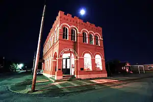 Museum at Gueydan, Louisiana | |
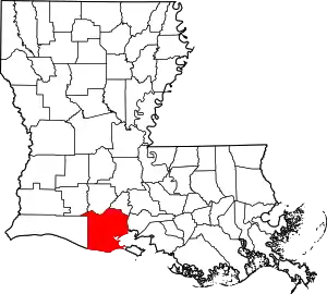 Location within the U.S. state of Louisiana | |
 Louisiana's location within the U.S. | |
| Coordinates: 29°49′N 92°19′W | |
| Country | |
| State | |
| Founded | 1844 |
| Named for | Vermilion River and Bay |
| Seat | Abbeville |
| Largest city | Abbeville |
| Area | |
| • Total | 1,542 sq mi (3,990 km2) |
| • Land | 1,173 sq mi (3,040 km2) |
| • Water | 369 sq mi (960 km2) 24% |
| Population (2010) | |
| • Total | 57,999 |
| • Estimate (2018) | 59,830 |
| • Density | 38/sq mi (15/km2) |
| Time zone | UTC−6 (Central) |
| • Summer (DST) | UTC−5 (CDT) |
| Congressional district | 3rd |
| Website | vermilionparishpolicejury |
Vermilion Parish is part of the Lafayette, LA Metropolitan Statistical Area.
Vermilion and neighboring Cameron parishes are represented in the Louisiana State Senate by the Republican Jonathan W. Perry of Kaplan.
In the past several decades, much of the southern portion of the parish has been swept away by water erosion, especially after Hurricane Katrina and Hurricane Rita in 2005.
History
Indigenous peoples lived in the area for thousands of years, from different cultures. By historic times, the Chitimacha and Atakapa inhabited the area and were the American Indians encountered by Spanish and French explorers and settlers. The tribes' numbers were drastically reduced as a result of exposure to European diseases to which they had no immunity.
French, Spanish, enslaved Africans, and French-Canadians from Acadia expelled after the Seven Years' War won by Great Britain, had all entered the area by the end of the 18th century. As the population became mostly Cajun, the primary language was French for years. In the mid- to late 19th century, they were joined by European Americans; immigrants from Italy, recruited to work on the plantations, as well as Jewish immigrants from Germany and eastern Europe, who tended to settle in towns and become merchants.
Geography
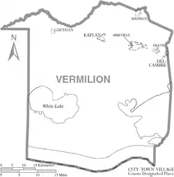
According to the U.S. Census Bureau, the parish has a total area of 1,542 square miles (3,990 km2), of which 1,173 square miles (3,040 km2) is land and 369 square miles (960 km2) (24%) is water.[4] It is the fifth-largest parish in Louisiana by total area. The Gulf of Mexico is located to the south of the parish.
Major highways
 U.S. Highway 167
 Louisiana Highway 13
 Louisiana Highway 14
 Louisiana Highway 82
Adjacent parishes
- Acadia Parish (north)
- Lafayette Parish (northeast)
- Iberia Parish (east)
- Cameron Parish (west)
- Jefferson Davis Parish (northwest)
Demographics
| Historical population | |||
|---|---|---|---|
| Census | Pop. | %± | |
| 1850 | 3,409 | — | |
| 1860 | 4,324 | 26.8% | |
| 1870 | 4,528 | 4.7% | |
| 1880 | 8,728 | 92.8% | |
| 1890 | 14,234 | 63.1% | |
| 1900 | 20,705 | 45.5% | |
| 1910 | 26,390 | 27.5% | |
| 1920 | 26,482 | 0.3% | |
| 1930 | 33,684 | 27.2% | |
| 1940 | 37,750 | 12.1% | |
| 1950 | 36,929 | −2.2% | |
| 1960 | 38,855 | 5.2% | |
| 1970 | 43,071 | 10.9% | |
| 1980 | 48,458 | 12.5% | |
| 1990 | 50,055 | 3.3% | |
| 2000 | 53,807 | 7.5% | |
| 2010 | 57,999 | 7.8% | |
| 2018 (est.) | 59,830 | [5] | 3.2% |
| U.S. Decennial Census[6] 1790-1960[7] 1900-1990[8] 1990-2000[9] 2010-2013[1] | |||
Home to a number of Cajun peoples, as of the census[10] of 2000, there were 53,807 people, 19,832 households, and 14,457 families residing in the parish. The population density was 46 people per square mile (18/km2). There were 22,461 housing units at an average density of 19 per square mile (7/km2). The racial makeup of the parish was 82.68% White, 14.17% Black or African American, 0.30% Native American, 1.82% Asian, 0.01% Pacific Islander, 0.26% from other races, and 0.76% from two or more races. 1.38% of the population were Hispanic or Latino of any race. 24.89% reported speaking French or Cajun French at home, while 1.64% speak Vietnamese and 1.02% Spanish.
There were 19,832 households, out of which 37.10% had children under the age of 18 living with them, 55.50% were married couples living together, 13.00% had a female householder with no husband present, and 27.10% were non-families. 23.10% of all households were made up of individuals, and 10.90% had someone living alone who was 65 years of age or older. The average household size was 2.67 and the average family size was 3.16.
In the parish the population was spread out, with 28.10% under the age of 18, 9.40% from 18 to 24, 28.20% from 25 to 44, 20.80% from 45 to 64, and 13.50% who were 65 years of age or older. The median age was 35 years. For every 100 females there were 93.90 males. For every 100 females age 18 and over, there were 89.80 males.
The median income for a household in the parish was $29,500, and the median income for a family was $36,093. Males had a median income of $31,044 versus $18,710 for females. The per capita income for the parish was $14,201. About 17.40% of families and 22.10% of the population were below the poverty line, including 30.00% of those under age 18 and 21.40% of those age 65 or over.
Education
Vermilion Parish School Board operates public schools in the parish. However, the schools serving Delcambre are located in Vermilion Parish and are operated by Iberia Parish School System.
On January 8, 2018, teacher Deyshia Hargrave was asked by a marshal to leave the room after she questioned the Vermilion Parish School Board on their decision to increase the salary of superintendent Jerome Puyau but keep teacher salaries stagnant. After she walked out into the hallway, the marshal handcuffed and arrested her. The city's prosecutor and the board declined to press charges.[11][12][13] Board president Anthony Fontana described the incident as a "set up" and blamed "the poor little woman" for the incident, saying, "She could have walked out and nothing would have happened."[11][14] As a result, Fontana resigned around ten days later.[15]
Schools
Public Schools that are run by the Vermilion Parish School Board include:
- Cecil Picard Elementary (Grades PK-5) (Maurice)
- Dozier Elementary (Grades PK-5) (Erath)
- Eaton Park Elementary (Grades PK-2) (Abbeville)
- Forked Island - E. Broussard Elementary (Grades PK-8) (Abbeville)
- Indian Bayou Elementary (Grades PK-5) (Rayne)
- James A. Herod Elementary (Grades 3-5) (Abbeville)
- Jesse Owens Elementary (Grades PK-5) (Gueydan)
- Kaplan Elementary (Grades PK-4) (Kaplan)
- Leblanc Elementary (Grades PK-5) (Abbeville)
- Meaux Elementary (Grades PK-5) (Abbeville)
- Seventh Ward Elementary (Grades PK-5) (Abbeville)
- Erath Middle (Grades 6-8) (Erath)
- J. H. Williams Middle (Grades 6-8) (Abbeville)
- North Vermilion Middle (Grades 6-8) (Maurice)
- Rene A. Rost Middle (Grades 5-8) (Kaplan)
- Abbeville High (Grades 9-12) (Abbeville)
- Erath High School (Grades 9-12) (Erath)
- Gueydan High (Grades 6-12) (Gueydan)
- Kaplan High (Grades 9-12) (Kaplan)
- North Vermilion High (Grades 9-12) (Maurice)
Vermilion Parish is also served by the Diocese of Lafayette with three schools:
- Maltrait Memorial School (Grades PK-8) (Kaplan)
- Mt. Carmel Catholic School (Grades PK-8) (Abbeville)
- Vermilion Catholic High School (Grades 9-12) (Abbeville)
Additionally, Vermilion Parish is served by two unaffiliated private school:
- Harvest Time Christian Academy (Grades PK-12) (Abbeville)
- Lighthouse Christian High School (Grades 9-12) (Abbeville)
Vermilion Parish is served by one institution of higher education:
- South Louisiana Community College, Gulf Area Campus (Abbeville)
Communities
Village
Unincorporated communities
Politics
| Year | Republican | Democratic | Third parties |
|---|---|---|---|
| 2020 | 80.3% 21,930 | 18.3% 5,009 | 1.4% 385 |
| 2016 | 78.3% 20,063 | 19.0% 4,857 | 2.8% 712 |
| 2012 | 75.7% 18,910 | 22.9% 5,720 | 1.4% 357 |
| 2008 | 72.8% 18,069 | 25.2% 6,266 | 2.0% 498 |
| 2004 | 61.4% 15,069 | 37.0% 9,085 | 1.6% 398 |
| 2000 | 56.2% 12,495 | 39.2% 8,704 | 4.7% 1,036 |
| 1996 | 33.8% 7,653 | 55.6% 12,609 | 10.6% 2,399 |
| 1992 | 30.1% 7,062 | 52.6% 12,324 | 17.3% 4,058 |
| 1988 | 42.0% 9,224 | 55.5% 12,180 | 2.6% 562 |
| 1984 | 56.9% 12,721 | 40.4% 9,033 | 2.8% 624 |
| 1980 | 49.0% 10,481 | 45.5% 9,743 | 5.5% 1,185 |
| 1976 | 34.4% 6,133 | 63.0% 11,246 | 2.6% 471 |
| 1972 | 66.4% 8,909 | 28.9% 3,876 | 4.7% 635 |
| 1968 | 21.6% 3,278 | 25.0% 3,806 | 53.4% 8,124 |
| 1964 | 35.1% 4,984 | 64.9% 9,204 | |
| 1960 | 14.9% 2,170 | 77.1% 11,257 | 8.0% 1,168 |
| 1956 | 44.6% 3,877 | 52.5% 4,564 | 2.9% 254 |
| 1952 | 42.4% 3,868 | 57.6% 5,261 | |
| 1948 | 19.4% 1,212 | 28.9% 1,806 | 51.8% 3,243 |
| 1944 | 12.6% 676 | 87.4% 4,684 | |
| 1940 | 34.5% 2,621 | 65.5% 4,969 | |
| 1936 | 10.7% 496 | 89.0% 4,141 | 0.3% 15 |
| 1932 | 8.4% 269 | 91.6% 2,945 | |
| 1928 | 14.9% 451 | 85.1% 2,580 | |
| 1924 | 41.0% 416 | 59.0% 598 | |
| 1920 | 72.1% 1,420 | 27.9% 549 | 0.1% 1 |
| 1916 | 3.5% 78 | 59.6% 1,340 | 37.0% 832 |
| 1912 | 13.9% 124 | 59.7% 531 | 26.4% 235 |
- Home of Catherine Romaine, Vermillion Catholic Alumni and 2018-2019 Louisiana Senior State Beta Club Vice President
See also
| Wikimedia Commons has media related to Vermilion Parish, Louisiana. |
References
- "State & County QuickFacts". United States Census Bureau. Retrieved August 18, 2013.
- "Find a County". National Association of Counties. Archived from the original on May 31, 2011. Retrieved 2011-06-07.
- "Vermilion Parish". Center for Cultural and Eco-Tourism. Retrieved September 5, 2014.
- "2010 Census Gazetteer Files". United States Census Bureau. August 22, 2012. Archived from the original on September 28, 2013. Retrieved September 2, 2014.
- "Population and Housing Unit Estimates". Retrieved October 27, 2019.
- "U.S. Decennial Census". United States Census Bureau. Retrieved September 2, 2014.
- "Historical Census Browser". University of Virginia Library. Retrieved September 2, 2014.
- "Population of Counties by Decennial Census: 1900 to 1990". United States Census Bureau. Retrieved September 2, 2014.
- "Census 2000 PHC-T-4. Ranking Tables for Counties: 1990 and 2000" (PDF). United States Census Bureau. Retrieved September 2, 2014.
- "U.S. Census website". United States Census Bureau. Retrieved 2008-01-31.
- "Teacher removed from Vermilion school board meeting in handcuffs". KATC. 8 January 2018. Retrieved 8 January 2018.
- Hauser, Christine; Victor, Daniel. "Teacher Arrested at School Board Meeting After Questioning Superintendent Contract". The New York Times. Retrieved 18 January 2018.
- "Teacher removed from public education meeting in handcuffs after asking why superintendents get raises but teachers don't / Boing Boing". boingboing.net. Retrieved 2018-01-09.
- LaFleur, Kendria. "Vermilion Parish teacher's arrest raises questions of gender inequality". KATC. Retrieved 18 January 2018.
- KATC (2018-01-19), Fontana resigning from Vermilion Parish School Board, retrieved 2018-04-29
- Leip, David. "Dave Leip's Atlas of U.S. Presidential Elections". Uselectionatlas.org. Retrieved 2 December 2017.
External links
- Heinrich, P. V., 2006, White Lake 30 x 60 minute geologic quadrangle. Louisiana Geological Survey, Baton Rouge, Louisiana.
- Heinrich, P. V., J. Snead, and R. P. McCulloh, 2003, Crowley 30 x 60 minute geologic quadrangle. Louisiana Geological Survey, Baton Rouge, Louisiana.
- Official website
- Vermilion Historical Society
- Vermilion Parish Sheriff's Office
Places adjacent to Vermilion Parish, Louisiana | ||||||||||
|---|---|---|---|---|---|---|---|---|---|---|
| ||||||||||
Municipalities and communities of Vermilion Parish, Louisiana, United States | ||
|---|---|---|
| Cities | | |
| Town | ||
| Village | ||
| Unincorporated communities | ||
| Footnotes | ‡This populated place also has portions in an adjacent parish or parishes | |
| ||
| Authority control |
|---|