Lovington, New Mexico
Lovington is a city in, and the county seat of, Lea County, New Mexico, United States.[3] The population was 11,009 at the 2010 census,[4] up from 9,471 in 2000.
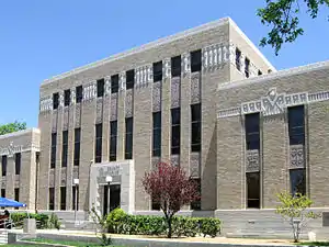
Lovington, New Mexico | |
|---|---|
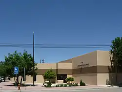 Lovington Public Library | |
 Location of Lovington, New Mexico | |
| Coordinates: 32°56′47″N 103°21′13″W | |
| Country | United States |
| State | New Mexico |
| County | Lea |
| Area | |
| • Total | 11.39 sq mi (29.50 km2) |
| • Land | 11.36 sq mi (29.42 km2) |
| • Water | 0.03 sq mi (0.08 km2) |
| Elevation | 3,911 ft (1,192 m) |
| Population (2010) | |
| • Total | 11,009 |
| • Estimate (2019)[2] | 11,489 |
| • Density | 1,011.27/sq mi (390.45/km2) |
| Time zone | UTC−7 (Mountain (MST)) |
| • Summer (DST) | UTC−6 (MDT) |
| ZIP code | 88260 |
| Area code(s) | 575 |
| FIPS code | 35-44490 |
| GNIS feature ID | 0899742 |
| Website | lovington |
Geography
Lovington is located slightly north of the center of Lea County at 32°56′47″N 103°21′13″W (32.946459, -103.353618).[5] U.S. Route 82 passes through the center of town, leading west 64 miles (103 km) to Artesia and northeast 35 miles (56 km) to Plains, Texas. New Mexico State Road 18 leads southeast from Lovington 21 miles (34 km) to Hobbs, the largest city in Lea County. State Road 83 leads east 18 miles (29 km) to the Texas border, where Texas State Highway 83 continues east 14 miles (23 km) to Denver City, Texas.
According to the United States Census Bureau, Lovington has a total area of 11.4 square miles (29.5 km2), of which 0.03 square miles (0.08 km2), or 0.26%, are water.[6]
Demographics
| Historical population | |||
|---|---|---|---|
| Census | Pop. | %± | |
| 1920 | 411 | — | |
| 1930 | 961 | 133.8% | |
| 1940 | 1,916 | 99.4% | |
| 1950 | 3,134 | 63.6% | |
| 1960 | 9,660 | 208.2% | |
| 1970 | 8,915 | −7.7% | |
| 1980 | 9,727 | 9.1% | |
| 1990 | 9,322 | −4.2% | |
| 2000 | 9,471 | 1.6% | |
| 2010 | 11,009 | 16.2% | |
| 2019 (est.) | 11,489 | [2] | 4.4% |
| U.S. Decennial Census[7] | |||
At the 2000 census there were 9,471 people, 3,297 households, and 2,459 families living in the city. The population density was 1,983.6 people per square mile (766.6/km2). There were 3,823 housing units at an average density of 800.7 per square mile (309.4/km2). The racial makeup of the city was 59.85% White, 3.03% African American, 0.78% Native American, 0.48% Asian, 0.06% Pacific Islander, 32.74% from other races, and 3.06% from two or more races. Hispanic or Latino of any race were 52.12%.[8]
Of the 3,297 households 41.6% had children under the age of 18 living with them, 57.0% were married couples living together, 13.0% had a female householder with no husband present, and 25.4% were non-families. 22.8% of households were one person and 11.5% were one person aged 65 or older. The average household size was 2.80 and the average family size was 3.29.
The age distribution was 31.8% under the age of 18, 10.9% from 18 to 24, 25.8% from 25 to 44, 18.8% from 45 to 64, and 12.6% 65 or older. The median age was 31 years. For every 100 females, there were 96.8 males. For every 100 females age 18 and over, there were 94.3 males.
The median household income was $26,458 and the median family income was $30,064. Males had a median income of $28,547 versus $19,826 for females. The per capita income for the city was $12,752. About 20.1% of families and 22.1% of the population were below the poverty line, including 28.1% of those under age 18 and 16.2% of those age 65 or over.
Notable people
- Ray Berry, American football player
- Ronnie Black, professional golfer
- Taymon Domzalski, retired professional and Duke University basketball star[9]
- Paul L. Foster, billionaire philanthropist and President of Western Refining
- Shirley Hooper, 18th Secretary of State of New Mexico
- Sean Murphy, professional golfer
- Earlene Roberts (1935–2013), politician
- Ralph Tasker, basketball coach
- Titanic Thompson, legendary gambler, raconteur
- Brian Urlacher, retired NFL football player, pro football hall of fame class of 2018
References
- "2019 U.S. Gazetteer Files". United States Census Bureau. Retrieved July 27, 2020.
- "Population and Housing Unit Estimates". United States Census Bureau. May 24, 2020. Retrieved May 27, 2020.
- "Find a County". National Association of Counties. Retrieved 2011-06-07.
- "Total Population: 2010 Census DEC Summary File 1 (P1), Lovington city, New Mexico". data.census.gov. U.S. Census Bureau. Retrieved May 7, 2020.
- "US Gazetteer files: 2010, 2000, and 1990". United States Census Bureau. 2011-02-12. Retrieved 2011-04-23.
- "U.S. Gazetteer Files: 2019: Places: New Mexico". U.S. Census Bureau Geography Division. Retrieved May 7, 2020.
- "Census of Population and Housing". Census.gov. Retrieved June 4, 2015.
- "U.S. Census website". United States Census Bureau. Retrieved 2008-01-31.
- Ganz, Adam. "`It's been the most fun season I've had here'". The Chronicle. Retrieved 21 January 2015.
External links
| Wikimedia Commons has media related to Lovington, New Mexico. |
Municipalities and communities of Lea County, New Mexico, United States | ||
|---|---|---|
| Cities | 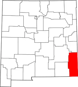 Map of New Mexico highlighting Lea County | |
| Town | ||
| CDPs | ||
| Other unincorporated communities | ||
| ||
Santa Fe (capital) | ||
| Topics |
| |
| Society | ||
| Regions |
| |
| Cities | ||
| Counties | ||

| Authority control |
|---|