Murca Formation
The Murca Formation (Spanish: Formación Murca, Kim) is a geological formation of the Altiplano Cundiboyacense, Eastern Ranges of the Colombian Andes. The predominantly subarkose sandstone with claystones and siltstones formation dates to the Early Cretaceous period; Valanginian epoch and has a maximum thickness of 924 metres (3,031 ft).
| Murca Formation Stratigraphic range: Late Valanginian ~135–133 Ma | |
|---|---|
| Type | Geological formation |
| Unit of | Cáqueza Group |
| Underlies | La Naveta Fm., Trincheras Fm., Útica Fm. |
| Overlies | not observed |
| Thickness | up to 924 m (3,031 ft) |
| Lithology | |
| Primary | Sandstone |
| Other | Claystone, siltstone |
| Location | |
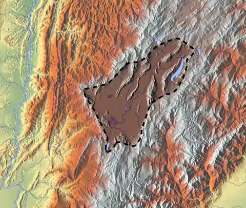
| Coordinates | 5°15′27″N 74°21′12″W |
| Region | Altiplano Cundiboyacense Eastern Ranges, Andes |
| Country | |
| Type section | |
| Named for | Murca River |
| Named by | Moreno |
| Location | Pacho, El Peñón |
| Year defined | 1990 |
| Coordinates | 5°15′27″N 74°21′12″W |
| Region | Cundinamarca, Boyacá |
| Country | |
Etymology
The formation was defined and named in 1990 by Moreno after the Murca River, Cundinamarca.[1][2]
Description
Lithologies
The Murca Formation has a maximum thickness of 924 metres (3,031 ft), and is characterised by a sequence of subarkose coarse-grained, locally cross-bedded sandstones with intercalating siltstones and claystones. The basal part of the black and grey feldspar bearing sandstone beds contains large pyrite crystals. The matrix is formed by cements of calcite, iron oxide, sericite and chlorite.[3]
Fossils of Berriasella colombiana and Pseudoosterella ubalaensis have been found in the Murca Formation.[4][5][6][7][8]
Stratigraphy and depositional environment
The Murca Formation, belonging to the Cáqueza Group, underlies the Trincheras Formation, lowermost unit of the Villeta Group. The contact with the underlying unit has not been observed.[3] The age has been estimated to be Valanginian. Stratigraphically, the formation is time equivalent with the Cumbre, Rosablanca and Útica Formations. The formation has been deposited in a marine environment characterised by turbidites.[4] A mid submarine fan and outer fan setting have been observed in the Murca Formation.[9] A possible source for the sandstones were Precambrian sandstones, gneisses and granites, belonging to the Guiana Shield.[3][10]
Outcrops
The Murca Formation is apart from its type locality, found near Nimaima and Guayabal in the western flank and Ubalá and Labranzagrande in the eastern flank of the Eastern Ranges.[1][5][6][7]
Regional correlations
| Age | Paleomap | VMM | Guaduas-Vélez | W Emerald Belt | Villeta anticlinal | Chiquinquirá- Arcabuco | Tunja- Duitama | Altiplano Cundiboyacense | El Cocuy | ||||
|---|---|---|---|---|---|---|---|---|---|---|---|---|---|
| Maastrichtian | 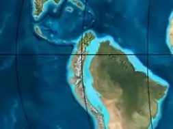 | Umir | Córdoba | Seca | eroded | Guaduas | Colón-Mito Juan | ||||||
| Umir | Guadalupe | ||||||||||||
| Campanian | Córdoba | ||||||||||||
| Oliní | |||||||||||||
| Santonian | La Luna | Cimarrona - La Tabla | La Luna | ||||||||||
| Coniacian | Oliní | Conejo | Chipaque | ||||||||||
Güagüaquí | Loma Gorda | undefined | La Frontera | ||||||||||
| Turonian | 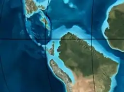 | Hondita | La Frontera | Otanche | |||||||||
| Cenomanian | Simití | hiatus | La Corona | Simijaca | Capacho | ||||||||
| Pacho Fm. | Hiló - Pacho | Churuvita | Une | Aguardiente | |||||||||
| Albian | 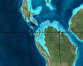 | Hiló | Chiquinquirá | Tibasosa | Une | ||||||||
| Tablazo | Tablazo | Capotes - La Palma - Simití | Simití | Tibú-Mercedes | |||||||||
| Aptian | Capotes | Socotá - El Peñón | Paja | Fómeque | |||||||||
| Paja | Paja | El Peñón | Trincheras | Río Negro | |||||||||
| La Naveta | |||||||||||||
| Barremian |  | ||||||||||||
| Hauterivian | Muzo | Cáqueza | Las Juntas | ||||||||||
| Rosablanca | Ritoque | ||||||||||||
| Valanginian | Ritoque | Furatena | Útica - Murca | Rosablanca | hiatus | Macanal | |||||||
| Rosablanca | |||||||||||||
| Berriasian |  | Cumbre | Cumbre | Los Medios | Guavio | ||||||||
| Tambor | Arcabuco | Cumbre | |||||||||||
| Sources | |||||||||||||
See also
References
- Acosta & Ulloa, 2002, p.37
- Moreno, 1990, p.66
- Moreno, 1990, p.72
- Acosta & Ulloa, 2002, p.38
- Dorado Galindo, 1990, p.23
- Moreno, 1990, p.76
- Piraquive et al., 2011, p.207
- Pseudoosterella ubalaensis
- Acosta & Ulloa, 2001, p.19
- Villamil, 2012, p.165
Bibliography
- Acosta Garay, Jorge E., and Carlos E. Ulloa Melo. 2002. Mapa Geológico del Departamento de Cundinamarca - 1:250,000 - Memoria explicativa, 1–108. INGEOMINAS. Accessed 2017-04-26.
- Acosta Garay, Jorge E., and Carlos E. Ulloa Melo. 2001. Geología de la Plancha 208 Villeta - 1:100,000, 1-84. INGEOMINAS. Accessed 2017-03-16.
- Dorado Galindo, Jorge. 1990. Contribución al Conocimiento de la Estratigrafía de la Formación Brechas de Buenavista (Límite Jurásico-Cretácico). Región Noroeste de Villavicencio (Meta). Geología Colombiana 17. 7-38. Accessed 2017-03-31.
- Moreno M., Juan Manuel. 1990. Stratigraphy of the Lower Cretaceous Rosablanca and Cumbre Formations, Útica Sandstone and Murca Formation, West Flank, Eastern Cordillera, Colombia. Geología Colombiana 17. 65-86. Accessed 2017-03-31.
- Piraquive, Alejandro; Juan Sebastián Díaz; Tomas Cuéllar; Germán Pardo, and & Andreas Kammer. 2011. Reactivación Neógena de estructuras de rift del Cretácico Temprano asociadas con la Falla de Chámeza, Pajarito, Boyacá (Colombia): evidencias tectónicas y bioestratigráficas - Neogene reactivation of Early Cretaceous rift structures associated with the Chámeza Fault, Pajarito, Boyacá (Colombia): tectonic and biostratigraphic evidences. Geología Colombiana 36. 197-216. Accessed 2017-03-31.
- Villamil, Tomas. 2012. Chronology Relative Sea Level History and a New Sequence Stratigraphic Model for Basinal Cretaceous Facies of Colombia, 161–216. Society for Sedimentary Geology (SEPM).
Maps
- Ulloa, Carlos, and Jorge Acosta. 1998. Plancha 208 - Villeta - 1:100,000, 1. INGEOMINAS. Accessed 2017-06-06.
External links
- Gómez, J.; N.E. Montes; Á. Nivia, and H. Diederix. 2015. Plancha 5-09 del Atlas Geológico de Colombia 2015 – escala 1:500,000, 1. Servicio Geológico Colombiano. Accessed 2017-03-16.
