Ritoque Formation
The Ritoque Formation (Spanish: Formación Ritoque, Kiri, Kirt) is a geological formation of the Altiplano Cundiboyacense, Eastern Ranges of the Colombian Andes. The formation consists of grey siltstones, limestones and fine sandstones intercalated. The formation dates to the Early Cretaceous period; Early Hauterivian epoch and varies in thickness between 70 and 110 metres (230 and 360 ft).
| Ritoque Formation Stratigraphic range: Early Hauterivian ~132–128 Ma | |
|---|---|
| Type | Geological formation |
| Underlies | Paja Formation |
| Overlies | Rosablanca Fm., Arcabuco Fm. |
| Thickness | 70–110 m (230–360 ft) |
| Lithology | |
| Primary | Siltstone |
| Other | Limestone |
| Location | |
| Coordinates | 4°27′07″N 74°03′20″W |
| Region | Altiplano Cundiboyacense Eastern Ranges, Andes |
| Country | |
| Type section | |
| Named for | Vereda Ritoque, Villa de Leyva |
| Named by | Etayo |
| Location | Villa de Leyva |
| Year defined | 1968 |
| Coordinates | 4°27′07″N 74°03′20″W |
| Region | Boyacá, Santander |
| Country | |
Definition
The formation was first defined and named by Etayo in 1968 after the vereda Ritoque of Villa de Leyva.[1]
Description
Lithologies
The Ritoque Formation is characterised by a sequence of grey siltstones, limestones and sandstones with a thickness between 70 and 110 metres (230 and 360 ft).[1]
Stratigraphy and depositional environment
The Ritoque Formation overlies the Rosablanca and Arcabuco Formations and is overlain by the Paja Formation. The age has been estimated to be Early Hauterivian. Stratigraphically, the formation is time equivalent with the Macanal Formation.[2]
Outcrops
.png.webp)
The Ritoque Formation is found, apart from its type locality near Villa de Leyva, Boyacá, found in the vicinity.
Regional correlations
| Age | Paleomap | VMM | Guaduas-Vélez | W Emerald Belt | Villeta anticlinal | Chiquinquirá- Arcabuco | Tunja- Duitama | Altiplano Cundiboyacense | El Cocuy | ||||
|---|---|---|---|---|---|---|---|---|---|---|---|---|---|
| Maastrichtian | 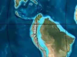 | Umir | Córdoba | Seca | eroded | Guaduas | Colón-Mito Juan | ||||||
| Umir | Guadalupe | ||||||||||||
| Campanian | Córdoba | ||||||||||||
| Oliní | |||||||||||||
| Santonian | La Luna | Cimarrona - La Tabla | La Luna | ||||||||||
| Coniacian | Oliní | Conejo | Chipaque | ||||||||||
Güagüaquí | Loma Gorda | undefined | La Frontera | ||||||||||
| Turonian |  | Hondita | La Frontera | Otanche | |||||||||
| Cenomanian | Simití | hiatus | La Corona | Simijaca | Capacho | ||||||||
| Pacho Fm. | Hiló - Pacho | Churuvita | Une | Aguardiente | |||||||||
| Albian |  | Hiló | Chiquinquirá | Tibasosa | Une | ||||||||
| Tablazo | Tablazo | Capotes - La Palma - Simití | Simití | Tibú-Mercedes | |||||||||
| Aptian | Capotes | Socotá - El Peñón | Paja | Fómeque | |||||||||
| Paja | Paja | El Peñón | Trincheras | Río Negro | |||||||||
| La Naveta | |||||||||||||
| Barremian |  | ||||||||||||
| Hauterivian | Muzo | Cáqueza | Las Juntas | ||||||||||
| Rosablanca | Ritoque | ||||||||||||
| Valanginian | Ritoque | Furatena | Útica - Murca | Rosablanca | hiatus | Macanal | |||||||
| Rosablanca | |||||||||||||
| Berriasian | 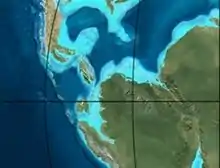 | Cumbre | Cumbre | Los Medios | Guavio | ||||||||
| Tambor | Arcabuco | Cumbre | |||||||||||
| Sources | |||||||||||||
See also
References
- Galvis & Valencia, 2009, p.10
- Galvis & Valencia, 2009, p.17
Bibliography
- Galvis Arenas, Beatriz Elena, and José Leonardo Valencia Escobar. 2009. Contribución en la determinación de los posibles paleoambientes de las rocas Cretáceas Tempranas sobre la vía Tunja-Villa de Leyva (entre Alto del Arrayán - Peaje Sáchica) y sectores aledaños, departamento de Boyacá (BSc. thesis), 1–127. Universidad de Caldas. Accessed 2019-03-10.
- Gómez Cruz, Arley de Jesús; Hermann D. Bermúdez, and Francisco J. Vega. 2015. A new species of Diaulax Bell, 1863 (Brachyura: Dialucidae) in the Early Cretaceous of the Rosablanca Formation, Colombia. Boletín de la Sociedad Geológica Mexicana 67. 103-112. Accessed 2017-04-04.
- Villamil, Tomas. 2012. Chronology Relative Sea Level History and a New Sequence Stratigraphic Model for Basinal Cretaceous Facies of Colombia, 161–216. Society for Sedimentary Geology (SEPM).
Maps
- Pulido González, Orlando. 2009. Plancha 151 - Charalá - 1:100,000, 1. INGEOMINAS. Accessed 2017-06-06.
- Ulloa, Carlos E, and Erasmo Rodríguez. 2009. Plancha 170 - Vélez - 1:100,000, 1. INGEOMINAS. Accessed 2017-06-06.
- Renzoni, Giancarlo, and Humberto Rosas. 2009. Plancha 171 - Duitama - 1:100,000, 1. INGEOMINAS. Accessed 2017-06-06.
- Fuquen M., Jaime A, and José F. Osorno M. 2009. Plancha 190 - Chiquinquirá - 1:100,000, 1. INGEOMINAS. Accessed 2017-06-06.
- Renzoni, Giancarlo; Humberto Rosas, and Fernando Etayo Serna. 1998. Plancha 191 - Tunja - 1:100,000, 1. INGEOMINAS. Accessed 2017-06-06.
External links
- Gómez, J.; N.E. Montes; Á. Nivia, and H. Diederix. 2015. Plancha 5-09 del Atlas Geológico de Colombia 2015 – escala 1:500,000, 1. Servicio Geológico Colombiano. Accessed 2017-03-16.
