National Register of Historic Places listings in Atlantic County, New Jersey
List of the National Register of Historic Places listings in Atlantic County, New Jersey
| Atlantic - Bergen - Burlington - Camden - Cape May - Cumberland - Essex - Gloucester - Hudson - Hunterdon - Mercer - Middlesex - Monmouth - Morris - Ocean - Passaic - Salem - Somerset - Sussex - Union - Warren |
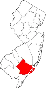
Location of Atlantic County in New Jersey
This is intended to be a complete list of properties and districts listed on the National Register of Historic Places in Atlantic County, New Jersey. The locations of National Register properties and districts (at least for all showing latitude and longitude coordinates below) may be seen in a map by clicking on "Map of all coordinates".[1]
- This National Park Service list is complete through NPS recent listings posted January 29, 2021.[2]
| [3] | Name on the Register[4] | Image | Date listed[5] | Location | City or town | Description |
|---|---|---|---|---|---|---|
| 1 | Absecon Lighthouse | 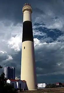 Absecon Lighthouse |
January 25, 1971 (#71000492) |
Vermont and Pacific Aves. 39°21′58″N 74°24′51″W |
Atlantic City | |
| 2 | Atlantic City Convention Hall | .jpg.webp) Atlantic City Convention Hall |
February 27, 1987 (#87000814) |
Georgia and Mississippi Aves. and the Boardwalk 39°21′17″N 74°26′20″W |
Atlantic City | |
| 3 | Capt. Francis Babcock House | 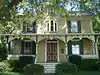 Capt. Francis Babcock House |
July 28, 1999 (#99000907) |
324 S. Shore Rd. 39°25′10″N 74°30′01″W |
Absecon City | |
| 4 | Barclay Court | 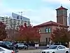 Barclay Court |
June 22, 1988 (#88000725) |
9-11 S. Pennsylvania Ave. 39°21′48″N 74°25′24″W |
Atlantic City | Demolished[6] |
| 5 | Bay Front Historic District | 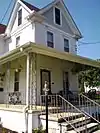 Bay Front Historic District |
March 22, 1989 (#89000227) |
Roughly bounded by Decatur Ave., Egg Harbor Bay, George Ave., and Shore Rd. 39°18′41″N 74°35′41″W |
Somers Point | |
| 6 | Belcoville Post Office | 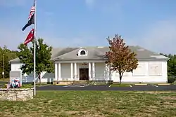 Belcoville Post Office |
March 14, 2008 (#08000174) |
1201 Madden Ave. 39°26′14″N 74°44′00″W |
Weymouth Township | |
| 7 | Bethlehem Loading Company Mays Landing Plant Archeological Historic District | 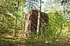 Bethlehem Loading Company Mays Landing Plant Archeological Historic District |
July 12, 2006 (#06000559) |
Address Restricted |
Estell Manor | |
| 8 | William L. Black House |  William L. Black House |
August 26, 1993 (#93000828) |
458 Bellevue Ave. 39°38′24″N 74°47′56″W |
Hammonton | |
| 9 | Amanda Blake Store | 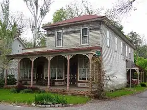 Amanda Blake Store |
January 15, 1979 (#79001469) |
104 Main St. 39°31′09″N 74°29′29″W |
Port Republic | |
| 10 | Church of the Ascension | 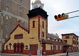 Church of the Ascension |
July 24, 1986 (#86001941) |
1601 Pacific Ave. 39°21′35″N 74°25′47″W |
Atlantic City | Demolished |
| 11 | Church of the Redeemer | 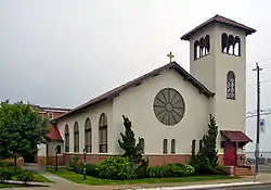 Church of the Redeemer |
September 10, 1992 (#92001179) |
Jct. of 20th and Atlantic Aves. 39°18′34″N 74°31′51″W |
Longport | Destroyed in a 2012 storm, later rebuilt.[7] |
| 12 | John Doughty House | 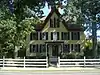 John Doughty House |
March 5, 2002 (#02000107) |
40 North Shore Rd. 39°25′28″N 74°29′56″W |
Absecon City | |
| 13 | Egg Harbor Commercial Bank | 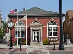 Egg Harbor Commercial Bank |
August 28, 2007 (#07000875) |
134 Philadelphia Ave. 39°31′46″N 74°38′48″W |
Egg Harbor City | |
| 14 | Estellville Glassworks Historic District | 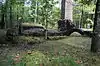 Estellville Glassworks Historic District |
November 21, 1991 (#91001678) |
Roughly bounded by Estell Manor Park, Stevens Cr. and NJ 50 39°23′43″N 74°44′52″W |
Estell Manor City | |
| 15 | Great Egg Coast Guard Station | 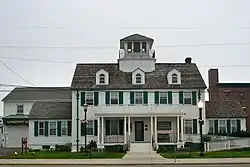 Great Egg Coast Guard Station |
October 31, 2005 (#05000128) |
2301 Atlantic Ave. 39°18′42″N 74°31′41″W |
Longport | |
| 16 | Head of the River Church | 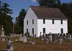 Head of the River Church |
March 7, 1979 (#79001467) |
NJ 49 39°18′38″N 74°49′19″W |
Estell Manor | |
| 17 | Holmhurst Hotel | 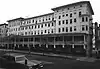 Holmhurst Hotel |
January 18, 1978 (#78001732) |
121 S. Pennsylvania Ave. 39°21′41″N 74°25′23″W |
Atlantic City | Demolished, March 1985.[6] Now a parking lot. |
| 18 | Jacobus Evangelical Lutheran Church | 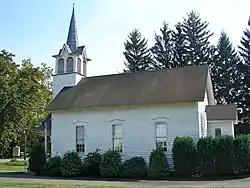 Jacobus Evangelical Lutheran Church |
June 9, 1988 (#88000635) |
Mays Landing Rd. and NJ 54 39°36′25″N 74°50′49″W |
Folsom Borough | |
| 19 | Capt. John Jeffries Burial Marker | 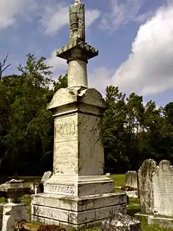 Capt. John Jeffries Burial Marker |
June 14, 1984 (#84002511) |
Palestine Bible Church Cemetery, NJ 559 39°20′55″N 74°39′42″W |
Somers Point | |
| 20 | Liberty Hotel | 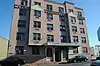 Liberty Hotel |
March 23, 2020 (#100005102) |
1519 Baltic Ave. 39°21′51″N 74°25′55″W |
Atlantic City | |
| 21 | Linwood Borough School No. 1 | 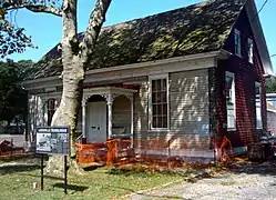 Linwood Borough School No. 1 |
December 20, 1984 (#84000510) |
16 W. Poplar Ave. 39°21′03″N 74°34′04″W |
Linwood | |
| 22 | Linwood Historic District | 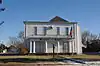 Linwood Historic District |
July 13, 1989 (#89000800) |
Roughly Shore Rd. from Royal Ave. to Sterling Ave. 39°20′27″N 74°34′30″W |
Linwood | |
| 23 | Lucy, the Margate Elephant | 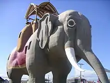 Lucy, the Margate Elephant |
August 12, 1971 (#71000493) |
Decatur and Atlantic Aves. 39°19′15″N 74°30′42″W |
Margate City | |
| 24 | Madison Hotel | 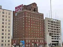 Madison Hotel |
December 20, 1984 (#84000506) |
123 S. Illinois Ave. 39°21′28″N 74°25′49″W |
Atlantic City | |
| 25 | Marven Gardens Historic District | 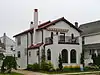 Marven Gardens Historic District |
September 13, 1990 (#90001440) |
Bounded by Ventnor, Fredericksburg, Winchester and Brunswick Aves. 39°20′00″N 74°29′43″W |
Margate City | |
| 26 | Mays Landing Historic District |  Mays Landing Historic District |
August 23, 1990 (#90001245) |
Jct. US 40, NJ 50; roughly bounded by Lake Lenape and Great Egg Harbor 39°27′06″N 74°43′51″W |
Mays Landing | |
| 27 | Mays Landing Presbyterian Church | 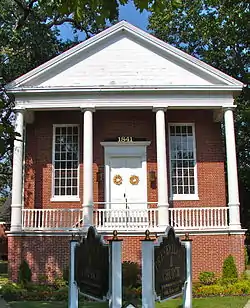 Mays Landing Presbyterian Church |
April 20, 1982 (#82003261) |
Main St. and Cape May Ave. 39°27′09″N 74°43′40″W |
Mays Landing | |
| 28 | Morton Hotel | 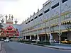 Morton Hotel |
July 15, 1977 (#77000843) |
150 S. Virginia Ave. 39°21′34″N 74°25′14″W |
Atlantic City | Demolished,[6] now occupied by Trump Taj Mahal |
| 29 | Neutral Water Health Resort Sanitarium |  Neutral Water Health Resort Sanitarium |
March 20, 1991 (#91000267) |
Jct. of Claudius St. and London Ave. 39°32′08″N 74°38′30″W |
Egg Harbor City | |
| 30 | Dr. Jonathan Pitney House | 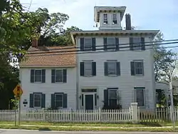 Dr. Jonathan Pitney House |
August 14, 1998 (#98001062) |
57 N. Shore Rd. 39°25′31″N 74°29′55″W |
Absecon City | |
| 31 | Pleasant Mills | 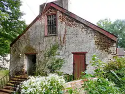 Pleasant Mills |
March 3, 1995 (#95000182) |
Elwood-Pleasant Mills Rd., E side 39°38′13″N 74°39′39″W |
Mullica Township | |
| 32 | Port Republic Historic District | 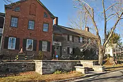 Port Republic Historic District |
May 16, 1991 (#91000596) |
Roughly bounded by Mill St., Clark's Landing Rd., Adams Ave., Port Republic-Smithville Rd. and Riverside Dr. 39°31′15″N 74°29′35″W |
Port Republic | |
| 33 | Samuel Richards Hotel | 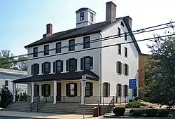 Samuel Richards Hotel |
August 31, 1979 (#79001468) |
106 E. Main St 39°27′04″N 74°43′31″W |
Mays Landing | |
| 34 | Jeremiah II or Edward Risley House |  Jeremiah II or Edward Risley House |
May 31, 1991 (#91000609) |
8 Virginia Ave. 39°22′32″N 74°32′22″W |
Northfield | |
| 35 | Risley School |  Risley School |
May 4, 2011 (#11000256) |
134 Cape May Ave. 39°22′37″N 74°49′29″W |
Estell Manor | |
| 36 | ROBERT J. WALKER (shipwreck and remains) | 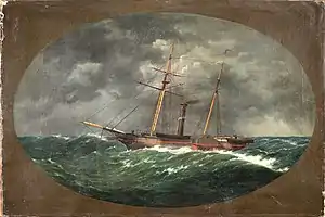 ROBERT J. WALKER (shipwreck and remains) |
March 19, 2014 (#14000064) |
Ten miles off the New Jersey coast 39°16′45″N 74°15′24″W |
Atlantic City | |
| 37 | St. Nicholas of Tolentine Church | 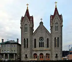 St. Nicholas of Tolentine Church |
February 2, 2001 (#01000039) |
1409 Pacific Ave. 39°21′38″N 74°25′41″W |
Atlantic City | |
| 38 | Santa Rita Apartments | 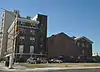 Santa Rita Apartments |
June 14, 1991 (#91000675) |
66 S. South Carolina Ave. 39°21′40″N 74°25′35″W |
Atlantic City | Demolished |
| 39 | Segal Building |  Segal Building |
February 9, 1984 (#84002517) |
1200 Atlantic Ave. 39°21′46″N 74°25′35″W |
Atlantic City | |
| 40 | Shelburne Hotel | 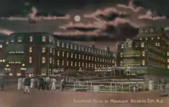 Shelburne Hotel |
May 19, 1978 (#78001733) |
Michigan Ave. and the Boardwalk 39°21′21″N 74°26′03″W |
Atlantic City | Demolished[6] |
| 41 | Smithville Apothecary | 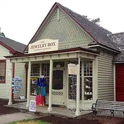 Smithville Apothecary |
June 9, 1978 (#78001734) |
Off Moss Mill Rd. 39°29′47″N 74°27′49″W |
Smithville | |
| 42 | Somers Mansion | 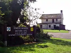 Somers Mansion |
December 18, 1970 (#70000378) |
Shore Rd. and Somers Point Circle 39°18′33″N 74°35′55″W |
Somers Point | |
| 43 | John Stafford Historic District | 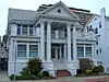 John Stafford Historic District |
June 9, 1988 (#88000723) |
Roughly bounded by Atlantic Ave., Vassar Ave., Boardwalk, and Austin Ave. 39°20′35″N 74°28′01″W |
Ventnor City | |
| 44 | Tofani–DiMuzio House | 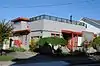 Tofani–DiMuzio House |
October 30, 2015 (#15000762) |
12 S. Cambridge Ave. 39°20′18″N 74°28′47″W |
Ventnor City | |
| 45 | Ventnor City Hall | 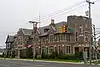 Ventnor City Hall |
October 10, 1996 (#96001088) |
6201 Atlantic Ave. 39°20′15″N 74°28′49″W |
Ventnor City | |
| 46 | WEYMOUTH (schooner) | April 25, 1985 (#85000874) |
Address Restricted |
Hamilton Township | ||
| 47 | Weymouth Road Bridge | 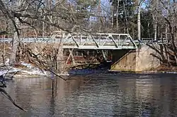 Weymouth Road Bridge |
June 21, 2001 (#01000671) |
Weymouth Rd. 39°31′07″N 74°46′45″W |
Hamilton Township | |
| 48 | World War I Memorial |  World War I Memorial |
August 28, 1981 (#81000388) |
O'Donnell Pkwy., S. Albany and Ventnor Aves. 39°21′05″N 74°27′19″W |
Atlantic City |
Former listings
| [3] | Name on the Register | Image | Date listed | Date removed | Location | City or town | Summary |
|---|---|---|---|---|---|---|---|
| 1 | Marlborough-Blenheim Hotel | _Atlantic_City%252C_NJ.jpg.webp) Marlborough-Blenheim Hotel |
August 23, 1977 (#77000842) | 1999 | Boardwalk and Ohio Aves. |
Atlantic City | Demolished in October 1978 |
| 2 | Traymore Hotel | 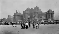 Traymore Hotel |
December 13, 1971 (#71001049) | 1972 | Illinois Ave. and Boardwalk. |
Atlantic City | Demolished |
| 3 | U.S. Coast Guard Station | June 23, 1976 (#76001144) | 1977 | About 3 mi. NNE of Brigantine City |
Brigantine City vicinity | Demolished |
References
- The latitude and longitude information provided in this table was derived originally from the National Register Information System, which has been found to be fairly accurate for about 99% of listings. Some locations in this table may have been corrected to current GPS standards.
- "National Register of Historic Places: Weekly List Actions". National Park Service, United States Department of the Interior. Retrieved on January 29, 2021.
- Numbers represent an alphabetical ordering by significant words. Various colorings, defined here, differentiate National Historic Landmarks and historic districts from other NRHP buildings, structures, sites or objects.
- "National Register Information System". National Register of Historic Places. National Park Service. April 24, 2008.
- The eight-digit number below each date is the number assigned to each location in the National Register Information System database, which can be viewed by clicking the number.
- NJ DEP Historic Preservation Office Archived 2006-10-17 at the Wayback Machine
- http://www.pressofatlanticcity.com/features/f7/longport-s-church-of-the-redeemer-destroyed-by-storm-sparked/article_9f7a4150-c30d-11e1-8a02-001a4bcf887a.html
| Topics | 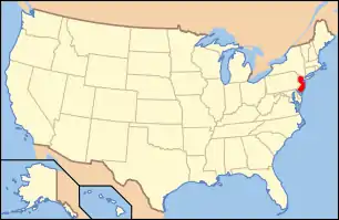 | ||
|---|---|---|---|
| Lists by county | |||
| Lists by city |
| ||
| Other lists | |||
| |||
Municipalities and communities of Atlantic County, New Jersey, United States | ||
|---|---|---|
| Cities | Map of New Jersey highlighting Atlantic County | |
| Boroughs | ||
| Town | ||
| Townships | ||
| CDPs | ||
| Other unincorporated communities | ||
| ||
| Wikimedia Commons has media related to National Register of Historic Places in Atlantic County, New Jersey. |
This article is issued from Wikipedia. The text is licensed under Creative Commons - Attribution - Sharealike. Additional terms may apply for the media files.