National Register of Historic Places listings in Cumberland County, New Jersey
List of the National Register of Historic Places listings in Cumberland County, New Jersey
| Atlantic - Bergen - Burlington - Camden - Cape May - Cumberland - Essex - Gloucester - Hudson - Hunterdon - Mercer - Middlesex - Monmouth - Morris - Ocean - Passaic - Salem - Somerset - Sussex - Union - Warren |
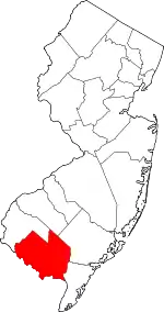
Location of Cumberland County in New Jersey
This is intended to be a complete list of properties and districts listed on the National Register of Historic Places in Cumberland County, New Jersey. The locations of National Register properties and districts (at least for all showing latitude and longitude coordinates below) may be seen in an online map by clicking on "Map of all coordinates".[1]
- This National Park Service list is complete through NPS recent listings posted January 29, 2021.[2]
| [3] | Name on the Register[4] | Image | Date listed[5] | Location | City or town | Description |
|---|---|---|---|---|---|---|
| 1 | A.J. MEERWALD (Schooner) | 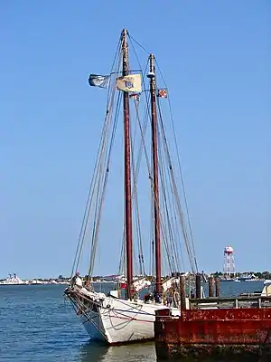 A.J. MEERWALD (Schooner) |
November 7, 1995 (#95001256) |
22 Miller Ave. on Maurice River, Commercial Township 39°14′05″N 75°01′50″W |
Commercial Township | |
| 2 | Beth Hillel Synagogue | 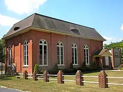 Beth Hillel Synagogue |
November 7, 1978 (#78001755) |
Irving Ave. 39°26′03″N 75°07′31″W |
Deerfield Township | |
| 3 | Bethel African Methodist Episcopal Church | 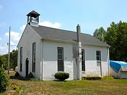 Bethel African Methodist Episcopal Church |
November 12, 1999 (#99001312) |
Sheppards Mill Rd. (Greenwich Township) 39°24′06″N 75°19′48″W |
Greenwich Township | |
| 4 | Bivalve Oyster Packing Houses and Docks | 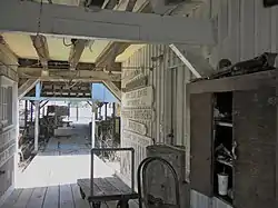 Bivalve Oyster Packing Houses and Docks |
February 28, 1996 (#96000079) |
Shell Rd., Miller and Howard Sts., Commercial Township 39°14′00″N 75°01′56″W |
Commercial Township | |
| 5 | Bridgeton Historic District | 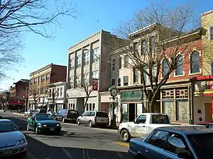 Bridgeton Historic District |
October 29, 1982 (#82001043) |
Roughly bounded by RR Tracks, South Ave., Lake, Commerce, Water, Belmont, Cohensey, and Penn Sts. 39°25′41″N 75°13′57″W |
Bridgeton | |
| 6 | Jeremiah Buck House | 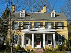 Jeremiah Buck House |
December 30, 1975 (#75001130) |
297 E. Commerce St. 39°25′43″N 75°13′36″W |
Bridgeton | |
| 7 | CASHIER (oyster schooner) | 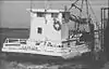 CASHIER (oyster schooner) |
February 23, 2016 (#15001050) |
2800 High St. 39°14′00″N 75°02′02″W |
Commercial Township | At the Bayshore Center at Bivalve. Draft nomination |
| 8 | Deerfield Pike Tollgate House |  Deerfield Pike Tollgate House |
May 21, 1975 (#75001131) |
89 Old Deerfield Pike 39°27′09″N 75°13′45″W |
Bridgeton | Demolished in 2001.[6] |
| 9 | Deerfield Presbyterian Church | 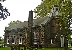 Deerfield Presbyterian Church |
September 29, 1980 (#80002481) |
NE of Seabrook 39°30′42″N 75°14′17″W |
Seabrook | |
| 10 | Gen. James Giles House | 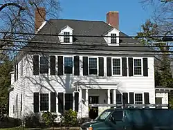 Gen. James Giles House |
March 8, 1978 (#78001754) |
143 W. Broad St. 39°25′44″N 75°14′33″W |
Bridgeton | |
| 11 | Greenwich Historic District |  Greenwich Historic District |
January 20, 1972 (#72000772) |
Main St. from Cohansey River N to Othello 39°23′51″N 75°20′25″W |
Greenwich | |
| 12 | Caesar Hoskins Log Cabin | 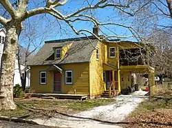 Caesar Hoskins Log Cabin |
September 10, 1987 (#87001521) |
Jct. of South and Second Sts. 39°17′02″N 74°59′41″W |
Mauricetown | |
| 13 | Indian Head Site | October 27, 2004 (#04001196) |
Address restricted |
Deerfield Township | ||
| 14 | Landis Theatre-Mori Brothers Building | 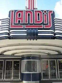 Landis Theatre-Mori Brothers Building |
November 22, 2000 (#00001405) |
830-834 Landis Ave. 39°29′10″N 75°01′03″W |
Vineland | |
| 15 | Thomas Maskel House | 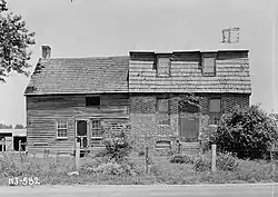 Thomas Maskel House |
June 10, 1975 (#75001132) |
2 mi (3.2 km). W of Greenwich on Bacon's Neck Rd. 39°24′04″N 75°22′34″W |
Greenwich | |
| 16 | Maurice River Lighthouse and East Point Archeological District | 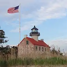 Maurice River Lighthouse and East Point Archeological District |
August 25, 1995 (#95001047) |
Lighthouse Road, near the junction of East Point Road 39°11′45″N 75°01′40″W |
Maurice River Township | |
| 17 | Mauricetown Historic District | 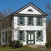 Mauricetown Historic District |
March 29, 2018 (#100002252) |
Roughly along Highland St. 39°17′10″N 74°59′40″W |
Commercial Township | |
| 18 | Miah Maull Shoal Lighthouse | 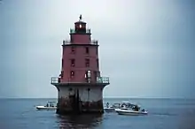 Miah Maull Shoal Lighthouse |
February 4, 1991 (#90002188) |
In Delaware Bay 5 mi (8.0 km). SW of Egg Island Point 39°07′36″N 75°12′35″W |
Downe Township | |
| 19 | Millville's First Bank Building | 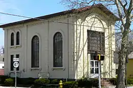 Millville's First Bank Building |
November 20, 1980 (#80002480) |
2nd and E. Main Sts. 39°23′43″N 75°02′14″W |
Millville | |
| 20 | Old Broad Street Presbyterian Church and Cemetery | 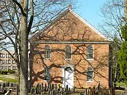 Old Broad Street Presbyterian Church and Cemetery |
December 2, 1974 (#74001159) |
Broad and Lawrence Sts. 39°25′44″N 75°14′46″W |
Bridgeton | |
| 21 | Old Stone Church | 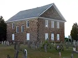 Old Stone Church |
May 12, 1977 (#77000860) |
N of Cedarville on NJ 553 39°21′37″N 75°13′30″W |
Cedarville | |
| 22 | Potter's Tavern | 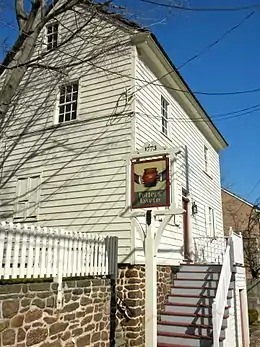 Potter's Tavern |
September 10, 1971 (#71000501) |
49-51 Broad St. 39°25′40″N 75°14′20″W |
Bridgeton | |
| 23 | John and Elizabeth Remington House | 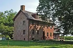 John and Elizabeth Remington House |
July 14, 2015 (#15000420) |
689 Roadstown Rd. 39°26′24″N 75°18′41″W |
Hopewell Township | |
| 24 | Samuel W. Seeley House | 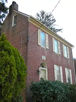 Samuel W. Seeley House |
May 13, 1976 (#76001150) |
274 E. Commerce St. 39°25′41″N 75°13′37″W |
Bridgeton | |
| 25 | Ship John Shoal Light Station | 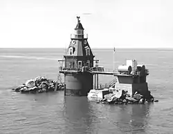 Ship John Shoal Light Station |
July 19, 2006 (#06000630) |
In Delaware Bay, 3.3 mi (5.3 km). W-SW of Sea Breeze 39°18′26″N 75°22′36″W |
Sea Breeze | |
| 26 | Siloam Cemetery | 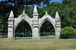 Siloam Cemetery |
April 3, 2020 (#100005155) |
550 North Valley Ave. 39°29′22″N 75°00′24″W |
Vineland | |
| 26 | Spindrift Sailing Yacht | April 22, 1982 (#82003271) |
S. of Bridgeton 39°22′48″N 75°13′24″W |
Bridgeton | Boat is no longer at this location. | |
| 27 | Trinity African Methodist Episcopal Church | 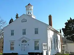 Trinity African Methodist Episcopal Church |
September 29, 1995 (#95001138) |
Bridgeton-Milltown Rd. (NJ 49), E of Woodruff Rd. (Co. Rd. 553), Fairfield Twp. 39°25′12″N 75°11′03″W |
Fairfield Township | |
| 28 | Vineland High School | 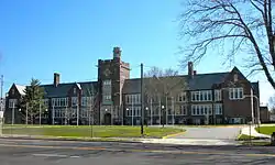 Vineland High School |
March 3, 1995 (#95000181) |
61 W. Landis Ave. 39°29′10″N 75°02′17″W |
Vineland | Now the Landis School. |
| 29 | Wood Mansion House |  Wood Mansion House |
December 24, 2013 (#13000975) |
821 Columbia Ave. 39°24′10″N 75°02′42″W |
Millville |
Former listing
| [3] | Name on the Register | Image | Date listed | Date removed | Location | City or town | Summary |
|---|---|---|---|---|---|---|---|
| 1 | Levoy Theatre | 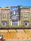 Levoy Theatre |
August 14, 1998 (#98001064) | July 17, 2013 | 126-130 N. High St. 39°23′49″N 75°02′18″W |
Millville City | 22,000-square-foot (2,000 m2) theater built in 1908. Collapsed January 3, 2011[7] Removed from register July 17, 2013. |
See also
- National Register of Historic Places in New Jersey
- List of National Historic Landmarks in New Jersey
References
| Wikimedia Commons has media related to National Register of Historic Places in Cumberland County, New Jersey. |
- The latitude and longitude information provided in this table was derived originally from the National Register Information System, which has been found to be fairly accurate for about 99% of listings. Some locations in this table may have been corrected to current GPS standards.
- "National Register of Historic Places: Weekly List Actions". National Park Service, United States Department of the Interior. Retrieved on January 29, 2021.
- Numbers represent an alphabetical ordering by significant words. Various colorings, defined here, differentiate National Historic Landmarks and historic districts from other NRHP buildings, structures, sites or objects.
- "National Register Information System". National Register of Historic Places. National Park Service. April 24, 2008.
- The eight-digit number below each date is the number assigned to each location in the National Register Information System database, which can be viewed by clicking the number.
- Accessed June 16, 2010.
- Walsh, Daniel (May 18, 2010). "Work about to start on renovations of 102-year-old Millville theater". The Press of Atlantic City. Atlantic City, New Jersey. Retrieved May 18, 2010.
| Topics | 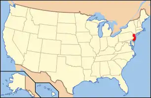 | ||
|---|---|---|---|
| Lists by county | |||
| Lists by city |
| ||
| Other lists | |||
| |||
Municipalities and communities of Cumberland County, New Jersey, United States | ||
|---|---|---|
| Cities | Map of New Jersey highlighting Cumberland County | |
| Borough | ||
| Townships | ||
| CDPs | ||
| Other unincorporated communities | ||
| ||
This article is issued from Wikipedia. The text is licensed under Creative Commons - Attribution - Sharealike. Additional terms may apply for the media files.