National Register of Historic Places listings in Closter, New Jersey
The table below includes 10 sites listed on the National Register of Historic Places in the Borough of Closter, New Jersey in Bergen County. Latitude and longitude coordinates of the sites listed on this page may be displayed in a map or exported in several formats by clicking on one of the links in the box below the map to the right.[1]
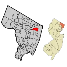
Map of Bergen County, New Jersey, highlighting Closter
| Atlantic - Bergen - Burlington - Camden - Cape May - Cumberland - Essex - Gloucester - Hudson - Hunterdon - Mercer - Middlesex - Monmouth - Morris - Ocean - Passaic - Salem - Somerset - Sussex - Union - Warren |
National Register listings elsewhere in Bergen County may be found in separate articles.
- This National Park Service list is complete through NPS recent listings posted January 29, 2021.[2]
Current listings
| [3] | Name on the Register[4] | Image | Date listed[5] | Location | Description |
|---|---|---|---|---|---|
| 1 | William De Clark House | 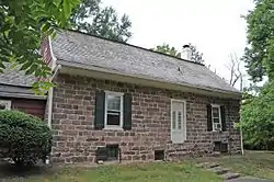 William De Clark House |
January 9, 1983 (#83001488) |
145 Piermont Rd. 40°58′41″N 73°56′40″W |
|
| 2 | Abram Demaree House | 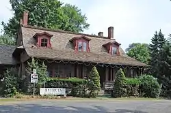 Abram Demaree House |
November 1, 1979 (#79001471) |
Schraalenburgh and Old Hooks Rds. 40°58′35″N 73°58′53″W |
|
| 3 | Haring-Auryanson House | 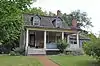 Haring-Auryanson House |
August 15, 1983 (#83001516) |
377 Piermont Rd. 40°58′17″N 73°56′53″W |
|
| 4 | Harold Hess Lustron House | 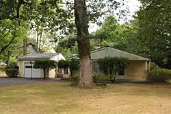 Harold Hess Lustron House |
July 25, 2000 (#00000796) |
421 Durie Ave. 40°58′15″N 73°58′02″W |
|
| 5 | John Nagle House | 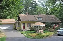 John Nagle House |
January 9, 1983 (#83001534) |
75 Harvard St. 40°58′46″N 73°56′27″W |
|
| 6 | Henry Naugle House | 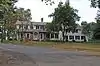 Henry Naugle House |
January 9, 1983 (#83001535) |
119 Hickory Lane 40°58′24″N 73°56′26″W |
|
| 7 | Isaac Naugle House | 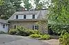 Isaac Naugle House |
January 9, 1983 (#83001537) |
80 Hickory Lane 40°58′21″N 73°56′34″W |
|
| 8 | Tallman-Vanderbeck House | 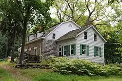 Tallman-Vanderbeck House |
January 9, 1983 (#83001551) |
639 Piermont Rd. 40°57′59″N 73°57′15″W |
|
| 9 | David & Cornelius Van Horn House | 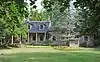 David & Cornelius Van Horn House |
January 9, 1983 (#83001572) |
11 Cedar Lane 40°58′37″N 73°58′50″W |
|
| 10 | Vervalen House | 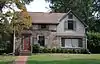 Vervalen House |
January 9, 1983 (#83001580) |
151 West St. 40°58′43″N 73°57′50″W |
References
| Wikimedia Commons has media related to National Register of Historic Places in Bergen County, New Jersey. |
- The latitude and longitude information provided in this table was derived originally from the National Register Information System, which has been found to be fairly accurate for about 99% of listings. Some locations in this table may have been corrected to current GPS standards.
- "National Register of Historic Places: Weekly List Actions". National Park Service, United States Department of the Interior. Retrieved on January 29, 2021.
- Numbers represent an alphabetical ordering by significant words. Various colorings, defined here, differentiate National Historic Landmarks and historic districts from other NRHP buildings, structures, sites or objects.
- "National Register Information System". National Register of Historic Places. National Park Service. July 9, 2010.
- The eight-digit number below each date is the number assigned to each location in the National Register Information System database, which can be viewed by clicking the number.
| Topics | 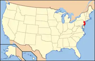 | ||
|---|---|---|---|
| Lists by county | |||
| Lists by city |
| ||
| Other lists | |||
| |||
This article is issued from Wikipedia. The text is licensed under Creative Commons - Attribution - Sharealike. Additional terms may apply for the media files.